Afternoon storm risk is the line that matters. Everything else is comfort. In summer, plan to be off the ridge before the build-up starts, not as it starts. Forecast for the summit point, adjusted for its elevation · data from Open-Meteo.
Standard route · Northwest Ridge
Overview
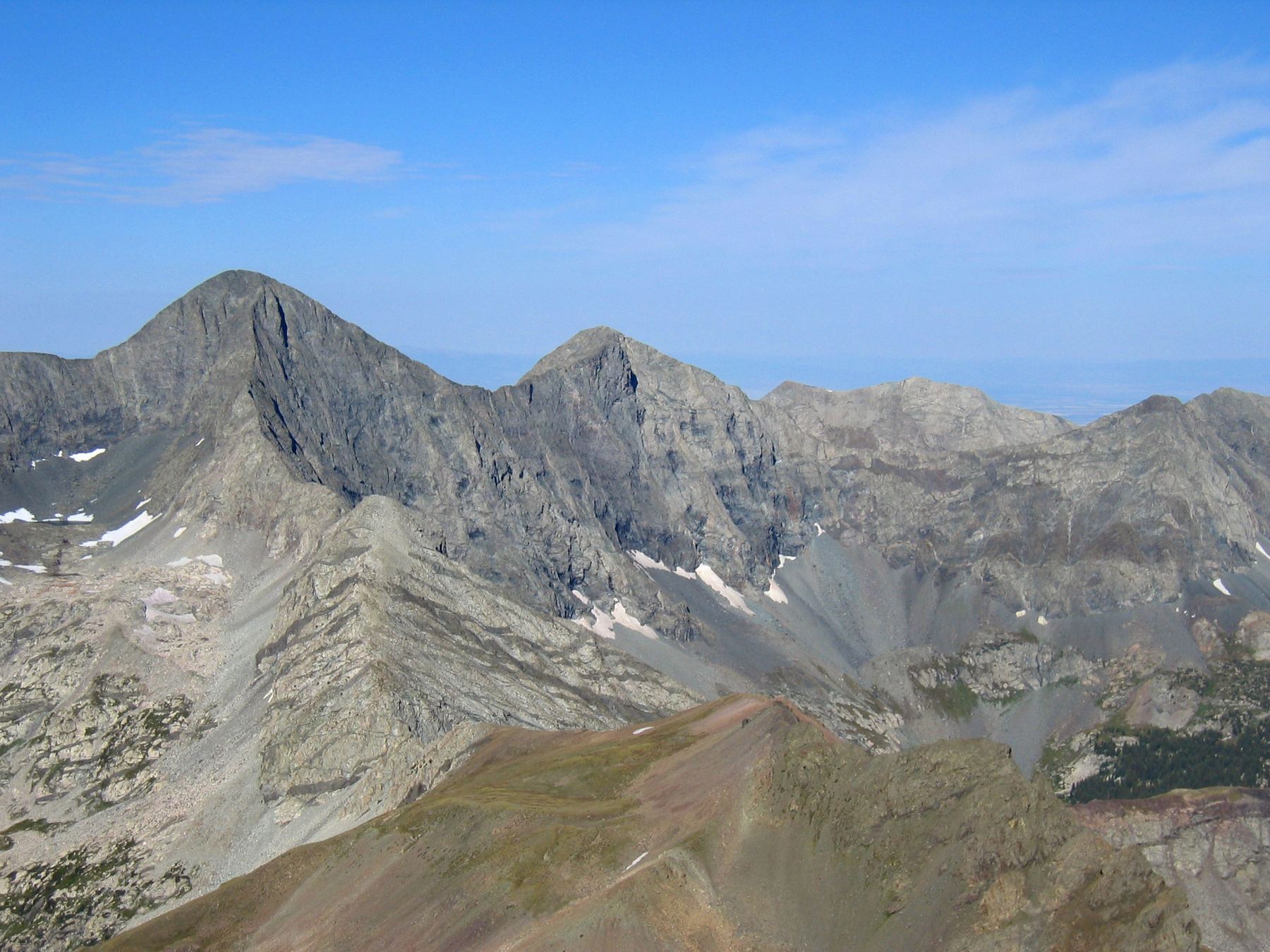
Blanca Peak is the highest point in the Sangre de Cristo Range and one of the tallest mountains in Colorado. The standard climb follows a rough jeep road to Lake Como, then a trail up a chain of lakes and rock steps into a high basin, and finally a steep, rocky ridge to the top. The last 900 feet or so is off the easy trail and takes careful hand-and-foot work on big blocks.
The biggest challenge is length. From the low 2WD parking at 8,000 feet the round trip is about 17 miles with roughly 6,500 feet of gain, and much of the first half is on a steep, loose road that is hard on the legs both ways. Most people camp near Lake Como and climb the next morning. Doing it in one day from the bottom is a 12 to 16 hour effort for fit, experienced hikers.
The upper ridge has real exposure and loose rock. Straying off the ridge crest puts you on steep, crumbly ground where a slip can be serious. This route suits hikers who have done several Class 2 peaks and are comfortable scrambling on large boulders with some air below them.
Plan of the day
Start by
From a Lake Como camp, leave by 5 a.m. From the lower road, start by 2 or 3 a.m. You are above treeline from about 12,000 feet to the summit and back, and storms often build by late morning.
Turnaround
If you are not at the corner with cairns near 13,400 feet (top of the second headwall) by 10 a.m., or if clouds are building, turn back. Do not start up the ridge late.
Crux
A short, steep step near the top of the northwest ridge. Stay on the ridge through it; the path that skirts it to the right leads onto loose ground and a poor finish.
Route-finding
Easy to the Blue Lakes: follow the road. The trail above is clear to about 13,400 feet. Above that it breaks into cairns and short trail segments across the face. People get lost by drifting right off the ridge into steep gullies, and on the way down by missing the traverse back to the trail.
Water
Plenty of water at Lake Como, the creek, the Blue Lakes and Crater Lake (about 12,800 feet). None on the ridge. Filter or treat all of it.
Low-clearance cars park at the absolute desert bottom (8,000'). The road itself is the most notoriously destructive 4WD track in Colorado.
Terrain
A hot, dusty desert track transitioning into a steep pine forest, rugged alpine lakes, and slick, near-vertical rock chimneys.
You begin with a grueling, hot, low-altitude march up a road lined with sharp volcanic rocks and axle-breaking boulders. As you painfully grind upward, the desert sagebrush slowly gives way to pine forest, and the grade turns unforgivingly steep. You pass pristine alpine lakes nestled under sheer rock walls before arriving at Lake Como. Above the lake, the hiking shifts to highly rugged terrain. For Blanca or Ellingwood, you pick your way through a massive basin of sharp talus to ascend a steep, rocky ridge. For Little Bear, you leave the trail entirely to scale a brutally steep gully of loose rock before entering "The Hourglass"—a smooth, steep, water-grooved rock chimney requiring an intense Class 4 scramble on all fours up slick, high-exposure stone.
From U.S. 160 east of Alamosa, turn north on Colorado 150 toward Great Sand Dunes National Park. After a little over 3 miles, turn right onto the Lake Como road, also called the Blanca Peak road. This road is famous for being one of the worst in Colorado.
Regular cars can usually go about 1.5 miles before the road gets rough; many people park around 8,000 feet. Stock 4WD SUVs and trucks can often crawl to pull-offs near 8,800 feet, which shortens the hike to about 14.25 miles round trip. Above that the road turns into large rock ledges and steps. Only short, high-clearance, modified 4WD vehicles, ATVs or UTVs should try to go higher, and parking is scarce. Many vehicles get damaged on this road. If in doubt, park and walk.
ScramblingRoadTrail in the treesTundraRidgeTalus and screeExposed to lightning
The line is elevation, the band underneath is the ground, and the numbered dots match the steps below. Mileage and elevations are approximate.
1
Lower Lake Como road 8,000' · 0 mi
Park where your vehicle stops being comfortable. Start walking up the road, which is sandy and rocky and climbs steadily through pinyon and juniper. The road is wide and easy to follow in the dark. Expect loose cobbles underfoot the whole way.
2
4WD pull-offs 8,800' · 1.4 mi
A cluster of pull-offs where most stock 4WD trucks stop. Above here the road becomes a series of big rock ledges. Keep following the main road up the hill; side spurs are short and dead-end.
Watch for: Vehicles come down this road fast and wide. Step well off to the side when you hear one.
3
Upper road 10,000' · 3.3 mi
The road enters forest and keeps climbing through large rock steps. It is steep and slow going with a pack. Take breaks in the shade; there is little water on the lower road.
4
Lake Como 11,750' · 5.5 mi
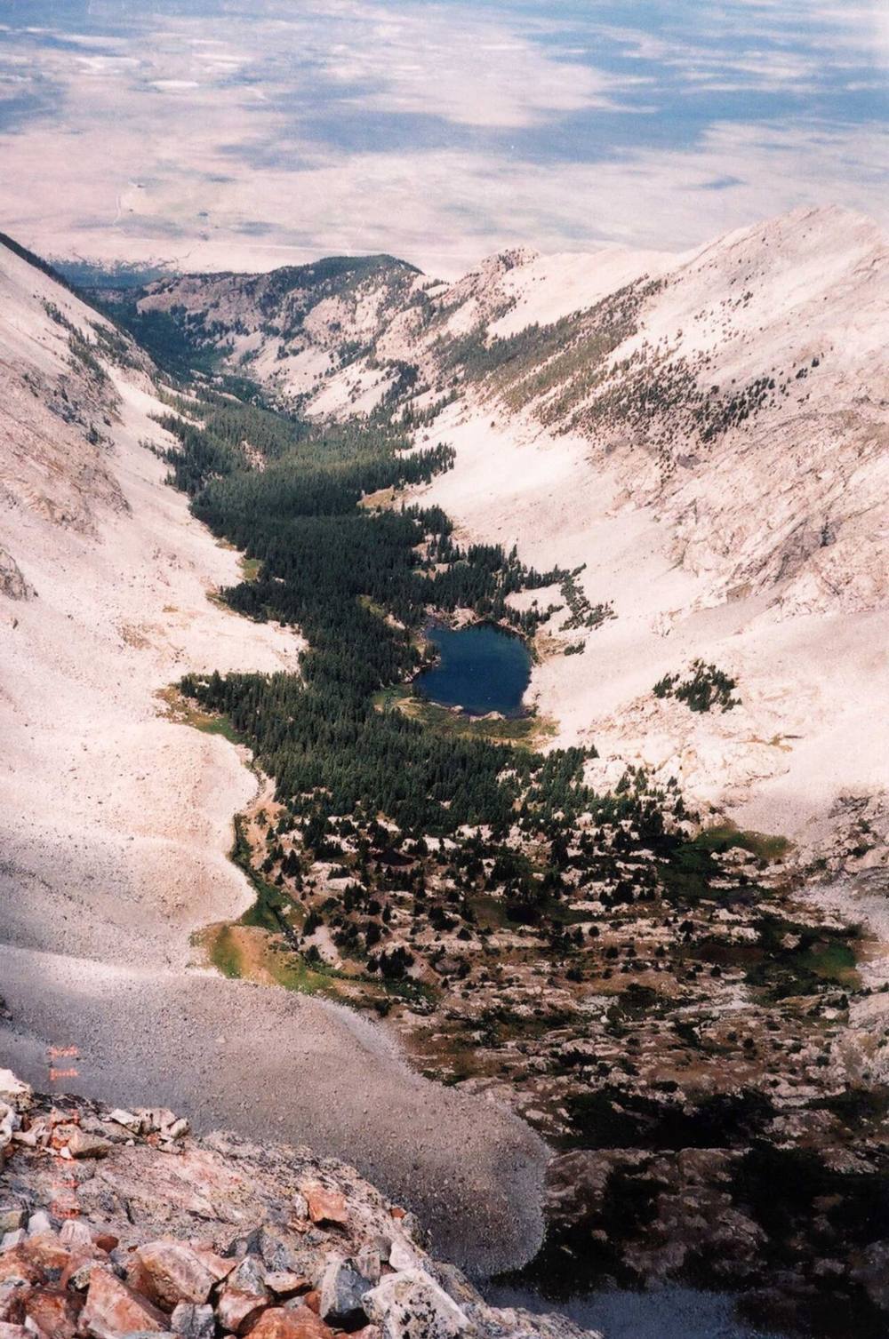
The road flattens and reaches Lake Como, a good-sized lake with forest around it and Blanca's ridges above. This is the usual camp area. Follow the road around the lake and continue uphill through more trees.
Watch for: Camp in established spots and store food well away from your tent.
Lake Como · Photo: Alethe88
5
Treeline 12,000' · 5.8 mi
The trees thin out and the basin opens up. Little Bear Peak is on your right and Ellingwood Point is ahead on the left. Stay on the road.
6
Blue Lakes 12,200' · 6 mi
The road ends near the Blue Lakes, a pair of small lakes in a meadow. A foot trail starts at the end of the road. Just ahead is a rock headwall with a waterfall running down it.
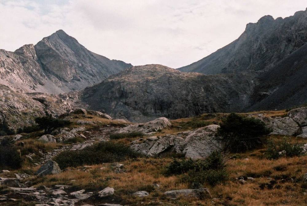
Ellingwood Point and Blanca above the Blue Lakes · Photo: Alethe88
7
Waterfall headwall 12,500' · 6.2 mi
Keep to the left of the waterfall and follow the trail as it switchbacks about 300 feet up the headwall. The trail is solid but steep. At the top the terrain eases.
Watch for: The rock near the waterfall can be wet or icy early in the day.
8
Small lakes 12,650' · 6.5 mi
Pass a small lake, keeping it on your right, then a second small lake just above it. The trail is clear here and weaves between rock and grass.
9
Crater Lake 12,800' · 6.7 mi
Round a corner to reach Crater Lake, the last lake in the basin. Ahead you can see a second, larger headwall below cliffs. This is the last good place to fill water.
Watch for: Last reliable water on the route.
10
Base of upper headwall 13,000' · 6.9 mi
Follow the trail across talus to the foot of the headwall, then swing right and start up. The trail zigzags through rock ledges and then traverses right under a band of cliffs.
11
Cairned corner 13,400' · 7.3 mi
Near 13,300 feet the trail turns left toward the top of the headwall. Just above 13,400 feet you reach a corner marked by a couple of cairns. Blanca's trail goes up and to the right. A fainter trail to the left goes toward Ellingwood Point. Note this spot on your map or phone so you can find it on the way down.
Watch for: Mark this junction. It is the key to finding your way back down.
12
Northwest face traverse 13,750' · 7.8 mi
Zigzag higher on a trail that gets rougher and fainter, then traverse left (northeast) across the face toward the northwest ridge. Follow short trail segments and cairns across broken rock.
Watch for: Loose rock on the face. Do not climb directly below other people.
13
Northwest ridge 13,950' · 8 mi
Reach the ridge and turn right to climb it. Stay on the crest or just right of it. A few spots have large boulders that need careful hand-and-foot moves. If you find yourself on steep, loose slabs or in a gully, you have wandered too far off the ridge.
Watch for: Moving far to the right of the ridge leads into steep, dangerous terrain.
14
Crux step 14,250' · 8.35 mi
Near the top of the ridge, a short, steep step blocks the way. Climb it on the ridge. A beaten path goes around it on the right, but that path leads onto loose ground and an unpleasant finish, so avoid it.
Watch for: Exposure here. Take your time and test holds.
15
Summit 14,350' · 8.5 mi
Past the crux, walk and scramble a short way to the summit. Ellingwood Point is to the north and Little Bear to the west, with the San Luis Valley spread out below.
Here a road goes off to the left. Turn right to follow the road.
Coming down: Turn left to stay on the trail you came up. Don’t take the road.
2Mile 1.7 · 8,990'
Turn right to stay on Mount Blanca Road
Here a road goes off to the left. Turn right to follow Mount Blanca Road.
Coming down: Turn left to stay on Mount Blanca Road. Don’t take the road.
3Mile 6.3 · 12,550'
Turn left to stay on Blanca Peak Trail
Here Little Bear Climber's Route goes off to the right. Turn left to follow Blanca Peak Trail.
Coming down: Turn right to stay on Blanca Peak Trail. Don’t take Little Bear Climber's Route.
4Mile 8.1 · 14,040'
Turn right to stay on Blanca Peak Northwest Ridge Route
Here Ellingwood Point South Face Route goes off to the left. Turn right to follow Blanca Peak Northwest Ridge Route.
Coming down: Turn left to stay on Blanca Peak Northwest Ridge Route. Don’t take Ellingwood Point South Face Route.
5Mile 8.3 · 14,210'
Turn right to stay on Blanca Peak Northwest Ridge Route
Here Ellingwood Point Climber's Route goes off to the left. Turn right to follow Blanca Peak Northwest Ridge Route.
Coming down: Turn left to stay on Blanca Peak Northwest Ridge Route. Don’t take Ellingwood Point Climber's Route.
Landmarks to know
The Lake Como road: steep, rocky, and impossible to lose
Lake Como at 11,750 feet, where the road flattens
The Blue Lakes and the end of the road, with a waterfall headwall just beyond
Two small lakes and then Crater Lake at 12,800 feet
The upper headwall under a band of cliffs
The corner with two cairns just above 13,400 feet (Ellingwood trail splits left)
The northwest ridge crest, climbed on or just right of the top
Getting down
Go back down the ridge the way you came, staying on or near the crest. Watch for where the cairns lead off the ridge to the left (west) to traverse back across the face. If you keep descending the ridge too far, or drop straight down the face, you end up on steep, loose rock above cliffs. Find the cairned corner near 13,400 feet before heading down the headwall.
Below the corner, follow the trail back down the switchbacks, past Crater Lake, and down the waterfall headwall to the Blue Lakes. The long road walk to the car is where tired legs lead to rolled ankles on loose cobbles. Take it slow and use trekking poles.
If things go wrong
Below the cairned corner at 13,400 feet, the trail is the quickest way off. If a storm builds while you are on the ridge, head down immediately the way you came and get off the ridge before you worry about getting to the lakes. Do not look for shortcuts down the face; it cliffs out. Lake Como is the nearest place with camps and other people. If someone is hurt, keep them warm, note your location, and call 911 if you have signal. Rescue on this peak is slow because of the road and terrain.
3D flyover
Press play to fly the Northwest Ridge. The graph shows elevation along the way and how much you gain each mile. Open full screen.
For planning only. The line is traced from open map data, not walked in the field, and off-trail parts are drawn straight. Load it in your GPS app to see the route, but navigate with your eyes, a map and the route description.
See the trail on video
A climb of this route filmed by Centennial Treks. The video belongs to them and only plays when you press play.
Jump to
Other routes
All 4 routes up Blanca Peak, with the class and round-trip distance for each.
Widely considered the most demanding, terrifying, and sustaining standard traverse in the state. After surviving the Hourglass on Little Bear, you step onto a mile-long, exceptionally exposed, jagged rock ridge. The ridge narrows down to widths of less than two feet in several places, forcing you to maintain absolute balance over crumbling towers and sheer drops for hours until you reach the solid granite of Blanca.
Link-upBlanca & Ellingwood LinkClass 2
Blanca Peak → Ellingwood Point
Widely considered the most demanding, terrifying, and sustaining standard traverse in the state. After surviving the Hourglass on Little Bear, you step onto a mile-long, exceptionally exposed, jagged rock ridge. The ridge narrows down to widths of less than two feet in several places, forcing you to maintain absolute balance over crumbling towers and sheer drops for hours until you reach the solid granite of Blanca.
A long day with a real commitment
The moves are not technical, but the distance and gain are serious and help is hours away. Know your pace, carry a headlamp even on a day trip, and be honest about whether you can still make good decisions at hour eleven.