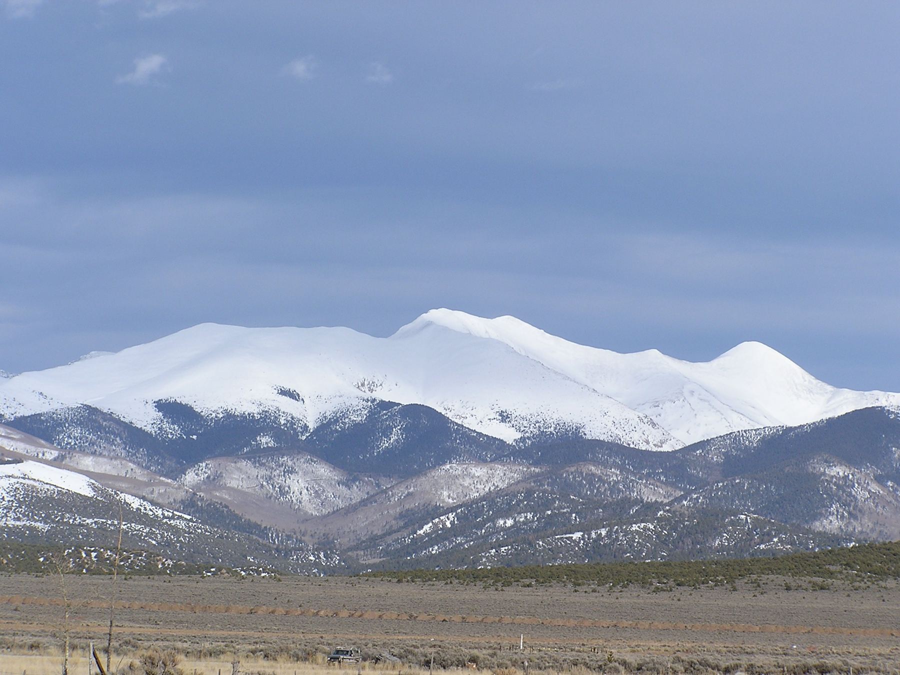
Afternoon storm risk is the line that matters. Everything else is comfort. In summer, plan to be off the ridge before the build-up starts, not as it starts. Forecast for the summit point, adjusted for its elevation · data from Open-Meteo.
Standard route · Northwest Ridge
Overview
Culebra Peak is the only Colorado 14er on private land. Every climb must be booked in advance with the Cielo Vista Ranch, and you pay a per-person fee. There is no legal way to the summit except through the ranch; anyone who goes another way is trespassing.
The climb itself is short. From the upper 4WD trailhead the round trip is about 5 miles with roughly 2,750 feet of gain, and most people take 4 to 7 hours. There is no built trail. You walk up open slopes to a broad ridge, then follow the ridge south and east over rocky bumps, a saddle and a false summit to a rounded top.
It suits most fit hikers with some Class 2 experience. The main risks are weather on the long, open ridge and route-finding in fog or low clouds, since the ridge has several high points that look like the summit. The ranch also sets a firm schedule, so pace yourself to be back when they expect you.
Plan of the day
Start by
The ranch sets the start: you are usually met at the gate around 6 a.m. and escorted in. Get moving from the upper trailhead as soon as you can after check-in.
Turnaround
If you are not on the false summit (13,900 feet) by 11 a.m., or if storms are building, turn back. Also follow any return time the ranch gives you.
Crux
The ridge from the saddle to the false summit has a couple of rough sections of large rock. None of it is harder than Class 2.
Route-finding
No trail. On the way up, the slopes are wide open and easy to read in clear weather. The ridge is easy to follow, but in fog it is easy to mistake the false summit or the big cairn for the top, or to come down the wrong slope from the ridge.
Water
A stream runs just below the upper parking area. Nothing on the ridge. Carry 2 liters or more and filter stream water.
From U.S. 160 at Fort Garland, go south on Colorado 159 a bit over 15.5 miles to the town of San Luis. By the gas station, make a left onto 4th Street, also called P.6 Road, and follow it 4 miles to Chama. Turn left on L.7 Road, go 3.6 miles, and after crossing a bridge go right onto 25.5 Road (dirt). After 0.5 mile, turn left on M.5 Road and drive 0.9 mile to the ranch's North Headquarters gate.
The gate is locked. Ranch staff meet hikers there, usually early in the morning, and escort you 2 miles to the headquarters to check in. A steep dirt road then climbs from headquarters to the upper trailhead, a distance of 4.4 miles; you need AWD or 4WD. Keep right at 0.1 mile. The grade eases after roughly 2.5 miles, and at 3.4 miles you reach a junction called Four Way, with plenty of parking. The upper trailhead is about 1 mile farther, straight ahead at the end of the road. Hiking dates are limited and change from year to year, so check with the ranch when you book.
Culebra (Cielo Vista Ranch) Trailhead. Road conditions near the trailhead change after storms. Check your clearance and have a backup plan for a lower lot.
Culebra is on a private ranch. You must book a climbing date and pay a fee with the ranch ahead of time. There is no walk-up access.
The route
TundraRidgeTalus and screeExposed to lightning
The line is elevation, the band underneath is the ground, and the numbered dots match the steps below. Mileage and elevations are approximate.
1
Upper 4WD trailhead 11,650' · 0 mi
Park at the end of the road. There is no trail. Culebra's northwest slopes rise to the southeast.
2
Stream crossing 11,600' · 0.1 mi
Drop slightly south from the parking area and cross the stream. Then head southeast toward the slopes above.
3
Gentle ridge 11,900' · 0.4 mi
Move away from the stream and climb along a low, gentle ridge on the south side of the creek. The ground is grass and scattered rock with some trees.
4
Treeline 12,200' · 0.7 mi
The trees end and the slopes open up. Keep heading southeast toward the top of the slopes. Look back now and then so you will recognize the way down.
Watch for: Note where you came up. The slope is wide and all looks alike.
5
Upper slopes 12,800' · 1.1 mi
The slope steepens and gets rockier. Pick the easiest line through grass and talus.
6
Ridge crest and big cairn 13,350' · 1.4 mi
Reach the ridge crest near a large cairn. Much of the route is now in view, but not the summit. Remember this cairn; it marks where you leave the ridge on the way down.
Watch for: This cairn is your key landmark for descent.
7
Rocks past the cairn 13,300' · 1.5 mi
Turn right and head south past the cairn, working through rocks.
8
13,200-foot saddle 13,200' · 1.6 mi
Descend to a saddle. From here the ridge turns east toward a false summit.
9
Ridge to the false summit 13,550' · 1.85 mi
Stay on the ridge. There are a couple of rough spots with larger rocks, but the way is obvious. The rock is mostly stable.
10
False summit 13,900' · 2.1 mi
Top out on the false summit. The true summit is now in view, less than half a mile away.
Watch for: Do not mistake this for the top in fog.
11
Small hump 13,850' · 2.25 mi
Drop a little and cross over a small hump on the ridge.
12
Final pitch 13,950' · 2.4 mi
Climb the last rocky slope toward the summit.
13
Summit 14,053' · 2.5 mi
A broad, rocky summit with views over the Sangre de Cristos and the San Luis Valley, and south into New Mexico.
Here a road goes off to the left. Turn right to follow Culebra Peak.
Coming down: Turn left to stay on the trail you came up. Don’t take the road.
Landmarks to know
Stream just below the upper parking area
A low ridge on the south side of the creek
The large cairn on the ridge crest near 13,350 feet
The 13,200-foot saddle south of the cairn
The false summit at 13,900 feet
A small hump just before the final pitch
Getting down
Retrace the ridge: down from the summit, over the small hump, back over the false summit, down to the saddle and up to the large cairn. You have some regain on the way back, so save energy. The most important step is leaving the ridge at the large cairn. If you drop off the ridge too early or too late, you can end up in the wrong drainage, far from the parking area.
From the cairn, head northwest down the open slopes toward the gentle ridge on the south side of the creek, then cross the stream back to the parking area. In fog, use a GPS track; the slopes are wide and have few features.
If things go wrong
The open northwest slopes below the large cairn are the quickest way to lower ground. If a storm builds while you are on the ridge, head back toward the cairn and get off the ridge. Do not descend other slopes on private land. Ranch staff know you are on the mountain, so if someone is hurt, tell the ranch and call 911 if you have signal. Keep the person warm and mark your location.
3D flyover
Press play to fly the Northwest Ridge. The graph shows elevation along the way and how much you gain each mile. Open full screen.
For planning only. The line is traced from open map data, not walked in the field, and off-trail parts are drawn straight. Load it in your GPS app to see the route, but navigate with your eyes, a map and the route description.
See the trail on video
A climb of this route filmed by Kevin Fedde. The video belongs to them and only plays when you press play.
Jump to
Other routes
All 1 route up Culebra Peak, with the class and round-trip distance for each.
TypeRouteClassTrailheadRound trip
Standard
Northwest Ridge
Class 2
Culebra (Cielo Vista Ranch)5 mi · 2,750'Full route →
Expect talus, scree and stretches where the trail disappears. Ankles and weather cause most of the trouble here. Start early, keep an eye on the sky, and set a turnaround time before you leave the car.