Afternoon storm risk is the line that matters. Everything else is comfort. In summer, plan to be off the ridge before the build-up starts, not as it starts. Forecast for the summit point, adjusted for its elevation · data from Open-Meteo.
Standard route · South Face
Overview
Ellingwood Point stands just north of Blanca Peak in the Sierra Blanca group, above the San Luis Valley. The South Face route starts on the infamous Lake Como road, climbs past Lake Como and a chain of alpine lakes to the Blanca trail, then leaves it at about 13,400 feet and crosses broken talus to Ellingwood's south face. The last part climbs cairned ledges and loose rock to a notch on the ridge and follows the crest to the top. It is rated Difficult Class 2.
The full day from 8,000 feet is about 17 miles round trip with 6,200 feet of gain. Starting from 4WD parking at 8,800 feet it is about 14.25 miles and 5,400 feet. Most people camp at Lake Como, which cuts the summit day to about 6 miles and 2,450 feet. The road up to the lake is steep, rocky, and hot, and it is a big part of the effort.
Above the Blanca trail, route-finding is the main challenge. The path is faint, the face is steep and loose, and rockfall is a real risk. Plan on 12 to 15 hours from the lower road, or 5 to 7 hours from Lake Como. This route suits experienced hikers who are steady on loose rock and can follow cairns across a big face. Many people pair it with Blanca, either by returning to the Blanca trail or by the Class 3 ridge between them.
Plan of the day
Start by
From a Lake Como camp, by 5 a.m. From the lower road, by 2 or 3 a.m. Storms often build over the Sangres by late morning, and the face is slow terrain.
Turnaround
If you have not reached the Ellingwood junction at about 13,400 feet by 10 a.m., or clouds are building, turn back. From there the summit is still 650 feet up on loose, slow ground.
Crux
The climb up the south face toward the 13,800-foot notch: steep, loose rock and ledges where you must find the cairns. The traverse from the junction to the face, below the cliffs of the Ellingwood-Blanca ridge, is also loose and faint.
Route-finding
Hard above 13,400 feet. The start of the Ellingwood trail is easy to miss at a corner with a couple of cairns. Look for an old mine hole with light-colored rock below it, above and ahead of you; the route traverses left beneath it. Mark the junction on your GPS so you can find it on the way down.
Water
The creek along the upper road, Lake Como, the Blue Lakes, and the small lakes up to Crater Lake at 12,800 feet. Filter or treat all of it. Above Crater Lake there is no water.
Low-clearance cars park at the absolute desert bottom (8,000'). The road itself is the most notoriously destructive 4WD track in Colorado.
Terrain
A hot, dusty desert track transitioning into a steep pine forest, rugged alpine lakes, and slick, near-vertical rock chimneys.
You begin with a grueling, hot, low-altitude march up a road lined with sharp volcanic rocks and axle-breaking boulders. As you painfully grind upward, the desert sagebrush slowly gives way to pine forest, and the grade turns unforgivingly steep. You pass pristine alpine lakes nestled under sheer rock walls before arriving at Lake Como. Above the lake, the hiking shifts to highly rugged terrain. For Blanca or Ellingwood, you pick your way through a massive basin of sharp talus to ascend a steep, rocky ridge. For Little Bear, you leave the trail entirely to scale a brutally steep gully of loose rock before entering "The Hourglass"—a smooth, steep, water-grooved rock chimney requiring an intense Class 4 scramble on all fours up slick, high-exposure stone.
From U.S. 160 east of Alamosa, turn north on Colorado 150 toward Great Sand Dunes National Park. Drive a little over 3 miles and turn right onto the Lake Como road, also called the Blanca Peak road.
How high you can drive depends on your vehicle. Most cars can go about 1.5 miles before the road gets too rough, to about 8,000 feet. Stock 4WD SUVs and trucks can creep 3.25 miles to several pull-offs at 8,800 feet, the most popular parking spot. Short, high-clearance 4WD vehicles may reach about 10,000 feet, but there is very little parking there. Above that, the road is a series of large rock ledges and only ATVs, UTVs, or modified rock crawlers make it to Lake Como. The route enters the Sangre de Cristo Wilderness, so wilderness rules apply.
ScramblingTalus and screeTrail in the treesTundraRidgeExposed to lightning
The line is elevation, the band underneath is the ground, and the numbered dots match the steps below. Mileage and elevations are approximate.
1
Lower Lake Como road 8,000' · 0 mi
Start walking up the Lake Como road from where most cars park. The road climbs steadily through open pinyon and juniper, on loose sand and rock. It can be very hot here later in the day.
Watch for: No shade and little water on the lower road. Carry plenty.
2
4WD parking 8,800' · 1.4 mi
Reach the pull-offs at 8,800 feet where most 4WD vehicles stop. The road gets much rougher from here, with big rocks and ledges.
3
Rough upper road 10,000' · 3 mi
The road climbs in long switchbacks and then heads up the valley, with large rock steps and loose cobbles. Watch for off-road vehicles on the road.
Watch for: Vehicles on the road. Step aside and give them room on the steep ledges.
4
Lake Como 11,750' · 5.5 mi
Reach Lake Como in its forested basin. Blanca and Ellingwood rise at the head of the valley. There are campsites around the lake. Follow the road around the lake.
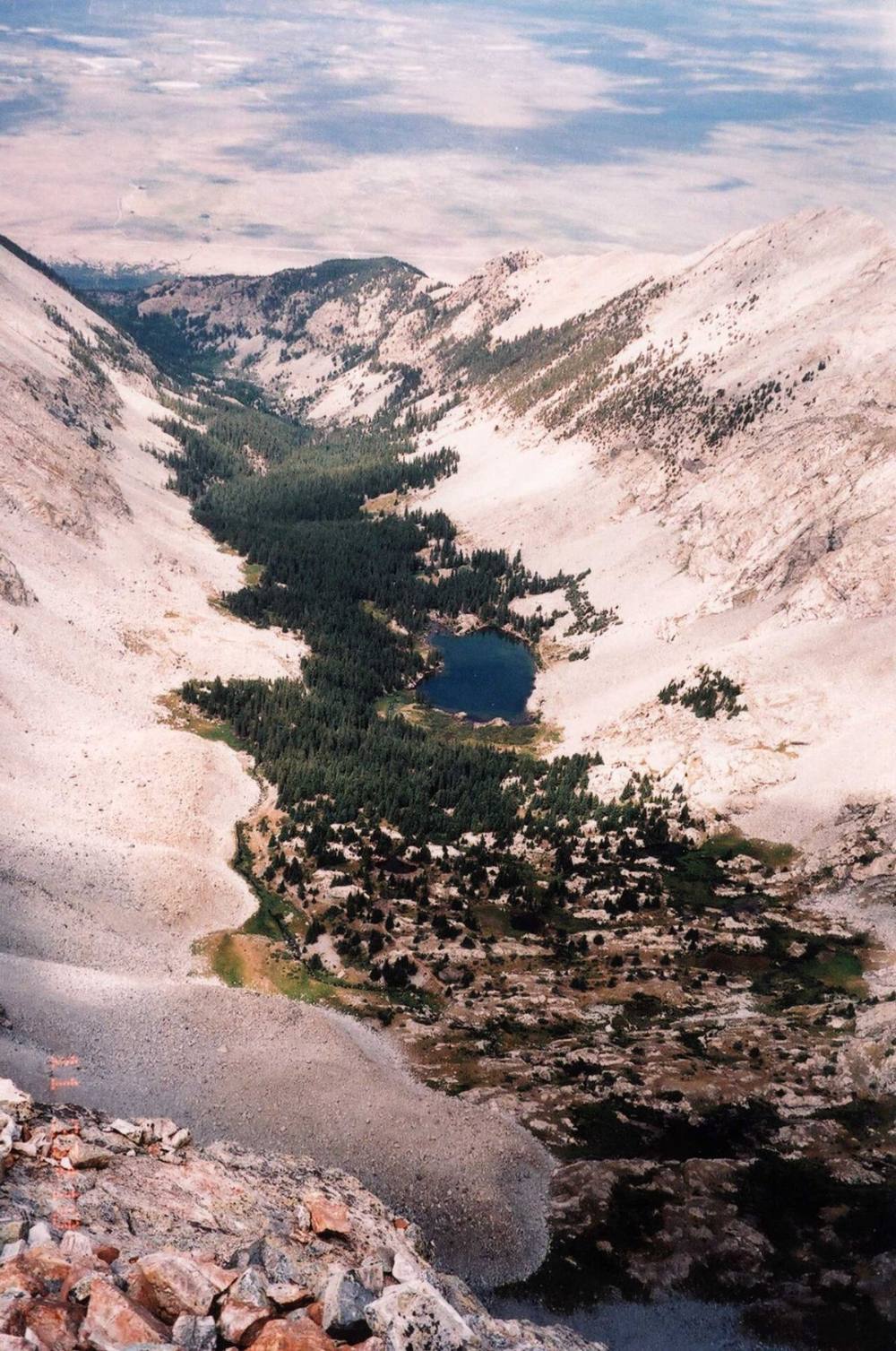
Lake Como · Photo: Alethe88
5
Treeline 12,000' · 5.9 mi
Past the lake, the road climbs through more forest and reaches treeline at about 12,000 feet.
6
Blue Lakes 12,200' · 6.2 mi
The road ends near the Blue Lakes at 12,200 feet. A trail continues from the end of the road toward a headwall with a waterfall just past the lake.
7
Waterfall headwall 12,500' · 6.5 mi
Stay left of the waterfall and follow the trail as it switchbacks about 300 feet up the headwall.
Watch for: Wet, slick rock near the falls, especially early in the day.
8
Small lakes 12,650' · 6.75 mi
After the headwall the ground eases. Pass a small lake on its right at about 12,600 feet, then another small lake just above.
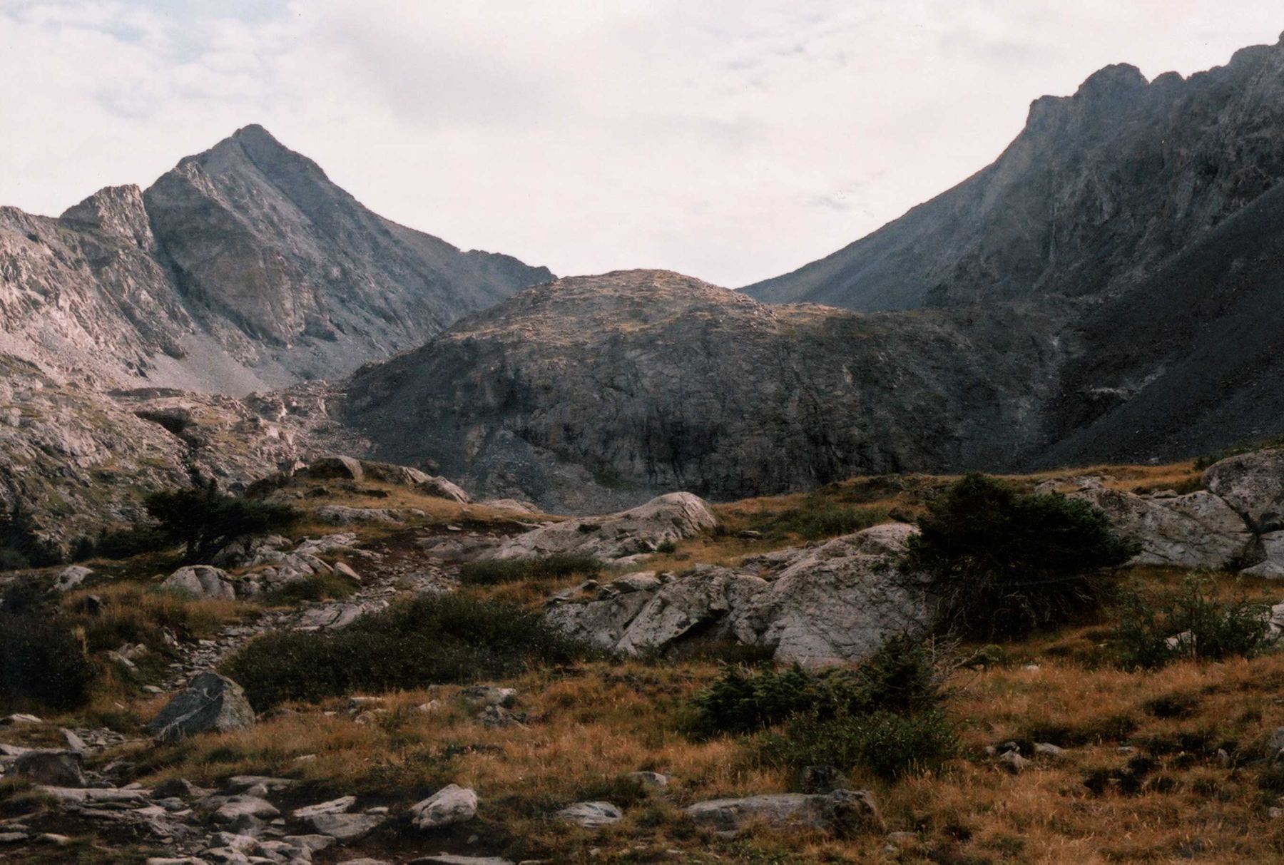
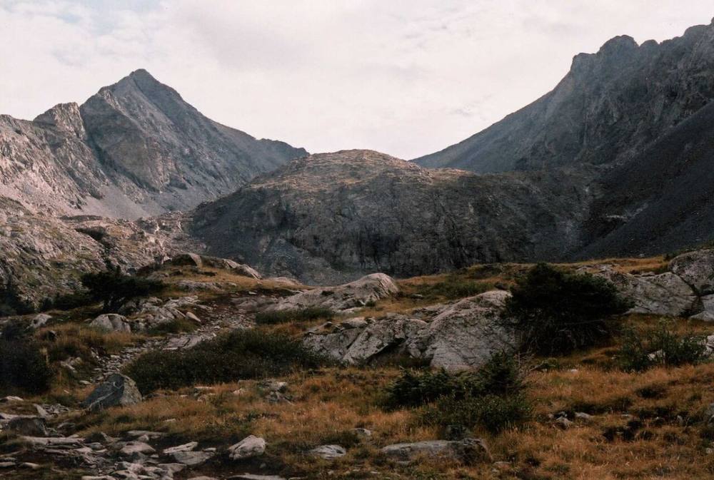
Ellingwood Point and Blanca above the Blue Lakes · Photo: Alethe88
9
Crater Lake 12,800' · 7 mi
Walk around a corner to Crater Lake at 12,800 feet, a rocky tarn below the big wall of Blanca and Ellingwood. Another headwall rises ahead near 13,000 feet.
Watch for: Last water. Fill up here.
10
Upper headwall 13,100' · 7.25 mi
Follow the trail through talus to the base of the headwall and bear right to start climbing it. The trail zigzags up through ledges, then traverses to the right side of the headwall under some cliffs.
11
Top of the headwall 13,300' · 7.45 mi
Near 13,300 feet, turn left as you near the top of the headwall.
12
Ellingwood junction 13,400' · 7.55 mi
A bit above 13,400 feet the trail turns a corner marked by two or three cairns. Here the Blanca trail climbs off to the right, while the fainter Ellingwood route heads left, close to a cairn. Scan ahead for an old mine hole under the ridge, with pale rock below it; the route traverses left beneath it.
Watch for: Save this spot on your GPS. You need to return here on the way down.
13
Traverse below the ridge 13,500' · 7.75 mi
Follow trail segments and cairns across the slope, passing below the steep ground of the Ellingwood-Blanca ridge. Near 13,500 feet the terrain eases once you are past the steep section.
Watch for: Loose talus and rockfall from the cliffs above.
14
Up the south face 13,800' · 8.2 mi
Continue a bit farther onto the south face, then turn right and climb straight up toward the ridge. Follow the cairns carefully and aim for a notch on the ridge that becomes clearer as you climb.
Watch for: Steep, loose rock and ledges. Keep your group close together so rocks cannot gain speed.
15
Ridge and false summit 13,950' · 8.35 mi
At or near the 13,800-foot notch, turn left and follow the ridge crest. Climb over a false summit and drop into another small notch.
16
Summit 14,057' · 8.5 mi
Climb out of the notch to the small, rocky summit. Blanca Peak is just to the south, and the San Luis Valley spreads out to the west.
Here a road goes off to the left. Turn right to follow the road.
Coming down: Turn left to stay on the trail you came up. Don’t take the road.
2Mile 1.6 · 8,950'
Turn right to stay on Mount Blanca Road
Here a road goes off to the left. Turn right to follow Mount Blanca Road.
Coming down: Turn left to stay on Mount Blanca Road. Don’t take the road.
3Mile 6.1 · 12,130'
Turn left to stay on Blanca Peak Trail
Here Little Bear Climber's Route goes off to the right. Turn left to follow Blanca Peak Trail.
Coming down: Turn right to stay on Blanca Peak Trail. Don’t take Little Bear Climber's Route.
4Mile 8.0 · 13,670'
Turn right to stay on Blanca Peak Northwest Ridge Route
Here Ellingwood Point South Face Route goes off to the left. Turn right to follow Blanca Peak Northwest Ridge Route.
Coming down: Turn left to stay on Blanca Peak Northwest Ridge Route. Don’t take Ellingwood Point South Face Route.
5Mile 8.3 · 13,900'
Turn right to stay on Ellingwood Point Climber's Route
Here Ellingwood Point South Face Route goes off to the left. Turn right to follow Ellingwood Point Climber's Route.
Coming down: Turn left to stay on Ellingwood Point Climber's Route. Don’t take Ellingwood Point South Face Route.
Landmarks to know
The rocky Lake Como road and the 8,800-foot 4WD pull-offs
Lake Como in its forested basin
The Blue Lakes at the end of the road
A waterfall on the headwall above the Blue Lakes (stay left of it)
Crater Lake at 12,800 feet
A corner with cairns just above 13,400 feet where the Ellingwood route leaves the Blanca trail
An old mine hole with light-colored rock below it, above the traverse
The 13,800-foot notch on the ridge, then a false summit
Getting down
From the summit, return over the false summit to the 13,800-foot notch. From there, go back down the south face the way you came, following the cairns. The face is broad and many lines look similar from above; if the ground gets steeper or cliffier than what you climbed, stop and look for the last cairn. Downclimbing loose ledges takes care. Face in where it is steep.
The biggest mistake is losing the traverse back to the Blanca trail. Aim for the junction you saved near 13,400 feet, passing below the mine hole. Do not try to drop straight down to Crater Lake from the face; the slopes below end in cliffs. Once back on the Blanca trail, go down the headwall, past Crater Lake and the small lakes, and down the waterfall headwall to the Blue Lakes. The walk down the rocky road from Lake Como is long and hard on tired legs.
If things go wrong
If the weather turns on the face, head back to the Blanca trail junction at 13,400 feet and down the headwall toward Crater Lake. Do not try shortcuts down the face. Stay off the ridge crest in lightning. Crater Lake and the lower lakes are the nearest safer ground, and Lake Como is the nearest shelter in the trees. Rescue here is slow and cell coverage is poor. If someone is hurt, protect them from rockfall and cold, and send a strong member down for help if you cannot call 911. Other climbers camped at Lake Como may be able to help.
3D flyover
Press play to fly the South Face. The graph shows elevation along the way and how much you gain each mile. Open full screen.
For planning only. The line is traced from open map data, not walked in the field, and off-trail parts are drawn straight. Load it in your GPS app to see the route, but navigate with your eyes, a map and the route description.
See the trail on video
A climb of this route filmed by Phil Bergmaier. The video belongs to them and only plays when you press play. This video covers Blanca and Ellingwood together.
Jump to
Other routes
All 4 routes up Ellingwood Point, with the class and round-trip distance for each.
Widely considered the most demanding, terrifying, and sustaining standard traverse in the state. After surviving the Hourglass on Little Bear, you step onto a mile-long, exceptionally exposed, jagged rock ridge. The ridge narrows down to widths of less than two feet in several places, forcing you to maintain absolute balance over crumbling towers and sheer drops for hours until you reach the solid granite of Blanca.
A long day with a real commitment
The moves are not technical, but the distance and gain are serious and help is hours away. Know your pace, carry a headlamp even on a day trip, and be honest about whether you can still make good decisions at hour eleven.