Afternoon storm risk is the line that matters. Everything else is comfort. In summer, plan to be off the ridge before the build-up starts, not as it starts. Forecast for the summit point, adjusted for its elevation · data from Open-Meteo.
Standard route · Northeast Ridge
Overview
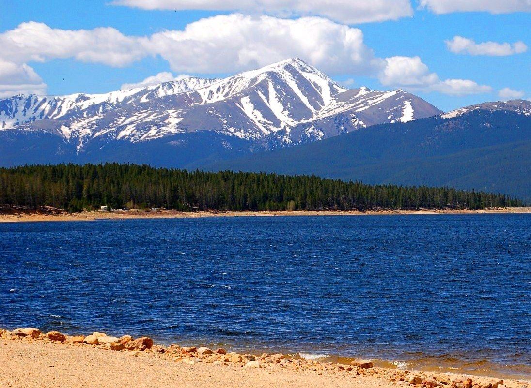
Mount Elbert is the highest peak in Colorado, and its northeast ridge is one of the most popular hikes in the state. There is a trail the whole way. You never need your hands. The climb is about stamina and altitude, not skill: roughly 4,500 feet of gain over 9.75 miles round trip, with most of that gain packed into the last two miles above the trees.
It suits fit hikers who have done a few long mountain days and want a first big 14er. It is not a stroll. The upper ridge is steep, rocky and loose in spots, and two high points near the top fool people into thinking they are almost done. You are above treeline for about three to four hours round trip, on a broad ridge with no shelter from lightning or wind.
Most people take 7 to 10 hours car to car. Weekends are crowded, so expect company on the trail and a full parking lot early.
Plan of the day
Start by
By 5 a.m. You reach treeline after about 3 miles, then spend hours on an open ridge. Summer storms often build by late morning.
Turnaround
If you are not on the flat part of the ridge near 13,900 feet by 10:30 a.m., or clouds are stacking up before then, turn around. The summit is still about 45 minutes or more from there.
Crux
The steep, rocky stretch of ridge from about 13,400 to 13,800 feet. The trail bends right and then back left, the rock is loose, and it is easy to wander off the main path.
Route-finding
Easy in summer. The two spots to pay attention to are the junctions low in the forest (Colorado Trail, then the North Mount Elbert trail) and the split near the summit where the East Ridge trail heads off. Take the northeast ridge back down.
Water
The creek at the footbridge near the start is the only sure water. There is none on the ridge. Carry all you need for the day, about 3 liters, and filter anything you take from the creek.
Easily accessible by standard 2WD vehicles; a peaceful dirt lot nestled in a thick forest.
Terrain
A relentlessly steep, well-defined staircase of dirt, embedded rocks, and alpine tundra.
This is a pure test of leg endurance and lung capacity. You start on the famous Colorado Trail, winding through a dense, shaded canopy of towering aspens and pines. Once you break above treeline, the trail turns directly up the nose of the massive mountain. The hike becomes a straightforward, grinding march up wide dirt switchbacks. You will mentally battle two distinct "false summits"—rocky, grassy ridges that appear to be the top from below—before finally stepping onto the highest point in Colorado.
From U.S. 24 a few miles south of Leadville, turn west onto Colorado 300. After about 0.7 mile, turn left on County Road 11. Go about 1.2 miles and turn right onto the Halfmoon Creek road. Follow this dirt road about 5 miles. The Mount Elbert trailhead parking is on the left.
The road is graded dirt and most cars can make it in summer. The lot is big but it fills early on summer weekends, so arrive well before dawn. Do not block the road or campsites if the lot is full.
Trail in the treesTundraRidgeTalus and screeExposed to lightning
The line is elevation, the band underneath is the ground, and the numbered dots match the steps below. Mileage and elevations are approximate.
1
North Mount Elbert trailhead 10,040' · 0 mi
Leave the parking area heading south into pine and aspen. The trail is wide and well used. In a few minutes it meets the Colorado Trail.
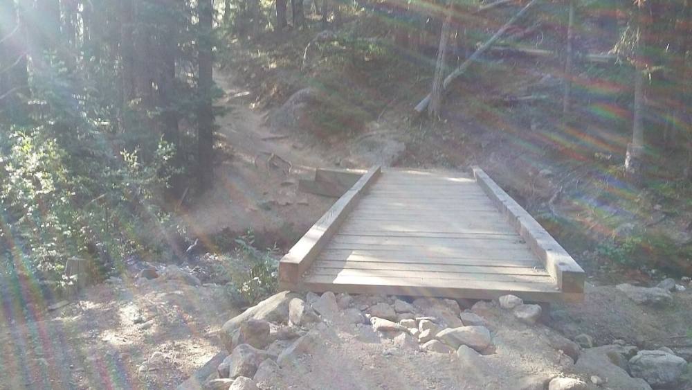
The footbridge on the Colorado Trail just past the trailhead · Photo: Xnatedawgx
2
Join the Colorado Trail 10,080' · 0.1 mi
Turn left onto the Colorado Trail. Cross the creek on a footbridge. This is the last dependable water on the route.
Watch for: Top off water here and filter it.
3
Switchbacks through the forest 10,400' · 0.6 mi
The trail climbs a forested slope in a series of switchbacks. The grade is steady and the footing is good dirt with some roots and rocks.
4
Top of the first slope 10,600' · 1.1 mi
The switchbacks end near 10,600 feet. Turn right and follow the trail as it drops a little over the next third of a mile.
5
North Mount Elbert trail junction 10,550' · 1.4 mi
At a signed junction, leave the Colorado Trail and turn right onto the North Mount Elbert trail. It starts climbing right away.
Watch for: Do not stay on the Colorado Trail. It keeps going south and does not climb the peak.
6
Small clearing 11,600' · 2.7 mi
After more than a mile of steady climbing in thick forest, you reach a small open spot near 11,600 feet. It is a good place for a short rest before the trees thin out.
7
Treeline 11,900' · 3.2 mi
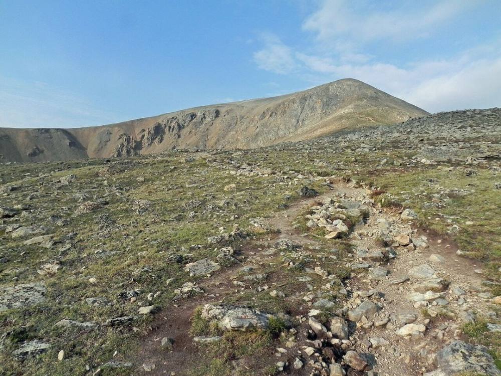
The forest ends and the long northeast ridge comes into view above you. The top you can see is not the summit. The trail switchbacks up open tundra toward the ridge crest.
Watch for: From here on you are exposed to lightning. Check the sky.
The trail climbing above treeline toward the northeast ridge · Photo: Fredlyfish4
8
Ridge crest 12,700' · 3.7 mi
The trail reaches the top of the ridge. Off to the left (east) is a large bowl at the head of Box Creek. Turn right and follow the ridge southwest.
9
Steep section begins 13,400' · 4.1 mi
The ridge gets much steeper. The trail veers right off the crest, then cuts back left to regain it. The ground is rocky and loose, with many side paths.
Watch for: Stay on the most worn trail. Side paths are looser and cause more erosion.
10
Flat spot on the ridge 13,900' · 4.4 mi
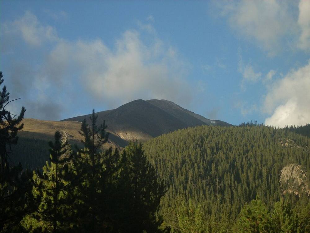
Above 13,800 feet the slope eases and you reach a flat area on the crest. The summit is still hidden. This is a good place to judge the weather and your time.
Watch for: This is the false-summit area. You still have about 500 feet to go.
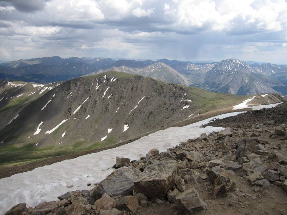
The northeast ridge and its false summits · Photo: Gilderien
11
Summit ridge in view 14,300' · 4.75 mi
Keep climbing on easier ground. Near 14,300 feet the final summit ridge finally shows itself ahead to the southwest.
12
Summit of Mount Elbert 14,438' · 4.9 mi
Walk southwest along the ridge to the top. The summit is broad and rocky, with rock wind shelters, and is often busy. You can see across the whole Sawatch Range, with Mount Massive close by to the north.
Watch for: Note where the East Ridge trail leaves the summit so you do not take it by mistake.
Looking west from the top of Colorado · Photo: Sailing Dutchman
The short trail from the parking lot ends at the Colorado Trail. Turn left. A minute later you cross the creek on a footbridge, which is the last dependable water.
Coming down: On the Colorado Trail heading back, watch for the short trail to the parking lot. Turn right onto it. If you go straight, you stay on the Colorado Trail and walk away from your car.
2Mile 1.4 · 10,550'
Turn right onto the North Mount Elbert Trail
A signed fork in the forest. The Colorado Trail keeps going nearly straight and does not climb the peak. Take the right fork. It starts climbing right away.
Coming down: The North Mount Elbert Trail ends at the Colorado Trail. Turn left to head back toward the trailhead.
3Mile 4.8 · 14,400'
Near the top, two trails come in from the south
Just below the summit, the East Ridge trail and the Black Cloud Trail join from the left. They come up from other trailheads on the south side. Keep going to the top.
Coming down: Leaving the summit, head down the northeast ridge, the way you came. Keep left. The two trails on your right go down the south side to trailheads miles from your car.
Landmarks to know
Footbridge over the creek just after joining the Colorado Trail.
Signed junction where you turn right off the Colorado Trail onto the North Mount Elbert trail.
Small forest clearing near 11,600 feet.
Treeline near 11,900 feet with the whole ridge in view.
Box Creek bowl to the east when you reach the ridge crest.
Steep, rocky trail from 13,400 to 13,800 feet.
Flat area on the ridge near 13,900 feet, then the summit ridge coming into view at 14,300 feet.
Getting down
Go back the way you came. Shortly after leaving the summit, the East Ridge trail splits off and heads toward a different trailhead. Stay on the northeast ridge, the way you came up, heading north-northeast with Mount Massive in front of you.
The steep, loose section between 13,800 and 13,400 feet is the most likely place to slip. Take short steps and stay on the main trail. Lower down, watch for the two junctions: turn left onto the Colorado Trail at the bottom of the North Mount Elbert trail, then keep on the Colorado Trail uphill a short way before the long switchbacks down to the footbridge and a right turn back to the parking area.
If things go wrong
The fastest way out is always back down the northeast ridge to treeline near 11,900 feet. Below that the forest gives cover from lightning and wind. If a storm catches you on the ridge, move down at once and do not wait it out on the crest. If someone is hurt or very sick from altitude, going down is the best treatment. Get them lower, keep them warm, and send for help. Other hikers are usually nearby on this route. In an emergency, call 911 if you have signal, and know that a rescue on the upper ridge can take many hours.
3D flyover
Press play to fly the Northeast Ridge. The graph shows elevation along the way and how much you gain each mile. Open full screen.
For planning only. The line is traced from open map data, not walked in the field, and off-trail parts are drawn straight. Load it in your GPS app to see the route, but navigate with your eyes, a map and the route description.
See the trail on video
A climb of this route filmed by Adventures of A+K. The video belongs to them and only plays when you press play.
Jump to
Other routes
All 4 routes up Mount Elbert, with the class and round-trip distance for each.
A Class 1 rating means a trail, not a stroll. Altitude, distance and weather still decide how this goes. Afternoon thunderstorms build fast above treeline in summer, so plan to be heading down by noon, and carry more water than you think you need.