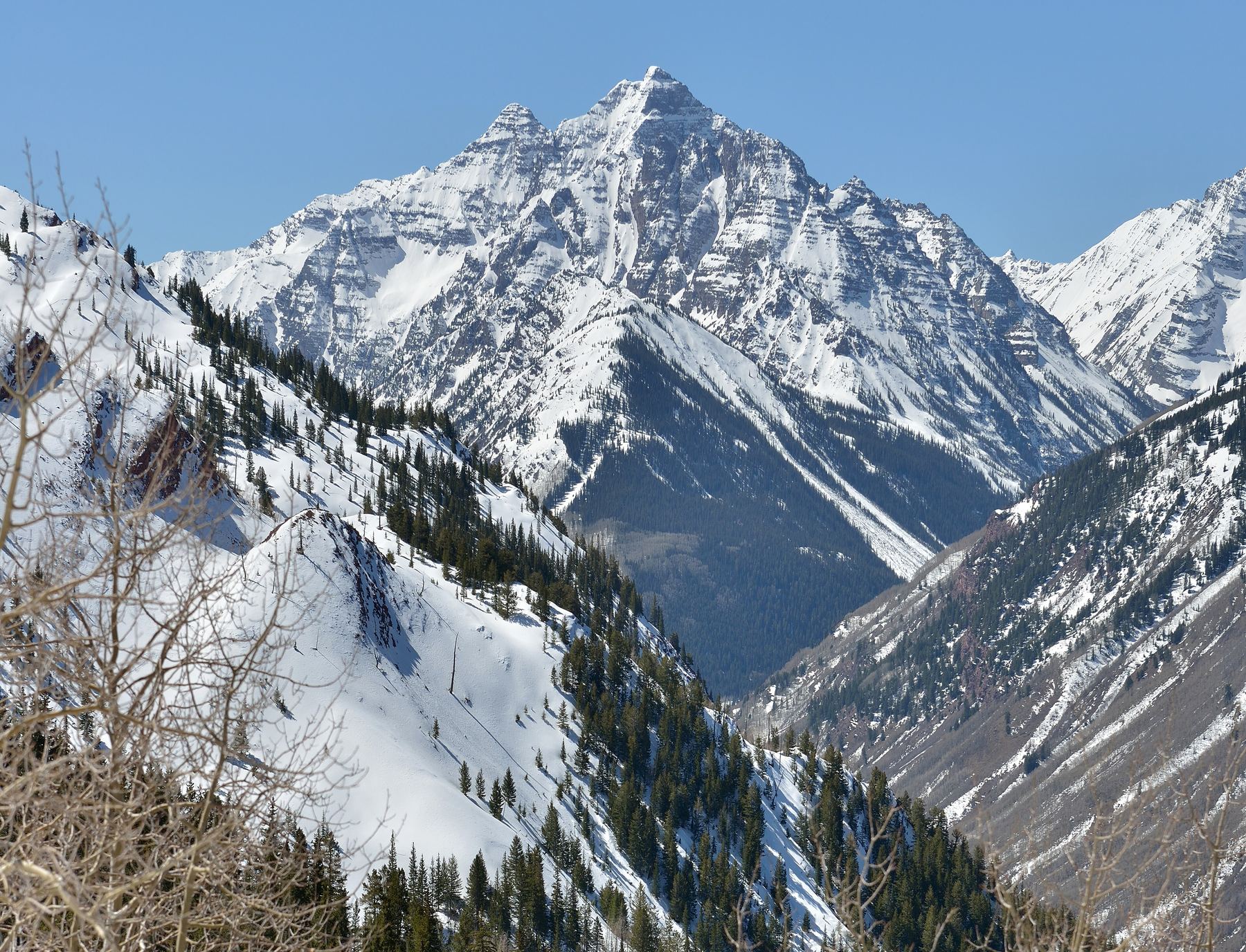
Afternoon storm risk is the line that matters. Everything else is comfort. In summer, plan to be off the ridge before the build-up starts, not as it starts. Forecast for the summit point, adjusted for its elevation · data from Open-Meteo.
Standard route · Northeast Ridge
Overview
Pyramid Peak is one of the hardest and most dangerous standard routes on any Colorado fourteener. It rises steeply above Maroon Lake near Aspen. The route starts on a good trail, then climbs into a rocky bowl, grinds up a steep 1,000-foot scree slope to a saddle on the northeast ridge, and finishes with about 1,000 feet of Class 3 and Class 4 climbing on ledges, gullies and walls of loose rock. There is no steady trail on the upper mountain, only cairns, and the exposure is severe in many places.
This climb is only for people with strong Class 3 skills who have done several hard scrambles and are calm on steep, exposed rock. It is not a peak to tick off a list. If you are not sure you or your partners are ready, go with a certified professional guide. Plan on 8 to 12 hours round trip; the upper 1,000 feet alone often takes several hours each way.
The Elk Range rock is loose and breaks easily. Rockfall from other climbers, and from the mountain goats that roam the ridge, is a constant danger. Route-finding on the upper mountain is hard, and many accidents happen when people lose the route on the way down.
Plan of the day
Start by
By 4 to 5 a.m. The upper mountain is slow going, and you want to be off the ridge before storms build over the Elks.
Turnaround
If you are not at the 13,000-foot saddle by 9 a.m., or not at the green rock strip near 13,400 feet by 10 a.m., turn back. The last 1,000 feet takes much longer than it looks, and so does the descent.
Crux
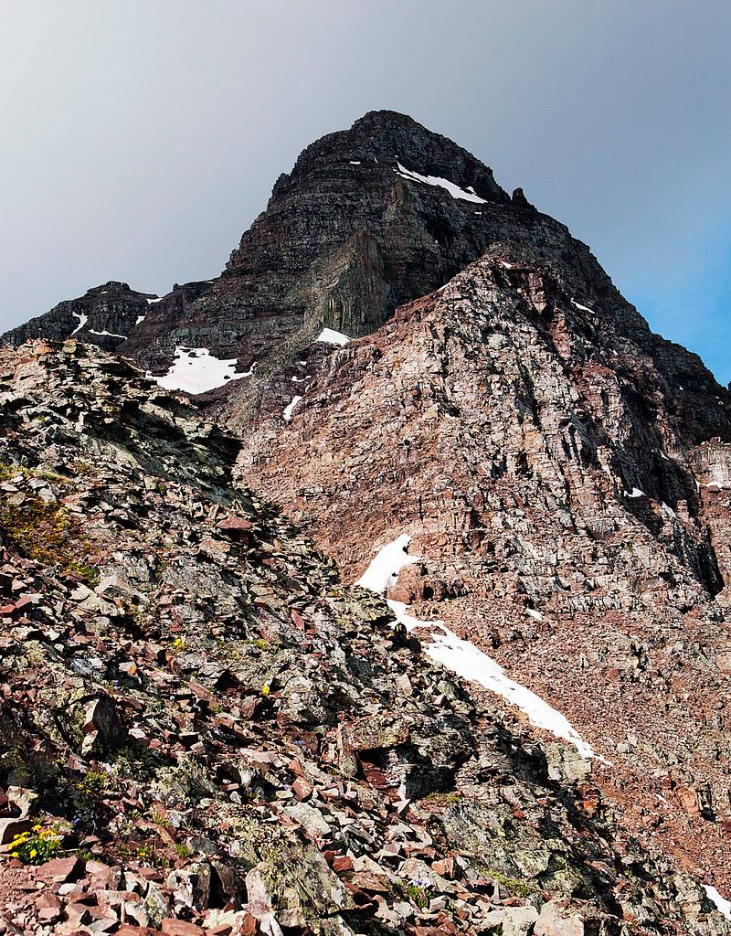
The upper 600 feet: climbing the loose green rock strip and then zig-zagging through red rock with exposed Class 3 ledges and a couple of short Class 4 pitches. The step across the gap called the leap of faith is short but exposed.
Route-finding
Hard. The trail ends at the entrance to the amphitheater. Above the 13,000-foot saddle there is no steady trail; follow cairns closely and study the route. Note the exact spot where you enter the green rock strip, because you need to find it again on the way down.
Water
Maroon Creek and small streams along the Crater Lake trail are the only sources, and they are near the start. Filter or treat it. There is no water above tree line, so carry at least 3 liters.
Paved road to a massive lot, but strictly regulated. You must reserve a shuttle bus ticket or parking pass months in advance; private cars are often banned between 8 AM and 5 PM.
Terrain
Gentle tourist paths around a stunning reflective lake that abruptly turn into steep, loose, crumbling red mudstone cliffs.
You start on one of the most photographed trails in America, walking smoothly around Maroon Lake with the "Bells" towering above. As you turn toward the peaks, the trail steepens aggressively through rocky scree fields. Once you hit the upper mountain, the "hiking" ends. The rock here is notoriously loose and rotten—every hold must be tested. You will find yourself carefully scrambling up steep, red dirt gullies and loose rock ledges where a single slip can send rocks tumbling onto climbers below. It is physically demanding, mentally exhausting, and visually spectacular.
Drive to Aspen and find the start of Maroon Creek Road at the roundabout on the west side of town. From the roundabout, drive about 4.7 miles to the Forest Service entrance station and about 9.5 miles to Maroon Lake and the trailhead at the end of the road.
The road is paved. During summer, private cars cannot drive beyond the entrance station from about 8 a.m. to 5 p.m., when a shuttle bus runs. Parking at the trailhead is limited and requires a reservation made in advance, including a same-day early-morning option. Leave your printed reservation on the dashboard. Camping near Crater Lake also requires a reservation. The route goes into the Maroon Bells-Snowmass Wilderness.
Trail in the treesTundraTalus and screeScramblingExposed to lightning
The line is elevation, the band underneath is the ground, and the numbered dots match the steps below. Mileage and elevations are approximate.
1
Maroon Lake 9,600' · 0 mi
From the parking area, walk past Maroon Lake with the Maroon Bells in view ahead. Pick up the Crater Lake trail and head into the aspen forest.
2
Crater Lake trail 9,900' · 0.8 mi
The trail climbs gently through the forest up the Maroon Creek valley. Look left to see the lower part of Pyramid's route and its steep north face.
3
Pyramid trail turnoff 10,100' · 1.5 mi
After about 1.5 miles, near 10,100 feet, turn left onto the Pyramid trail. There are two cairned entry points close together; they join soon after entering the trees.
Watch for: Easy to walk past. Watch for the cairns on the left.
4
Switchbacks through the trees 10,700' · 1.8 mi
Walk southeast across a rocky area, then climb about 1,000 feet of switchbacks up a steep, forested slope.
5
Amphitheater entrance 11,200' · 2.1 mi
Leave the last trees at the mouth of a large bowl below Pyramid's north face. The built trail ends here, and a few big cairns form a kind of gateway.
Watch for: From here on, follow cairns.
6
Rock glacier 11,500' · 2.5 mi
Go south into the amphitheater for almost half a mile. Keep to the right of a rock glacier and follow cairns across rocky ground.
7
Cross to the east side 11,700' · 2.7 mi
Before reaching the base of the north face, turn left (east) and hop across the rock glacier toward a steep slope below the northeast ridge. Find the trail at the foot of the slope.
8
Scree slope 12,400' · 2.95 mi
Climb about 1,000 feet up a steep, scree-covered slope. There is a trail for much of it, with several paths on the steeper parts. It is loose and tiring.
Watch for: Rockfall from climbers above. Wear your helmet here.
9
Northeast ridge saddle 13,000' · 3.2 mi
Reach a saddle on the northeast ridge. From there, go right (southwest) on a trail that stays on the ridge's right-hand side and crosses ledges to a second saddle.
Watch for: Last good place to turn back before the hard climbing.
10
Traverse left 13,200' · 3.4 mi
Follow cairns on the right side of the ridge, then back up to the crest. Near 13,200 feet, before the ridge gets harder, follow cairns left (south) and climb across loose rock ribs.
Watch for: Loose rock. Test every hold.
11
The leap of faith 13,300' · 3.5 mi
Near 13,300 feet, turn a corner and move through steep ground to a small platform. Step across a short gap to a narrow ledge that crosses steep, exposed rock.
Watch for: Serious exposure. The step is short, but a fall would be fatal.
12
Gully crossing 13,350' · 3.55 mi
Past the ledge, climb higher and around another corner to a steep gully. Cross it and follow ledges on the far side.
Watch for: Rocks often come down this gully.
13
Green rock strip 13,400' · 3.65 mi
Reach a band of light greenish rock. Stop and study this spot carefully; you must return to it on the way down. Climb the first green wall, then continue up the strip.
Watch for: Gravel and loose rock sit on the strip. Do not knock rocks onto others.
14
Exit the strip 13,600' · 3.8 mi
After about 200 feet on the green rock, and before reaching the ridge crest, follow cairns left out of the strip.
Watch for: Missing this exit leads onto harder terrain.
15
Red rock and Class 4 pitches 13,900' · 4 mi
Zig-zag up through loose, reddish rock, following cairns. Expect exposed Class 3 ledges and a couple of short, steep Class 4 steps. Take your time finding the line.
Watch for: Most exposed and loose section of the route.
The rocky upper mountain · Photo: Dusty J
16
Summit 14,029' · 4.1 mi
Above 13,900 feet the angle eases and you can walk to the top. The summit looks straight down on Maroon Lake and across to the Maroon Bells.
Here an unmarked path goes off to the right; Maroon Lake Trail goes off to the right; an unmarked path goes off straight ahead. Keep right to follow Maroon Creek Trail.
Coming down: Keep going straight on Maroon Creek Trail. Don’t take the unmarked path or Maroon Lake Trail.
2Mile 1.2 · 10,010'
Keep right onto Maroon-Snowmass Trail
Here Scenic Loop Trail goes off straight ahead; West Maroon Portal Trail goes off to the right. Keep right to follow Maroon-Snowmass Trail.
Coming down: Keep right to stay on Maroon Lake Trail. Don’t take Scenic Loop Trail or West Maroon Portal Trail.
3Mile 1.4 · 10,070'
Turn right to stay on Maroon-Snowmass Trail
Here Maroon Bells Connector goes off to the left. Turn right to follow Maroon-Snowmass Trail.
Coming down: Turn left to stay on Maroon-Snowmass Trail. Don’t take Maroon Bells Connector.
Landmarks to know
Maroon Lake with the Maroon Bells behind it.
Cairned turnoff left from the Crater Lake trail near 10,100 feet.
Large cairns forming a gateway at the amphitheater entrance, where the trail ends.
Rock glacier in the amphitheater below the north face.
Steep scree slope to the 13,000-foot saddle on the northeast ridge.
Small platform and short gap at the leap of faith, then a narrow ledge.
Strip of pale green rock near 13,400 feet, then loose red rock to the summit.
Getting down
Reverse the route, and treat the descent as the hardest part. Down-climb the Class 4 steps facing in. The key is to find the exact spot where you left the green rock strip near 13,600 feet and then go down the strip to its bottom near 13,400 feet. Wandering down the wrong gully here leads to cliffs; this is where many serious accidents have happened. If the cairns stop making sense, stop, look around, and go back up to the last spot you were sure of.
Cross the steep gully, the ledge and the leap of faith with the same care you used going up. Back at the saddle, the scree slope is very loose; spread out or move close together so rocks cannot gain speed, and never descend directly above another party. Once in the amphitheater, follow cairns across the rock glacier back to the big cairns at the trail.
If things go wrong
The 13,000-foot saddle is the last easy place to turn back. Above it, the only way off is to reverse the route you came up. There are no safe shortcuts down the faces. If weather turns while you are high on the mountain, head down right away but do not rush the exposed spots; wet rock here is very slick. Once below the scree slope, the trees at the amphitheater entrance are the nearest real shelter. If someone is hurt, keep them anchored and still on a stable ledge, keep them warm, and send for help. Rescue on this peak is slow and difficult. Call 911 if you have a signal, and carry a satellite messenger.
3D flyover
Press play to fly the Northeast Ridge. The graph shows elevation along the way and how much you gain each mile. Open full screen.
For planning only. The line is traced from open map data, not walked in the field, and off-trail parts are drawn straight. Load it in your GPS app to see the route, but navigate with your eyes, a map and the route description.
See the trail on video
A climb of this route filmed by Hiking in Colorado. The video belongs to them and only plays when you press play.
Jump to
Other routes
All 3 routes up Pyramid Peak, with the class and round-trip distance for each.
Class 4 is exposed climbing where a slip is likely fatal and the rock is often loose. This demands prior Class 3 and Class 4 experience, flawless route-finding, a helmet and a partner who knows the line. Treat any trip report, including this one, as one person’s day rather than a guarantee of yours.