Afternoon storm risk is the line that matters. Everything else is comfort. In summer, plan to be off the ridge before the build-up starts, not as it starts. Forecast for the summit point, adjusted for its elevation · data from Open-Meteo.
Standard route · Via Redcloud Peak
Overview
Sunshine Peak is usually climbed together with Redcloud Peak. You follow the Silver Creek trail up to Redcloud's summit, walk south along a connecting ridge trail about 1.5 miles to Sunshine, and then come back over Redcloud. It is all Class 2 on a mostly clear trail, and you get two 14ers in one day.
The round trip is about 12.25 miles with 4,800 feet of gain, including the climb back over Redcloud. Most hikers take 8 to 11 hours. The ridge between the peaks stays above 13,500 feet, so you spend several hours high and exposed.
The biggest danger is a shortcut. Tired hikers look down the slopes west of the Redcloud–Sunshine saddle and try to skip the climb back over Redcloud. That ground is steep, loose and has caused serious accidents. Plan from the start to return over Redcloud.
Plan of the day
Start by
By 5 a.m. You are above treeline from about 11,800 feet for most of the day, and you need to reach Sunshine and get back over Redcloud before afternoon storms.
Turnaround
If you are not on Redcloud's summit by 10 a.m., skip Sunshine. If you are not on Sunshine by 11 a.m., turn back. The return over Redcloud takes most people an hour or more.
Crux
No hard moves. The crux is the regain: about 500 feet back up to Redcloud from the saddle, late in the day, with no safe shortcut.
Route-finding
The trail is clear from the trailhead to Redcloud and along the ridge to Sunshine. The main mistake is leaving the route to descend west from the Redcloud–Sunshine saddle.
Water
Silver Creek and its side streams along the lower trail. None on the upper basin slopes or the ridge. Carry 3 liters and filter creek water.
Head south out of Lake City on Colorado 149 for roughly 2 miles, then go right on County Road 30, the road to Cinnamon Pass. The trailhead is almost 16 miles up this road. Keep right close to 11.8 miles.
After about 12.5 miles the road gets rougher. Between 13 and 14.5 miles it becomes a narrow shelf road cut into the south side of Sunshine Peak; drive slowly and watch for oncoming traffic. The Silver Creek / Grizzly Gulch trailhead is just before the 16-mile mark. The Silver Creek trail goes north from the road; the Grizzly Gulch trail across the road leads to Handies Peak.
Trail in the treesTundraRidgeExposed to lightning
The line is elevation, the band underneath is the ground, and the numbered dots match the steps below. Mileage and elevations are approximate.
1
Silver Creek trailhead 10,400' · 0 mi
Start on the Silver Creek trail on the north side of the road. It climbs through forest near the creek.
Watch for: Do not take the Grizzly Gulch trail on the other side of the road; that goes to Handies Peak.
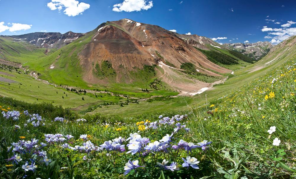
Redcloud above the Silver Creek valley · Photo: Bureau of Land Management
2
Silver Creek valley 10,800' · 0.8 mi
The trail climbs steadily up the valley with the creek nearby. Footing is dirt and rock.
3
Upper forest 11,300' · 1.5 mi
The trees begin to thin. You start to see the reddish slopes of Redcloud ahead.
4
Treeline 11,800' · 2.2 mi
Leave the trees and enter the open upper valley. The trail stays clear as it climbs through grass and rock.
Watch for: Fill water here if you need it. The streams above are unreliable.
5
Upper basin 12,300' · 2.8 mi
Continue up the basin. The saddle on Redcloud's northeast ridge is ahead at the head of the valley.
6
Switchbacks to the saddle 12,700' · 3.3 mi
The trail switchbacks up a steep slope of dirt and small rocks toward the saddle.
Watch for: Loose, gravelly footing. Watch your step going down.
7
Northeast ridge saddle 13,000' · 3.6 mi
Reach the saddle. Turn left (south) and follow the trail up Redcloud's northeast ridge.
8
Northeast ridge 13,600' · 4 mi
The trail climbs the ridge on red, broken rock. The summit is in view ahead.
9
Redcloud Peak 14,034' · 4.5 mi
Reach Redcloud's summit. Sunshine is about 1.5 miles to the south along a ridge trail. Check the weather now; you must return over this summit.
Watch for: Decision point. Only continue if the weather is good.
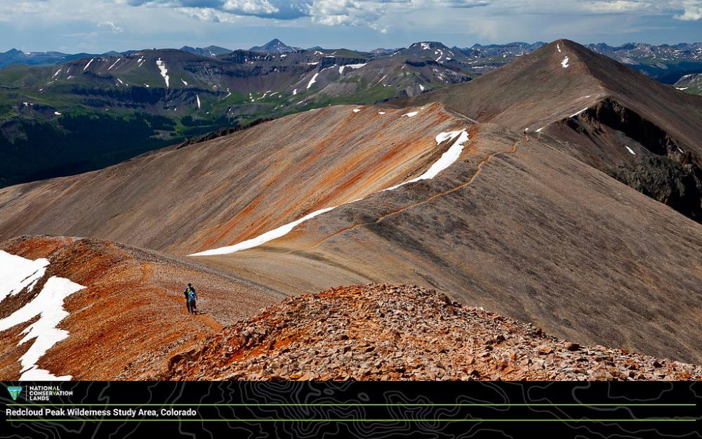
The ridge toward Redcloud · Photo: Bureau of Land Management
10
South ridge 13,900' · 4.8 mi
Head south off Redcloud and follow the trail along the right (west) side of the ridge.
11
Point 13,841 13,841' · 5.1 mi
Pass a 13,841-foot point on the ridge and keep following the trail south.
12
Redcloud–Sunshine saddle 13,500' · 5.5 mi
Descend to the saddle between the two peaks. The slopes to the west look like a shortcut down. They are not.
Watch for: Never descend west from this saddle. It is steep, loose and dangerous.
13
Rugged points 13,600' · 5.65 mi
Climb Sunshine's north ridge past some rocky points. The trail weaves around them.
14
Flat spot 13,700' · 5.8 mi
Reach a flat area near 13,700 feet. The summit is ahead.
15
Summit 14,004' · 6.1 mi
Follow the trail to Sunshine's summit. Look back at Redcloud, which is your way home.
Here Sunshine Peak Climber's Route goes off to the right. Keep going straight on the trail.
Coming down: Keep going straight on the trail you came up. Don’t take Sunshine Peak Climber's Route.
Landmarks to know
Silver Creek trail on the north side of the road
Treeline and the open Silver Creek basin
Switchbacks up to the saddle on Redcloud's northeast ridge
Red rock on Redcloud's upper ridge
Point 13,841 on the ridge between the peaks
The Redcloud–Sunshine saddle at 13,500 feet
A flat spot near 13,700 feet below Sunshine's summit
Getting down
Go back north along the ridge to the Redcloud–Sunshine saddle, then climb back past Point 13,841 to Redcloud's summit. From Redcloud, follow the northeast ridge back down to the saddle and then the switchbacks into the Silver Creek basin. Stay on the main trail to the car.
Do not descend west from the Redcloud–Sunshine saddle or off Sunshine's northwest face as a shortcut. These slopes are steep, loose and dangerous, and people have been seriously hurt on them. The switchbacks below the northeast ridge saddle are gravelly and slick; take them slowly.
If things go wrong
Before Redcloud's summit, the bail is simple: turn around and follow the trail down. Between the peaks, the safest way out is back over Redcloud, so if the weather looks bad from Redcloud, do not go on to Sunshine. If a storm catches you on the ridge, move quickly back toward Redcloud and down its northeast ridge to the saddle and the basin; do not try the west slopes. If someone is hurt, keep them warm, note your location, and call 911 if you have signal.
3D flyover
Press play to fly the Via Redcloud Peak. The graph shows elevation along the way and how much you gain each mile. Open full screen.
For planning only. The line is traced from open map data, not walked in the field, and off-trail parts are drawn straight. Load it in your GPS app to see the route, but navigate with your eyes, a map and the route description.
See the trail on video
A climb of this route filmed by The Virtual sherpa. The video belongs to them and only plays when you press play. This video covers Redcloud and Sunshine together.
Jump to
Other routes
All 3 routes up Sunshine Peak, with the class and round-trip distance for each.
TypeRouteClassTrailheadRound trip
Standard
Via Redcloud PeakAlso summits Redcloud Peak
Class 2
Silver Creek / Grizzly Gulch12.25 mi · 4,800'Full route →
Expect talus, scree and stretches where the trail disappears. Ankles and weather cause most of the trouble here. Start early, keep an eye on the sky, and set a turnaround time before you leave the car.