Afternoon storm risk is the line that matters. Everything else is comfort. In summer, plan to be off the ridge before the build-up starts, not as it starts. Forecast for the summit point, adjusted for its elevation · data from Open-Meteo.
Centennial 13er · Northeast Ridge
Overview
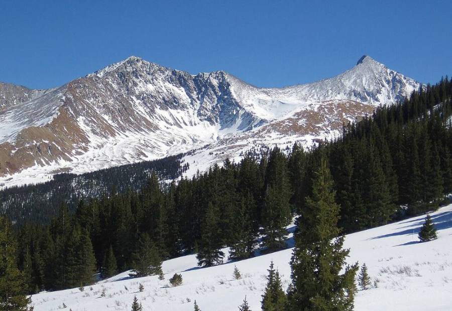
Crystal Peak is a rugged Tenmile Range summit southwest of Breckenridge, between Peak 10 and Pacific Peak. This route starts at the Spruce Creek trailhead, climbs an old road and trail to the two Crystal Lakes, then goes up to the northeast ridge and follows it to the summit. It is the easiest way up Crystal and one of the gentler high 13ers near Breckenridge.
Most of the route follows an old mining road and a trail. The last part is a rocky ridge with smaller, fairly stable talus. It is Class 2 with no real exposure on route, but the ridge has steep drops on its north and west sides. It suits fit hikers who are new to 13ers and comfortable on some talus.
The round trip is about 9.5 miles with about 3,500 feet of gain. Plan on 6 to 8 hours. You will be above treeline for 3 to 4 hours.
Plan of the day
Start by
By 5:30 a.m. You want to be on the ridge by mid-morning and off it before afternoon storms, which often build by late morning.
Turnaround
If you are not at the upper Crystal Lake by 10 a.m., turn around. Leave the summit by 11:30 a.m. at the latest.
Crux
The steep talus and switchbacks from the upper lake to the ridge, then the rocky ridge walk to the summit. It is slow but not exposed.
Route-finding
Easy on the road and trail to the upper lake. From there a climbers' trail leads to the ridge, and the ridge is easy to follow in clear weather. The main mistake is taking the wrong road or trail near the start, where several paths cross.
Water
Spruce Creek, Crystal Creek and the two Crystal Lakes have water. There is none on the ridge. Filter or treat all water; old mines are nearby.
From the center of Breckenridge, drive south on Highway 9 for about 2.5 miles. Turn right (west) onto Spruce Creek Road. It passes through a neighborhood and climbs about 1.2 miles to the lower Spruce Creek trailhead. Passenger cars can reach this lot.
Past the lower trailhead, the road becomes a rough 4WD track toward an upper parking area. Only high-clearance 4WD vehicles should try it. This description starts at the lower lot. The lot is busy on summer weekends because it also serves Mohawk Lakes, so arrive early. Do not park along the residential road.
RoadTundraTalus and screeRidgeExposed to lightning
The line is elevation, the band underneath is the ground, and the numbered dots match the steps below. Mileage and elevations are approximate.
1
Spruce Creek trailhead 10,400' · 0 mi
Start on the Spruce Creek trail at the west side of the lot. It climbs gently through thick spruce and fir. The trail is wide and easy to follow.
2
Wheeler Trail crossing 10,900' · 1 mi
The trail crosses the Wheeler Trail and reaches the rough 4WD road near the upper parking area. Several paths meet here, so read the signs and your map.
Watch for: Easy to take the wrong path here.
3
Crystal Lakes road 11,100' · 1.4 mi
Turn onto the old road that heads up toward Crystal Lakes, away from the Mohawk Lakes trail. It climbs through forest along Crystal Creek.
4
Road through the trees 11,500' · 2 mi
The road climbs steadily through the forest. It is rocky but wide. The trees start to thin and you get views of the peaks ahead.
5
Lower Crystal Lake 11,980' · 2.6 mi
The road reaches the lower lake near treeline. Crystal Peak's rocky east side rises ahead. This is a good spot for a break and to fill water.
6
Above the lower lake 12,400' · 3.1 mi
Continue on the road and trail as it climbs above treeline over open tundra. Look back for views of Breckenridge and the Blue River valley.
7
Upper Crystal Lake 12,850' · 3.5 mi
The upper lake sits in a rocky bowl below Crystal's summit. You may see old mining ruins near the lake. Check the weather and time here.
Watch for: Decision point. If clouds are building, turn back here.
8
Switchbacks to the ridge 13,100' · 3.8 mi
Follow a climbers' trail that switchbacks up the talus toward the ridge north of the summit. The path is steep and loose in places.
Watch for: Loose rock on the switchbacks. Watch for people above you.
9
Northeast ridge 13,300' · 4 mi
Reach the ridge. The Peak 10 side is to the right, and Crystal's summit is up the ridge to the left. The north side of the ridge drops steeply into a cirque.
Watch for: Wind is often strong on the ridge. Add a layer.
10
Upper ridge 13,600' · 4.4 mi
Walk up the ridge on smaller, fairly stable talus. There may be some tundra patches near the crest. Stay near the crest and away from the steep north and west edges.
Watch for: Steep drop on the north and west sides.
11
Summit 13,860' · 4.75 mi
The rocky top gives a view of Pacific Peak's notched summit to the south, the Crystal Lakes below to the east, and the Mohawk Lakes basin to the southeast.
Watch for: Start down soon if clouds are building.
Here Burro Trail goes off to the right; Burro Trail goes off straight ahead. Keep right to follow Crystal Lake Road.
Coming down: Keep right to stay on Crystal Lake Road. Don’t take Burro Trail.
2Mile 1.5 · 11,170'
Keep left to stay on Crystal Lake Road
Here Francie's Cabin access road goes off to the right. Keep left to follow Crystal Lake Road.
Coming down: Keep right to stay on Crystal Lake Road. Don’t take Francie's Cabin access road.
3Mile 1.6 · 11,230'
Keep right to stay on Crystal Lake Road
Here Wheeler Trail goes off to the left; Wheeler Trail goes off to the right. Keep right to follow Crystal Lake Road.
Coming down: Keep left to stay on Crystal Lake Road. Don’t take Wheeler Trail.
4Mile 2.5 · 11,900'
Turn right onto Crystal Trail
Here a road goes off to the left. Turn right to follow Crystal Trail.
Coming down: Turn left to stay on Crystal Lake Road. Don’t take the road.
Landmarks to know
Wide Spruce Creek trail through thick forest
Wheeler Trail crossing near the upper parking area
Old road climbing along Crystal Creek
Lower Crystal Lake near treeline
Upper Crystal Lake in a rocky bowl, with old mining ruins nearby
Climbers' trail switchbacking up talus to the ridge
Pacific Peak's notched summit to the south from the top
Getting down
Go back down the ridge and take the switchbacks slowly down to the upper lake. The loose rock on the switchbacks is easy to slip on. Do not try to shortcut straight down the talus from the ridge; the slopes get steeper and looser than they look.
From the upper lake, follow the road down past the lower lake and through the forest. At the bottom, be careful to take the Spruce Creek trail back to the lower lot, since several trails and roads meet near the upper parking area.
If things go wrong
The upper Crystal Lake is the main decision point. If weather looks bad or someone is struggling, turn back there. From the ridge, the fastest safe way off is back down the switchbacks to the upper lake and then the road. Do not drop off the north or west sides of the ridge. If lightning is close, get off the ridge crest, spread out, and crouch low on your pack. If someone is hurt, keep them warm and still and send someone down the road, where other hikers are common. Call 911 when you can reach help.
3D flyover
Press play to fly the Northeast Ridge. The graph shows elevation along the way and how much you gain each mile. Open full screen.
For planning only. The line is traced from open map data, not walked in the field, and off-trail parts are drawn straight. Load it in your GPS app to see the route, but navigate with your eyes, a map and the route description.
See the trail on video
A climb of this route filmed by The Virtual sherpa. The video belongs to them and only plays when you press play. This video covers Mount Helen, Father Dyer and Crystal together.
Jump to
Other routes
Every way up Crystal Peak we list, with its class.
This describes the route on a dry summer day. Snow, ice, a washed-out road or an afternoon storm can make it a very different climb. Check recent conditions the week you go and turn around when the day tells you to.