Afternoon storm risk is the line that matters. Everything else is comfort. In summer, plan to be off the ridge before the build-up starts, not as it starts. Forecast for the summit point, adjusted for its elevation · data from Open-Meteo.
Centennial 13er · South Face
Overview
Hagerman Peak sits in the Elk Mountains between Snowmass Mountain and Snowmass Peak, high above Geneva Lake and Snowmass Lake. The route starts in Lead King Basin at the end of a very rough 4WD road, follows a good trail up to Geneva Lake, then continues toward Trail Rider Pass. Near 11,480 feet you leave the trail and climb a drainage into a basin under Hagerman's south face, then go up one of several shallow gullies or rock ribs to the summit ridge. The round trip is about 10 miles with about 4,358 feet of gain.
The upper climb is steep and loose. When dry, it is a long grind on big talus and rubble. Early in the season the gullies hold snow, which can make the climb faster but calls for an ice axe and crampons or spikes and the skill to use them. The rating is Difficult Class 2 with moderate snow.
This climb suits hikers comfortable on steep talus and, early in summer, on snow. Most parties take 8 to 10 hours from Lead King Basin. Many people camp at Geneva Lake to split up the day; the sites there need a reservation.
Plan of the day
Start by
By 5 a.m. from Lead King Basin, or 6 a.m. from Geneva Lake. The face and the summit ridge are fully exposed, and the steep terrain is slow to retreat from.
Turnaround
Be in the basin at 12,200 feet below the south face by 9:30 a.m. and on the summit ridge by 11 a.m. If not, turn around.
Crux
The south face: about 1,600 feet of steep, loose rubble and boulders on a rib, or hard snow in the gullies early in the season.
Route-finding
The trail to Geneva Lake and toward Trail Rider Pass is clear. The key is leaving it at the right stream, near 11,480 feet, just after the trail swings around Hagerman's huge south ridge. On the face, pick one of the three shallow gullies or the ribs between them; the one leading toward the Hagerman and Snowmass Peak notch works well.
Water
Plenty along the trail, at Geneva Lake and in the stream you follow into the basin. There is none on the face once the snow is gone. Filter everything.
From Highway 133 between Carbondale and McClure Pass, turn east onto County Road 3 and drive 5 paved miles to Marble. Follow the main road through town to Beaver Lake, where you can park if you do not have a strong 4WD. Past the lake the road forks; take the right fork between cabins, and the road quickly gets rough as it climbs Daniels Hill. High-clearance 4WD is required from here.
At the top of the hill, the left fork (Forest Road 315) climbs along Lost Trail Creek with two sets of tight switchbacks and drops into Lead King Basin to the Geneva Lake trailhead. The right fork (Forest Road 314) goes past Lizard Lake and the Crystal Mill through Crystal, then climbs a very steep, rocky road into the basin. Both are slow and hard on vehicles, with narrow shelf sections where you must watch for oncoming traffic. Snowdrifts can block the upper road well into summer in big snow years. Ask the Forest Service or locals in Marble about current conditions.
Trail in the treesOff-trail, no set pathTundraTalus and screeRidgeExposed to lightning
The line is elevation, the band underneath is the ground, and the numbered dots match the steps below. Mileage and elevations are approximate.
1
Geneva Lake trailhead 9,685' · 0 mi
From the parking area, follow a path north along the east side of the road to the trailhead kiosk near the first switchback. Head north up the trail.
2
Trail turns west 9,900' · 0.3 mi
After about a quarter mile the trail turns west and climbs. Tall plants crowd the path, and there is avalanche damage in places.
3
Switchbacks and falls 10,500' · 1.2 mi
Between about 10,400 and 10,600 feet, the trail climbs through switchbacks. Look for waterfalls on the stream that drains Geneva Lake.
4
Geneva Lake 10,950' · 2 mi
Reach Geneva Lake. The trail goes north along the west shore. An alternate is to cross the outlet on a log jam and bushwhack southeast through steep forest to rejoin the trail higher up, but it has cliffs to avoid and is easy to get wrong.
Watch for: Camping here only at designated, reserved sites.
5
Stream north of the lake 11,000' · 2.5 mi
The trail swings east to cross the stream that feeds the lake from the north. You may need to wade.
Watch for: Cold, possibly deep water in early summer.
6
Point 11,402 11,400' · 3.1 mi
The trail heads southeast and climbs to a high point marked 11,402 on maps. Hagerman's huge south ridge rises to the north.
7
Leave the trail 11,480' · 3.5 mi
The trail swings around the south ridge, heads east out of the trees and crosses a smaller stream draining Hagerman and Snowmass Peak. Leave the trail here and turn north up the drainage.
Watch for: Easy to miss; this stream is your turnoff.
8
Drainage 11,850' · 3.8 mi
Follow the creek drainage north toward Hagerman and Snowmass Peak. There is no trail. The ground turns from grass to rock.
9
Basin below the south face 12,200' · 4 mi
Reach a large basin at about 12,200 feet. It is often snow-filled early in the season. Hagerman's south face rises ahead, with three shallow gullies divided by broad rock ribs.
Watch for: Decision point: check snow, time and weather.
10
South face rib or gully 12,900' · 4.4 mi
Pick a gully or rib. The rib just west of the gully that leads to the notch between Snowmass Peak and Hagerman is a good choice. The slope is not very steep but is full of large rocks and boulders, so you weave back and forth. With firm snow, a gully can go quickly with an ice axe and spikes or crampons.
Watch for: Loose boulders and rockfall; snow needs an axe.
11
Upper face 13,500' · 4.75 mi
Keep grinding up steep rubble toward the summit ridge. Stay close to your partners so that dislodged rocks do not gain speed.
Watch for: Do not climb directly below another party.
12
Summit ridge 13,750' · 4.9 mi
Reach the summit ridge and turn left (west) toward the true summit.
13
Hagerman Peak summit 13,848' · 5 mi
The top looks down on the broad snowfield of Snowmass Mountain's east face and on Snowmass Lake. The ridge west to Snowmass Mountain is a jumble of large, broken blocks and is a serious traverse.
Watch for: Do not try the ridge to Snowmass Mountain without experience.
Along the route
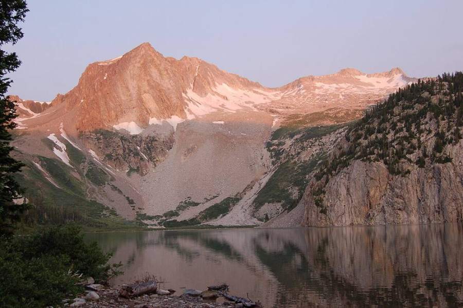
Hagerman Peak and Snowmass Mountain · Photo: Nelsestu
Landmarks to know
The trailhead kiosk near the first switchback of the road out of Lead King Basin.
Waterfalls on the outlet stream of Geneva Lake.
Geneva Lake, with the trail on its west shore.
The high point marked 11,402 feet on the trail.
Hagerman's giant south ridge, which the trail curves around.
The small stream crossing near 11,480 feet where you turn north.
Three shallow gullies and rock ribs on the south face.
Getting down
Go back down the same gully or rib. The loose boulders are easier to trip on going down, so move slowly and keep the group close. If the gullies still hold snow and you have an ice axe and know how to self-arrest, a glissade can drop you about 1,000 feet quickly. Never glissade with crampons on, and only on snow with a safe runout.
In the basin, follow the drainage south back to the Trail Rider Pass trail. Do not drop too far west into the steep ground above Geneva Lake. Once on the trail, retrace your steps around the south ridge, past the lake and down the switchbacks to Lead King Basin.
If things go wrong
The basin at 12,200 feet is the main bail point. From there, the drainage leads back to the trail and into the trees. On the face, the fastest safe retreat is down the line you came up; do not traverse into other gullies. If lightning starts, get off the ridge and down to the basin. If someone is hurt, the Trail Rider Pass trail and Geneva Lake are busy in summer, and other hikers may be able to help carry word out. Call 911 if you have a signal; the road into Lead King Basin is slow, so expect a long wait.
3D flyover
Press play to fly the South Face. The graph shows elevation along the way and how much you gain each mile. Open full screen.
For planning only. The line is traced from open map data, not walked in the field, and off-trail parts are drawn straight. Load it in your GPS app to see the route, but navigate with your eyes, a map and the route description.
See the trail on video
A climb of this route filmed by Steve Bremner. The video belongs to them and only plays when you press play.
Other routes
Every way up Hagerman Peak we list, with its class.
This describes the route on a dry summer day. Snow, ice, a washed-out road or an afternoon storm can make it a very different climb. Check recent conditions the week you go and turn around when the day tells you to.