Afternoon storm risk is the line that matters. Everything else is comfort. In summer, plan to be off the ridge before the build-up starts, not as it starts. Forecast for the summit point, adjusted for its elevation · data from Open-Meteo.
Centennial 13er · North Section
Overview
Holy Cross Ridge is the high point on the long ridge running south from Mount of the Holy Cross, in the Sawatch Range south of Minturn. This route follows the standard Mount of the Holy Cross trail over Half Moon Pass, down to East Cross Creek, and up the north ridge to the 14er summit. From there you walk southwest down to a saddle and climb a pile of big boulders to the top of Holy Cross Ridge. It is easier to go over the 14er summit than to try to contour below it on trailless boulders.
This is a very long day. The round trip is about 13 miles with about 5,800 feet of gain, because you lose about 900 feet going down to East Cross Creek and must regain it on the way back out. The trail is good to treeline, then climbs endless talus to the summit of Holy Cross. The traverse to Holy Cross Ridge is tiring boulder-hopping with no trail. It is Class 2 with no real exposure, but the length and the boulders make it hard.
Plan on 11 to 14 hours. Many people camp at East Cross Creek to split the day. Mount of the Holy Cross has a long history of lost and injured hikers, mostly on the way down. Only strong, experienced hikers should try this in a single day.
Plan of the day
Start by
By 4 a.m. for a day trip, or at first light from a camp at East Cross Creek. You need to be off the high ridges before storms build, often by late morning.
Turnaround
If you are not on the summit of Mount of the Holy Cross by 10:30 a.m., skip Holy Cross Ridge. If you will not reach Holy Cross Ridge by 11:30 a.m., turn around.
Crux
The long boulder climb up Holy Cross's north ridge, then the boulder scramble from the saddle up to Holy Cross Ridge. The final climb back up to Half Moon Pass at the end of the day is also very hard on tired legs.
Route-finding
The trail is clear to treeline and marked by cairns up the north ridge. The traverse to Holy Cross Ridge has no trail. The biggest danger is on the way down from Holy Cross: people drift off the north ridge to the west and get lost in steep, rough terrain. Stay on the ridge crest and follow the cairns.
Water
East Cross Creek is the last reliable water. There is none on the north ridge or the traverse. Carry enough for the whole upper route and filter or treat all water.
From I-70, take the Minturn exit (Exit 171) and drive south on US 24 through Minturn. About 3.5 miles past the sharp turn at the north end of town, turn right onto Tigiwon Road (Forest Road 707), just before the highway crosses Eagle Creek. From Leadville, the turnoff is on the left just after the highway crosses the Eagle River below Battle Mountain.
Tigiwon Road is a long, graded gravel road with many turns and switchbacks. It runs about 8.5 miles to the Half Moon trailhead. Most passenger cars can make it when it is dry, but a crossover or SUV is safer. The road often does not open until mid-June. The lot is small and fills early on summer weekends; you may have to park well back down the road. The Half Moon and Fall Creek trails both start here, so make sure you take the Half Moon trail.
Trail in the treesRidgeTalus and screeScramblingExposed to lightning
The line is elevation, the band underneath is the ground, and the numbered dots match the steps below. Mileage and elevations are approximate.
1
Half Moon trailhead 10,320' · 0 mi
Take the Half Moon trail toward Mount of the Holy Cross. Do not take the Fall Creek trail, which starts from the same area. The trail climbs gently through forest.
Watch for: Two trails start here. Take the Half Moon trail.
2
Forest climb 11,000' · 0.8 mi
The trail climbs at a steady, easy grade through the trees and into open meadows with wildflowers in summer.
3
Half Moon Pass 11,600' · 1.7 mi
Reach the pass. Mount of the Holy Cross comes into view across the valley to the west. From here the trail drops down the other side.
Watch for: Remember you must climb back up to this pass at the end of the day.
4
Descent to the creek 11,100' · 2.3 mi
The trail drops steadily through forest toward East Cross Creek. Rocks and roots make the footing uneven.
5
East Cross Creek 10,700' · 3.1 mi
Cross East Cross Creek. This is the low point of the route and the last reliable water. There are campsites in this area. Fill your bottles here.
Watch for: Last water. Carry enough for the rest of the climb.
6
North ridge trail 11,300' · 3.6 mi
The trail heads west a short way, then turns south and climbs steeply through the trees up the north ridge of Mount of the Holy Cross.
7
Treeline 11,800' · 4.1 mi
The trees end and the ridge opens up. The rest of the climb is on talus and big boulders. Look for cairns marking the route up the ridge.
Watch for: Decision point. If it is late or the weather is poor, turn back here.
8
North ridge talus 12,600' · 4.6 mi
Climb the ridge over talus and boulders. The path is faint in places. Stay near the crest and follow the cairns.
Watch for: Big boulders can shift. Take your time.
9
Upper north ridge 13,400' · 5.2 mi
The ridge steepens toward the summit. Keep following cairns on the boulders. Note landmarks along the ridge to help you stay on route on the way down.
10
Mount of the Holy Cross 14,005' · 5.7 mi
The 14er summit is a big, rocky top. Look southwest down the ridge toward Holy Cross Ridge and the saddle between them. Check the weather and time before going on.
Watch for: Key decision point. If weather is building, go back down the north ridge.
11
Southwest ridge 13,680' · 5.95 mi
Walk southwest down the ridge. The rock improves around this elevation and travel gets a bit easier. Keep heading toward the saddle.
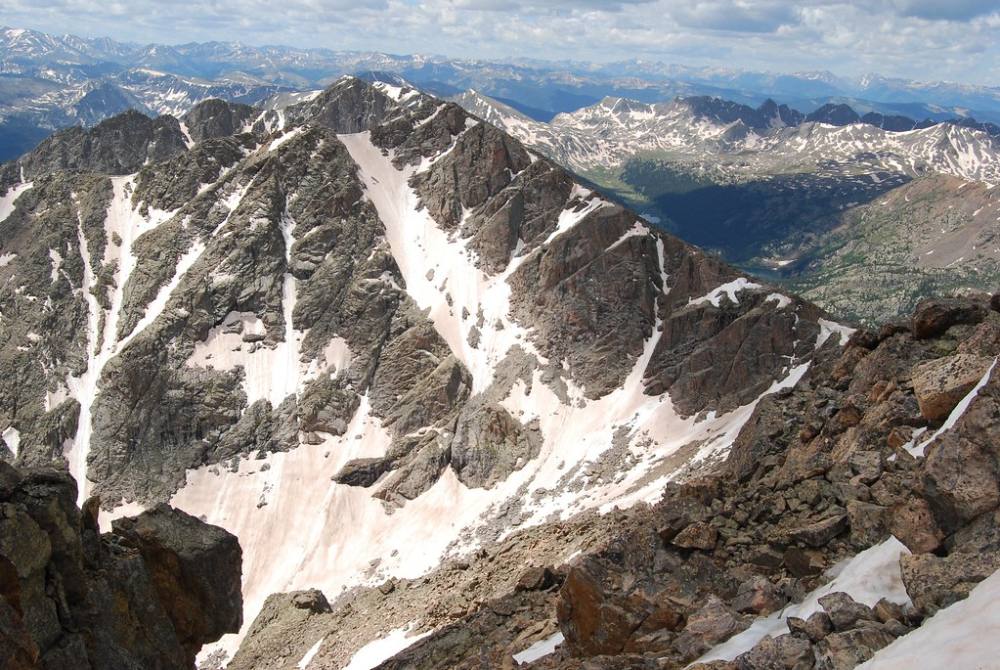
Halo Ridge · Photo: Orion Wiseman
12
Saddle 13,500' · 6.2 mi
Reach the low saddle between Mount of the Holy Cross and Holy Cross Ridge. From here you climb back up on big boulders.
13
Holy Cross Ridge 13,850' · 6.5 mi
Scramble up the large boulders to the small, rocky summit. It is slow going and there is no trail. From the top you can see the long ridge running south and back north to Mount of the Holy Cross.
Watch for: Do not linger. You still have a long way back over the 14er.
Along the route
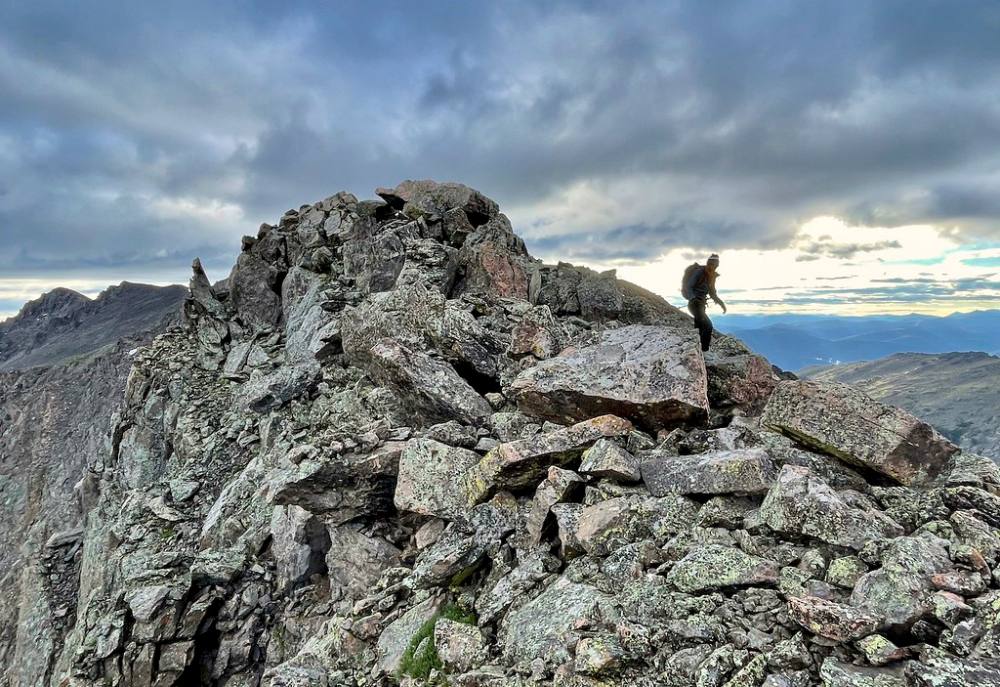
Walking the rocks of Halo Ridge · Photo: kalestews
Keep right to stay on Mount of the Holy Cross #2009
Here Notch Mountain goes off to the left. Keep right to follow Mount of the Holy Cross #2009.
Coming down: Keep going straight on Mount of the Holy Cross #2009. Don’t take Notch Mountain.
Landmarks to know
Start of the Half Moon trail at the trailhead (not the Fall Creek trail)
Half Moon Pass with the first view of Mount of the Holy Cross
East Cross Creek crossing and campsites at the low point
Cairns marking the route up the north ridge above treeline
The large, rocky summit of Mount of the Holy Cross
Low saddle between the 14er and Holy Cross Ridge
Small, rocky summit of Holy Cross Ridge above a field of big boulders
Getting down
Go back down to the saddle and climb back up to the summit of Mount of the Holy Cross. From there, descend the north ridge. This is where most people get into trouble on this mountain. It is easy to drift west off the ridge into steep, rough terrain that leads away from the trail. Stay on the ridge crest, follow the cairns, and check your map or GPS often, especially in fog or snow.
Below treeline, follow the trail down to East Cross Creek. Then save energy for the last climb back up to Half Moon Pass, about 900 feet of gain at the end of a long day. From the pass, the trail drops easily back to the trailhead.
If things go wrong
The summit of Mount of the Holy Cross is the main decision point for Holy Cross Ridge. If the weather is poor or anyone is tired, skip Holy Cross Ridge and go straight back down the north ridge. Once on the traverse, the only practical way out is back over the 14er. Do not try to drop off either side of the ridge to shortcut. If lightning is close, get off the ridge crest, spread out, and crouch low on your pack. If someone is hurt, keep them warm and still and send someone down to East Cross Creek or Half Moon Pass, where other hikers are common. Call 911 when you can reach help.
3D flyover
Press play to fly the North Section. The graph shows elevation along the way and how much you gain each mile. Open full screen.
For planning only. The line is traced from open map data, not walked in the field, and off-trail parts are drawn straight. Load it in your GPS app to see the route, but navigate with your eyes, a map and the route description.
See the trail on video
No video yet
We haven’t found a good video of this route that matches the way we describe it. The route strip, junctions and 3D flyover show the way in the meantime.
Other routes
Every way up Holy Cross Ridge we list, with its class.
This describes the route on a dry summer day. Snow, ice, a washed-out road or an afternoon storm can make it a very different climb. Check recent conditions the week you go and turn around when the day tells you to.