Afternoon storm risk is the line that matters. Everything else is comfort. In summer, plan to be off the ridge before the build-up starts, not as it starts. Forecast for the summit point, adjusted for its elevation · data from Open-Meteo.
Centennial 13er · North Spur from Hoosier Pass
Overview
Mount Silverheels is the big, rounded peak that stands alone at the north end of South Park, east of Hoosier Pass and northeast of Fairplay. This route starts at the top of Hoosier Pass, crosses open high ground to the east, drops into the upper Beaver Creek valley, and then climbs the long north spur of Silverheels to its rocky summit.
It is mostly off-trail but on easy ground: tundra, grass, a band of willows along the creek, and some scree and small rubble higher up. There is no exposure and no scrambling. The main challenges are the distance, the drop into the Beaver Creek valley that you have to climb back out of on the way home, and the wind, which is often fierce on this open peak. It is a good choice for fit hikers who want a quiet, big-view summit without technical ground.
The round trip is about 9 miles with about 3,500 feet of gain. Plan on 6 to 8 hours. You are above treeline almost the whole way, with no shelter until the rock windbreak on the summit.
Plan of the day
Start by
By 5:30 a.m. You are above treeline for nearly the whole route, and storms over South Park often build by late morning.
Turnaround
If you have not crossed Beaver Creek by 9:30 a.m., turn around. Leave the summit by 11:30 a.m. at the latest, since you still have to climb back out of the Beaver Creek valley.
Crux
There is no technical crux. The hardest parts are the long, steady climb up the north spur and the climb back up out of the Beaver Creek valley at the end of the day.
Route-finding
There is little or no trail, but the terrain is open. In clear weather Silverheels is easy to see. In fog, the broad slopes and ridges make it easy to drift off course, especially on the way back to the pass. Carry a map or GPS track. Much of the land nearby is private, so stay on public land and obey posted signs.
Water
Beaver Creek is the only reliable water. There is none on the north spur. Filter or treat it; the area has a long mining and grazing history.
Hoosier Pass is on Highway 9 between Breckenridge and Alma. From I-70, take the Frisco exit and follow Highway 9 south through Breckenridge to the top of the pass. From US 285, turn north on Highway 9 at Fairplay and drive north through Alma to the pass.
Any car can make it to the pass on this paved highway. Park at the summit of the pass, on the highway's west side. Sightseers crowd it in summer, so get there early. South and east of the pass there are several old roads and property lines. A few roads people once used to approach Silverheels are now signed as private, so stay off them.
RidgeTundraTalus and screeScramblingExposed to lightning
The line is elevation, the band underneath is the ground, and the numbered dots match the steps below. Mileage and elevations are approximate.
1
Hoosier Pass 11,500' · 0 mi
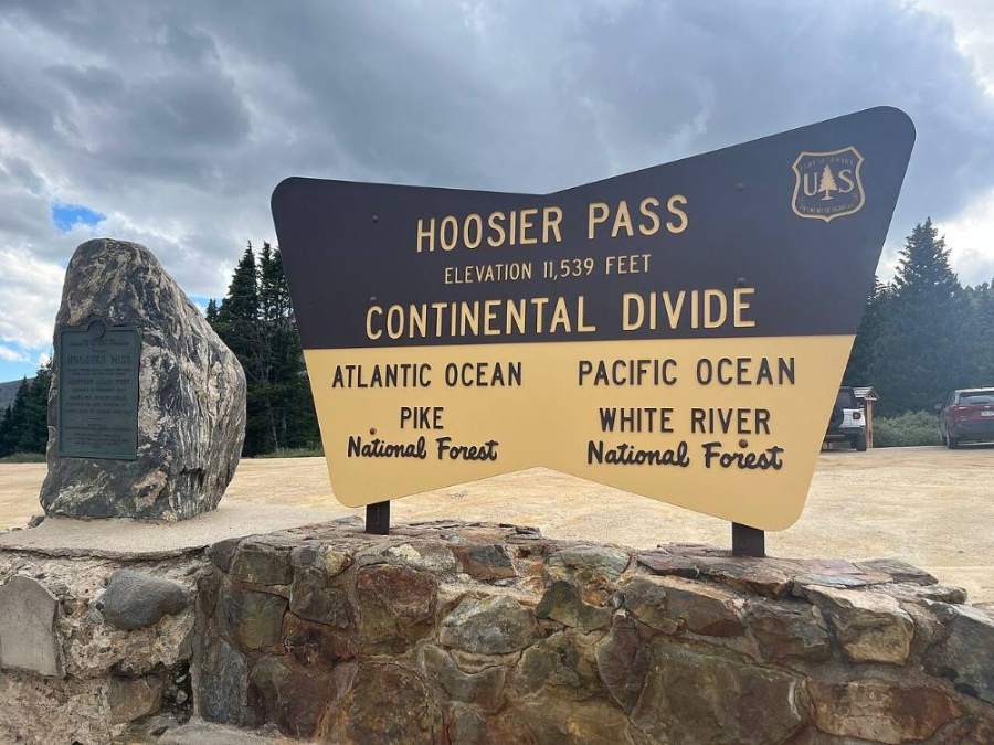
Start at the top of the pass. Cross the highway carefully and head east onto the open slopes. Silverheels is the big, rounded peak to the southeast.
Watch for: Watch for traffic when crossing the highway.
The Hoosier Pass sign where the route starts · Photo: Gbear605
2
Open slopes east of the pass 11,800' · 0.6 mi
Climb east over tundra and through scattered trees. The ground is gentle and open. Stay on public land and away from posted private roads and cabins.
3
Broad ridge 12,200' · 1.3 mi
The trees give way to open tundra on a broad ridge. Views open up of South Park to the south and the Tenmile and Mosquito ranges to the west.
Watch for: Wind is often strong here.
4
High point on the ridge 12,500' · 2 mi
Reach the high point of the ridge. Look southeast into the upper Beaver Creek valley and up the long north spur of Silverheels. Pick your line down to the creek and up the spur.
Watch for: Remember this spot. You must climb back up to it on the way home.
5
Descent toward Beaver Creek 12,200' · 2.4 mi
Head down the grassy slopes into the valley. Aim for an easy crossing where the willows are thin.
6
Beaver Creek crossing 11,900' · 2.8 mi
Cross the creek and the willows along it. Look for gaps in the willows to avoid thrashing through thick brush. Fill water here if you need it.
Watch for: Last water. Willows can be wet and slow.
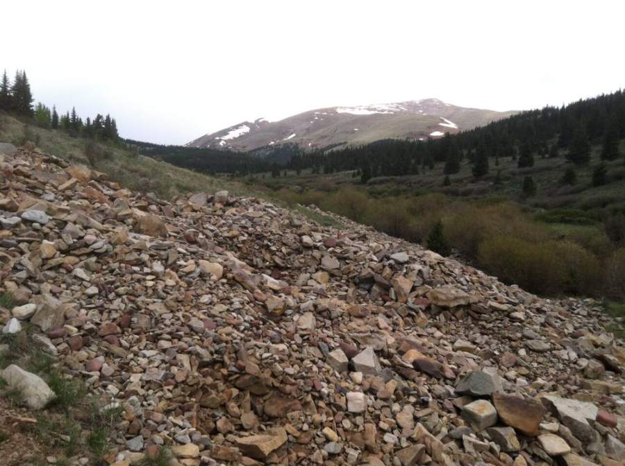
Upper Beaver Creek with Silverheels in the distance · Photo: QKC
7
Base of the north spur 12,200' · 3.1 mi
On the far side of the creek, start up the north spur. The grass is steady and firm.
8
Lower north spur 12,700' · 3.5 mi
Follow the spur upward on tundra and grass. The grade is steady. Silverheels' summit is ahead and above you.
9
Middle north spur 13,200' · 3.9 mi
The ground turns to scree and small rubble mixed with tundra. The walking is easy but slower. Keep to the crest of the spur.
Watch for: Wind can be severe. Add layers early.
10
Upper north spur 13,600' · 4.3 mi
Climb the last slopes toward the summit. The rock gets a bit bigger, but there is no scrambling.
11
Summit 13,828' · 4.5 mi
The rocky summit has a large rock windbreak. The view takes in all of South Park, the Mosquito Range, and the Tenmile Range. Rest out of the wind, then start back.
Watch for: Start down soon if clouds are building. You still have a long way back.
Landmarks to know
Hoosier Pass parking on Highway 9
Open tundra on the broad ridge east of the pass
View into the upper Beaver Creek valley from the ridge high point
Willows along Beaver Creek at the low point of the route
Long, grassy north spur rising toward the summit
Scree and small rubble on the upper spur
Large rock windbreak on the summit
Getting down
Go back down the north spur the same way. The spur is broad, and in fog it is easy to drift off to one side. Keep checking your map or GPS so you head back to the same place on Beaver Creek.
After crossing the creek, you have to climb about 600 feet back up to the ridge high point. Save energy for this. From the ridge, head west back to Hoosier Pass. Stay on the route you came up and avoid cutting across private land or onto posted roads.
If things go wrong
The Beaver Creek crossing is the main decision point. If weather is building or someone is tired, turn around there. From the north spur, the fastest way to safety is back down to the creek and then over the ridge to the pass. Be aware that you have to climb back up to reach the pass, so do not wait too long. If lightning is close, get off high points, spread out, and crouch low on your pack. If someone is hurt, keep them warm and out of the wind, and send someone back to Hoosier Pass, where there is a busy highway. Call 911 when you can reach help.
3D flyover
No 3D flyover for this peak
There is no set trail from Hoosier Pass. The whole climb is an open ridge walk, so there is no fixed line to follow. A flyover only works when there is a set trail to trace. Without one, the line would be a guess, and a guess could send you the wrong way on the mountain. Use the step-by-step route with a good map and GPS track instead.
See the trail on video
A climb of this route filmed by The Virtual sherpa. The video belongs to them and only plays when you press play.
Jump to
Other routes
Every way up Mount Silverheels we list, with its class.
North Spur from Hoosier Passthis routeClass 2 9 mi
This describes the route on a dry summer day. Snow, ice, a washed-out road or an afternoon storm can make it a very different climb. Check recent conditions the week you go and turn around when the day tells you to.