Afternoon storm risk is the line that matters. Everything else is comfort. In summer, plan to be off the ridge before the build-up starts, not as it starts. Forecast for the summit point, adjusted for its elevation · data from Open-Meteo.
Centennial 13er · South Ridge
Overview
Thunder Pyramid is the high point on the jagged ridge that runs south from Pyramid Peak, above West Maroon Creek. It is a serious climb on typical Elk Range rock: crumbly, layered sandstone that breaks into small scree and covers every ledge. Almost every hold and step can move. This is not a peak for beginners.
The route follows the popular West Maroon trail past Crater Lake, then leaves it at a creek crossing and climbs east into a hidden upper basin. From the basin, a narrow couloir leads to the saddle between Thunder Pyramid and its neighbor to the south, Lightning Pyramid. From the saddle you work north along the south ridge, with a short detour on the east side, to the summit. Much of it is Class 3, with a few moves that some people rate low Class 4, and there is real exposure.
Rockfall is the biggest danger. The couloirs are narrow and funnel anything that falls. Plan on 9 to 12 hours round trip. Many people backpack in and camp near the creek crossing to shorten the day.
Plan of the day
Start by
By 4 to 5 a.m. You need to be through the loose couloirs before other parties and before afternoon storms, and you are above treeline for many hours.
Turnaround
If you are not at the Thunder-Lightning saddle by 10 a.m., turn around. Do not start up the couloir if another party is in it or above it.
Crux
The narrow, loose couloir to the saddle and the east-side detour off the south ridge, where you climb a talus gully and crumbly ledges back to the crest. Some moves are low Class 4 and the rock is poor.
Route-finding
The trail to the creek crossing is easy. The climb into the hidden basin follows faint paths and cairns through cliff bands. From the basin, picking the correct couloir takes care: get almost directly west of the saddle between Thunder and Lightning before you start up.
Water
West Maroon Creek and the stream in the upper basin. Filter all water. There is little or no water above the basin, so fill up there.
From Highway 82 just west of Aspen, take the roundabout and head south on Maroon Creek Road toward Aspen Highlands and Maroon Lake. The road is paved and fine for any car. There is a staffed entry station about 4.7 miles in where a fee is collected.
In summer, private car access to Maroon Lake is limited and a parking reservation is required, often booked well ahead. Without one, you ride the shuttle from Aspen Highlands, which does not run early enough for most climbers. Check the White River National Forest website for current rules. There is no camping at Maroon Lake. Overnight trips need a permit, and bear canisters are required in this area.
Trail in the treesTalus and screeScramblingRidgeExposed to lightning
The line is elevation, the band underneath is the ground, and the numbered dots match the steps below. Mileage and elevations are approximate.
1
Maroon Lake 9,600' · 0 mi
Start at the trailhead at Maroon Lake. Follow the wide trail around the lake toward Crater Lake. The Maroon Bells rise straight ahead. Early in the morning you will have it mostly to yourself.
2
Wilderness boundary 9,900' · 1 mi
The trail climbs steadily through aspens and across an old rocky moraine. You pass the wilderness boundary sign along the way.
3
Crater Lake junction 10,076' · 1.8 mi
Near the north end of Crater Lake the trail forks. The right branch climbs toward Buckskin Pass. Stay left and follow the trail south along the west side of the lake toward West Maroon Pass.
Watch for: Do not take the Buckskin Pass trail.
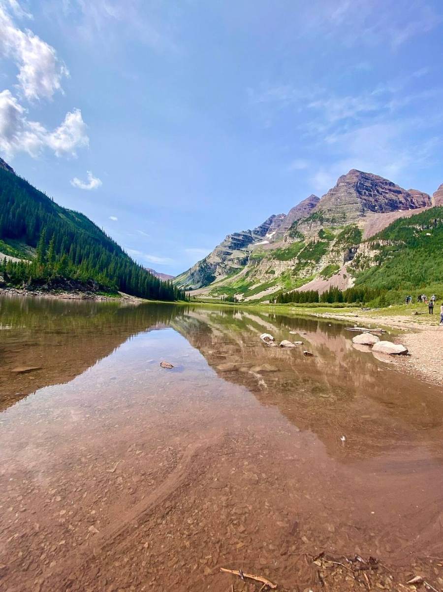
The Maroon Bells from Crater Lake · Photo: Whyleesaa
4
Talus crossing 10,200' · 2.5 mi
South of the lake the trail climbs a bit, then drops across a band of talus. It then weaves through thick willows along the creek. Wet willows will soak you on a rainy morning.
5
West Maroon Creek crossing 10,500' · 3.75 mi
At about 3.75 miles the trail crosses from the west side to the east side of West Maroon Creek. There may not be a bridge. This is where you leave the trail. Campsites can be found near here if you are backpacking.
Watch for: Creek can be high and cold in early summer.
6
Cliff bands and benches 11,000' · 4.1 mi
Head east up the slope through trees, using game trails and cairned paths. The hillside is a series of small cliffs and flat benches. Look for a cairned line that goes through a boulder field and up beside a steep gully to another bench.
Watch for: Easy to get cliffed out. Back up and look for the cairns if the terrain turns steep.
7
Upper basin 11,800' · 4.4 mi
The slope eases and you enter a hidden basin at about 11,800 feet. The west side of the creek is gentle tundra; the east side is mostly talus. Stop here and identify Thunder Pyramid, Lightning Pyramid and the lower peak to the south.
8
Couloir apron 12,200' · 4.6 mi
Get almost directly west of the saddle between Thunder and Lightning. A big cone of talus spreads out below the couloir that leads to it. Climb the talus about 400 feet as it narrows into the couloir.
Watch for: Large talus can shift under your feet.
9
Narrow couloir 12,900' · 4.9 mi
The couloir is steep and very narrow in places, less than 10 feet wide, with loose large talus in the bottom. When dry it is rough Class 3 with a few short stemming moves. Early in the season it can be full of hard snow.
Watch for: Rockfall funnels down the whole couloir. Do not enter if anyone is in or above it.
10
Thunder-Lightning saddle 13,400' · 5.1 mi
Top out at the saddle on the main ridge. Lightning Pyramid is the point to the south. Thunder Pyramid is to the north. Take a break and look over the ridge ahead.
11
East-side traverse 13,550' · 5.25 mi
The ridge right above the saddle is hard to follow directly. Drop onto the east side and pick your way across terraced, loose ledges toward an obvious talus couloir that climbs back up to the ridge crest.
Watch for: Loose rock on sloping ledges. Every step needs testing.
12
Return couloir 13,840' · 5.4 mi
Climb the talus-filled couloir back to the ridge crest, which you reach near 13,840 feet. Early in the season it can hold snow and a cornice at the top; if so, you may need to cross higher on rock beside it.
Watch for: Snow here early in the season. Ice axe needed.
13
Upper south ridge 13,900' · 5.5 mi
Follow the ridge north. Small rock steps can be passed on either side by finding breaks in the low cliffs. You will pass the top of a pale, white-rock couloir that drops off the west side. Note where it is.
Watch for: Exposure on both sides of the ridge.
14
Summit 13,944' · 5.6 mi
The summit is about 100 yards past the white-rock couloir. Views take in Pyramid Peak to the north, the Maroon Bells across the valley and the whole Elk Range.
Along the route
Crater Lake below the Bells · Photo: Leonardkaroline
Landmarks to know
Crater Lake and the fork where the Buckskin Pass trail goes right.
The spot where the West Maroon trail crosses from the west to the east side of the creek, about 3.75 miles in.
A boulder field and a steep gully beside the cairned line up to the hidden basin.
The hidden upper basin at about 11,800 feet with tundra on one side and talus on the other.
A large talus cone narrowing into the couloir below the Thunder-Lightning saddle.
The talus couloir on the east side that returns you to the ridge near 13,840 feet.
The top of the white-rock couloir on the west side, about 100 yards south of the summit.
Getting down
The safest way down for most people is to reverse the ascent: back south along the ridge, down the east-side couloir and across the ledges to the saddle, then down the narrow couloir to the basin. Move one at a time in the couloirs and keep the group close so falling rocks do not pick up speed. Face in on the steeper steps if you need to.
Some parties descend the white-rock couloir on the west side instead. It is loose scree at the top and often holds snow lower down early in the season. It is steep and needs an ice axe and good judgment. Lower on the slope, a cliff band near 12,000 feet must be avoided by traversing left onto easier grass. Below the basin, be careful to find the cairned line down through the cliff bands to the creek crossing.
If things go wrong
The saddle is the last good place to decide. If weather is building or the rock feels too loose, turn around there and go straight back down the couloir to the basin. Above the saddle there are no quick exits, and the ridge is a bad place in lightning. The upper basin is the nearest safer ground; from there the West Maroon trail is less than a mile below. If someone is hurt, keep them still and warm, get out of any rockfall line, and send for help or use a satellite messenger. Call 911 if you have a signal. A rescue in this terrain is slow and difficult.
3D flyover
No 3D flyover for this peak
Above the Maroon Lake trail the route is about a mile of off-trail loose rock with no set trail. A flyover only works when there is a set trail to trace. Without one, the line would be a guess, and a guess could send you the wrong way on the mountain. Use the step-by-step route with a good map and GPS track instead.
See the trail on video
A climb of this route filmed by Matt Payne. The video belongs to them and only plays when you press play.
Other routes
Every way up Thunder Pyramid we list, with its class.
This describes the route on a dry summer day. Snow, ice, a washed-out road or an afternoon storm can make it a very different climb. Check recent conditions the week you go and turn around when the day tells you to.