Afternoon storm risk is the line that matters. Everything else is comfort. In summer, plan to be off the ridge before the build-up starts, not as it starts. Forecast for the summit point, adjusted for its elevation · data from Open-Meteo.
Combo route · Blanca and Ellingwood
Overview
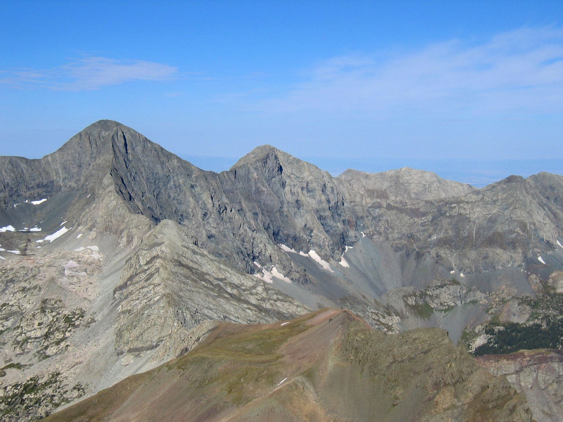
This link-up climbs Ellingwood Point and Blanca Peak in one day from the Lake Como road. It goes up Ellingwood first by its standard South Face route, then crosses to Blanca on a Class 3 traverse below the ridge between the two peaks. The day ends on Blanca's summit, and you descend Blanca's standard Northwest Ridge route.
It suits strong hikers who have done Class 3 scrambling and can handle a very long day. The round trip is about 18 miles with roughly 6,800 feet of gain from low on the road. You can shorten that if your vehicle can drive higher. The traverse itself follows a line of cairns and stays mostly below the crest. It is not the hardest scrambling in the state, but it has loose rock and a gully of white rubble to cross.
Most people camp near Lake Como and climb both peaks the next day. From a camp, plan on 7 to 10 hours for the two summits. You can also skip the traverse by going down to the standard trail between the peaks and back up, which is easier but longer.
Plan of the day
Start by
By 5 a.m. from a camp at Lake Como. Doing it in one push from the lower road means starting well before 3 a.m.
Turnaround
If you are not on Ellingwood's summit by 10 a.m., skip the traverse and head down. If weather looks unsettled on the traverse, you can drop toward the basin instead of finishing to Blanca.
Crux
The traverse between the peaks. Staying on the cairned line without losing too much height, and crossing a loose gully of white rock about halfway across.
Route-finding
Moderate. Ellingwood's standard route and Blanca's standard route are well used. On the traverse, drop about 150 feet from the notch on Ellingwood's east ridge and then follow cairns. Keep your elevation.
Water
Lake Como and the streams in the basin above it have water. There is none on the upper peaks or the traverse. Filter before you leave the basin and carry about 2 to 3 liters for the summits.
East of Alamosa, leave U.S. 160 and go north on Colorado 150, the road to Great Sand Dunes National Park. After a little more than 3 miles, make a right on the Lake Como road, which some call the Blanca Peak road. How high you can drive depends on your vehicle. Most cars can go about 1.5 miles before the road gets rough.
Stock 4WD SUVs and trucks can creep up about 3.25 miles to pull-offs near 8,800 feet, which is a popular place to park. From there it is a bit under 4 miles to Lake Como. Short, high-clearance 4WD vehicles may reach about 10,000 feet, but there are few places to park. Beyond that, the road is only for modified off-road vehicles and expert drivers. Stats for this route assume a low start.
RoadTundraTalus and screeRidgeExposed to lightning
The line is elevation, the band underneath is the ground, and the numbered dots match the steps below. Mileage and elevations are approximate.
1
Lower Lake Como road parking 8,000' · 0 mi
Start walking up the rough road where your car can go no farther. The road climbs steadily through dry, open country.
Watch for: The road is hot and exposed low down. Start early.
2
4WD pull-offs 8,800' · 1.75 mi
Pass the pull-offs near 8,800 feet where many 4WD vehicles park. The road gets much rougher above here.
Watch for: Watch for off-road vehicles on the road.
3
Road near 10,000 feet 10,000' · 3.5 mi
Keep walking the rocky road. It passes the last spots where normal 4WD vehicles can park and gets steeper.
4
Lake Como 11,750' · 5.6 mi
Reach Lake Como, the usual place to camp. Fill water and filter it.
Watch for: Camp here if you can. Doing both peaks from the lower road is a huge day.
5
Upper basin 12,300' · 6.4 mi
Follow the standard route up the basin above the lake toward Blanca and Ellingwood. Water is still available from streams here.
Watch for: Last reliable water.
6
Ellingwood South Face 13,200' · 7.3 mi
Leave the main trail and follow Ellingwood's standard South Face route up talus and rock toward the east ridge. As you get higher, you can see the traverse route across to Blanca.
Watch for: Loose rock on the face. Watch for people above you.
7
Notch on Ellingwood's east ridge 13,900' · 7.9 mi
Climb to the notch on the east ridge that the standard route passes. Note it well. You will come back here after the summit.
8
Summit of Ellingwood Point 14,057' · 8.1 mi
Scramble the last stretch to the first summit. Check your time and the sky before starting the traverse.
Watch for: This is your main decision point for the traverse.
9
Start of the traverse 13,800' · 8.3 mi
Go back along the east ridge to the notch. Drop about 150 feet below the ridge and find the cairned line that stays just under the hardest ground on the crest.
Watch for: Do not lose more height than you need. Dropping too low makes the traverse longer and looser.
10
White rock gully 13,700' · 8.55 mi
About halfway across, cross a gully full of loose white rock. Move one at a time and step carefully. Then pick up the cairns again on the far side.
Watch for: Rockfall risk. Do not stand below anyone in the gully.
11
Below the ridge low point 13,650' · 8.75 mi
Pass under the lowest part of the ridge. The ground gets easier here, and you start climbing again on the Blanca side.
12
Join Blanca's Northwest Ridge 13,950' · 8.95 mi
Climb up and to the left to meet Blanca's standard Northwest Ridge route. Follow it up the ridge.
13
Summit of Blanca Peak 14,350' · 9.1 mi
Scramble up the last part of the ridge to Blanca's summit, the higher of the two peaks.
Getting down
Go down Blanca's standard Northwest Ridge route. Downclimb the Class 2 and easy Class 3 ridge with care, then follow the trail back into the basin and down to Lake Como. From the lake, walk the Lake Como road back to your car. The long road descent is hard on the knees and feels endless after a big day.
If things go wrong
Before the traverse, Ellingwood's summit is your decision point. If weather turns, go back down Ellingwood's South Face to the basin. On the traverse, the easier ground near the low point of the ridge lets you drop into the basin between the peaks and reach the standard trail. Below the peaks, Lake Como is the place to regroup. In an emergency, call 911 if you have signal. Rescue from the upper mountain can take many hours.
This describes the route in its usual season. Distances and elevations are close estimates for planning. Snow, ice, rockfall, a washed-out road or an afternoon storm can make it a very different climb. Check recent conditions the week you go and turn around when the day tells you to.