Afternoon storm risk is the line that matters. Everything else is comfort. In summer, plan to be off the ridge before the build-up starts, not as it starts. Forecast for the summit point, adjusted for its elevation · data from Open-Meteo.
Combo route · Harvard and Columbia Traverse
Overview
This link-up climbs Mount Harvard first, then traverses to Mount Columbia before dropping back into Horn Fork Basin. You reach Harvard by its standard south slopes route. The traverse between the two peaks avoids the rugged connecting ridge by dropping below it on the east side, then climbing back up to Columbia's summit ridge.
The whole route is Class 2, but it is a very long and tiring day. The traverse involves a lot of loose talus with little or no trail. It suits strong, experienced hikers who are comfortable on rough ground and moving for 12 hours or more.
Plan on about 15 miles round trip with roughly 6,100 feet of gain. Many parties camp in the basin to split up the day. The traverse alone takes a couple of hours or more.
Plan of the day
Start by
By 4 a.m. from the trailhead, or earlier if you plan to do it in one day.
Turnaround
Do not start the traverse unless the weather is clearly stable and you are on Harvard's summit by about 9:30 a.m. If not, go back down Harvard's standard route.
Crux
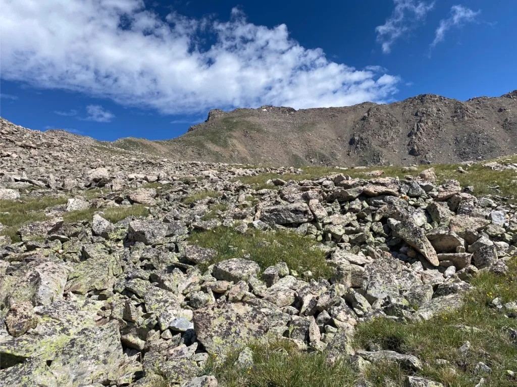
The talus below Point 13,516 and the long, tedious slog back up toward Columbia's ridge. It is slow and loose.
Route-finding
Hard on the traverse. There is only a faint trail at first, then none. Before dropping down, stop on Point 13,516's east ridge and study the rest of the route ahead.
Water
North Cottonwood Creek and streams in Horn Fork Basin. None on the traverse. Carry 3 to 4 liters and filter.
In Buena Vista, go about half a mile north of downtown and head west on County Road 350, also called Crossman Avenue. Reset your odometer here. After 2 miles, make a right onto County Road 361. At 3 miles, turn left onto County Road 365, which is dirt.
Continue a little over 5 miles to the end of the road and the trailhead, about 8.1 miles from the highway. You will find the trail leaving from the parking loop's west side.
Trail in the treesTundraRidgeTalus and screeExposed to lightning
The line is elevation, the band underneath is the ground, and the numbered dots match the steps below. Mileage and elevations are approximate.
1
North Cottonwood Creek trailhead 9,900' · 0 mi
Begin on the trail at the west edge of the parking loop. Follow the standard route for Mount Harvard up the valley.
2
Valley trail 10,600' · 2 mi
The trail climbs steadily through forest along the creek toward Horn Fork Basin.
Watch for: Stay on the trail signed for Horn Fork Basin at any junctions.
3
Horn Fork Basin 11,800' · 4 mi
The forest opens into the basin. Harvard is at the head of the basin and Columbia is on the right. Keep following the standard trail toward Harvard.
Watch for: From here you are above treeline for many hours.
4
Harvard's upper slopes 13,200' · 5.9 mi
The trail climbs rocky slopes toward Harvard's summit ridge.
5
Summit of Mount Harvard 14,424' · 6.8 mi
Reach the top. Check the time and the sky carefully before starting the traverse, which takes at least a couple of hours.
Watch for: If the weather is turning, do not start the traverse. Go back down the way you came.
6
Harvard's summit ridge 14,300' · 7 mi
Head east along the ridge and pass through a notch. Close to the east end, pass a rocky point by either side and reach a small flat spot.
7
Pointed rock formation 14,100' · 7.3 mi
Head down the ridge to the southeast, toward a sharp rock point. Go around its right side, then pick up a faint trail that crosses loose talus along the ridge's south side.
Watch for: Loose talus. Move carefully.
8
North side of Point 13,516 13,500' · 7.8 mi
Get back on the ridge trail and go down toward Point 13,516. The trail fades. Traverse talus on the point's north side until you reach the edge of the east ridge. From here you can see the rest of the route.
Watch for: Take a good look ahead. You will not follow the crest from here.
9
Leave the east ridge 12,750' · 8.3 mi
Go left and head down Point 13,516's east ridge. When you are under 12,800 feet, go right off the ridge. This bypasses a much harder stretch of the main ridge.
10
Talus climb 13,000' · 8.8 mi
Contour southwest onto talus, then pick a line up toward the ridge. After some hard work, turn left and head south. Near 13,000 feet the ground gets easier and Columbia comes into view.
Watch for: This is the most tiring part of the day. Pace yourself.
11
Around Point 13,497 13,200' · 9.2 mi
Hike south around the right side of Point 13,497. Next, go up grassy slopes to gain the ridge, left of the Columbia saddle with this point.
12
Columbia's ridge 13,400' · 9.5 mi
On the ridge near 13,400 feet, turn left and head toward the summit.
13
Steeper rock 13,900' · 9.9 mi
Near 13,900 feet, climb about 100 feet of steeper rock.
Watch for: Use your hands for balance and test holds.
14
Summit of Mount Columbia 14,075' · 10.1 mi
Walk the last stretch to the top.
Getting down
Go down Columbia's standard west slopes route into Horn Fork Basin. It is steep and loose in places, so take your time. In the basin, join the main trail and follow it back down the valley to the trailhead.
If things go wrong
On Harvard, the standard route back down is the only good way out. Once you are past Point 13,516, the easiest exit is usually to keep going to Columbia's ridge and descend its west slopes, or to drop west into Horn Fork Basin where the terrain allows. Do not try to follow the rugged main ridge crest between the peaks. If a storm hits during the traverse, get off the high ground as fast as you safely can.
Other routes
Every way up Mount Harvard we list, with its class.
Harvard and Columbia Traversethis routeClass 2 15 mi
Conditions change the route
This describes the route in its usual season. Distances and elevations are close estimates for planning. Snow, ice, rockfall, a washed-out road or an afternoon storm can make it a very different climb. Check recent conditions the week you go and turn around when the day tells you to.