Afternoon storm risk is the line that matters. Everything else is comfort. In summer, plan to be off the ridge before the build-up starts, not as it starts. Forecast for the summit point, adjusted for its elevation · data from Open-Meteo.
Alternate route · Northwest Face
Overview
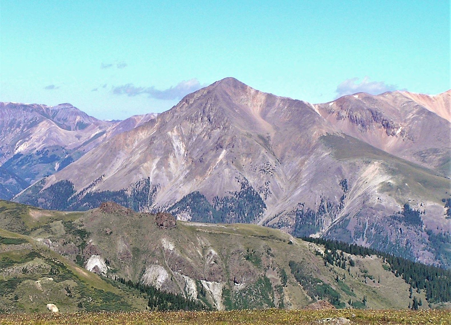
The Northwest Face route starts at the Silver Creek trailhead and goes up Silver Creek's South Fork to climb Sunshine Peak. It is a direct way to reach Sunshine without first going over Redcloud Peak. It goes up a quiet basin, a steep scree gully, and then the west ridge to the summit.
It is rated difficult Class 2. The steep, loose gully near 13,000 feet is the hardest part. It suits hikers who can handle loose scree and some route-finding. The round trip is about 8.5 miles with about 3,800 feet of gain.
Plan on 6 to 8 hours. Many people use this route as the way down after climbing Redcloud and Sunshine. That is where most mistakes happen, because the right gully is hard to spot from above.
Plan of the day
Start by
By 5 or 5:30 a.m. You are above treeline for several hours.
Turnaround
If you have not reached the top of the gully near 13,300 feet by about 10 a.m., or clouds are building, turn around.
Crux
The small, steep gully to the left of a rock tower. It is full of scree and gains about 500 feet to 13,300 feet.
Route-finding
Moderate. Watch for a cairn near 11,300 feet where you leave the main trail and cross the stream. In the upper basin, keep heading straight south. At the gully, make sure you pick the one left of the tower, and remember where it tops out.
Water
Silver Creek and the South Fork. There is none high up. Treat what you collect.
Head south out of Lake City on Colorado 149 for about 2 miles. Make a right onto County Road 30, which leads toward Cinnamon Pass. The trailhead is nearly 16 miles up this road.
Stay right near 11.8 miles. After about 12.5 miles the road gets rougher. Between about 13 and 14.5 miles, the road is a narrow shelf cut into Sunshine Peak's south side. Most careful drivers in high-clearance cars can make it in dry weather.
Trail in the treesTundraTalus and screeRidgeExposed to lightning
The line is elevation, the band underneath is the ground, and the numbered dots match the steps below. Mileage and elevations are approximate.
1
Silver Creek trailhead 10,400' · 0 mi
The trail heads northeast, climbs a hill and enters the trees; follow it.
2
Leave the forest 11,100' · 0.6 mi
The trail leaves the trees and runs beside Silver Creek on your right.
3
Stream crossing 11,300' · 0.9 mi
Above 11,300 feet, watch for a cairn down by the stream. Leave the main trail and cross. Find a small path in the bushes just to the left. It heads south into the South Fork.
Watch for: Easy to miss. If you keep climbing on the main trail, you are headed for Redcloud.
4
South Fork valley 11,600' · 1.3 mi
Walk through the trees beside the South Fork stream. Near 11,600 feet, turn left and climb a slope back into the trees.
5
Old shack 11,800' · 1.6 mi
Pass an old cabin and continue up to treeline. Most of the rest of the route is now in view to the south.
6
Rock glacier 12,400' · 2.6 mi
Go to the basin's south end and climb a rock glacier. Keep going on talus to the head of the basin.
Watch for: Do not turn left (east) here. Keep going straight south. The trail may fade, but a few cairns help.
7
Base of the gully 12,800' · 3.1 mi
Find a rock tower at the head of the basin. Go to the small, steep gully on its left.
Watch for: Choose the correct gully. The wrong one leads into harder ground.
8
Top of the gully 13,300' · 3.4 mi
Go up the steep gully, which is full of scree, to about 13,300 feet. Look back and memorize this spot if you plan to come down the same way.
Watch for: Loose scree. Keep your group close so rocks do not fall on anyone.
9
Below the northwest face 13,400' · 3.5 mi
Climb another 100 feet or so to a flat area under the northwest face. Go south below the face to find a trail up to the west ridge.
10
West ridge 13,600' · 3.8 mi
Climb to the crest of the west ridge near 13,600 feet. Turn left.
11
Sunshine Peak summit 14,004' · 4.25 mi
Follow the ridge to the top. Redcloud Peak is to the north.
Getting down
Retrace your steps down the west ridge, then cross beneath the northwest face to the top of the dirt gully. Stop here and make sure it is the right one. Seen from the ridge, it is just east (right) of the two rock towers' smaller one. Cairns may lead toward the wrong gully, so do not follow them blindly. Descend the gully carefully, then retrace the basin, the South Fork, and the stream crossing back to the Silver Creek trail.
If things go wrong
Below the gully, you can head back down the basin at any time. Once on the ridge, the quickest way down is the same gully. In a storm, do not rush the gully choice. A wrong gully can cliff out. Another option is to go over to Redcloud and down its standard trail, but that is longer and more exposed. Call 911 if someone is hurt and you have signal.
Other routes
Every way up Sunshine Peak we list, with its class.
This describes the route in its usual season. Distances and elevations are close estimates for planning. Snow, ice, rockfall, a washed-out road or an afternoon storm can make it a very different climb. Check recent conditions the week you go and turn around when the day tells you to.