Afternoon storm risk is the line that matters. Everything else is comfort. In summer, plan to be off the ridge before the build-up starts, not as it starts. Forecast for the summit point, adjusted for its elevation · data from Open-Meteo.
This is a snow climb. It is only safe when the snow is firm and stable, usually early in the morning in late spring and early summer. You need an ice axe, crampons, a helmet and the skills to use them. Check avalanche conditions before you go.
Snow route · East Face
Overview
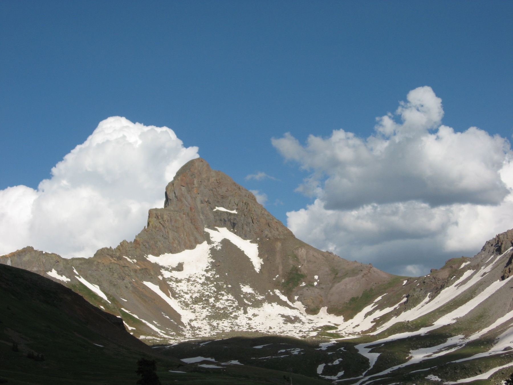
The East Face is a steep snow climb on Wetterhorn Peak. It rises about 900 feet from the basin southeast of the peak to just below the summit block. From there it joins the standard route for a short rock climb to the top.
It is rated Class 3 with steep snow. The face gets steeper as it narrows, reaching about 45 to 48 degrees near the top, with small rock bands to get through. It is for experienced snow climbers who can judge avalanche danger. It is harder and more exposed than the standard southeast ridge.
The round trip is about 6.5 miles with about 3,300 feet of gain. Plan on 6 to 8 hours.
Plan of the day
Start by
Very early, often 3 or 4 a.m. The face gets early sun, which quickly weakens the snow.
Turnaround
Stop at the base of the face near 12,900 feet and look hard at the snow. If it is soft, wind loaded, or already in the sun, do not go up. Aim to be off the face by mid-morning.
Crux
The upper face above 13,600 feet, where the slope reaches 45 to 48 degrees and small rock bands break it up. Then the 100-foot Class 3 summit pitch.
Route-finding
Easy to the basin on the standard trail. Pick your own line up the face. Above it, find a small notch a little left of the summit block, then climb the shallow gully on the summit pitch.
Water
Matterhorn Creek near the start. It may be frozen or buried early in the season. Carry 2 to 3 liters.
In Lake City, turn west on Second Street. After 0.1 mile, go left on Henson Creek Road and set your trip meter to zero. Near 5 miles you go by a sign for the Nellie Creek trailhead.
Make a right onto North Henson Road at about 9 miles. It is rougher, but most good-clearance vehicles can drive it. Near 11 miles a sign points to the Matterhorn Creek trailhead. Without 4WD, park here; with it, go right; the trailhead is 0.7 mile farther.
TundraScramblingExposed to lightning
The line is elevation, the band underneath is the ground, and the numbered dots match the steps below. Mileage and elevations are approximate.
1
Matterhorn Creek trailhead 10,720' · 0 mi
Start up the standard approach trail along Matterhorn Creek.
Watch for: If you park at the lower junction, add about 0.7 mile each way.
2
Basin southeast of Wetterhorn 12,000' · 1.9 mi
Follow the approach into the basin below the peak. The east face comes into view.
3
Base of the east face 12,900' · 2.5 mi
Choose your line and head north and northwest to about 12,900 feet. Stop and study the face. Avalanches are common on it, and the sun hits it early.
Watch for: This is your go or no-go point.
4
Start of the face 13,100' · 2.6 mi
If conditions are good, go to the base of the face. Put on crampons, helmet and avalanche gear, and start up.
5
Steepening slope 13,300' · 2.75 mi
Above 13,200 feet the slope passes 35 degrees. Between 13,300 and 13,600 feet it goes over 40 degrees.
Watch for: A slip would be very hard to stop.
6
Narrow upper face 13,700' · 2.95 mi
The face narrows and steepens to about 45 to 48 degrees. Work through small rock bands as needed.
Watch for: Rock and ice can fall from above as the sun warms the face.
7
Below the summit block 13,850' · 3.05 mi
Climb about 150 more feet to easier ground below the summit block. Here you join the standard southeast ridge route.
8
Notch and slab 13,900' · 3.1 mi
Look for a small notch a little left of the summit block. Go through it and down a tilted slab to the base of the last pitch.
9
Wetterhorn Peak summit 14,021' · 3.25 mi
Go up the shallow gully in the face's center, about 100 feet of Class 3 rock. Partway up, move left, then follow cairns to the top.
Watch for: Exposed. Take off crampons if the rock is dry.
Getting down
Most climbers do not go back down the east face. Descend the standard southeast ridge. Downclimb the summit pitch carefully, go back through the notch, and follow the ridge down into the basin. Then take the Matterhorn Creek trail back to the trailhead. Early in the season the ridge may still hold snow, so keep your axe and crampons handy.
If things go wrong
Below 12,900 feet, the basin and trail are easy to reach. On the face, going down means downclimbing steep snow, which is slow and risky. Decide at the base, not halfway up. Near the top, it is often safer to finish and take the southeast ridge down. In a storm, get off the summit block quickly. Call 911 if someone is hurt and you have signal.
Other routes
Every way up Wetterhorn Peak we list, with its class.
This describes the route in its usual season. Distances and elevations are close estimates for planning. Snow, ice, rockfall, a washed-out road or an afternoon storm can make it a very different climb. Check recent conditions the week you go and turn around when the day tells you to.