Afternoon storm risk is the line that matters. Everything else is comfort. In summer, plan to be off the ridge before the build-up starts, not as it starts. Forecast for the summit point, adjusted for its elevation · data from Open-Meteo.
Standard route · Northeast Ridge
Overview
Capitol Peak is a sharp granite peak in the Elk Mountains, and its northeast ridge is the hardest standard 14er route in Colorado. It is long and committing, with sustained exposure and loose rock between solid sections. Climbers have died here, including several in one summer. Only climbers with real Class 4 experience, good route-finding skills and steady partners should try it.
Most people split it into two days. Day one is a 6-mile hike to Capitol Lake. Day two climbs to the saddle with Mount Daly, crosses a long talus traverse to the sub-peak called K2, downclimbs off K2, crosses the famous Knife Edge, and then works up the steep upper east face to the summit. You must return the same way, including the Knife Edge and the climb back up to K2.
From the trailhead, the full trip is about 17 miles round trip with 5,300 feet of gain. From Capitol Lake the climb is about 5 miles round trip and 2,900 feet of gain, but it still takes most people 8 to 12 hours because the ridge is slow.
Plan of the day
Start by
From Capitol Lake, by 4 a.m. You want to be past the Knife Edge and on the summit early, since retreat from the ridge is slow and afternoon storms are common.
Turnaround
If you are not on top of K2 by 8:30 a.m., or clouds are building, turn around there. K2 is the last reasonable place to decide. Be on the summit by 10:30 a.m.
Crux
The Knife Edge, a short, very exposed ridge with long drops on both sides, and the steep Class 4 climbing on the upper east face beyond it. The downclimb off K2 is also tricky.
Route-finding
Hard above the Daly saddle. The talus traverse to K2 has no trail and only cairns. Past the Knife Edge you must pick a line across the upper east face. Never try to shortcut back to the lake; every side of the ridge ends in cliffs.
Water
Capitol Creek and several streams on the approach, and Capitol Lake. Nothing above the lake on climb day. Filter all water; cattle graze the lower valley.
A long, bumpy dirt road accessible by most decent-clearance SUVs, ending at a standard dirt parking circle in a pastoral valley.
Terrain
Pastoral meadows and aspen forests leading to a high-alpine basin, finishing on a razor-sharp, death-defying granite ridge.
The approach is deceptively peaceful. You hike for miles through rolling green cow pastures and quiet aspen groves, eventually reaching the stunning Capitol Lake basin. From the saddle, the game changes instantly. You cross the legendary "Knife Edge"—a 100-foot stretch of jagged rock so sharp and exposed that most climbers choose to sit and scoot across it, legs dangling over 1,000-foot drops on both sides. It is widely considered the single most intense mental test on any standard 14er route.
Snowmass Creek Road leaves Colorado 82 about 26 miles southeast of Glenwood Springs; turn right onto it and zero your odometer. Near 1.7 miles, go right at a junction onto Capitol Creek Road. Around 8.1 miles you will see a parking area for trailers to your right. Leave your car here if it has low clearance or if the road is wet and muddy.
The road beyond gets narrow and steep. The trailhead is at about 10 miles. The last mile is the roughest and may need AWD or 4WD when it is wet or has potholes. Camping at Capitol Lake needs a permit, and there are few of them. Without one, either day hike or camp below the cattle fence about 2 miles below the lake. The route is in the Maroon Bells-Snowmass Wilderness.
Trail in the treesTundraRidgeTalus and screeScramblingExposed to lightning
The line is elevation, the band underneath is the ground, and the numbered dots match the steps below. Mileage and elevations are approximate.
1
Capitol Creek trailhead 9,450' · 0 mi
Capitol Peak is in full view to the south. Two trails start here. Take the signed ditch trail from the west end of the parking area. It avoids losing and regaining elevation.
2
Leave the ditch 9,500' · 1.2 mi
At a junction after 1.2 miles, leave the ditch and follow a clear trail through forest. Cross a stream, walk through a meadow, and enter the wilderness.
3
Capitol Creek crossing 9,600' · 3.25 mi
Walk through aspen and clearings to open slopes above Capitol Creek. Follow the hillside for about 1.5 miles, then drop to the creek. Angle left, cross it, and turn right (south) on the main Capitol Creek trail.
Watch for: The creek can run high in early summer.
4
Cattle fence 10,000' · 4 mi
About 4 miles in, pass through a gate in a fence. This marks the lower edge of the Capitol Lake permit zone. Close the gate behind you.
Watch for: No camping above here without a permit.
5
Sharp right turn 11,400' · 5.6 mi
Continue up the valley through forest and meadows. Near 11,400 feet the trail turns sharply right and climbs a bit to the basin below the lake.
6
Basin below Capitol Lake 11,600' · 6 mi
The designated campsites are on the right, just below Capitol Lake. The huge north face of Capitol rises above the lake.
Watch for: Last water. Fill up for the whole climb.
7
Daly-Capitol saddle 12,500' · 6.7 mi
Just below the lake, turn left onto the trail heading southeast. It climbs about 900 feet to the saddle between Mount Daly and Capitol. This is the end of the easy trail.
Watch for: Stay on the standard route on the east side. The direct ridge south of the saddle is harder.
8
The two gullies 12,400' · 7 mi
From the east side of the saddle, follow a trail south. You cross a couple of gullies. The second one is harder: either drop on a steep trail and cross a rock rib, or take a more direct line with some scrambling along its sides.
Watch for: Loose rock in the gullies.
9
Talus traverse 12,700' · 7.4 mi
The route now crosses big talus with no trail. Follow cairns and try to hold your elevation. Near 12,700 feet, angle up and right toward K2, a rocky sub-peak to the southwest.
Watch for: Large talus can shift. Test blocks before stepping.
10
K2 13,664' · 7.9 mi
Hop up the talus to the right side of K2 just below its top, then scramble to the top. From here you can see the Knife Edge and the rest of the route to the summit.
Watch for: Last good decision point. If in doubt, turn back here.
11
Downclimb off K2 13,580' · 7.95 mi
Backtrack a few feet from the top and step west to see the downclimb. Descend about 80 feet of exposed rock to a flat spot with a faint trail. Turn left and walk back to the ridge crest.
Watch for: Exposed downclimb. Face in and test holds.
12
Knife Edge 13,600' · 8.1 mi
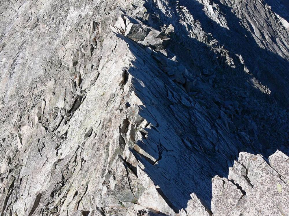
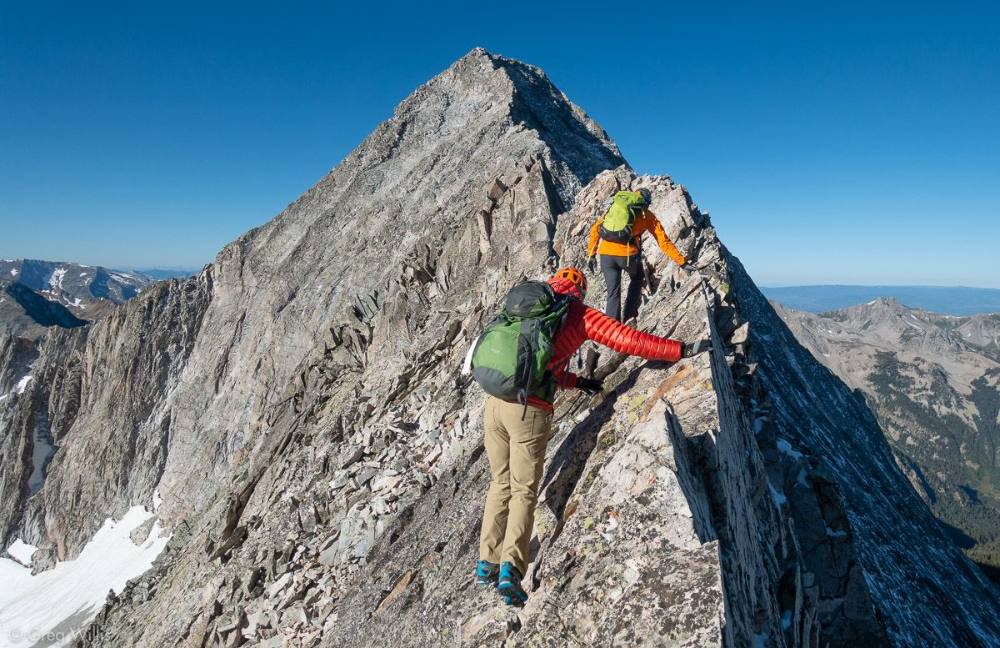
Drop a little to the narrow ridge and pass a rock tower by going over or around it. Scramble on to the Knife Edge, a short, razor-thin granite ridge with huge drops on both sides. Cross on the crest, or with your hands on the crest and feet on the side.
Watch for: Extreme exposure. One slip is fatal. Do not cross in wind, rain or ice.
The Knife Edge from above · Photo: Xpda
13
Notch past the Knife Edge 13,650' · 8.2 mi
The climbing stays hard. Work along the ridge or its sides for about 0.1 mile. Then drop down to a notch; a steep gully falls away to your left. From this spot, study the upper east face and pick out landmarks.
14
Upper east face 13,900' · 8.35 mi
Drop into the notch and climb a steep pitch, following cairns where you can. Above 13,800 feet, leave the ridge crest and traverse the upper east face. Angle left to a gray, slate-colored rock wall and cross it.
Watch for: Loose rock on the face. Do not knock rocks onto people below.
15
Southeast ridge notch 14,030' · 8.43 mi
Climb steeply from the gray wall to a notch on the southeast ridge. Turn right and climb the ridge.
16
Summit of Capitol Peak 14,138' · 8.5 mi
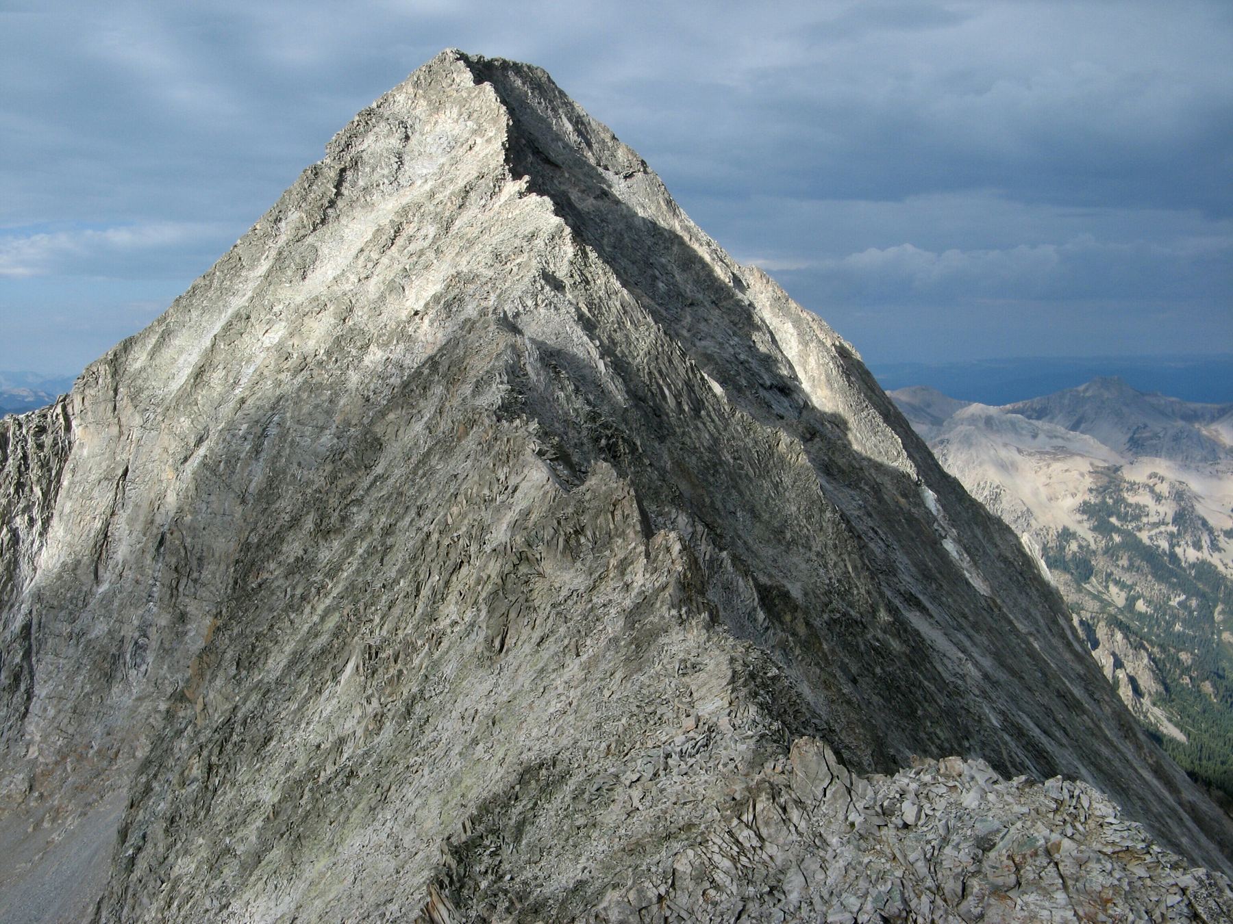
Stay on the ridge crest where you can; it has the most solid rock. Near the top you can also traverse left before climbing to the small summit. Snowmass Mountain and the Maroon Bells are in view.
Watch for: You must return all the way to K2 the same way.
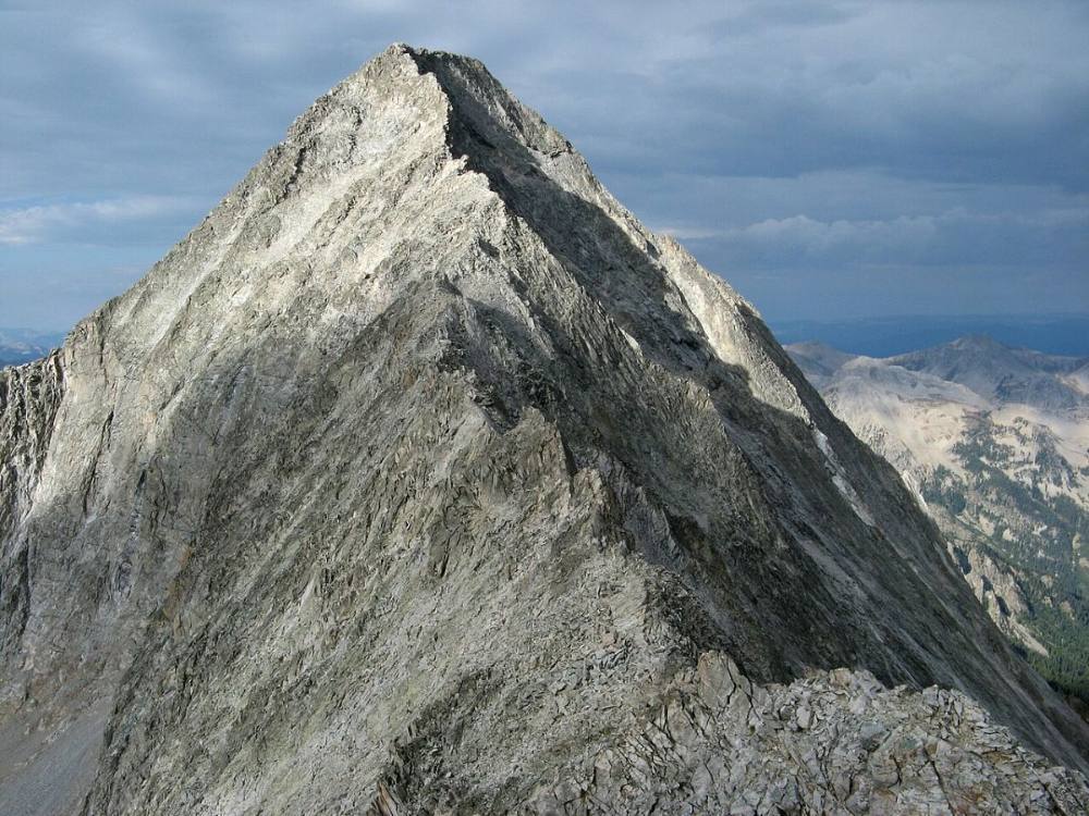
The northeast ridge to the summit · Photo: MostlyDeserts
Here Lower Capital Trail goes off to the left. Keep going straight on Capitol Creek Trail.
Coming down: Keep going straight on Capitol Creek Trail. Don’t take Lower Capital Trail.
2Mile 1.1 · 9,500'
Stay on Capitol Creek Trail
Here Nicholson Creek goes off to the left. Keep going straight on Capitol Creek Trail.
Coming down: Keep going straight on Capitol Creek Trail. Don’t take Nicholson Creek.
3Mile 3.8 · 9,890'
Turn left to stay on Capitol Creek Trail
Here Capitol Ditch Trail goes off to the right. Turn left to follow Capitol Creek Trail.
Coming down: Turn right to stay on Capitol Creek Trail. Don’t take Capitol Ditch Trail.
4Mile 4.5 · 10,440'
Stay on Capitol Creek Trail
Here West Snowmass Trail goes off to the left. Keep going straight on Capitol Creek Trail.
Coming down: Keep left to stay on Capitol Creek Trail. Don’t take West Snowmass Trail.
5Mile 7.4 · 12,700'
Keep right to stay on Capitol Creek Trail
Here Capitol Creeek Backcountry Camping Path goes off to the right; Capital Peak Route Trail goes off to the left; an unmarked path goes off straight ahead. Keep right to follow Capitol Creek Trail.
Coming down: Keep going straight on Capitol Creek Trail. Don’t take Capitol Creeek Backcountry Camping Path or Capital Peak Route Trail or the unmarked path.
Landmarks to know
Capitol Peak in full view from the trailhead.
Capitol Creek crossing about 3.25 miles in, then the cattle fence at 4 miles.
Capitol Lake below the huge north face.
The saddle between Mount Daly and Capitol.
The rocky sub-peak K2 at the end of the talus traverse.
The Knife Edge, a thin granite ridge just past a rock tower.
A gray, slate-colored rock wall on the upper east face.
A notch on the southeast ridge just below the summit.
Getting down
Reverse the route exactly. Climb down the southeast ridge to the notch, then down across the gray wall and the upper east face to the notch past the Knife Edge. Cross the Knife Edge again with the same care, then climb back up to K2. You must go back over or around K2 on the same line. Do not look for a shortcut down toward Capitol Lake from anywhere on the ridge. Every slope off the sides leads to cliffs, and people have died trying.
From K2, descend the talus to the traverse and follow the cairns back north across the talus and the two gullies to the Daly saddle. Tired legs make the talus and gullies risky. Then follow the trail down to Capitol Lake. If you are hiking out the same day, remember the long walk back to the trailhead, and take the ditch trail back at the creek crossing.
If things go wrong
Before K2, you can turn around at any point and walk back to the Daly saddle and the lake. Past K2, the only safe way off is back over the Knife Edge and K2. There are no escape routes off the sides. If weather turns while you are past K2, move steadily and carefully back toward K2 rather than pushing on. If someone is hurt, secure them on a safe ledge, keep them warm and send for help. Cell signal is spotty; a satellite messenger is worth carrying here. Call 911 if you can. Rescue from this ridge is slow and often needs a helicopter.
3D flyover
Press play to fly the Northeast Ridge. The graph shows elevation along the way and how much you gain each mile. Open full screen.
For planning only. The line is traced from open map data, not walked in the field, and off-trail parts are drawn straight. Load it in your GPS app to see the route, but navigate with your eyes, a map and the route description.
See the trail on video
A climb of this route filmed by The Virtual sherpa. The video belongs to them and only plays when you press play.
Jump to
Other routes
All 1 route up Capitol Peak, with the class and round-trip distance for each.
Class 4 is exposed climbing where a slip is likely fatal and the rock is often loose. This demands prior Class 3 and Class 4 experience, flawless route-finding, a helmet and a partner who knows the line. Treat any trip report, including this one, as one person’s day rather than a guarantee of yours.