Afternoon storm risk is the line that matters. Everything else is comfort. In summer, plan to be off the ridge before the build-up starts, not as it starts. Forecast for the summit point, adjusted for its elevation · data from Open-Meteo.
Standard route · South Ridge
Overview
Conundrum Peak sits on the ridge just north of Castle Peak in the Elk Mountains south of Aspen. The standard route follows the long Montezuma Basin road, climbs into the upper basin below Castle, and goes up a steep slope to the saddle between Castle and Conundrum. From the saddle, a short, rocky ridge leads north to Conundrum's double summit.
The crux is the steep slope just below the saddle. With firm, stable snow on it, it is a straightforward snow climb for someone who knows how to use an ice axe and crampons. Once the snow melts, it turns into steep, loose rubble that is miserable and dangerous to climb or descend. Many people only climb this route while the slope still holds snow. The ridge above the saddle is loose Difficult Class 2 with small ledges and some exposure.
From the lower trailhead the round trip is 13.5 miles with about 4,400 feet of gain, mostly on a rough 4WD road. With a capable 4WD vehicle you can start near 11,200 feet, which cuts the day to about 7 miles and 2,900 feet. Many people also climb Castle the same day from the saddle.
Plan of the day
Start by
By 4 a.m. from the lower trailhead, or by 5 a.m. if you drive higher. You want to climb the snow below the saddle while it is still firm, and be off the ridge before afternoon storms.
Turnaround
Be at the Castle-Conundrum saddle (about 13,800 feet) by 10:30 a.m. If you are not, or if the snow below the saddle has turned soft and slushy, turn around.
Crux
The steep slope from the upper basin to the saddle. With good snow it is a steep snow climb; without snow it is loose rubble that is best avoided.
Route-finding
The road is easy to follow to its end at 12,800 feet. Above that there is no real trail: climb the headwall into the upper basin, keep to the right (west) side past the small lake, and climb to the obvious saddle. On the summit ridge, the south summit is not the true top; the higher one is to the north.
Water
Castle Creek runs near the road low down, and there are streams from snowmelt in Montezuma Basin. Filter or treat. Water gets scarce above the end of the road later in summer.
A paved road turns into a rough 4WD dirt track. Standard cars park low; aggressive 4WDs can drive miles up the rocky road to the upper basin.
Terrain
A long, loose 4WD road hike leading into a massive, scree-filled alpine bowl (Montezuma Basin).
If you don't have a jeep, you start your day hiking up a dusty, rocky road for several miles. Once in the upper basin, the route is a steep grind on loose rock and snow. You will trudge up unstable scree fields where for every two steps up, you might slide one step back. The final ridge traverse to Castle is a fun, airy scramble, but the approach is defined by loose footing and managing the shifting rock of the Elk Range.
From the roundabout on the west side of Aspen, take Castle Creek Road south. Drive 12.5 miles on pavement to the Castle Creek trailhead at about 9,800 feet. Park here with a passenger car. Forest Road 102 branches to the right and climbs toward Montezuma Basin. Cars with good clearance can go about a mile up it to dispersed campsites along the road.
To go higher you need a high-clearance 4WD. At about 1.3 miles there is a creek crossing with a footbridge next to it. In spring and early summer the water can be deep and fast; walk across the footbridge and look before you drive it, and do not try it in a low car. The road continues to the Pearl Pass road junction at about 3 miles and 11,150 feet, where there are a few parking spots. Stay right. The road above gets steadily worse on the way to 12,800 feet. The route enters the Maroon Bells-Snowmass Wilderness, which has its own rules on group size, camping, fires and dogs.
Trail in the treesRoadRidgeTundraTalus and screeExposed to lightning
The line is elevation, the band underneath is the ground, and the numbered dots match the steps below. Mileage and elevations are approximate.
1
Castle Creek trailhead 9,800' · 0 mi
Walk up Forest Road 102 from the lower parking area. The first mile or so has marked campsites along the road in the trees.
2
Creek crossing 10,200' · 1.3 mi
The road crosses Castle Creek. A footbridge beside the ford lets hikers cross dry.
Watch for: High, fast water in early summer. Use the footbridge.
3
Road pull-offs 11,000' · 2.6 mi
The road climbs steadily up the valley. There are small pull-offs used for parking around here.
4
Pearl Pass junction 11,150' · 3.2 mi
The Pearl Pass road splits off. Stay right on the main road toward Montezuma Basin. Castle Peak comes into view ahead.
Watch for: Stay right. The left road goes to Pearl Pass.
5
Into Montezuma Basin 12,000' · 4.3 mi
The road switchbacks up into the basin on rough, rocky ground. The big peak ahead is Castle; Conundrum is the lower summit on the ridge to its right.
6
Montezuma Mine 12,500' · 4.8 mi
Pass the old Montezuma Mine. The road continues about another half mile.
Watch for: Stay away from old mine workings.
7
End of the road 12,800' · 5.3 mi
The road ends in the basin below a steep headwall. From here there is no defined trail.
8
Headwall to the upper basin 13,400' · 5.7 mi
Climb about 500 feet up the headwall into the upper basin. Early in the season this is usually snow; later it is loose rock and dirt.
Watch for: Loose footing or steep snow.
9
Past the small lake 13,450' · 5.95 mi
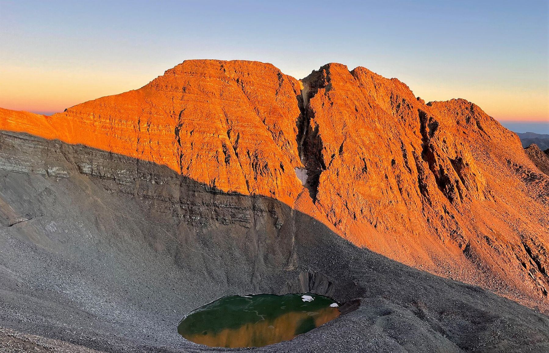
The upper basin opens up with a small lake. Traverse along the right (west) side of the basin and stay off the lake. The steep slope leading to the saddle between Castle and Conundrum is straight ahead.
Watch for: Do not walk on the frozen lake early in the season.
10
Base of the steep slope 13,500' · 6.05 mi
At the base of the slope, check the snow. It should be firm enough to kick good steps. Put on crampons and get your ice axe out.
Watch for: If the slope is bare rubble or the snow is soft and slushy, this is the place to turn around.
11
Castle-Conundrum saddle 13,800' · 6.25 mi
Climb the steep slope carefully to the saddle. Castle is up the ridge to the left. Turn right (north) for Conundrum.
Watch for: A slip on hard snow here can lead to a long fall.
12
Lower south ridge 13,880' · 6.35 mi
Stay near the ridge crest and follow bits of trail up through loose rock and small ledges. Pass a rock outcrop.
Watch for: Loose rock. Watch for people below you.
13
Flat spot on the ridge 13,930' · 6.45 mi
A short flat area on the ridge. Above it the ground gets steeper. Look for trail segments and gaps in the rock that let you move up the ridge.
14
South summit 14,000' · 6.6 mi
Climb broken rock to the south end of the summit ridge. This is the lower of Conundrum's two summits. The true top is to the north.
15
Notch between the summits 13,990' · 6.7 mi
Walk to the middle of the summit ridge and drop into a notch between the two summits. Cross the flat area in the notch.
Watch for: Some exposure on both sides of the ridge.
16
Summit 14,060' · 6.75 mi
Climb the last short pitch to the true, northern summit. Castle rises just to the south, and the Maroon Bells area spreads out to the west.
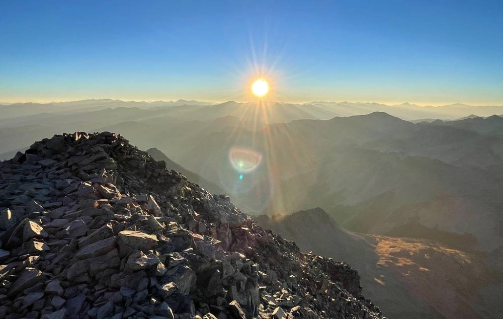
Sunrise from the top of Conundrum · Photo: kalestews
Landmarks to know
The creek crossing with a footbridge at about 1.3 miles.
The Pearl Pass road junction near 11,150 feet; stay right.
The old Montezuma Mine, then the end of the road at 12,800 feet.
A steep headwall leading to the upper basin at about 13,400 feet.
A small lake in the upper basin; keep to its right (west) side.
The steep slope and saddle between Castle and Conundrum.
Two summits on Conundrum, with a notch between them; the north one is the true top.
Getting down
Go back the same way. Return south along the ridge through the notch and over the south summit, then down the loose ridge to the saddle. Take your time on the ledges; loose rock is easy to knock onto people coming up.
The steep slope below the saddle is the most dangerous part of the descent. Face in and kick steps with your axe planted if the snow is steep or hard, or wait for it to soften a little if it is icy. Do not glissade unless you can clearly see a safe runout, you know how to self-arrest, and you have taken your crampons off. Many accidents on this peak happen here. Below, cross back along the west side of the basin, down the headwall, and follow the road out.
If things go wrong
Before the saddle, the way out is simply back down the basin and road. Once on the ridge, the only easy way off is back to the saddle and down the steep slope, so do not start the ridge if weather is building. If a storm hits on the ridge, get down to the saddle and off the slope as quickly as you safely can; the upper basin is still exposed, but lower and away from the ridge. If someone is hurt, keep them warm and out of the wind. The road is a good landmark for rescuers. Call 911 if needed.
3D flyover
Press play to fly the South Ridge. The graph shows elevation along the way and how much you gain each mile. Open full screen.
For planning only. The line is traced from open map data, not walked in the field, and off-trail parts are drawn straight. Load it in your GPS app to see the route, but navigate with your eyes, a map and the route description.
See the trail on video
A climb of this route filmed by The Virtual sherpa. The video belongs to them and only plays when you press play. This video covers Castle and Conundrum together.
Jump to
Other routes
All 3 routes up Conundrum Peak, with the class and round-trip distance for each.
The moves are not technical, but the distance and gain are serious and help is hours away. Know your pace, carry a headlamp even on a day trip, and be honest about whether you can still make good decisions at hour eleven.