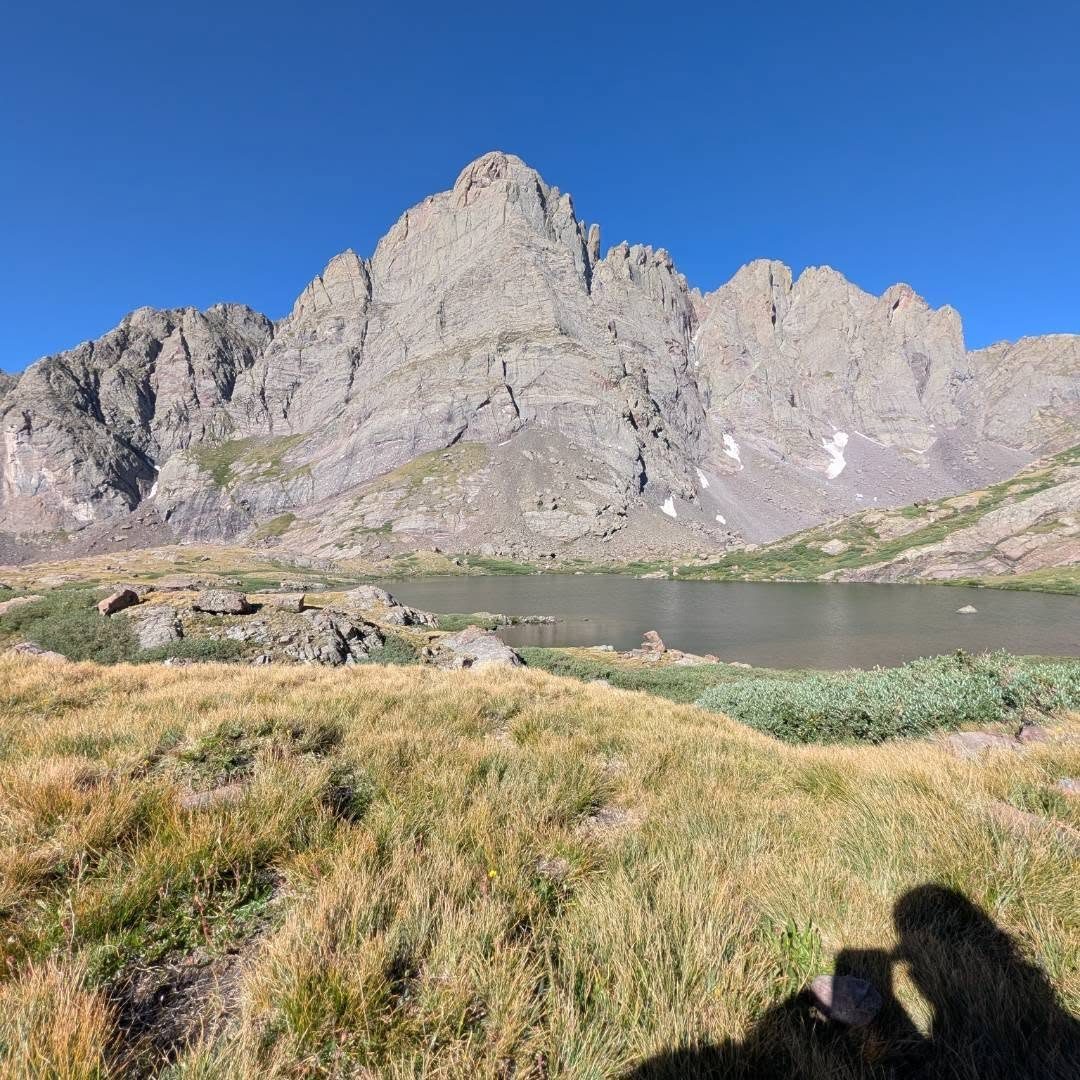
Photo: Michael McKenzieClass 4, severe consequence
Standard routeSouth Face
DifficultyClass 4
Round trip11.5 mi
Elevation gain4,700'
RangeSangre de Cristo
Conditions on the summit
LoadingFetching the forecast for 14,196'…
—Summit temp now
—Sustained wind
—Gusting to
—Freezing level
Today
—
Tomorrow
—
Day three
—
Afternoon storm risk is the line that matters. Everything else is comfort. In summer, plan to be off the ridge before the build-up starts, not as it starts. Forecast for the summit point, adjusted for its elevation · data from Open-Meteo.
Standard route · South Face
Overview
Crestone Needle is one of the classic Class 4 climbs in Colorado. After a long approach to South Colony Lakes and a steep scramble to Broken Hand Pass, the route crosses the Needle's south face and climbs a steep gully of knobby conglomerate rock to a small summit. The rock is solid for the most part and has great holds, but it is steep, and the exposure grows as you climb.
From the 4WD trailhead the round trip is about 11.5 miles with 4,700 feet of gain. Many people camp near the lakes and climb the next day; from Lower South Colony Lake it is only about 3 miles round trip. Done in one day from the trailhead, expect 9 to 12 hours.
This is not a beginner peak. You need to be comfortable climbing steep rock with a big drop below you, and you need to be good at route-finding. The descent is where most accidents happen: people pick the wrong gully or lose the exit back to the trail and end up on cliffs. When the rock is wet, snowy or icy, the knobby rock becomes slick and the climb gets much more dangerous.
Plan of the day
Start by
By 4 a.m. from the trailhead, or 5:30 a.m. from a lake camp. You want to be off the gully before clouds build, which in the Sangres can be late morning.
Turnaround
If you are not at the base of the east gully (where the trail ends near 13,300 feet) by 9:30 a.m. from a camp, or 10 a.m. at the latest, turn back. If rain or hail starts while you are in the gully, head down right away; wet conglomerate is slick.
Crux
A short, steep pitch just right of a dihedral (a corner in the rock) about 300 feet up the east gully. It is solid Class 4 with some exposure.
Route-finding
The trail is good to the lakes and mostly clear to Broken Hand Pass. From the pass a trail leads to the south face, then ends where you drop into the east gully. From there, you choose your own line. The most important place is the point where you left the trail to enter the gully; people who miss it on the way down wander onto cliffs.
Water
South Colony Creek along the road, and Lower and Upper South Colony Lakes. Nothing reliable above the lakes. Filter everything.
From Westcliffe, drive south on Colorado 69 for about 4.5 miles and turn right on Colfax Lane. Follow Colfax about 5.5 miles to where it ends. Turn right onto a dirt road and drive 1 mile to a junction, then keep straight on County Road 120. The 2WD trailhead is 0.3 mile up, at about 8,800 feet.
With a high-clearance 4WD vehicle you can continue about 2.7 more miles up a rough, rocky road to parking and campsites just before a creek crossing, near 9,900 feet. The road is gated there and this is the official trailhead. Starting from the 2WD lot adds about 5.5 miles round trip and 1,200 feet of gain. The route enters the Sangre de Cristo Wilderness; check its rules on camping, group size and dogs.
RoadRidgeTundraScramblingExposed to lightning
The line is elevation, the band underneath is the ground, and the numbered dots match the steps below. Mileage and elevations are approximate.
1
South Colony 4WD trailhead 9,900' · 0 mi
Start at the kiosk in the main lot. Walk past the gate and up the old road, now closed to vehicles. It climbs through forest along South Colony Creek.
2
Old road 10,500' · 1.4 mi
The old road is wide and rocky with a steady grade. Stay on the main track toward South Colony Lakes; side trails are short.
3
Upper end of the old road 11,000' · 2.6 mi
The road ends and a foot trail continues up the valley. The trees open up and Crestone Needle's sharp profile and Broken Hand Peak come into view ahead.
4
Broken Hand Pass junction 11,650' · 3.9 mi
Near Lower South Colony Lake, turn left onto the trail signed for Broken Hand Pass. This is the start of the steep part. Lake campers join the route here.
Watch for: Last reliable water.
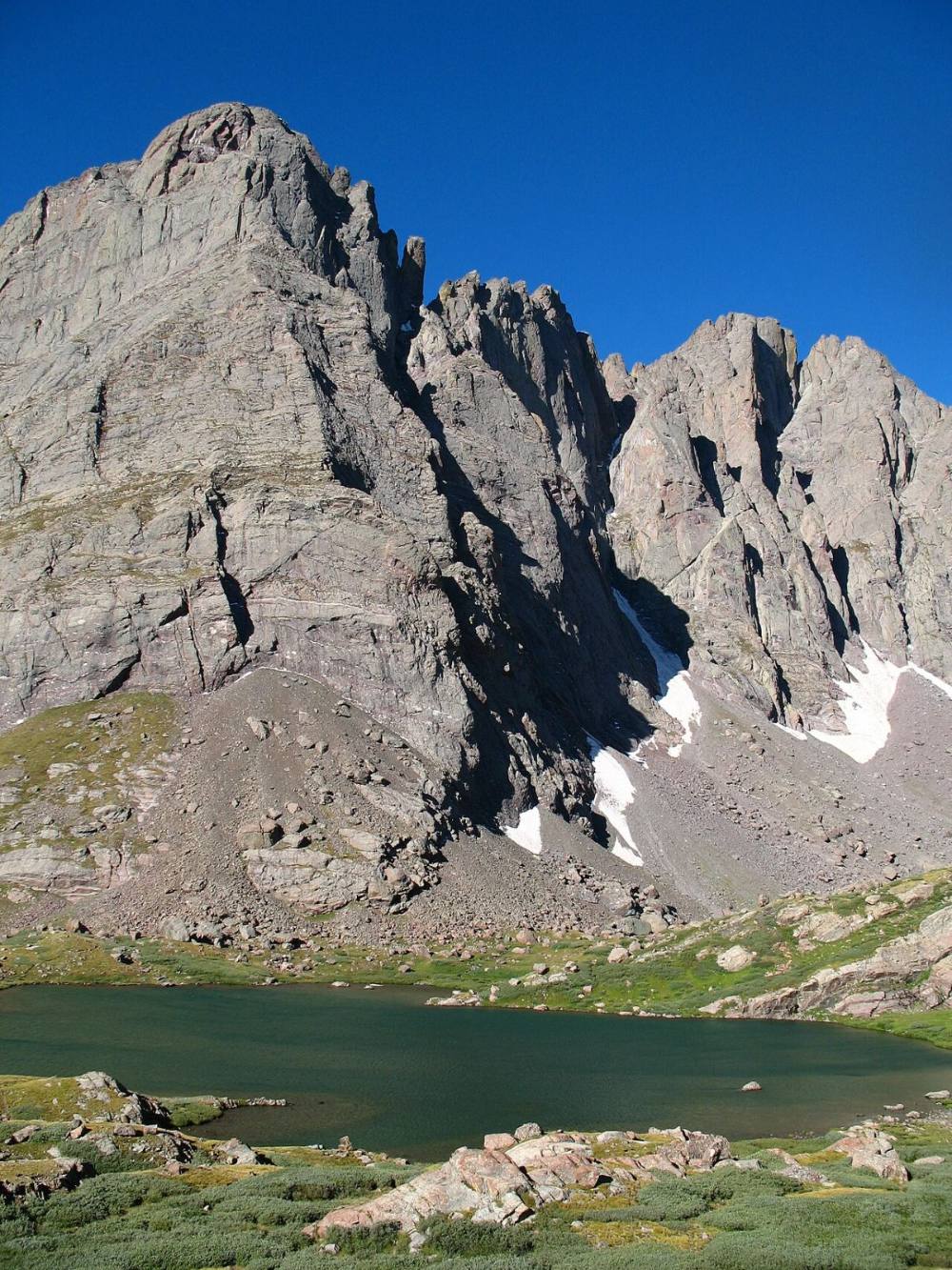
Crestone Needle over Lower South Colony Lake · Photo: Meniscus
5
North slopes of Broken Hand 12,100' · 4.2 mi
The trail climbs south up the north slopes of Broken Hand Peak, then traverses west toward the pass. It gets rocky and harder to follow as you go up; watch for cairns.
6
Class 3 section below the pass 12,650' · 4.55 mi
Below the pass, the trail enters loose ground and then a narrow Class 3 section with few options. Climb carefully and watch for rocks from people above.
Watch for: Rockfall here is common with crowds. Keep groups close together.
7
Broken Hand Pass 12,850' · 4.7 mi
Hike another 200 feet to the pass. The Needle's south face is up to your right, with its two gullies separated by a rib. Cottonwood Lake is below on the other side.
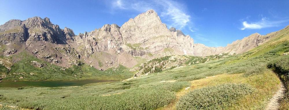
Broken Hand Peak, with the pass to its right · Photo: Andrew Davidoff
8
Trail to the south face 13,100' · 4.95 mi
Turn right and follow a clear trail toward the upper south face. It weaves through rock and grass along the base of the face.
9
Notch down-climb 13,300' · 5.1 mi
Near 13,300 feet, down-climb a short pitch into a notch. Then turn left and descend about 75 feet to reach the east gully.
10
Enter the east gully 13,250' · 5.15 mi
The trail ends here. Stop and study the spot: note the rocks around you, mark it on your GPS, and take a photo. You must come back to this exact place on the way down.
Watch for: The most important spot on the route. Know where it is.
11
Lower east gully 13,550' · 5.3 mi
Turn right and climb the gully for about 300 feet on Class 3 rock. The rock is covered in knobs that make good holds. Higher up, the center of the gully gets deep and narrow.
12
Dihedral crux 13,650' · 5.4 mi
Above the narrow part, the gully forms a corner (dihedral) and the climbing becomes Class 4. Climb a short, steep pitch to the right of the corner, then reach a ledge where you can rest.
Watch for: Crux. Steep and exposed. Test holds; some knobs break.
13
Chockstones 13,750' · 5.5 mi
Go back into the gully and climb to a couple of wedged boulders (chockstones). Climb over them and continue up the gully.
14
Upper gully 13,900' · 5.6 mi
Near 13,900 feet the gully opens up. Stay on the right side, next to a rock wall, and follow the gully up to the summit ridge.
15
Summit ridge 14,150' · 5.7 mi
At the ridge, turn left and scramble a short distance along it.
16
Summit 14,196' · 5.75 mi
A small, exposed summit. Crestone Peak is just to the northwest, and Humboldt Peak is across the South Colony valley.
Along the route
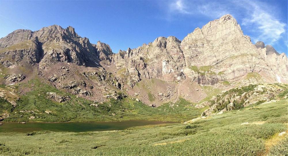
Broken Hand Peak and Crestone Needle · Photo: Andrew Davidoff
Here Broken Hand Pass Trail goes off to the left. Turn right to follow Broken Hand Pass.
Coming down: Turn left to stay on Broken Hand Pass. Don’t take Broken Hand Pass Trail.
Landmarks to know
Gate and kiosk at the 4WD trailhead
The signed Broken Hand Pass trail near Lower South Colony Lake
The narrow Class 3 section just below Broken Hand Pass
Broken Hand Pass, with the Needle's south face to the right
The short down-climb into a notch near 13,300 feet
End of the trail at the east gully (mark it)
The dihedral and rest ledge, then two chockstones
The open upper gully near 13,900 feet, climbed along the right-side wall
Getting down
Go back down the east gully the same way. Down-climbing Class 4 is harder than going up; face in, move one hold at a time, and use the ledge below the crux to regroup. Near the bottom of the gully you must find the spot where you entered it and climb back up about 75 feet to the notch and the trail. Many people keep going down the gully past this spot and end up above cliffs. If the gully starts to look unfamiliar, stop, go back up, and look again.
If you climbed the west gully variation, you must find the exact crossover point back into the east gully. Once on the trail, follow it back to Broken Hand Pass. The Class 3 section below the pass is loose; go one at a time and do not kick rocks onto people below.
If things go wrong
Broken Hand Pass is the key safe point. If weather turns while you are in the gully, climb down right away the way you came; do not look for other ways off the face. Once back on the trail at the notch, you can walk to the pass and down to the lakes, where there are campsites and usually other people. If someone is hurt in the gully, do not try to rush them down steep rock. Keep them warm and secure, mark your exact location, and call 911 if you have signal. Rescues on this face are slow and technical.
3D flyover
Press play to fly the South Face. The graph shows elevation along the way and how much you gain each mile. Open full screen.
For planning only. The line is traced from open map data, not walked in the field, and off-trail parts are drawn straight. Load it in your GPS app to see the route, but navigate with your eyes, a map and the route description.
See the trail on video
A climb of this route filmed by The Virtual sherpa. The video belongs to them and only plays when you press play.
Jump to
Other routes
All 3 routes up Crestone Needle, with the class and round-trip distance for each.
Class 4 is exposed climbing where a slip is likely fatal and the rock is often loose. This demands prior Class 3 and Class 4 experience, flawless route-finding, a helmet and a partner who knows the line. Treat any trip report, including this one, as one person’s day rather than a guarantee of yours.