Afternoon storm risk is the line that matters. Everything else is comfort. In summer, plan to be off the ridge before the build-up starts, not as it starts. Forecast for the summit point, adjusted for its elevation · data from Open-Meteo.
Standard route · Southwest Slopes
Overview
Handies Peak sits deep in the San Juan Mountains, southwest of Lake City. From American Basin it is one of the easiest 14,000-foot peaks in Colorado: a short, well-built trail through a high basin famous for summer wildflowers, past Sloan Lake, up to a saddle, and along a gentle ridge to the top.
The hike is only 5.75 miles round trip with about 2,500 feet of gain, and it suits most fit hikers, including people doing their first 14er. The trailhead is already at 11,600 feet, so the whole hike is at or near treeline and in the open. The hardest parts are the altitude, a short talus traverse past Sloan Lake, and the long, rough drive to get there.
Most people take 4 to 6 hours. There are no trees on the route, so you are exposed to lightning from the moment you leave the car.
Plan of the day
Start by
By 6 a.m. The whole route is above treeline, and San Juan storms often build by late morning.
Turnaround
If you are not at the saddle at 13,500 feet by 11 a.m., or clouds are building, turn around.
Crux
A short talus traverse just east of Sloan Lake, where the trail crosses rocks and dips slightly. Take your time there.
Route-finding
Easy. Stay on the trail in the upper basin as it curves right toward Sloan Lake rather than heading straight at the summit, and turn left at the junction just north of the lake.
Water
Small streams run through American Basin, and Sloan Lake is near the route at about 12,900 feet. Filter anything you drink. There is no water on the upper slope or ridge.
Requires a long drive on the Alpine Loop scenic byway. A decent-clearance SUV is needed to reach the upper parking area.
Terrain
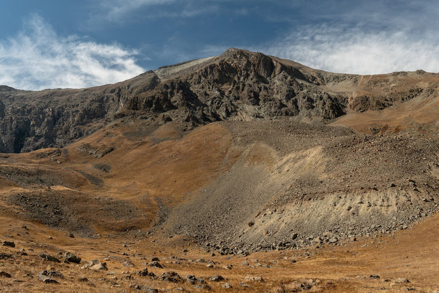
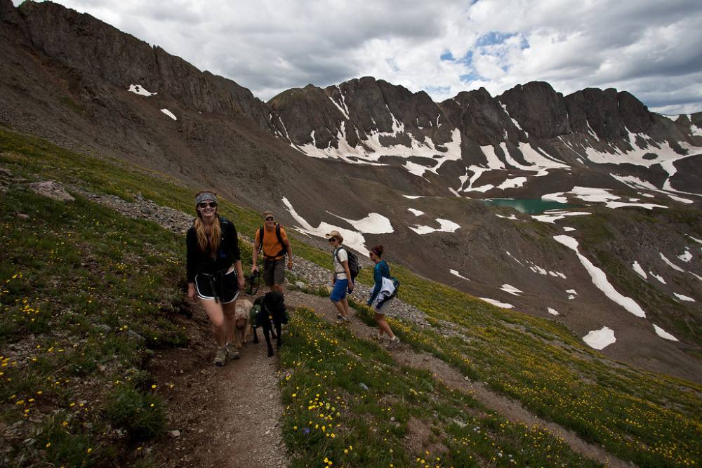
A lush, vibrant green valley filled with wildflowers and streams, leading to a smooth, well-built trail up the slopes.
Often cited as the most beautiful hike in Colorado. You walk through waist-high wildflowers and across rushing streams in a technicolor green basin. The trail is excellent—smooth, well-graded dirt switchbacks take you all the way up the grassy slopes. The final push is a straightforward hike up a wide ridge. It’s physically easier than most 14ers and visually overwhelming in its beauty.
Head south out of Lake City on Colorado 149 for roughly 2 miles, then go right on County Road 30, the road to Cinnamon Pass. It is more than 20 miles to the trailhead. Keep right close to 11.8 miles. The road turns rougher around 12.5 miles, and from about 13 to 14.5 miles it narrows to a shelf road cut into the south side of Sunshine Peak. Just short of 16 miles you pass the Grizzly Gulch trailhead. Beyond there you need 4WD or AWD and good clearance.
At a signed junction around 20 miles, turn left for American Basin. It is about 0.9 mile to the trailhead. You cross a stream after 0.2 mile, and the road above it gets narrow and harder. There are parking spots in this lower area if you do not want to drive higher; walking from the bottom of the American Basin road adds about 2 miles round trip and 300 feet of gain. Do not trust Google or Apple Maps for this drive; they may send you over Cinnamon Pass.
TundraTalus and screeRidgeScramblingExposed to lightning
The line is elevation, the band underneath is the ground, and the numbered dots match the steps below. Mileage and elevations are approximate.
1
American Basin trailhead 11,600' · 0 mi
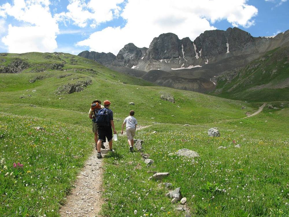
Start at the end of the road. The trail heads south into American Basin through open meadows that are full of wildflowers in midsummer. Handies is up to your left.
Watch for: If you parked lower, walk up the road to this point first.
Heading up American Basin · Photo: OakleyOriginals
2
Lower American Basin 12,000' · 0.6 mi
The trail climbs gently south up the basin floor, with small streams nearby.
3
Turn up the center slope 12,400' · 1 mi
Near 12,400 feet, turn left and climb a slope in the middle of the basin on switchbacks.
4
Upper basin 12,700' · 1.3 mi
At about 12,700 feet the ground levels out and the wide upper basin opens up. Follow the trail east.
5
Curve toward Sloan Lake 12,850' · 1.55 mi
The summit is up to your left, but do not head straight for it. Stay on the trail as it bends right (south) and climbs toward Sloan Lake.
Watch for: Cutting straight to the summit puts you on loose, steep ground.
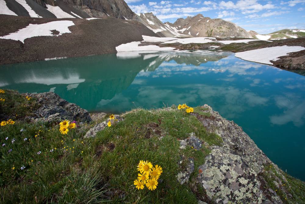
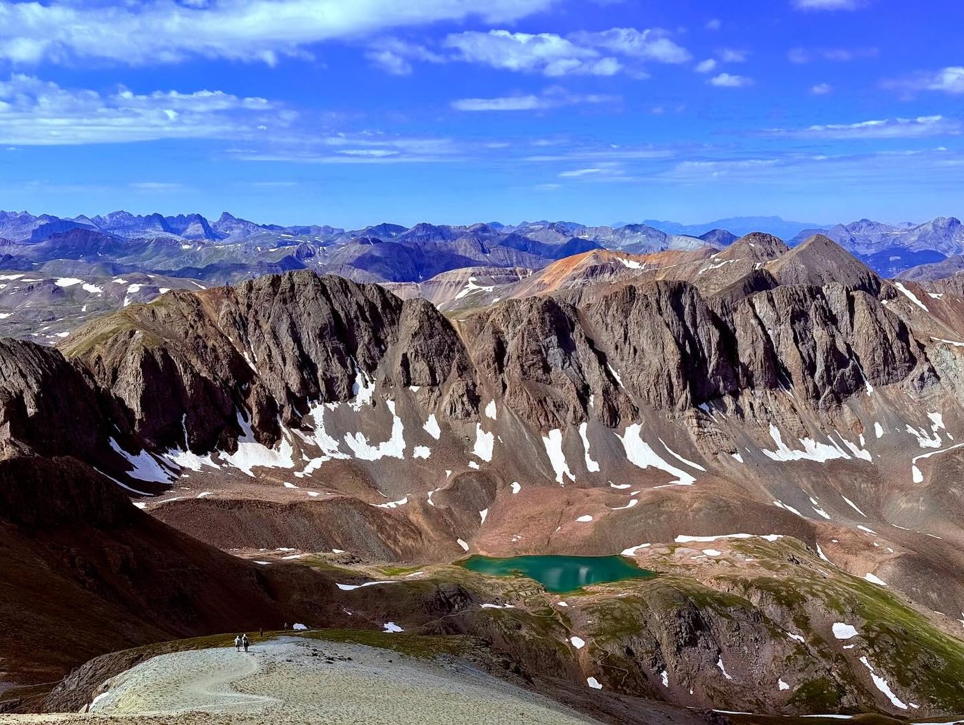
Sloan Lake in American Basin · Photo: Bureau of Land Management
6
Junction north of Sloan Lake 13,050' · 1.8 mi
Climb a bit over 300 feet to a trail junction just north of Sloan Lake, a small lake in a rocky bowl. Turn left and head east.
7
Talus traverse 13,000' · 2 mi
The trail crosses a talus slope toward easier ground on Handies' southwest slope. At the roughest spot it drops slightly.
Watch for: Watch your step on the rocks. This is the hardest footing on the route.
8
Southwest slope switchbacks 13,200' · 2.2 mi
Above 13,000 feet you leave the talus behind. The trail switchbacks up the southwest slope on dirt and small rock.
9
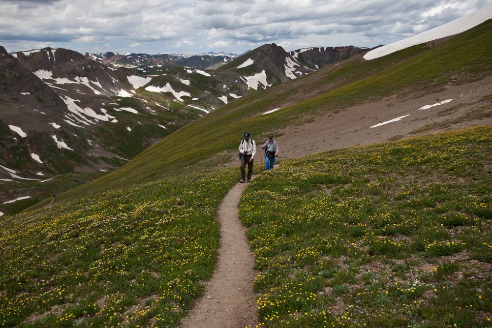
Saddle 13,500' · 2.45 mi
Reach the saddle between Handies and Point 13,588 to the south. Turn left (north) onto the ridge.
Watch for: Good place to check the weather before the final climb.
The trail climbing toward the saddle · Photo: Bureau of Land Management
10
Summit ridge 13,800' · 2.7 mi
Follow the trail up the ridge. It is wide and not exposed, with big views west over the San Juans.
11
Summit of Handies Peak 14,058' · 2.875 mi
Reach the broad summit. San Juan peaks stretch out in every direction.
Along the route
Hikers on the switchbacks above the basin · Photo: Bureau of Land Management
Here Hardrock 100 Route goes off to the right. Keep going straight on American Basin Trail.
Coming down: Keep going straight on American Basin Trail. Don’t take Hardrock 100 Route.
Landmarks to know
Wildflower meadows at the start of American Basin.
The turn left onto a switchbacking slope near 12,400 feet.
The wide, flat upper basin near 12,700 feet.
Sloan Lake in a rocky bowl, with a trail junction just north of it.
A short talus traverse east of the lake.
The saddle between Handies and Point 13,588.
The broad ridge leading north to the summit.
Getting down
Go back the way you came. From the summit, follow the ridge south to the saddle at 13,500 feet and turn right (west) to switchback down the southwest slope.
Take care on the talus traverse, then turn right at the junction by Sloan Lake to head back down into the basin. Do not try to shortcut straight down from the ridge into the upper basin; it is steep and loose. In the lower basin, stay on the trail to protect the meadows. Drive down the shelf road slowly and yield to uphill traffic.
If things go wrong
Every part of this route is close to the trail and the basin, so turning back is simple. If a storm builds, head down right away. There is no shelter anywhere on the route, but getting off the ridge and saddle and down into the lower basin lowers your risk. A vehicle is often the best shelter once you reach the trailhead. If someone is hurt or sick from altitude, go down; the basin is wide and easy to walk. Keep them warm and call 911 if you have signal. Lake City, the nearest town, is a long drive away.
3D flyover
Press play to fly the Southwest Slopes. The graph shows elevation along the way and how much you gain each mile. Open full screen.
For planning only. The line is traced from open map data, not walked in the field, and off-trail parts are drawn straight. Load it in your GPS app to see the route, but navigate with your eyes, a map and the route description.
See the trail on video
A climb of this route filmed by The Virtual sherpa. The video belongs to them and only plays when you press play.
Jump to
Other routes
All 3 routes up Handies Peak, with the class and round-trip distance for each.
A Class 1 rating means a trail, not a stroll. Altitude, distance and weather still decide how this goes. Afternoon thunderstorms build fast above treeline in summer, so plan to be heading down by noon, and carry more water than you think you need.