Afternoon storm risk is the line that matters. Everything else is comfort. In summer, plan to be off the ridge before the build-up starts, not as it starts. Forecast for the summit point, adjusted for its elevation · data from Open-Meteo.
Standard route · South Ridge
Overview
Maroon Peak is the higher of the two Maroon Bells, the famous striped peaks above Maroon Lake near Aspen. The standard route is one of the most dangerous 14er climbs in Colorado. After an easy walk past Crater Lake, you climb a brutal 2,800-foot slope to the south ridge, then spend hours working north along the ridge on ledges, chimneys and gullies of loose, crumbly maroon rock to the summit.
The rock in the Elk Mountains is fractured sedimentary rock. Holds break, ledges are covered in gravel, and rocks fall easily. Route finding on the upper ridge is hard: there are many cairns, not all of them useful, and wrong turns lead to cliffs. This climb is only for people with solid Class 3 skills, good route-finding judgment and experienced partners. It is not a peak to tick off a list.
The round trip is about 12 miles and 4,800 feet of gain. Plan on 10 to 13 hours. From the notch where you first reach the south ridge, fast climbers need at least an hour and a half to the summit, and most parties need two hours or more.
Plan of the day
Start by
By 4 a.m. The slope to the ridge alone takes 3 to 4 hours, and the ridge is slow. You want to be off the ridge before early-afternoon storms.
Turnaround
If you are not at the south ridge notch near 13,250 feet by 9 a.m., turn around. From the notch it is still 2 or more hours to the top and nearly as long back. Be on the summit by 11 a.m. at the latest.
Crux
Getting past Point 13,753 by climbing partway up one of two loose gullies and then traversing ledges, and the exposed ledges and slope just above the notch at the top of the broad summit gully.
Route-finding
Hard. The approach and the slope to the ridge are on trail, though it gets faint in the rocky bands above 11,600 feet. On the ridge, stop often to study the terrain and look ahead for cairns. Expect some backtracking.
Water
Maroon Lake, Crater Lake and West Maroon Creek on the approach. There is no water on the 2,800-foot slope or the ridge. Fill up at the creek before the Maroon Peak trail junction and filter it.
Paved road to a massive lot, but strictly regulated. You must reserve a shuttle bus ticket or parking pass months in advance; private cars are often banned between 8 AM and 5 PM.
Terrain
Gentle tourist paths around a stunning reflective lake that abruptly turn into steep, loose, crumbling red mudstone cliffs.
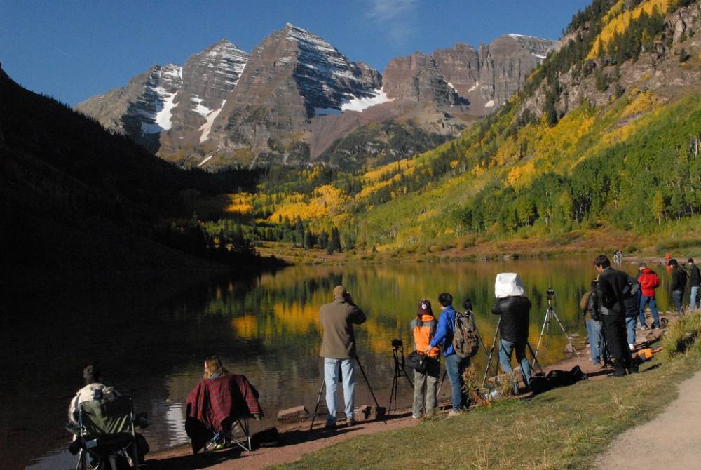
You start on one of the most photographed trails in America, walking smoothly around Maroon Lake with the "Bells" towering above. As you turn toward the peaks, the trail steepens aggressively through rocky scree fields. Once you hit the upper mountain, the "hiking" ends. The rock here is notoriously loose and rotten—every hold must be tested. You will find yourself carefully scrambling up steep, red dirt gullies and loose rock ledges where a single slip can send rocks tumbling onto climbers below. It is physically demanding, mentally exhausting, and visually spectacular.
Drive to Aspen and find the start of the Maroon Creek Road at the roundabout just west of town. From the roundabout, you pass a ranch at about 3.2 miles and the Forest Service entrance station at about 4.7 miles. The Maroon Lake trailhead is at about 9.5 miles. The road is paved and fine for any car.
In summer, the road past the entrance station is closed to private cars during the day, roughly 8 a.m. to 5 p.m., and a shuttle runs from Aspen. Parking at the trailhead needs an advance reservation, and camping near Crater Lake needs a wilderness permit; both are limited, so plan ahead and check the current rules. Most climbers drive in before dawn with a parking reservation or get dropped off early. Place your printed parking reservation on your dashboard. The route is in the Maroon Bells-Snowmass Wilderness.
Trail in the treesTalus and screeTundraScramblingRidgeExposed to lightning
The line is elevation, the band underneath is the ground, and the numbered dots match the steps below. Mileage and elevations are approximate.
1
Maroon Lake trailhead 9,590' · 0 mi
Walk west along the edge of Maroon Lake with the Bells straight ahead. Pass the lake and pick up the trail toward Crater Lake.
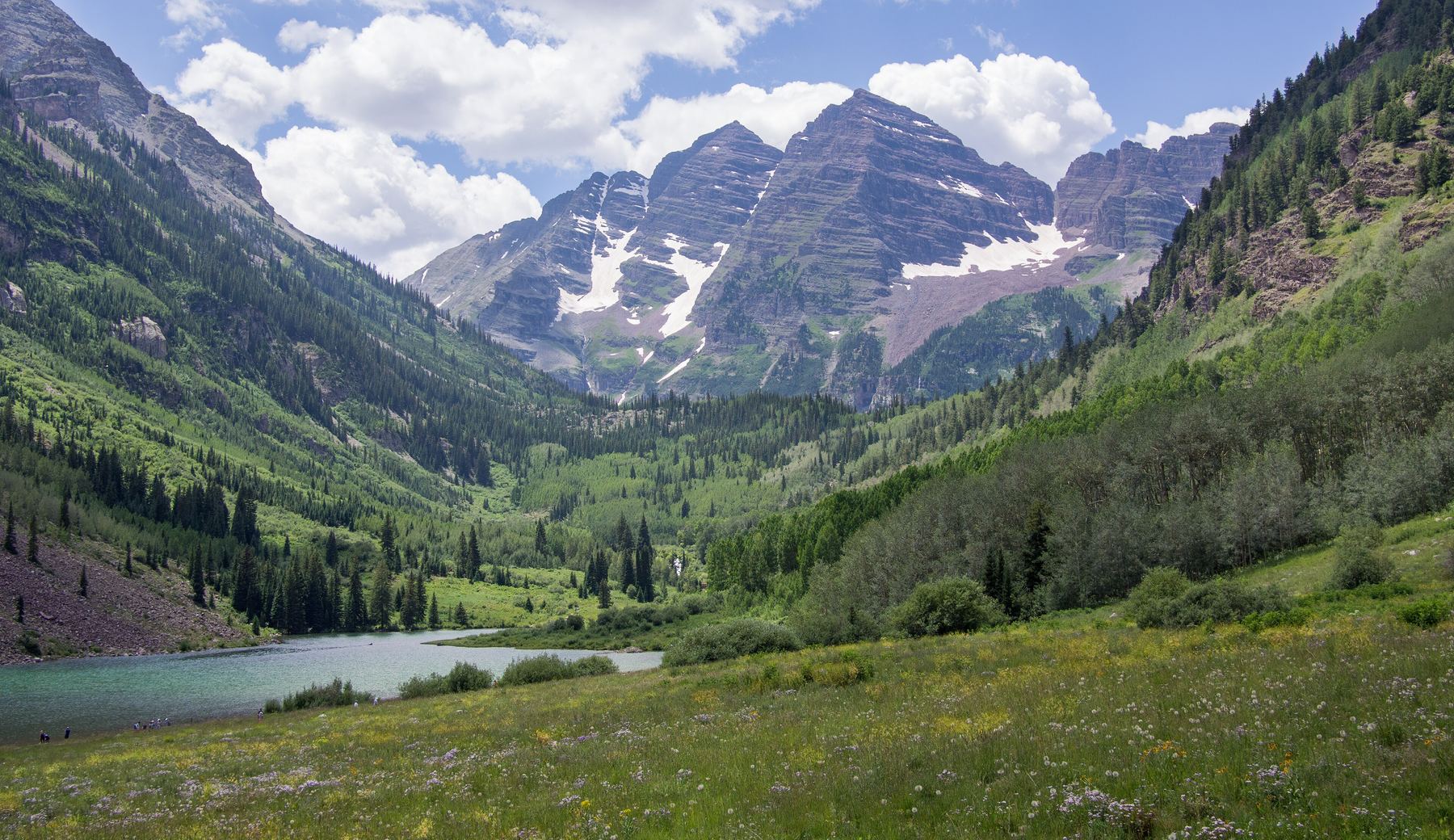
The Maroon Bells from Maroon Lake · Photo: U.S. Department of Agriculture
2
West Maroon trail junction 9,990' · 1.7 mi
After about 1.75 miles, reach a signed junction. Turn left onto the West Maroon Creek trail toward Crater Lake.
3
Crater Lake and talus field 10,100' · 2.3 mi
Follow the trail along the right side of Crater Lake and back into the trees. Past the south end of the lake, walk through thick brush and cross a talus field, then continue south along West Maroon Creek.
Watch for: Fill water here. There is none higher.
4
Maroon Peak trail junction 10,400' · 3 mi
About half a mile past the talus, look for a cairned junction near 10,400 feet. Turn right onto the Maroon Peak trail. The big climb starts here.
Watch for: Easy to miss in the dark. Watch for the cairns.
5
Turn up the slope 10,900' · 3.5 mi
The trail traverses for about half a mile, then near 10,900 feet turns west and heads straight up the grassy east slope. It is very steep and sustained.
6
Rock outcrops and cliff bands 11,600' · 3.8 mi
Near 11,600 feet you reach rock outcrops and small cliff bands. The trail angles left into them. It gets steeper and rockier, and harder to follow.
Watch for: Look for the worn trail and cairns. Stray paths lead into cliffy ground.
7
Southern turn 12,900' · 4.2 mi
Near 12,900 feet you reach the most southern point of the route. Turn right and follow a steep, loose trail up toward the ridge.
Watch for: Loose dirt and gravel. Knocked rocks roll far.
8
South ridge notch 13,250' · 4.4 mi
Reach the south ridge at a small notch near 13,250 feet. Climb through the notch and over a rock outcrop. Now you can see much of the rest of the route to the north.
Watch for: Decision point. Turn back here if weather or your group is not good.
9
Chimney and crack 13,400' · 4.55 mi
For roughly 0.1 mile, follow a cairned path along the ridge's west side. Turn right and find a chimney between rock towers. Climb the chimney, then go left and up through a large crack to easier ground above 13,400 feet.
Watch for: Helmets on. Climb one at a time in the chimney.
10
White rock band 13,500' · 4.85 mi
Cross below a notch and climb to a large, obvious band of white rock. Traverse ledges and around a corner. Point 13,753 comes into view ahead. More ledges lead to broken, ugly ground below it.
11
The two gullies 13,550' · 5.1 mi
Two gullies lie ahead. You can climb either one about halfway to reach cairned ledges that lead left around the west side of Point 13,753. If you use the first gully, exit near 13,500 feet and traverse a ledge left into the second gully, then climb to an exit near 13,550 feet.
Watch for: Very loose rock. Study the terrain and look for cairns before committing.
12
Robot rock and broad gully 13,600' · 5.35 mi
Follow ledges left to a rock shaped a bit like a robot. Go around a corner to reach the broad gully between Point 13,753 and the summit.
13
Top of the broad gully 13,900' · 5.6 mi
Enter the gully, turn right, and climb it to a notch in the south ridge at its top.
Watch for: Rockfall from climbers above. Spread out sideways, not in a line.
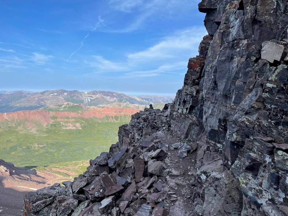
Loose ledges high on the south ridge · Photo: kalestews
14
Exposed ledges and slope 14,050' · 5.8 mi
Turn left and climb onto ledges. Past some cliffs, turn right and go up about 150 feet, then traverse left across the slope. Pass below more cliffs to a corner.
Watch for: Most exposed part of the route. Loose gravel sits on the ledges.
15
Summit of Maroon Peak 14,163' · 6 mi
Turn right around the corner and scramble a short way to the ridge crest. Follow the ridge to the summit. North Maroon Peak is just across a deep gap to the north.
Watch for: Do not try the traverse to North Maroon unless you have planned for it.
Here Maroon Bells Connector goes off to the left. Turn right to follow Maroon-Snowmass Trail.
Coming down: Turn left to stay on Maroon-Snowmass Trail. Don’t take Maroon Bells Connector.
2Mile 2.0 · 10,040'
Turn right to stay on the main trail
Here an unmarked path goes off to the left. Turn right to follow the main trail.
Coming down: Turn left to stay on the main trail. Don’t take the unmarked path.
3Mile 2.7 · 10,270'
Turn left to stay on West Maroon Trail
Here an unmarked path goes off to the right. Turn left to follow West Maroon Trail.
Coming down: Turn right to stay on West Maroon Trail. Don’t take the unmarked path.
Landmarks to know
Maroon Lake and the Bells straight ahead from the trailhead.
Signed junction to Crater Lake, then Crater Lake on your left side.
Cairned Maroon Peak trail junction near 10,400 feet along West Maroon Creek.
Rock outcrops and small cliff bands near 11,600 feet on the big slope.
Small notch on the south ridge near 13,250 feet.
Chimney between rock towers, then a large white rock band.
Point 13,753 with two gullies below it, and a robot-shaped rock past it.
Broad gully between Point 13,753 and the summit, topped by a notch.
Getting down
Reverse the route. This is where many accidents happen. People are tired, the rock is loose, and the correct line is harder to see from above. At the summit, look hard at where you came from. Downclimb the exposed ledges and slope carefully to the notch at the top of the broad gully, then descend the gully and find the ledges heading right past the robot rock.
Getting back around Point 13,753 is the easiest place to go wrong. Look for the cairned ledges and the gully exits you used. Do not follow a gully downhill just because it looks easy; the gullies below the ridge end in cliffs. Stay with the route back to the south ridge notch at 13,250 feet. The loose trail down the big slope is steep. Go slowly and watch for rocks kicked loose by people above. Turn left at the Maroon Peak trail junction and walk back past Crater Lake.
If things go wrong
The south ridge notch near 13,250 feet is the key bail point. Below it, the slope is steep but on a trail, and you can drop quickly toward treeline. Above it, the only safe way off is back along the route you came, which takes time. Do not try shortcuts down the east or west faces; they end in cliffs. If a storm hits on the ridge, keep moving back toward the notch with care rather than rushing on loose ledges. If someone is hurt, stop, secure them away from rockfall, keep them warm and send for help. Cell signal is poor here. Rescue from the ridge is slow and may need a helicopter. Call 911 if you can get through.
3D flyover
Press play to fly the South Ridge. The graph shows elevation along the way and how much you gain each mile. Open full screen.
For planning only. The line is traced from open map data, not walked in the field, and off-trail parts are drawn straight. Load it in your GPS app to see the route, but navigate with your eyes, a map and the route description.
See the trail on video
A climb of this route filmed by Krischan. The video belongs to them and only plays when you press play.
Other routes
All 3 routes up Maroon Peak, with the class and round-trip distance for each.
Bell Cord CouloirA beautiful, highly dangerous snow couloir cutting directly between the two massive Maroon bells. You ascend a dead-straight, deeply inset snow funnel that continuously gets narrower and steeper, hitting a 50-degree pinch at the top saddle where helmets are mandatory to survive the constant threat of falling rock.
A committing high-altitude alpine link-up across crumbling, highly unstable maroon mudstone. You navigate a razor-thin ridge connecting the two summits, climbing up exposed chimneys and bypassing rotten towers where every handhold must be pulled downward rather than outward to prevent total structural failure of the rock.
This is a climb, not a hike
Class 3 means sustained scrambling with your hands, on terrain where a fall has real consequence. Build up on easier scrambles first, wear a helmet, go with someone who has led this kind of ground, and remember that downclimbing is harder than going up.