Afternoon storm risk is the line that matters. Everything else is comfort. In summer, plan to be off the ridge before the build-up starts, not as it starts. Forecast for the summit point, adjusted for its elevation · data from Open-Meteo.
Standard route · West Slopes
Overview
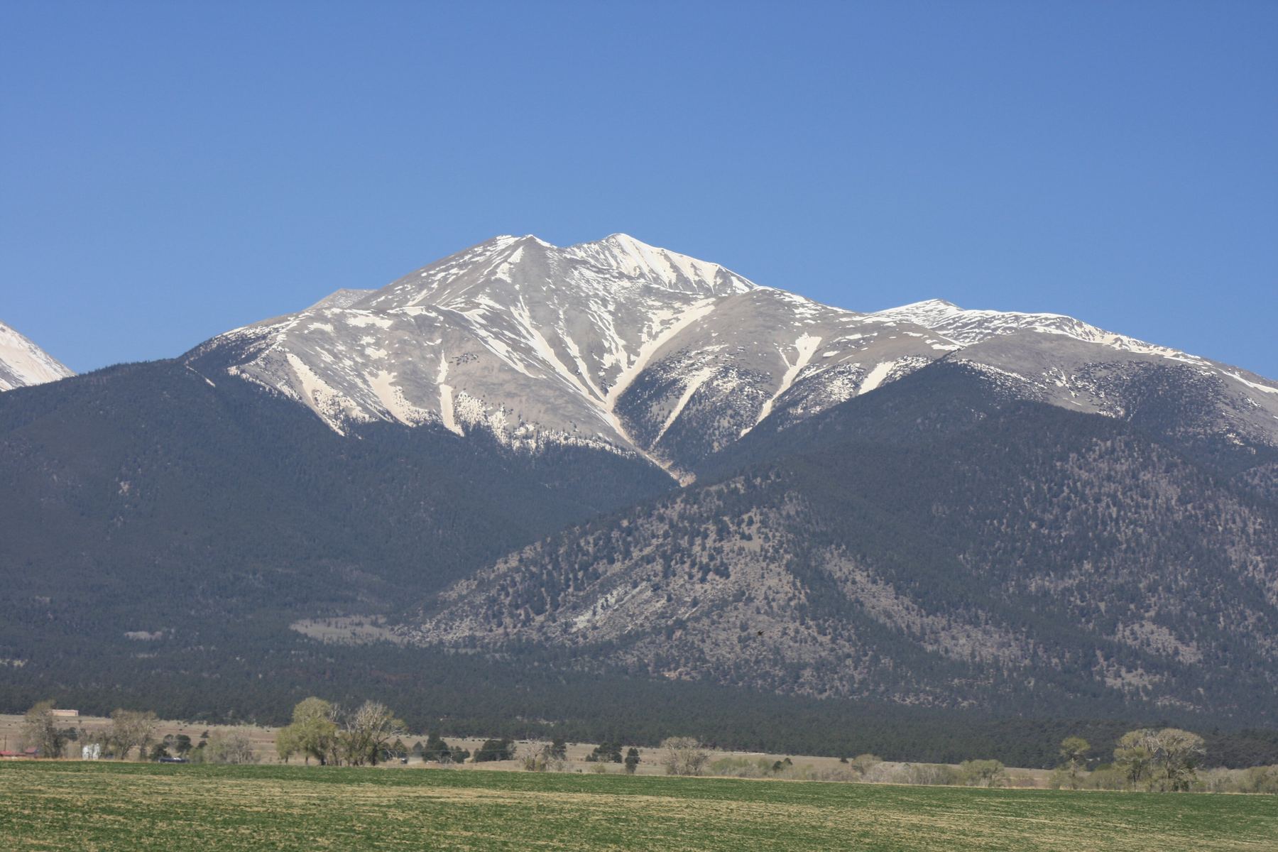
Mount Antero rises above Chalk Creek south of Buena Vista. It is famous for gem hunting and for a rough 4WD road that climbs most of the way up its west side. The standard route follows that road for miles, first through forest, then up long switchbacks above treeline, then around a high point to the south ridge. Only the last part, a rocky ridge and a short steep pitch to the top, is off the road.
From the lower trailhead the full hike is 15.5 miles round trip with about 5,200 feet of gain. That is long, and most of it is on a dusty, rocky road shared with jeeps, trucks and off-road vehicles. The walking is easy but the distance and altitude wear people down. Many people drive part of the road in a short, high-clearance 4WD to cut the day, but the road is steep, narrow and rough.
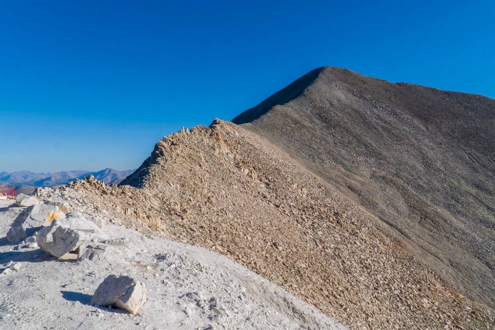
The ridge section near the top is the most interesting part, with some rocky Class 2 hiking and loose rock on the final pitch. Hiking from the bottom, plan on 9 to 12 hours. You are above treeline for more than half the day.
Plan of the day
Start by
By 4:30 or 5 a.m. from the lower trailhead. You reach treeline around 4.5 miles in and then spend hours on open road and ridge with no shelter.
Turnaround
If you are not at the ridge crest near 13,100 feet by 10 a.m., turn back. From there it is still about a mile and a half to the summit.
Crux
The final pitch above the 13,850-foot saddle. The old traverse trail is braided and eroded, so most people climb straight up near the ridge crest on loose rock.
Route-finding
Easy but tedious. The main place to go wrong is the road network: turn left onto the 278 road at the creek crossing, then keep left at two junctions after the ridge crest. There are many spur roads to old mines.
Water
Baldwin Creek near 10,850 feet is the last reliable water. There is none on the upper road or ridge. Carry at least 3 liters and filter creek water.
South of Buena Vista, U.S. 285 and U.S. 24 meet. Head south on 285 from that junction for roughly 5.5 miles, and past Nathrop take a right (west) onto Chaffee County Road 162. This road goes up the Chalk Creek valley; the pavement stops at about 10 miles. At nearly 12.5 miles, watch on the left for the signed Baldwin Gulch road, also known as the 277 road.
Passenger cars park at pull-offs along County Road 162 near the bottom of the Baldwin Gulch road. The 277 road is steep, rocky and narrow, and only short-wheelbase, high-clearance 4WD vehicles should try it. Drive slowly and be ready to back up for oncoming traffic. There are dispersed campsites along the road above the creek crossing near 10,850 feet. Snow can block parts of the road into early July.
RoadTrail in the treesTundraTalus and screeRidgeExposed to lightning
The line is elevation, the band underneath is the ground, and the numbered dots match the steps below. Mileage and elevations are approximate.
1
Baldwin Gulch lower trailhead 9,420' · 0 mi
Start up the 277 jeep road from County Road 162. The road climbs steeply through pine and aspen right away. It is rocky and rough underfoot.
Watch for: Step aside for vehicles. Drivers have limited room.
2
Lower Baldwin Gulch road 10,200' · 1.5 mi
The road keeps climbing steadily up the gulch through the forest. Baldwin Creek is below you to the side. There is little to see but trees.
3
Junction and Baldwin Creek crossing 10,850' · 3 mi
At a road junction near 10,850 feet, turn left onto the 278 road and cross Baldwin Creek. Campsites line the road above the crossing.
Watch for: Last reliable water. The crossing can be high and cold in early summer.
4
Treeline 11,700' · 4.4 mi
About a mile and a half past the creek, the trees end. The road begins switchbacking up Antero's broad west slopes. Point 13,800 is the high point above you.
Watch for: From here you are exposed to storms for the rest of the climb.
5
Switchbacks on the west slopes 12,400' · 5.2 mi
The road zigzags back and forth up the west side of Point 13,800. The slopes are gray talus and scree. It is slow, steady walking.
6
Long southward traverse 12,800' · 5.7 mi
Near 12,800 feet the road makes a long, straight run heading south across the slope toward the ridge crest.
7
Ridge crest 13,100' · 6.1 mi
The road reaches the ridge crest near 13,100 feet. Turn east onto the 278A road, toward Point 13,800.
8
First junction 13,150' · 6.2 mi
Soon after leaving the crest, the road splits. Keep left.
Watch for: Wrong turns here lead onto mining spur roads.
9
Second junction 13,200' · 6.6 mi
About 0.4 mile farther, near 13,200 feet, the road splits again. Keep left and follow the road up the south side of Point 13,800.
10
Saddle east of Point 13,800 13,650' · 7.1 mi
The road reaches a small saddle on the east side of Point 13,800. Antero's summit is now in view to the south and east.
11
Mining area and south ridge 13,700' · 7.25 mi
Walk through a scarred old mining area to reach Antero's south ridge. The ground is torn up and littered with rock.
Watch for: Stay out of old mine workings and pits.
12
South ridge traverse 13,800' · 7.45 mi
Follow the ridge crest and short trail sections just to its right. This is rocky Class 2 hiking with some big blocks and more fun than the road.
Watch for: Watch your footing on loose, tippy rocks.
13
Saddle at the base of the final pitch 13,850' · 7.55 mi
The ridge dips to a small saddle at 13,850 feet below the summit cone. An old trail traverses right across the south slope, but it is eroded. Most people head straight up near the ridge crest.
14
Summit of Mount Antero 14,271' · 7.75 mi
Climb the steep, loose final 400 feet to the rocky summit. Mount Princeton is close to the north and the Chalk Creek valley lies far below.
Watch for: Loose rock on the final pitch. Do not knock rocks onto people below you.
Here Boulder Mountain 4Wd Road goes off to the right. Keep going straight on Baldwin Creek 4Wd Road.
Coming down: Keep going straight on Baldwin Creek 4Wd Road. Don’t take Boulder Mountain 4Wd Road.
2Mile 6.7 · 13,290'
Turn left to stay on Antero 4Wd Road
Here Forest Road 278.C Antero/Mt.White Cutoff goes off straight ahead. Turn left to follow Antero 4Wd Road.
Coming down: Turn right to stay on Antero 4Wd Road. Don’t take Forest Road 278.C Antero/Mt.White Cutoff.
3Mile 7.3 · 13,720'
Keep right onto Mount Antero Trail
Here a road goes off to the left. Keep right to follow Mount Antero Trail.
Coming down: Keep left to stay on Antero 4Wd Road. Don’t take the road.
Landmarks to know
Signed Baldwin Gulch (277) road on the left side of County Road 162.
Road junction and Baldwin Creek crossing near 10,850 feet, where you turn left.
Treeline and the start of the long switchbacks on the west slopes.
A long straight southward road section near 12,800 feet.
The ridge crest near 13,100 feet, where you turn east.
Two junctions after the crest, both keep left.
The saddle east of Point 13,800 and the torn-up mining area.
The small saddle at 13,850 feet at the foot of the summit cone.
Getting down
Go back the way you came. Downclimb the final pitch slowly, since it is loose and steep. On the way back across the ridge and mining area, aim for the saddle east of Point 13,800 and pick up the road there.
On the road, both junctions near 13,200 feet become right turns heading back to the ridge crest. At the crest, turn back west and follow the switchbacks down. At the creek crossing, turn right onto the 277 road to head down Baldwin Gulch. Watch for vehicles on the road, especially on blind corners, and on the loose, steep lower road, where it is easy to roll an ankle.
If things go wrong
The road is your bail route at every point. Once you are off the ridge and back on the road you can move down quickly, but you are still above treeline until about 11,700 feet, and there is no shelter on the switchbacks. If a storm builds while you are on the south ridge or the summit cone, head back to the road right away and keep moving down. If someone is hurt, the road may let a vehicle reach you or help carry them out, and passing drivers may be able to help. Keep the injured person warm and call 911 if you have signal.
3D flyover
Press play to fly the West Slopes. The graph shows elevation along the way and how much you gain each mile. Open full screen.
For planning only. The line is traced from open map data, not walked in the field, and off-trail parts are drawn straight. Load it in your GPS app to see the route, but navigate with your eyes, a map and the route description.
See the trail on video
A climb of this route filmed by Dave spates. The video belongs to them and only plays when you press play. Parts of this route may differ from the standard route described here.
Jump to
Other routes
All 2 routes up Mount Antero, with the class and round-trip distance for each.
Expect talus, scree and stretches where the trail disappears. Ankles and weather cause most of the trouble here. Start early, keep an eye on the sky, and set a turnaround time before you leave the car.