Afternoon storm risk is the line that matters. Everything else is comfort. In summer, plan to be off the ridge before the build-up starts, not as it starts. Forecast for the summit point, adjusted for its elevation · data from Open-Meteo.
Standard route · West Ridge
Overview
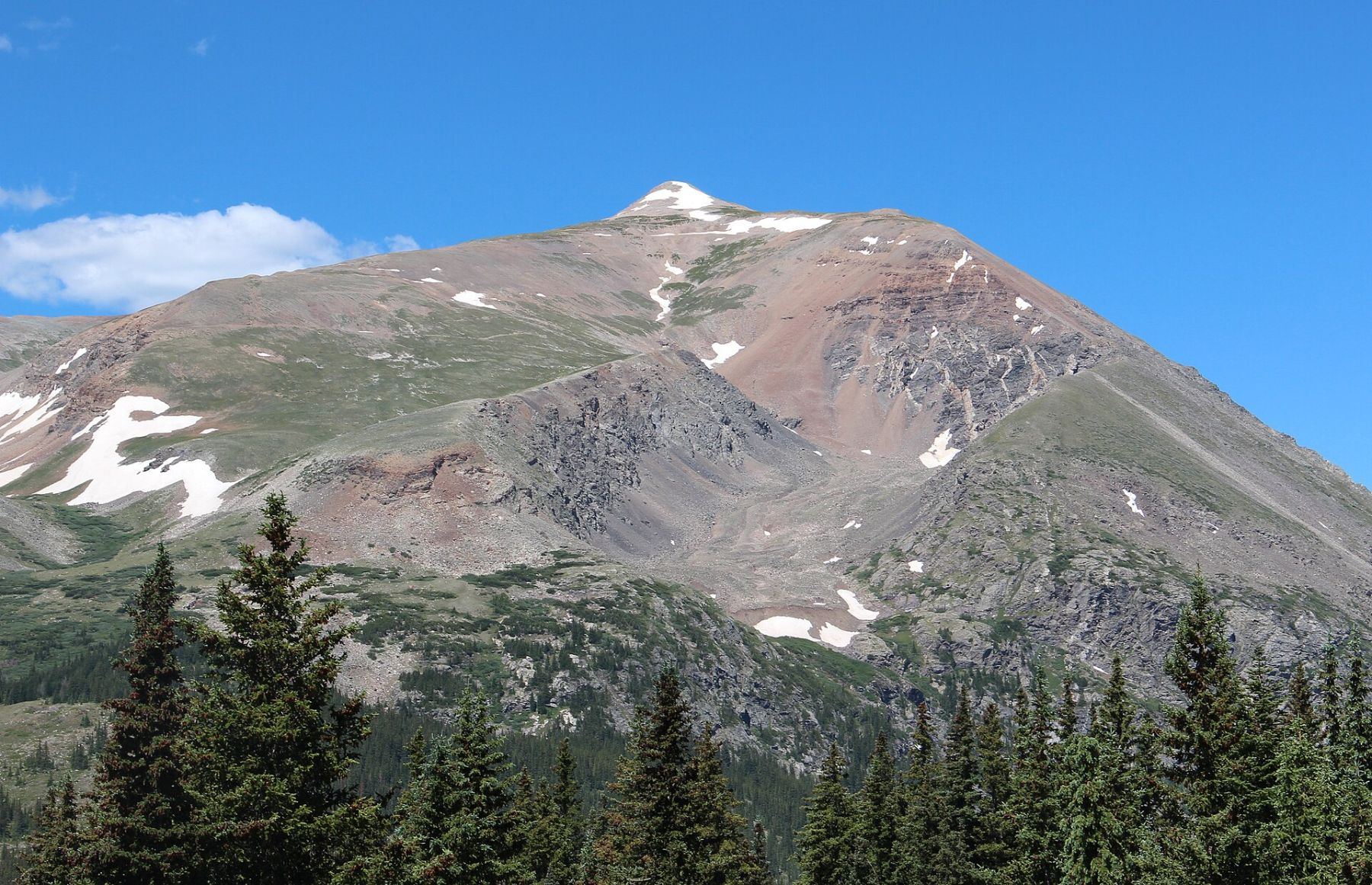
Mount Lincoln is the highest peak in the Mosquito Range and the tallest of the four summits around Kite Lake. The West Ridge route climbs from the lake to the Democrat-Cameron saddle, follows Cameron's west ridge to its broad, flat top, then crosses a short saddle to Lincoln's small, rocky summit. It is Class 2 and on trail nearly the whole way.
Because the trailhead sits at 12,000 feet, you are above treeline from the first step. That makes the day short, about 6 miles round trip and 2,600 feet of gain, but it also means there is no shelter anywhere on the route. Many people add Democrat and Bross to make the Decalibron loop. A plain out-and-back to Lincoln takes most hikers 4 to 6 hours.
This is a good first or second 14er for people who are fit and used to altitude. The main dangers are lightning on the open ridges, the thin air, and loose rock on the steeper parts of the trail. Much of the land around the route is private mining property, so stay on the trail.
Plan of the day
Start by
By 6 a.m. You are above treeline the whole time with nowhere to hide from a storm, and afternoon lightning is common here in July and August.
Turnaround
If you are not on top of Cameron by 11 a.m., or clouds are building, turn back from Cameron. Do not start the traverse to Lincoln with a storm coming.
Crux
The final short Class 2 pitch up to Lincoln's summit, on loose rock with some drop-off to the east. Below that, the steep, rocky slope above 12,600 feet is the roughest trail.
Route-finding
Easy in good weather. The trail is clear and busy. In clouds, the broad top of Cameron can be confusing; head northeast for Lincoln and back southwest for the Democrat-Cameron saddle.
Water
Kite Lake and the stream near the trailhead are the only water. Much of the water in this area drains old mines, so filter or treat, or better yet bring all you need. Carry at least 2 liters.
Drive Colorado 9 to Alma. In the middle of town, on the west side of the highway, look for a small sign for Kite Lake. Turn there and drive through a short stretch of houses, then follow the dirt road about 6 miles up the valley to Kite Lake.
The road is dirt and gets rougher in the last mile. A 2WD car with good clearance can usually get within a couple hundred yards of the lot when the road is dry. Low cars may need to park lower and walk. There are restrooms and some campsites at the lake, and a parking fee is charged. The lot fills very early on summer weekends.
TundraRidgeExposed to lightning
The line is elevation, the band underneath is the ground, and the numbered dots match the steps below. Mileage and elevations are approximate.
1
Kite Lake trailhead 12,000' · 0 mi
From the parking area, walk up the closed road past the lake on its east side. The four peaks of the Decalibron ring the basin around you. Lincoln is hidden behind Cameron for now.
2
Leave the basin 12,100' · 0.3 mi
Past the north end of the lake, the trail starts climbing out of the basin to the north on grass and dirt. The route is wide and easy to follow.
3
Collapsed mine shack 12,200' · 0.5 mi
Near 12,200 feet you pass the ruins of an old mine building. Leave it alone and stay on the trail. Mining claims cover much of this area.
Watch for: Old mine sites can be unstable. Do not climb on them or enter any openings.
4
Rugged slope 12,600' · 0.8 mi
At 12,600 feet the trail gets steeper and rockier as it climbs a rough slope. Take your time and use the switchbacks. This is the steepest trail of the day before the saddle.
Watch for: Loose gravel on the steep sections, especially on the way down.
5
Base of Democrat's east slope 12,800' · 1 mi
Near 12,800 feet the trail bends left (south) for a short distance, then turns right and heads north across the east slope of Democrat. The saddle is now in view above you.
6
Democrat-Cameron saddle 13,380' · 1.3 mi
Reach the broad saddle between Democrat on the left and Cameron on the right. Many people head left here for Democrat. For Lincoln, turn right (east).
Watch for: This saddle is windy. It is also the last easy place to turn back.
7
Right side of Cameron's west ridge 13,450' · 1.5 mi
The trail runs along the right side of Cameron's west ridge, a bit below the crest. The footing is dirt and small rock.
8
Back on the ridge crest 13,500' · 1.6 mi
Near 13,500 feet the trail swings left to get back on the ridge. From here it follows the crest up toward Cameron.
9
Ridge flattens at 14,000 feet 14,000' · 2.1 mi
The ridge gets less steep around 14,000 feet, and you can see the rest of the way to Cameron's summit. Pass a bump on its left side.
10
Mount Cameron 14,238' · 2.3 mi
Walk up to Cameron's wide, flat, rocky top. It is not an official 14er because it does not rise far enough above Lincoln. Look northeast: Lincoln is the pointed summit across a shallow saddle.
Watch for: Check the weather here before you commit to Lincoln.
11
Cameron-Lincoln saddle 14,150' · 2.6 mi
Drop northeast off Cameron on the trail to the shallow saddle between the two peaks. If you plan the loop to Bross, you will come back to this area after Lincoln.
12
Bump before Lincoln 14,200' · 2.8 mi
Follow the trail past a small bump on the ridge. Lincoln's summit block comes into full view ahead.
13
Summit 14,293' · 3 mi
Walk over to the base of the final pitch and climb the short, steep Class 2 slope to the top. The summit is small and rocky, with a steep drop on its east side. Views take in the rest of the Mosquito Range and the Tenmile Range to the north.
Watch for: The summit is small and drops off steeply to the east. Watch your step, especially when it is crowded.
Here Cameron Ridge Connector Trail goes off to the right. Keep left to follow the trail.
Coming down: Keep right to stay on Mount Democrat Trail. Don’t take Cameron Ridge Connector Trail.
Landmarks to know
Kite Lake at the trailhead, with the four peaks around the basin
A collapsed mine shack near 12,200 feet
The broad Democrat-Cameron saddle at about 13,380 feet (turn right)
Cameron's wide, flat, rocky summit
Lincoln's pointed summit to the northeast of Cameron
A small bump on the ridge just before Lincoln's final pitch
Getting down
Return to Cameron, then back down the west ridge to the Democrat-Cameron saddle and turn left (south) to drop back to Kite Lake. The most common mistake is on Cameron's broad top in fog, where it is easy to head the wrong direction. From Cameron, aim southwest along the ridge, not east toward Bross.
If you do the full loop over Bross, know that the descent from Bross back to Kite Lake is steep, loose scree and gravel. It is harder on the legs than the ascent route. Whichever way you go, take it slow on the steep slope between 12,600 feet and the lake, where loose gravel causes slips.
If things go wrong
There is no shelter on this route. The fastest way down from anywhere between Cameron and Lincoln is to go back over Cameron and down its west ridge to the saddle, then drop south to Kite Lake. If lightning starts, get off the ridges and summits right away, spread your group out, and keep moving down. The trailhead is only about 3 miles from the summit, so help can reach the area fairly fast, but cell coverage is spotty. If someone is hurt, keep them warm and sheltered from wind, and call 911 if you can get a signal.
3D flyover
Press play to fly the West Ridge. The graph shows elevation along the way and how much you gain each mile. Open full screen.
For planning only. The line is traced from open map data, not walked in the field, and off-trail parts are drawn straight. Load it in your GPS app to see the route, but navigate with your eyes, a map and the route description.
See the trail on video
A climb of this route filmed by The Virtual sherpa. The video belongs to them and only plays when you press play. This video covers the DeCaLiBron loop, which includes Lincoln.
Jump to
Other routes
All 4 routes up Mount Lincoln, with the class and round-trip distance for each.
Mount Democrat → Mount Cameron → Mount Lincoln → Mount Bross
Class 2 still means loose rock and route-finding
Expect talus, scree and stretches where the trail disappears. Ankles and weather cause most of the trouble here. Start early, keep an eye on the sky, and set a turnaround time before you leave the car.