Afternoon storm risk is the line that matters. Everything else is comfort. In summer, plan to be off the ridge before the build-up starts, not as it starts. Forecast for the summit point, adjusted for its elevation · data from Open-Meteo.
Standard route · East Slopes
Overview
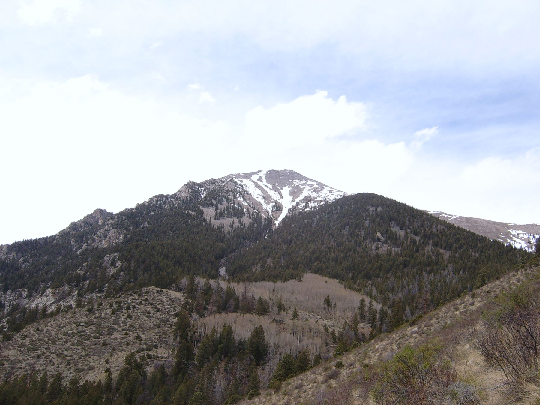
Shavano is the southernmost of the big Sawatch fourteeners, standing above the Arkansas Valley west of Salida. The standard route climbs its east side from the Blank Cabin trailhead. It starts low, at 9,750 feet, so the first half of the day is a long walk through forest. Above treeline, a newly built trail zig-zags up a rocky slope to the ridge below the summit.
It is rated Class 2 because of rough, rocky ground near the top, but most of the route is on good trail. The hard part is the length and the gain: 10 miles round trip and about 4,500 feet of climbing. Expect 7 to 9 hours for a fit hiker. Tabeguache Peak is a mile to the west and many people add it, which makes a much longer day.
Near the top, trail work has been under way and the new trail may seem to stop around 13,800 feet. From there you follow older paths up rocky ground to the summit ridge. Pay attention in this area, because you need to find the same spot on the way down. Going down the wrong way toward the saddle south of the summit is a known mistake.
Plan of the day
Start by
By 5 a.m. The first 3 miles are in the trees, and you still have about 2,000 feet of climbing above treeline after that. Storms often arrive around noon.
Turnaround
If you are not at the rock stairs and trail sign near 12,650 feet by 9:30 a.m., or at the point where the new trail ends near 13,800 feet by 11 a.m., turn around.
Crux
The last 400 feet above 13,800 feet: rocky, uneven ground where the new trail has not been finished, then a boulder-strewn ridge to the top.
Route-finding
The trail is clear through the forest and up the slope. There are a few junctions in the first half mile, and the upper section near 13,800 feet can be confusing while trail work is ongoing. On the way down, do not drop straight south toward the saddle below the summit.
Water
A small stream crosses the trail near 10,750 feet. There is no reliable water above treeline. Filter or treat.
Drive US 285 to about one mile north of its junction with US 50 near Poncha Springs. This is about 21 miles south of Buena Vista, across from the Salida airport. Turn west onto County Road 140 and reset your odometer. At 1.7 miles, turn right on County Road 250. The pavement ends at about 2.6 miles.
Once the road enters BLM land it gets rough and rocky. A higher-clearance vehicle is best. At 5.9 miles, keep left at a fork onto Forest Road 252. The signed trailhead is at just over 9 miles, at 9,750 feet. If the lot is full, there is overflow parking about 0.1 mile past the trailhead.
Trail in the treesTundraRidgeExposed to lightning
The line is elevation, the band underneath is the ground, and the numbered dots match the steps below. Mileage and elevations are approximate.
1
Blank Cabin trailhead 9,750' · 0 mi
Start on the trail from the parking area. Within about 0.1 mile you reach a junction.
2
Colorado Trail junction 9,800' · 0.1 mi
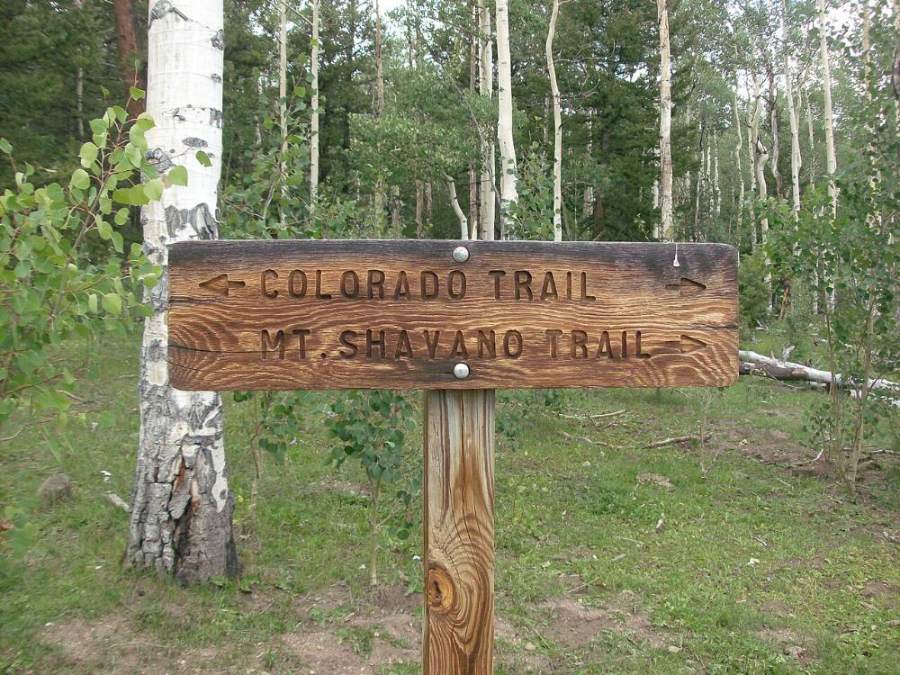
Turn right onto the Colorado Trail and follow it for about a quarter mile.
The Colorado Trail and Mount Shavano trail sign · Photo: Xnatedawgx
3
Mount Shavano trail 9,900' · 0.35 mi
At the next junction, turn left onto the Mount Shavano trail. It starts as a wide, rocky path, then you turn right onto a narrower, well-marked trail heading north and then west.
Watch for: Several junctions close together here. Watch for the Shavano trail signs.
4
Turn north on the hillside 10,600' · 1.5 mi
The trail climbs steadily through the forest. Near 10,600 feet it turns right and traverses north up a hillside and around a corner.
5
Flat ground and stream 10,750' · 1.8 mi
The grade eases on flatter ground. Walk northwest and cross a small stream. This is the last water on the route.
6
Large rock 10,950' · 2.2 mi
Climbing again, you pass a notable rock beside the trail. Keep heading west.
7
Corner at halfway 11,200' · 2.5 mi
The trail reaches a corner and turns right. You are about halfway in distance. Above here the trail climbs on many log steps.
Watch for: Plenty of climbing is still ahead. Check your time.
8
Approaching treeline 11,800' · 3 mi
The trail bends southwest as the trees thin out. Views open over the Arkansas Valley to the east.
9
Southeast slopes 12,300' · 3.3 mi
Out of the trees, the trail traverses west across Shavano's open southeast slopes.
Watch for: You are now exposed to lightning.
10
Rock stairs and sign 12,650' · 3.6 mi
A set of stone steps and a trail sign mark the start of the new trail to the summit. The old trail to the left is closed for restoration. Take the new trail.
11
Top of the zig-zags 13,400' · 4.1 mi
The new trail switchbacks about 700 feet up a rocky slope. At about 13,400 feet the grade eases and the summit finally comes into view ahead.
12
Below the saddle 13,600' · 4.35 mi
Follow the trail west below a saddle toward the final climb. Here the trail steepens.
13
End of the new trail 13,800' · 4.55 mi
The new trail may seem to end here while work is unfinished. Pick one of the older paths that climbs toward the ridge crest ahead. Look around and note this spot and the view back down, since you need to come back to it.
Watch for: Take a photo or mark this spot on your GPS for the descent.
14
Summit ridge 14,100' · 4.85 mi
Climb rocky, uneven ground up to a flat section on the ridge. You are close.
Watch for: Loose rock and boulders.
15
Summit 14,230' · 5 mi
Bear slightly right, then turn left to reach the top. Tabeguache is the peak to the west. The Arkansas Valley spreads out to the east.
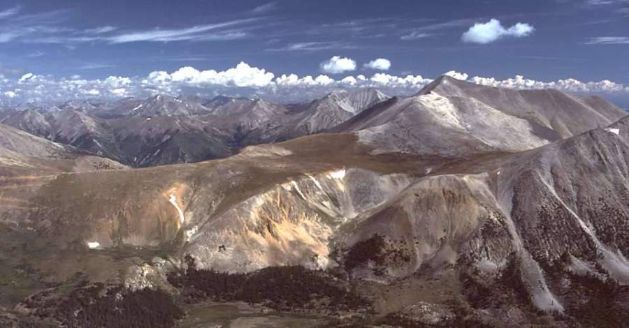
Looking north to Mount Antero from Shavano's summit · Photo: G. Thomas
Landmarks to know
A quick series of junctions in the first half mile, first onto the Colorado Trail, then left onto the Shavano trail.
A small stream crossing on flatter ground near 10,750 feet.
A large rock beside the trail near 10,950 feet.
A corner at 11,200 feet, about halfway, followed by many log steps.
Stone steps and a trail sign near 12,650 feet where the new trail begins.
First view of the summit near 13,400 feet.
A flat section on the ridge just below the top.
Getting down
Go back the same way. The key place is the top of the route: from the summit, go back down the ridge to the spot near 13,800 feet where you left the new trail, then follow it down the zig-zags. Do not head straight south off the summit toward the saddle between Shavano and the point to the south. That line is steep and loose and takes you off route.
Below the rock stairs, the trail back through the forest is long but clear. Stay on it at the junctions near the bottom: right off the Shavano trail onto the Colorado Trail, then left back to the trailhead. Tired legs on the rocky lower trail and the log steps cause many slips late in the day.
If things go wrong
The only good way down is the way you came up. Above treeline, the fastest way to get lower is to go back down the new trail to the rock stairs near 12,650 feet and then into the trees below 11,800 feet. If a storm is building while you are above 13,400 feet, go down now; the upper slope has no shelter. If someone is hurt, keep them warm and out of the wind, and call 911 if needed. Rescue from above treeline here takes many hours, so carry enough to wait.
3D flyover
Press play to fly the East Slopes. The graph shows elevation along the way and how much you gain each mile. Open full screen.
For planning only. The line is traced from open map data, not walked in the field, and off-trail parts are drawn straight. Load it in your GPS app to see the route, but navigate with your eyes, a map and the route description.
See the trail on video
A climb of this route filmed by The Virtual sherpa. The video belongs to them and only plays when you press play. This video covers Shavano and Tabeguache together.
Jump to
Other routes
All 3 routes up Mount Shavano, with the class and round-trip distance for each.
TypeRouteClassTrailheadRound trip
Standard
East Slopes
Class 2
Blank Cabin (Shavano / Tabeguache)10 mi · 4,500'Full route →
Snow
Angel of Shavano
Class 2easy snow
Blank Cabin (Shavano / Tabeguache)8 mi · 4,600'Full route →
Link-up
Via Mount ShavanoAlso summits Tabeguache Peak
Class 2
Blank Cabin (Shavano / Tabeguache)12 mi · 5,600'Full route →
Expect talus, scree and stretches where the trail disappears. Ankles and weather cause most of the trouble here. Start early, keep an eye on the sky, and set a turnaround time before you leave the car.