Afternoon storm risk is the line that matters. Everything else is comfort. In summer, plan to be off the ridge before the build-up starts, not as it starts. Forecast for the summit point, adjusted for its elevation · data from Open-Meteo.
Standard route · Southwest Ridge
Overview
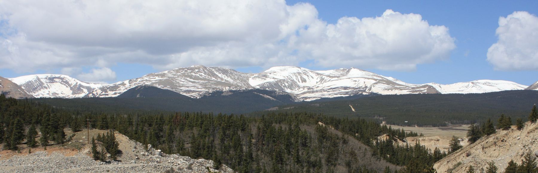
Mount Sherman is one of the easiest 14ers in Colorado. From the gate on Fourmile Creek it is 5.25 miles round trip with about 2,100 feet of gain. Most people take 4 to 6 hours. You walk old mining roads past historic mine buildings, climb a short trail to a saddle, and follow a ridge to a long, flat summit.
The route is Class 1, but it starts at 12,000 feet and never goes below treeline, so there is no shelter from wind or lightning. Sherman is known for fierce wind. The ridge above the saddle narrows for a short stretch and has loose rock on the trail. That is the only part that takes some care.
Sherman is a good first 14er. It is also a common winter climb, when the road is closed lower down and the trip is twice as long. Stay out of the old mine buildings and openings. They are unstable and dangerous.
Plan of the day
Start by
By 6 a.m. The whole route is above treeline, and storms in the Mosquito Range often build before noon.
Turnaround
If you are not at the Sherman-Sheridan saddle (13,150 feet) by 10 a.m., turn around. Head down from anywhere on the ridge at the first thunder or fast-building clouds.
Crux
The narrow part of the southwest ridge above 13,600 feet. The trail has loose rock and there is some drop on the sides. It is short and not technical.
Route-finding
Easy in good weather. The mine roads branch in several places, so watch for the turns. On the way down, people often try shortcuts from the ridge straight to the Hilltop Mine and end up on loose slopes. In fog, the saddle trail can be hard to find.
Water
There is no reliable water on the route. Small streams and ponds in the basin are near old mines and not worth drinking. Carry 2 liters from the car.
Leave Fairplay heading south on U.S. 285, and after slightly more than a mile take a right (west) onto County Road 18. Follow it about 10 miles, past the old Leavick mine site at about 11,250 feet. Keep going about 2 more miles to a gate and a small parking area at about 12,000 feet.
The road is dirt. When dry, most good-clearance cars can reach about 11,800 feet. The last part gets rougher, but most SUVs make it to the gate. If the upper lot is full, park in a pull-off lower on the road and walk up. In winter the road is closed lower down, near 11,100 feet.
TundraRoadRidgeScramblingExposed to lightning
The line is elevation, the band underneath is the ground, and the numbered dots match the steps below. Mileage and elevations are approximate.
1
Fourmile Creek gate 12,000' · 0 mi
Walk past the gate and up the old mining road. Sherman is the broad, flat-topped peak above the basin. You will reach it from the saddle on its left.
2
Dauntless Mine 12,300' · 0.4 mi
Pass the ruins of the Dauntless Mine along the road at about 12,300 feet.
Watch for: Stay out of all mine buildings and openings.
3
Road junction 12,500' · 0.7 mi
Near 12,500 feet the road splits. Turn right and stay on the main road.
4
Pond and flats 12,650' · 1 mi
The road heads east, then bends north. It passes a small pond and crosses a big flat area below the Hilltop Mine buildings.
5
Turn below the upper mine 12,800' · 1.2 mi
Keep following the road. At about 12,800 feet, as you near the upper mine area, turn left.
6
Flat with saddle view 12,900' · 1.3 mi
Reach a flat area near 12,900 feet. The saddle between Sherman and Mount Sheridan comes into view ahead.
7
Gray gravel pile 12,950' · 1.4 mi
Stay on the road as it passes a gray gravel pile of mine waste. Just past it, look for cairns and a trail leaving the mine area toward the slope below the saddle.
Watch for: Easy to miss. Look for the cairns just past the gravel pile.
8
Switchbacks to the saddle 13,050' · 1.55 mi
Switchbacks carry the trail up toward the saddle, aiming for its left end. Early in the summer, parts of this slope may still be under snow. Watch for cairns and keep to the trail.
9
Sherman-Sheridan saddle 13,150' · 1.7 mi
Reach the saddle at 13,150 feet. Turn right. Sherman's southwest ridge rises in front of you. This saddle is often very windy.
10
Base of the ridge 13,300' · 1.85 mi
Walk to the base of the ridge. Several trails start here. Follow the most worn, cairned one. For the first few hundred feet, it stays on the right side of the ridge.
11
Notch on the crest 13,600' · 2.05 mi
Near 13,600 feet, climb back onto the ridge crest at a small notch. The rest of the ridge is now in view. Follow the crest.
12
Narrow ridge 13,800' · 2.2 mi
The ridge narrows and the trail has loose rock on it. This is the hardest part of the climb. Watch your feet and take your time.
Watch for: Loose rock and some drop off the sides. Go carefully in high wind.
13
Summit ridge 14,000' · 2.4 mi
Climb the final pitch of the ridge to the south end of the summit ridge. The top is a long, flat walk from here.
14
Summit 14,043' · 2.6 mi
Walk about two-tenths of a mile north along the broad, flat summit ridge to the high point. Look across to the Decalibron peaks to the west.
Here an unmarked path goes off to the right. Turn left to follow the road.
Coming down: Turn right to stay on the trail you came up. Don’t take the unmarked path.
2Mile 0.5 · 12,370'
Turn left
Here a road goes off straight ahead. Turn left to follow the trail.
Coming down: Turn right to stay on the trail you came up. Don’t take the road.
3Mile 2.6 · 14,040'
Keep right
Here an unmarked path goes off to the left. Keep right to follow the trail.
Coming down: Turn right to stay on the trail you came up. Don’t take the unmarked path.
Landmarks to know
The gate and small lot at 12,000 feet on Fourmile Creek.
The Dauntless Mine ruins at about 12,300 feet.
The Hilltop Mine buildings above a large flat and a small pond.
A gray gravel pile, with cairns and a trail leaving the road just past it.
The Sherman-Sheridan saddle at 13,150 feet.
A small notch where the trail regains the ridge crest near 13,600 feet.
The long, flat summit ridge, walked north to the high point.
Getting down
Go back down the ridge the same way to the saddle. Take care on the narrow, loose section. At the saddle, turn left and follow the switchbacks down to the mine area.
Do not cut straight down from the ridge toward the Hilltop Mine. It looks faster, but the slopes are loose and steep and there are old mine hazards. Once back on the road, retrace your route past the gravel pile, down past the flats and pond, left at the 12,500-foot junction, and down past the Dauntless Mine to the gate.
If things go wrong
The safest way off is back down the ridge to the saddle and then down the trail to the mine roads. If weather turns, leave the ridge at once. There is no shelter on the route; the mine buildings are unsafe and are not a place to hide. Keep moving down the road toward your car. If someone is hurt, keep them warm and out of the wind, stay on the trail where others pass, and call 911. Do not count on a cell signal everywhere on the route.
3D flyover
Press play to fly the Southwest Ridge. The graph shows elevation along the way and how much you gain each mile. Open full screen.
For planning only. The line is traced from open map data, not walked in the field, and off-trail parts are drawn straight. Load it in your GPS app to see the route, but navigate with your eyes, a map and the route description.
See the trail on video
A climb of this route filmed by Outdoor Devin. The video belongs to them and only plays when you press play.
Jump to
Other routes
All 3 routes up Mount Sherman, with the class and round-trip distance for each.
A Class 1 rating means a trail, not a stroll. Altitude, distance and weather still decide how this goes. Afternoon thunderstorms build fast above treeline in summer, so plan to be heading down by noon, and carry more water than you think you need.