Afternoon storm risk is the line that matters. Everything else is comfort. In summer, plan to be off the ridge before the build-up starts, not as it starts. Forecast for the summit point, adjusted for its elevation · data from Open-Meteo.
Standard route · South Face
Overview
Sunlight Peak is famous for its summit block, a tilted boulder perched over a huge drop. From a camp in Chicago Basin it is about 6 miles round trip with 3,000 feet of gain. Most people take 6 to 8 hours from camp. You climb to Twin Lakes, cross the upper basin, go up a loose gully to a saddle, and then scramble on Class 3 rock to the summit block.
The route to the base of the block is Class 3 with steady route-finding. The block itself is Class 4 and has extreme exposure. The moves are short, and the rock grips well when dry, but a slip there would likely be fatal. Many climbers stop at the base of the block and count the summit as done. That is a sound choice.
Sunlight suits climbers with Class 3 experience who are calm on exposure. It is remote. You are a train ride and a 6-mile hike from any road, so help is many hours away. Climb with a partner and turn back if the rock is wet.
Plan of the day
Start by
By 5 a.m. from camp. San Juan storms often build by late morning, and the upper scramble and summit block are no place to be in rain or lightning.
Turnaround
If you are not at the notch near the saddle at the top of the gully (about 13,800 feet) by 10 a.m., turn around. Do not try the summit block if the rock is wet or clouds are building.
Crux
The summit block. It is a short Class 4 move onto a boulder with a sheer drop below. Before that, the Class 3 route-finding above the notch, including a small chimney with a hole at its top, is the hardest climbing.
Route-finding
The trail to Twin Lakes is clear. Above the lakes, cairns lead across the basin. Above the notch, the route winds through ledges and cliffs and is easy to lose. Many people are drawn through the hole in the ridge, which leads to harder terrain.
Water
Needle Creek near camp, the streams below Twin Lakes, and Twin Lakes itself. There is none above the lakes. Filter everything and fill up at Twin Lakes.
No cars. You must take the Durango & Silverton Narrow Gauge Railroad deep into the wilderness and get dropped off at a riverside stop called Needleton.
Terrain
A remote, multi-day backpacking expedition. You hike 6 miles from the train into a high alpine basin, set up a basecamp, and climb from there.
This is a full wilderness adventure. After backpacking into the stunning Chicago Basin (filled with mountain goats), you launch your summit bids from your tent. Windom is a fun scramble up solid granite blocks. Eolus involves a breathtaking, exposed traverse across a narrow rock sidewalk called the "Catwalk." Sunlight is the hardest—requiring a terrifying move to stand on a tiny, exposed summit block with nothing but air below you. It is the ultimate remote 14er experience.
The trip starts at the Durango and Silverton Narrow Gauge Railroad station in Durango; signs in town point the way. Reserve a seat ahead of time on a train that stops at Needleton. The ride is about 2.5 hours. From Needleton, cross the Animas River and hike up the Needle Creek trail about 6 miles and 2,800 feet to Chicago Basin. Plan your return train with care; missing it can mean another night out.
Camp in the basin, where dispersed sites are found between about 10,800 and 11,100 feet. This is Weminuche Wilderness, so follow wilderness rules. The basin's mountain goats are bold and want salt; keep gear close and urinate on rock away from camp. The mileage below starts from a camp near 11,100 feet.
Needleton / Chicago Basin (Train Access). Road conditions near the trailhead change after storms. Check your clearance and have a backup plan for a lower lot.
Trail in the treesScramblingTundraTalus and screeExposed to lightning
The line is elevation, the band underneath is the ground, and the numbered dots match the steps below. Mileage and elevations are approximate.
1
Chicago Basin camp 11,100' · 0 mi
From camp, follow the main trail northeast toward the head of the basin.
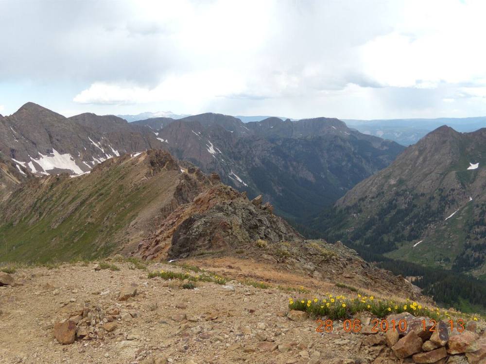
Chicago Basin from below Jupiter Mountain · Photo: SFC H
2
Twin Lakes junction 11,200' · 0.3 mi
Near 11,200 feet, turn left at a signed junction toward Twin Lakes. This trail serves Sunlight, Windom, and Eolus.
Watch for: Do not continue straight toward Columbine Pass.
3
Slabs in the trees 11,350' · 0.5 mi
Climb through the last of the forest. The trail gets harder to see as it crosses rocky slabs.
4
Out of the trees 11,400' · 0.6 mi
Leave the trees near 11,400 feet. Two streams run down the slope below Twin Lakes.
5
First stream crossing 11,700' · 0.8 mi
At about 11,700 feet, cross the first stream. Go right and follow switchbacks up steeper ground.
Watch for: Wet or icy rock at the crossing early in the day.
6
Second stream crossing 12,300' · 1.3 mi
Cross the second stream near 12,300 feet and keep climbing the trail.
7
Twin Lakes 12,500' · 1.5 mi
Reach Twin Lakes at about 12,500 feet. Fill your water here. Sunlight rises to the northeast, above the upper basin.
Watch for: Last water on the route.
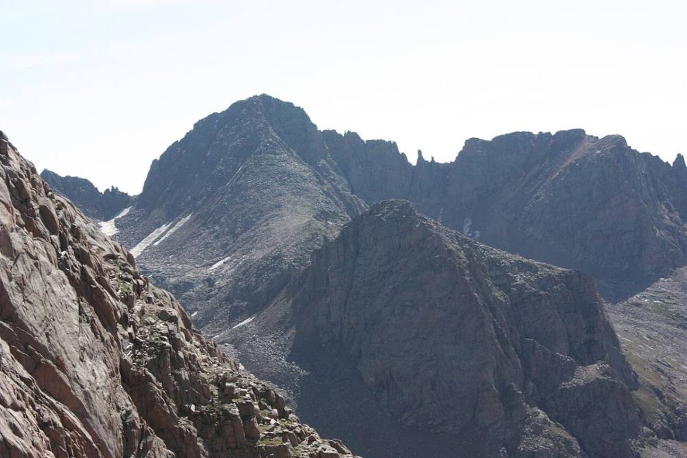
Windom and its neighbors above the upper basin · Photo: Jeremiah LaRocco
8
Around the first lake 12,550' · 1.6 mi
Keep right and take the trail east as it circles the first lake. A little farther on, bear right again and climb switchbacks up a slope.
9
Upper basin 12,900' · 1.9 mi
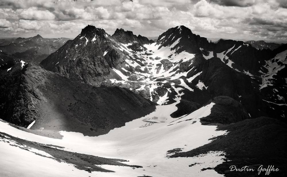
Next the trail curves back to the center of the basin and flattens out. Between Sunlight and Windom, the wide upper basin opens up.
10
Big cairn 13,050' · 2.1 mi
Continue to a large cairn just above 13,000 feet. Go a bit farther east to a second cairn. Here the cairns split. The ones to the left lead to Sunlight.
Watch for: Other cairns lead toward Windom. Stay left for Sunlight.
11
Cross the basin 13,150' · 2.25 mi
Follow the cairns east a short way, then turn left and cross the basin. Pick up a trail climbing toward the gully between Sunlight and Sunlight Spire.
12
Sunlight gully 13,450' · 2.5 mi
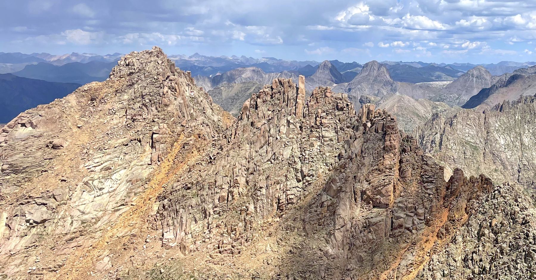
Climb the gully toward the saddle at its top. It is steep, with loose rock and scree. The rock here has a reddish color.
Watch for: Loose rock. Keep close to your group and watch for rockfall.
13
Notch near the saddle 13,800' · 2.75 mi
Near the saddle, turn left and climb into a notch. From here on, the route is Class 3 with route-finding.
Watch for: Decision point. Wet rock or building clouds mean turn back here.
14
Below the cliffs 13,950' · 2.85 mi
From the notch, climb up and traverse below cliffs, then go up again. You may see a hole through the ridge. Do not go through it; it leads to harder ledges on the far side. Stay left, drop a little, and climb a short, steep rock step. Look for cairns.
Watch for: Passing through the hole in the ridge leads to harder, more exposed climbing.
15
Chimney with a hole 14,010' · 2.95 mi
Above the rock step, go left to a small chimney with a hole at the top. Climb up and through the hole. Turn left and scramble a short way to the base of the summit block.
Watch for: Tight squeeze. Take off a large pack if needed.
16
Summit block 14,061' · 3 mi
The summit block is a tilted boulder with a big drop on its far side. The moves are short and the rock is grippy when dry. Choose your line carefully. Many climbers touch the block and call it good.
Watch for: Extreme exposure. A fall here is likely fatal. Skip it if you are unsure.
Here Needle Creek Trail (504) goes off straight ahead. Keep left to follow Chicago Basin Trail.
Coming down: Keep going straight on Needle/Johnson Creek Trail. Don’t take Needle Creek Trail (504).
2Mile 2.4 · 13,330'
Stay on Sunlight Peak Climber's Route
Here Windom Peak Climber's Route goes off to the right. Keep going straight on Sunlight Peak Climber's Route.
Coming down: Keep going straight on Sunlight Peak Climber's Route. Don’t take Windom Peak Climber's Route.
Landmarks to know
The signed Twin Lakes junction near 11,200 feet.
Two streams on the slope below Twin Lakes.
Twin Lakes at 12,500 feet, with Sunlight rising to the northeast.
Two large cairns above 13,000 feet where the Sunlight cairns go left.
The reddish, loose gully between Sunlight and Sunlight Spire.
The notch to the left near the saddle at the top of the gully.
A hole through the ridge (avoid it) and then a small chimney with a hole at its top.
The tilted summit block with a sheer drop behind it.
Getting down
Down-climb from the summit block with care; facing in often helps. Go back through the hole at the top of the chimney. Then retrace the ledges down to the notch. This section is easy to lose on the way down. Take note of cairns and rock features on the way up.
From the notch, go down the loose gully. Keep your group close and move one at a time in the steep parts. At the bottom, cross the basin to the cairns and follow the trail back down to Twin Lakes and camp. If you plan to also climb Windom, do not head straight up Windom's north face. That line is steep and loose. Instead, near 13,500 feet in the gully, follow cairns left out of the loose ground, drop south to about 13,300 feet, cross the basin, and join the Windom route below the saddle on its west ridge.
If things go wrong
There is only one safe way down, the way you came. The notch near the saddle is the main decision point; below it the gully is loose but not exposed. If storms build, get off the upper ledges first, then down the gully to the basin, and keep moving toward Twin Lakes. Do not try other gullies off the ridge. If someone is hurt, keep them warm, still, and out of the fall line of rocks. Call 911 if you have a signal, but coverage is poor and rescue from Chicago Basin can take many hours. A satellite messenger is a good idea. Other climbers in the basin may also be able to help.
3D flyover
Press play to fly the South Face. The graph shows elevation along the way and how much you gain each mile. Open full screen.
For planning only. The line is traced from open map data, not walked in the field, and off-trail parts are drawn straight. Load it in your GPS app to see the route, but navigate with your eyes, a map and the route description.
See the trail on video
A climb of this route filmed by The Virtual sherpa. The video belongs to them and only plays when you press play. This video covers Sunlight and Windom together.
Jump to
Other routes
All 1 route up Sunlight Peak, with the class and round-trip distance for each.
TypeRouteClassTrailheadRound trip
Standard
South Face
Class 4
Needleton (Durango & Silverton train)6 mi · 3,000'Full route →
The ultimate single-day wilderness push matching four separate high points. You launch from a remote camp, scrambling across the high-exposure Catwalk on Eolus, dropping down into the basin floor, ascending the giant blocky granite boulder fields of Windom, and finishing with the technical, exposed chimney cracks of Sunlight Peak's Red Chute.
Link-upChicago Basin QuadClass 4
Mount Eolus → North Eolus → Sunlight Peak → Windom Peak
The ultimate single-day wilderness push matching four separate high points. You launch from a remote camp, scrambling across the high-exposure Catwalk on Eolus, dropping down into the basin floor, ascending the giant blocky granite boulder fields of Windom, and finishing with the technical, exposed chimney cracks of Sunlight Peak's Red Chute.
Do not make this an introduction to anything
Class 4 is exposed climbing where a slip is likely fatal and the rock is often loose. This demands prior Class 3 and Class 4 experience, flawless route-finding, a helmet and a partner who knows the line. Treat any trip report, including this one, as one person’s day rather than a guarantee of yours.