Afternoon storm risk is the line that matters. Everything else is comfort. In summer, plan to be off the ridge before the build-up starts, not as it starts. Forecast for the summit point, adjusted for its elevation · data from Open-Meteo.
Standard route · Southeast Ridge
Overview
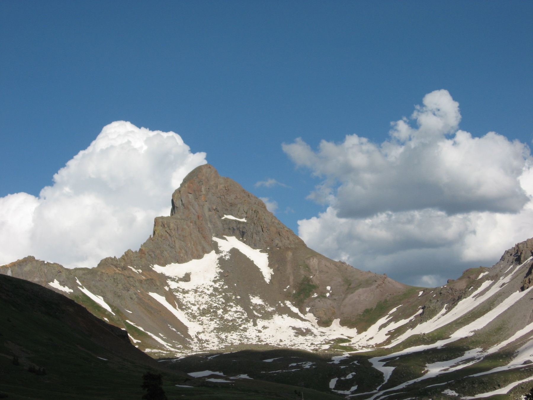
Wetterhorn is the sharp, pointed peak just west of Uncompahgre in the San Juans, near Lake City. Its standard route follows a trail up the Matterhorn Creek valley into the basin east of the peak, climbs to a saddle on the southeast ridge, and then scrambles up the ridge past a fin of rock called the Prow. The last pitch is steep Class 3 rock right to a small, airy summit.
It is one of the more approachable Class 3 fourteeners, but the top is exposed. The final 200 feet or so has big drops on the sides, and a fall there would be serious. Most of the ledges are solid, but there is some loose rock and the route above the saddle takes some care to follow.
The round trip is 7 miles with about 3,300 feet of gain. Most parties take 6 to 8 hours. It suits people who have done several Class 2 peaks and want a first real Class 3 summit, as long as they are comfortable with exposure and can turn around if the weather turns.
Plan of the day
Start by
By 5 a.m. You leave the trees in about a mile, and the ridge and summit block are no place to be in a storm. San Juan storms often build before noon.
Turnaround
Be at the 13,100-foot saddle on the southeast ridge by 9:30 a.m. and at the Prow by 11 a.m. If not, or if clouds are building, turn around. Do not start the summit pitch in wet weather.
Crux
The final Class 3 pitch from the notch above the Prow to the summit: steep, exposed ledges ending at a narrow catwalk just below the top.
Route-finding
The trail is clear to the saddle, with two junctions to watch for. Above the saddle, the path turns faint and weaves through rock on the left side of the ridge. The rock rib, the notches near the Prow and the final pitch all need care. Note your line on the way up for the way down.
Water
Matterhorn Creek runs near the trail in the lower valley. There is little or no water above treeline later in summer. Filter or treat.
From Lake City, turn west on Second Street, then left after about a block onto the Henson Creek road (part of the Alpine Loop). Reset your odometer at this turn. You pass the Nellie Creek road at about 5 miles. At about 9 miles, turn right onto the North Henson road. It is rougher than the Henson Creek road but most vehicles with good clearance can drive it.
At about 11 miles there is a junction with a sign for the Matterhorn Creek trailhead. Without 4WD, park here and walk. With 4WD, turn right and drive about 0.7 mile to the trailhead and parking area at about 10,800 feet. Walking from the lower parking adds about 1.4 miles round trip. The route enters the Uncompahgre Wilderness, which has its own rules on group size, camping, fires and dogs.
Trail in the treesTundraRidgeScramblingExposed to lightning
The line is elevation, the band underneath is the ground, and the numbered dots match the steps below. Mileage and elevations are approximate.
1
Matterhorn Creek trailhead 10,800' · 0 mi
Start from the upper trailhead and follow the trail north up the valley. It begins as an old road through forest near Matterhorn Creek.
2
First junction 11,200' · 0.75 mi
At a junction near 11,200 feet, turn right. The trail switchbacks up a hillside and then continues north.
Watch for: Easy to miss. Make sure you turn right here.
3
Treeline 11,600' · 1.1 mi
The trees end and the upper valley opens up. Wetterhorn's sharp tower is up and to the left, and Matterhorn Peak is ahead. Stay on the main trail.
4
Wetterhorn trail junction 12,000' · 1.5 mi
Turn left onto the Wetterhorn trail. It heads north toward the rocky ground east of the peak.
Watch for: Do not continue on toward Uncompahgre.
5
Rocky ground 12,400' · 2 mi
The trail reaches rocky terrain on the east side of Wetterhorn and zig-zags through it for about half a mile. The path is clear but the footing is rough.
6
Out of the rocks 12,800' · 2.5 mi
After leaving the rocks, the trail heads southwest toward a saddle on the southeast ridge.
7
Southeast ridge saddle 13,100' · 2.75 mi
At the saddle, turn right and start up the ridge. The whole upper route is now in view.
Watch for: Check the time and weather. This is a good place to turn around.
8
Yellow dirt 13,300' · 2.9 mi
Climb a slope of yellow-colored dirt to the rockier upper ridge. A faint, broken trail weaves up through the rocks on the left side of the ridge.
Watch for: Loose dirt and gravel.
9
Rock rib 13,500' · 3.05 mi
Stay below the ridge crest with some easy scrambling. The fin-shaped Prow is visible about 400 feet above. A rock rib blocks the way; go right and climb a small gully toward the crest to get around it.
10
Top of the small gully 13,650' · 3.2 mi
Two choices here. Either find a notch on the left, go through it and drop slightly on the far side to continue below the Prow, or scramble up the rocks directly to the ridge crest. Once on the ridge, turn left toward the Prow.
11
The Prow 13,800' · 3.3 mi
Go around the right side of the Prow and into an open spot beneath the summit block. Looking ahead, you can see two notches separating the Prow from the summit.
12
Higher notch 13,870' · 3.37 mi
Go through the higher of the two notches. Climb over an angled slab, then turn right. The final Class 3 pitch is now in front of you.
Watch for: Do not start this pitch if the rock is wet or storms are close.
13
Final pitch 13,950' · 3.45 mi
Climb up a series of ledges. Most are solid, but some rocks are loose. Use three points of contact and test holds.
Watch for: Big exposure. A fall here would be serious.
14
Catwalk below the summit 14,000' · 3.48 mi
Just below the top you reach a narrow ledge. Climb straight up from it, or move a few feet left for easier moves.
Watch for: Exposure on the ledge.
15
Summit 14,021' · 3.5 mi
A small, exposed summit. Uncompahgre's flat top is to the east and Matterhorn Peak to the north.
Watch for: Small summit with drops on all sides. Keep a hand on the rock and stay seated in wind.
Turn right to stay on Ridge Stock Driveway Trail 233
Here Matterhorn Cutoff Trail (245) goes off straight ahead. Turn right to follow Ridge Stock Driveway Trail 233.
Coming down: Turn left to stay on Ridge Stock Driveway Trail 233. Don’t take Matterhorn Cutoff Trail (245).
2Mile 3.0 · 13,430'
Stay on Wetterhorn Peak Climber's Route
Here Wetterhorn Peak Trail #256 goes off to the right; Wetterhorn Basin Trail 226 goes off to the left. Keep going straight on Wetterhorn Peak Climber's Route.
Coming down: Keep going straight on Wetterhorn Peak Climber's Route. Don’t take Wetterhorn Peak Trail #256 or Wetterhorn Basin Trail 226.
Landmarks to know
An old road through the forest along Matterhorn Creek.
A right turn at a junction near 11,200 feet.
A left turn onto the Wetterhorn trail near 12,000 feet.
Half a mile of zig-zags through rocky ground east of the peak.
The 13,100-foot saddle on the southeast ridge.
A slope of yellow dirt above the saddle.
The Prow, a fin-shaped tower you pass on its right.
Two notches between the Prow and the summit; take the higher one.
Getting down
Go down the same way. The top pitch is harder going down, so face in on the steep ledges and climb down carefully, testing each hold. Go back through the higher notch and across the angled slab, then pass the Prow on the side you came up.
Below the Prow, the faint trail on the left side of the ridge is easy to lose. Look for the small gully you used to get around the rock rib and follow it back down. Aim for the yellow dirt slope and the saddle; do not drop off the ridge on the wrong side or down other gullies. From the saddle, the trail back to the trailhead is clear, but remember to stay right at the Wetterhorn trail junction and left at the lower junction.
If things go wrong
Below the 13,100-foot saddle, the trail gives a quick, easy way down into the basin and valley. Above the saddle, the only way off is back down the ridge. If weather turns while you are on the upper ridge, get off the summit block and down to the saddle, then keep going into the basin. Do not try the final pitch in rain or hail; wet rock and exposure together are a bad mix. If someone is hurt, keep them warm and out of the wind and call 911 if needed. Help from Lake City will take many hours to arrive.
3D flyover
Press play to fly the Southeast Ridge. The graph shows elevation along the way and how much you gain each mile. Open full screen.
For planning only. The line is traced from open map data, not walked in the field, and off-trail parts are drawn straight. Load it in your GPS app to see the route, but navigate with your eyes, a map and the route description.
See the trail on video
A climb of this route filmed by The Dreamologist. The video belongs to them and only plays when you press play.
Jump to
Other routes
All 2 routes up Wetterhorn Peak, with the class and round-trip distance for each.
Class 3 means sustained scrambling with your hands, on terrain where a fall has real consequence. Build up on easier scrambles first, wear a helmet, go with someone who has led this kind of ground, and remember that downclimbing is harder than going up.