Afternoon storm risk is the line that matters. Everything else is comfort. In summer, plan to be off the ridge before the build-up starts, not as it starts. Forecast for the summit point, adjusted for its elevation · data from Open-Meteo.
Alternate route · Via Little Browns Creek
Overview
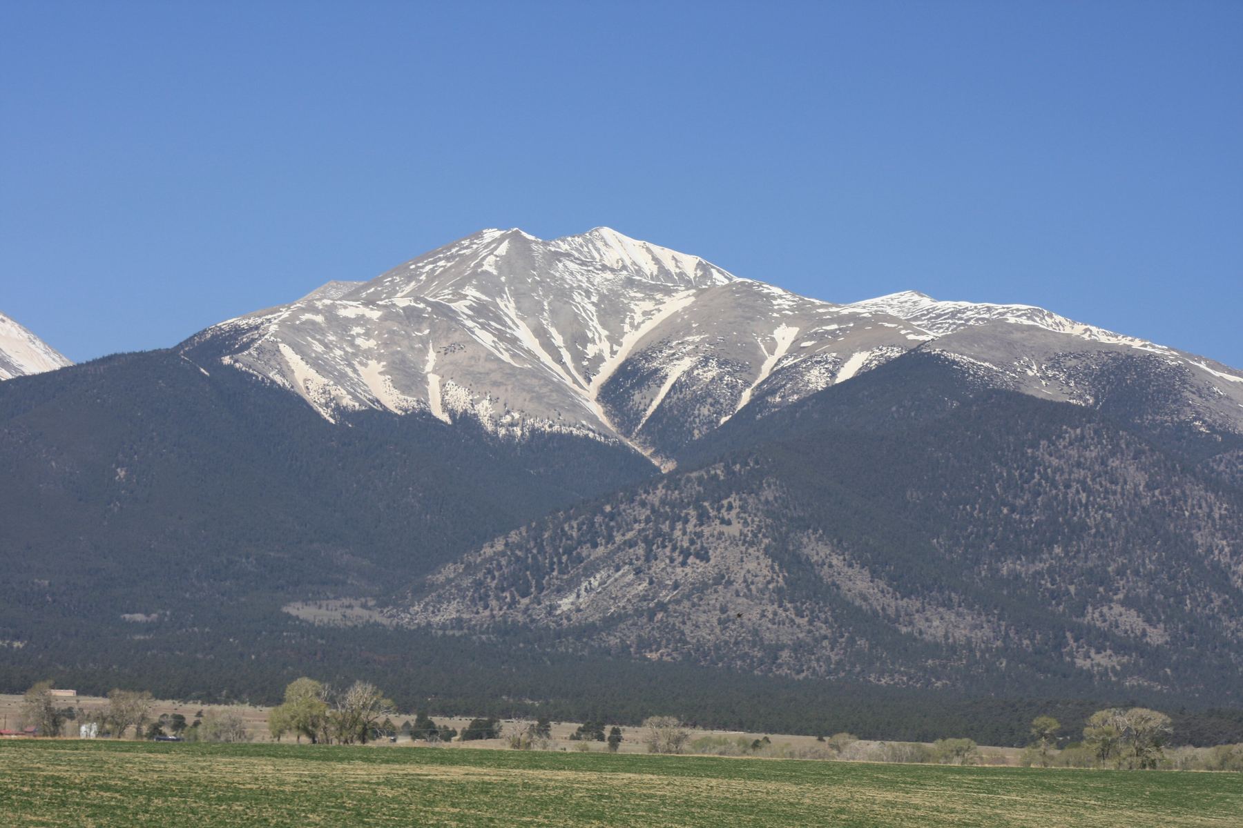
This is a long, quiet way up Mount Antero from the east. It uses the Browns Creek and Little Browns Creek trails to reach the saddle between Antero and Mount White, then joins the old mining roads for the last part of the climb. The route is Class 2 overall.
It suits strong hikers who want to avoid the busy Baldwin Gulch road and its vehicle traffic. It is much longer than the standard route: about 16.25 miles round trip with roughly 5,550 feet of gain. The final ridge offers some of the most interesting walking of the day.
Plan on 10 to 13 hours car to car. Some people split it over two days by camping in the Little Browns Creek drainage.
Plan of the day
Start by
By 4 or 4:30 a.m. You have about 6 miles of hiking before you reach the saddle, and the upper mountain is fully exposed.
Turnaround
If you are not at the Antero and Mount White saddle by about 9:30 a.m., or storms are building, turn around. From the saddle you still have more than 2 miles and 1,400 feet to go.
Crux
The south ridge above the mining area near 13,700 feet. You leave the road and follow bits of trail on the right side of the crest, then climb near the crest to the top.
Route-finding
Moderate. Watch the junctions low down: right onto the Colorado Trail, then a sharp left onto the Little Browns Creek trail. Above the saddle, the mining roads branch several times, so keep track of each turn for the way back.
Water
Browns Creek and Little Browns Creek run near the trail for the first several miles. The last water is near tree line where you cross the creek. Filter or treat it. Carry at least 3 liters for the upper mountain.
Starting where U.S. 285 meets U.S. 24, a little south of Buena Vista, head south on U.S. 285 for 9 miles. Turn west onto County Road 270 and set your trip meter to zero.
At 1.5 miles, keep straight onto County Road 272, which is dirt. At 3.5 miles, turn left (south) to stay on County Road 272. The Browns Creek trailhead is at about 5.1 miles. The road is fine for most cars in dry conditions.
Trail in the treesTundraRidgeRoadExposed to lightning
The line is elevation, the band underneath is the ground, and the numbered dots match the steps below. Mileage and elevations are approximate.
1
Browns Creek trailhead 8,950' · 0 mi
Start west on the Browns Creek trail. The path is wide and easy to follow through the forest.
2
Colorado Trail junction 9,500' · 1.4 mi
Go right at the first junction and take the Colorado Trail north.
3
Little Browns Creek trail junction 9,550' · 1.7 mi
After about a third of a mile, turn sharply left onto the Little Browns Creek trail. It heads west and southwest.
Watch for: This turn is easy to miss. Note it for the way back.
4
Little Browns Creek 10,200' · 2.8 mi
The trail drops a little and meets Little Browns Creek near 10,200 feet. Keep heading west as the trail climbs steadily beside the creek.
5
Four miles in 11,000' · 4 mi
Near 11,000 feet you are about 4 miles from the car. The trail keeps climbing up the valley through the trees.
6
Tree line and creek crossing 11,800' · 4.8 mi
The forest opens near 11,700 feet, and soon you pass tree line. After crossing Little Browns Creek, the grade steepens as you climb into the upper drainage.
Watch for: This is your last good water. Fill up here.
7
Antero and Mount White saddle 12,830' · 5.8 mi
Head west with the creek off to your right. At about 12,830 feet the trail tops out on the wide saddle that links Antero and Mount White.
Watch for: You are fully exposed from here to the summit. Check the sky.
8
Onto the mining roads 12,900' · 6.1 mi
Turn right onto the road at the saddle, then right again at the next junction. Stay right after a short way and head northeast on a long stretch of road.
Watch for: Many roads cross here. Remember each turn.
9
Road junctions at 13,100 and 13,200 feet 13,200' · 6.8 mi
At 13,100 feet, turn left. Climb about 100 feet to a final junction near 13,200 feet.
10
Switchbacks below Point 13,800 13,700' · 7.4 mi
Follow the road as it switchbacks up to about 13,700 feet on the east side of Point 13,800.
Watch for: Watch for vehicles on the mining roads in summer.
11
South ridge 13,800' · 7.6 mi
Walk through an old, scarred mining area to the south ridge. Step off the road and pick up short stretches of trail to the right of the crest.
Watch for: The rock on the ridge is loose in places.
12
Small saddle at 13,850 feet 13,850' · 7.8 mi
The ridge brings you to a small saddle where the last climb begins.
13
Summit of Mount Antero 14,271' · 8.1 mi
Climb near the ridge crest to the top. The summit is small and rocky, with wide views over the southern Sawatch Range.
Getting down
Return the same way. Retrace the mining roads carefully to the saddle with Mount White, then follow the Little Browns Creek trail down the valley. Near the bottom, go right on the Colorado Trail, then left on the Browns Creek trail back to your car. The long walk out is tiring, so save energy and water for it.
If things go wrong
The quickest way off the high ground is back to the Antero and Mount White saddle and down the Little Browns Creek drainage to tree line near 11,800 feet. If a storm hits on the upper ridge, get off the crest right away and head down. The standard route down Baldwin Gulch to the west is a much shorter way off the peak, but it leads to a different trailhead far from your car. In an emergency, call 911 if you have signal.
Other routes
Every way up Mount Antero we list, with its class.
This describes the route in its usual season. Distances and elevations are close estimates for planning. Snow, ice, rockfall, a washed-out road or an afternoon storm can make it a very different climb. Check recent conditions the week you go and turn around when the day tells you to.