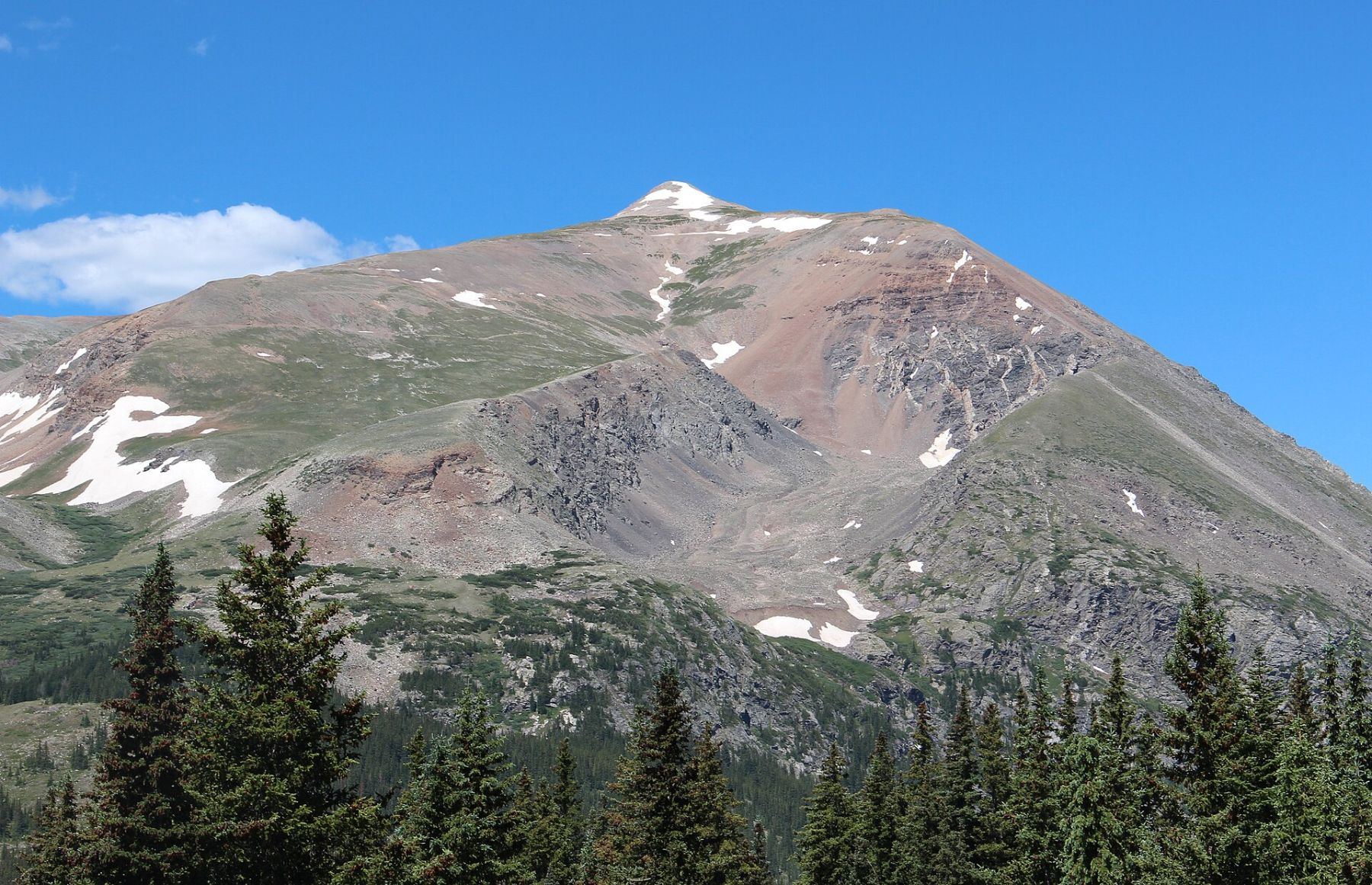
Mount Lincoln, 14,293' · also on Mount Cameron, Mount Bross, Mount Democrat
DifficultyClass 2
Round trip7.5 mi
Elevation gain3,500'
TrailheadKite Lake
Trailhead elevation12,000'
Conditions on the summit
LoadingFetching the forecast for 14,293'…
—Summit temp now
—Sustained wind
—Gusting to
—Freezing level
Today
—
Tomorrow
—
Day three
—
Afternoon storm risk is the line that matters. Everything else is comfort. In summer, plan to be off the ridge before the build-up starts, not as it starts. Forecast for the summit point, adjusted for its elevation · data from Open-Meteo.
Combo route · Decalibron
Overview
The Decalibron is a loop over four 14ers from Kite Lake: Mount Democrat, Mount Cameron, Mount Lincoln and Mount Bross. It is one of the easiest ways to get four summits in one day. The high trailhead and short distances between peaks make it popular.
The whole loop is Class 2 on trails. Most of the time you are above 13,000 feet on open ridges, with no shelter. It suits hikers who have done a standard 14er and want a longer day up high. The hardest parts are the steep, loose slopes on Democrat and the gravel descent off Bross.
The loop is about 7.5 miles with 3,500 feet of gain. Most people take 6 to 9 hours. Note that the true summit of Bross has been closed to the public for years; see the Bross step below.
Plan of the day
Start by
By 5:30 a.m. You are above treeline the whole day, and on the ridge for hours.
Turnaround
Reassess on each summit. If it is past 11 a.m. on Lincoln or storms are building, skip Bross and go back down between Democrat and Cameron.
Crux
The steep, loose slope up Democrat above the saddle, and the gravel-covered descent off Bross.
Route-finding
Easy in good weather. The key is staying on the Bross descent trail and not dropping off the ridge too early.
Water
Kite Lake and its streams near the start. None on the ridges. Carry 3 liters.
Follow Colorado 9 to Alma. In the town center, a small Kite Lake road sign stands on the highway's west side. Turn there, drive through a neighborhood, and continue about 6 miles to Kite Lake.
The last mile is rougher. In dry conditions, a 2WD car with good clearance can usually get near the lot. There are restrooms and campsites at the lake, and a fee is charged.
TundraRidgeExposed to lightning
The line is elevation, the band underneath is the ground, and the numbered dots match the steps below. Mileage and elevations are approximate.
1
Kite Lake trailhead 12,000' · 0 mi
Walk the closed road past the lake. Then start climbing out of the basin on the trail.
2
Old mine area 12,400' · 0.8 mi
Above 12,400 feet you pass a collapsed mine shack. The trail then climbs a rough slope to the foot of Democrat's east side.
Watch for: Stay out of old mine workings.
3
Democrat-Cameron saddle 13,400' · 1.4 mi
Near 12,800 feet the trail bends left, then turns right and heads north up to the saddle between Democrat and Cameron. At the saddle, turn left and climb west up the ridge.
Watch for: This saddle is the best bail point on the loop.
4
Democrat summit ridge 13,900' · 1.8 mi
After about 200 feet up the ridge, the trail cuts left and traverses southwest. It climbs steeper ground past some old prospect holes to the summit ridge.
Watch for: Loose rock on this slope.
5
Summit of Mount Democrat 14,154' · 2 mi
Walk to the last short climb and follow the trail to the top. This is the first summit.
6
Back to the saddle 13,400' · 2.6 mi
Go back down to the Democrat-Cameron saddle. Check the weather and your time before going on.
Watch for: Decide here whether to continue.
7
Cameron west ridge 14,000' · 3.2 mi
Go northeast, keeping to the right of Cameron's west ridge, and rejoin it near 13,500 feet. Keep going up the ridge. Near 14,000 feet the slope eases.
8
Summit of Mount Cameron 14,238' · 3.6 mi
Go around a bump on its left side and walk to Cameron's broad, rounded top. This is the second summit.
9
Summit of Mount Lincoln 14,293' · 4.5 mi
Head northeast down to the saddle between Cameron and Lincoln. Follow the trail over a bump and up the last short climb to Lincoln. This is the highest point of the loop.
Watch for: Bross is now about 1.5 miles away, and the car about 3 miles.
10
Cameron-Bross saddle 13,850' · 5.4 mi
Go back southwest to the saddle below Cameron. At Cameron's north end, take a good trail south toward Bross to the saddle near 13,850 feet.
11
Mount Bross summit area 14,178' · 6 mi
Keep southeast to a trail junction above 13,900 feet and turn right. Soon a road junction appears; keep left and go south under the summit. Keep going until you meet a broad, shallow gully dropping off to your right. The true summit, up to your left, has been closed to the public since 2007. Reaching this spot is commonly counted as the summit.
Watch for: Respect the closure. Check the current status before your trip.
Getting down
From the gully on Bross, follow the trail west down Bross's west ridge. The ridge is covered in gravel and gets narrow. Stay on the ridge trail down to about 13,350 feet. Many people leave the ridge too early and end up on steep, loose scree. Near some dark-colored rocks, the trail turns left and drops into a big gully. Take the trail down the gully's south side into the basin just east of Kite Lake, then walk back to the trailhead.
If things go wrong
The Democrat-Cameron saddle is the main escape. From there, drop back down the trail to Kite Lake. After Lincoln, the fastest way down is to continue over to Bross and descend its west ridge, or go back to the Democrat-Cameron saddle; pick whichever is closer and safer at the time. Do not drop off the ridges into unknown gullies. In an emergency, call 911 if you have signal.
Other routes
Every way up Mount Lincoln we list, with its class.
This describes the route in its usual season. Distances and elevations are close estimates for planning. Snow, ice, rockfall, a washed-out road or an afternoon storm can make it a very different climb. Check recent conditions the week you go and turn around when the day tells you to.