Afternoon storm risk is the line that matters. Everything else is comfort. In summer, plan to be off the ridge before the build-up starts, not as it starts. Forecast for the summit point, adjusted for its elevation · data from Open-Meteo.
This is a snow climb. It is only safe when the snow is firm and stable, usually early in the morning in late spring and early summer. You need an ice axe, crampons, a helmet and the skills to use them. Check avalanche conditions before you go.
Snow route · Southwest Couloir
Overview
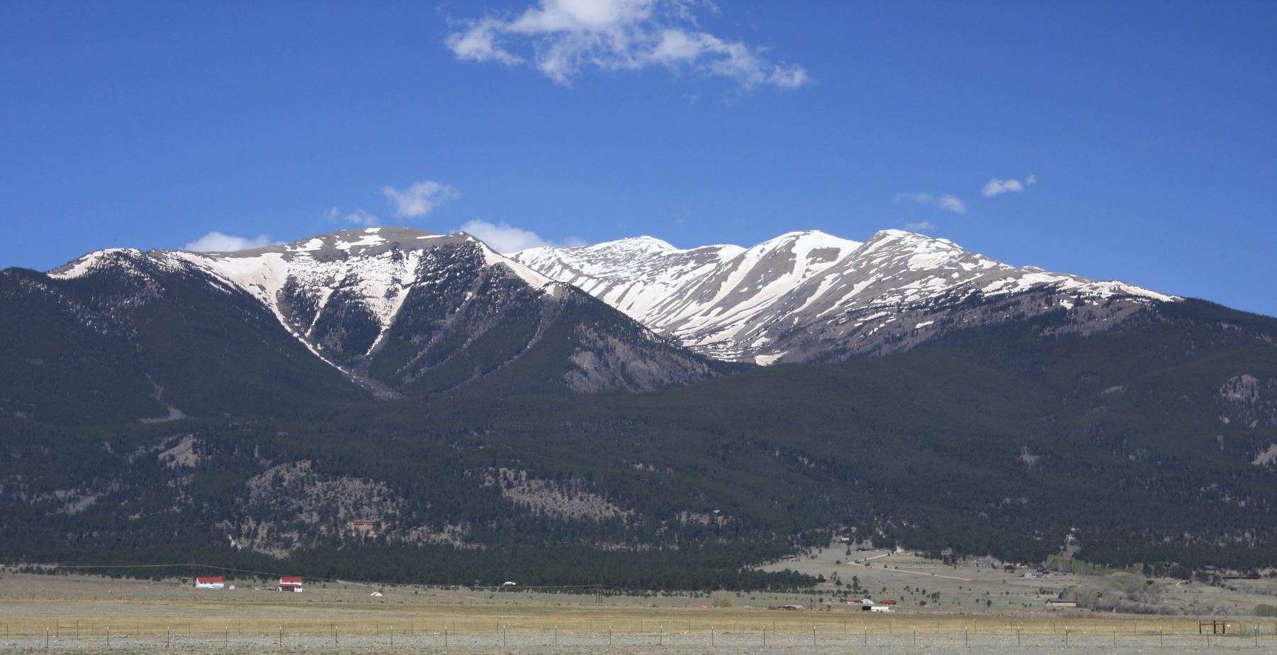
The Southwest Couloir is a snow climb on Mount Columbia in the Sawatch Range. It rises from the North Cottonwood Creek valley straight up to the summit ridge, then follows the ridge to the top. It is Class 2 with moderate snow, and it is recommended only when it is filled with snow.
The couloir's lower half runs about 28 degrees, and many people climb it on skis or snowshoes. The upper half reaches about 32 degrees. The large avalanche run-out at the bottom shows that this couloir can slide big, so it is only for climbers who can judge snow conditions.
Because the road is often closed in spring, this route is usually longer than the standard route: about 13.5 miles round trip and 4,800 feet of gain from parking below the summer trailhead. Plan on 9 to 12 hours.
Plan of the day
Start by
Very early, around 3 or 4 a.m. You have several miles of approach before the couloir, and you want to climb on firm, frozen snow.
Turnaround
If you reach the run-out and the snow is not well frozen, or you are not through the choke by about 8 a.m., turn around. Warming snow in this couloir is a serious slide risk.
Crux
The upper half of the couloir above the choke, which steepens to about 32 degrees. If conditions look poor, you can exit left and climb the slope just west of the couloir.
Route-finding
Moderate. The key turn is near 10,950 feet, where you leave the main trail at a small stream and head straight north through the trees. Take note of this spot so you can find the trail again on the way down.
Water
North Cottonwood Creek and its side streams are along the approach. Filter or treat it. Above the trees, plan on melting snow or carrying all you need.
In Buena Vista, go west on County Road 350 (Crossman Avenue), about half a mile north of downtown, and zero your trip meter. At 2 miles, turn right onto County Road 361. At 3 miles, turn left onto County Road 365, which is dirt. The road ends at the North Cottonwood Creek trailhead at about 8.1 miles.
In winter the road is closed near 9,200 feet, over 3 miles short of the summer trailhead. During spring and early summer a car can often reach the Harvard Lakes trailhead or the Silver Creek trailhead, about 1.5 miles below the end of the road. Park where the road is closed and walk up to the summer trailhead.
Trail in the treesTundraSnow or couloirRidgeExposed to lightning
The line is elevation, the band underneath is the ground, and the numbered dots match the steps below. Mileage and elevations are approximate.
1
Parking below the summer trailhead 9,400' · 0 mi
Start from wherever the road is open, often near the Silver Creek trailhead. Walk up the road toward the end of the road.
Watch for: Your distance depends on where the road is closed.
2
North Cottonwood Creek trailhead 9,900' · 1.5 mi
The trail leaves from the parking loop's west side. Follow the main trail up the valley.
3
Small stream crossing 10,950' · 4.6 mi
After a bit more than 3 miles on the trail, you reach a small stream crossing near 10,950 feet. Go right and head due north up this drainage through the trees.
Watch for: The summer trail may be buried in snow. Mark this turn in your mind for the way down.
4
Avalanche run-out 11,500' · 5.1 mi
About half a mile north, you come out into a large open avalanche path at the base of the couloir. Stop and study the snow and the slope above.
Watch for: The size of this run-out shows how big slides here can be. Do not go on if the snow is wet or unstable.
5
The choke 11,900' · 5.4 mi
Walk toward the couloir and climb to its narrow neck, called the choke, near the base. Below here the slope is about 28 degrees.
6
Upper couloir 12,700' · 5.8 mi
Above the choke, keep checking the snow. Climb the couloir, or leave it and climb the slope just to its west (left).
Watch for: The upper half reaches about 32 degrees. A fall here is serious.
7
Steeper slopes below the ridge 13,400' · 6.1 mi
Climb northeast up steepening ground. If you stayed west of the couloir, you join the standard West Slopes route somewhere above 13,000 feet. Near 13,400 feet, angle left toward the ridge.
8
Summit ridge 13,650' · 6.2 mi
Reach the ridge west of the flat top of the couloir. The rest of the route comes into view. Turn left.
9
Along the ridge 13,800' · 6.5 mi
The ridge crosses a series of rocky bumps and small saddles. It is a bit more than half a mile to the summit.
Watch for: Wind can be strong on the ridge.
10
Summit of Mount Columbia 14,075' · 6.75 mi
After a flat stretch, one last pile of rock leads to the true summit.
Getting down
Most people go back down the same way if the snow is still firm. If the couloir has softened, a safer choice is often the west slopes route, which you can reach from the ridge, then drop back to the North Cottonwood Creek trail. Either way, find the main trail again near 10,950 feet and follow it back down the valley to your car.
If things go wrong
Below the choke, turning back is simple: head back down to the run-out and the trees. Higher up, you can leave the couloir to the west and join the standard west slopes route. If conditions turn bad, get out of the couloir and off its run-out as quickly as you safely can. In an emergency, call 911 if you have signal.
Other routes
Every way up Mount Columbia we list, with its class.
This describes the route in its usual season. Distances and elevations are close estimates for planning. Snow, ice, rockfall, a washed-out road or an afternoon storm can make it a very different climb. Check recent conditions the week you go and turn around when the day tells you to.