Afternoon storm risk is the line that matters. Everything else is comfort. In summer, plan to be off the ridge before the build-up starts, not as it starts. Forecast for the summit point, adjusted for its elevation · data from Open-Meteo.
Combo route · Via Challenger Point
Overview
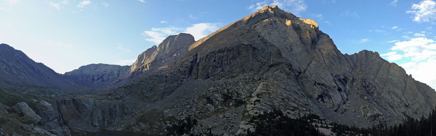
This link-up climbs Challenger Point first and then Kit Carson Peak, starting from the Willow Creek trailhead in Crestone. It follows the standard Challenger Point route to that summit, then crosses a ledge called Kit Carson Avenue and climbs a gully to the top of Kit Carson. The hardest moves are easy Class 3.
It suits experienced hikers who are comfortable on loose, steep talus and some exposure. It is a long, hard day: about 15 miles round trip with roughly 6,250 feet of gain. Many people camp near Willow Lake to split it up.
After Kit Carson you must climb back over Challenger to get down, so allow time and good weather for the return. From a camp at Willow Lake, plan on 7 to 10 hours. From the trailhead in one push, plan on 12 to 15 hours.
Plan of the day
Start by
From a camp at Willow Lake, by 5 a.m. From the trailhead in one day, by 2 or 3 a.m.
Turnaround
Only leave Challenger for Kit Carson if the sky is clear and it is before about 10 a.m. If you are not on Kit Carson by 11 a.m., turn back. You still have to return along the Avenue and over Challenger.
Crux
The loose talus slope below Challenger's summit ridge, and the gully above Kit Carson Avenue, which has Difficult Class 2 with brief easy Class 3 sections.
Route-finding
Hard in places. Know where you enter the gully from the Avenue near 13,650 feet, since you must find it again on the way back. Follow small cairns and trail pieces in the gully.
Water
Willow Creek and Willow Lake on the approach. Filter or treat it. Above about 12,000 feet there is only early season snowmelt.
Drive Colorado 17 to Moffat. At the south end of town, go east on County Road T where the sign points to Crestone. Drive about 11.5 miles to Crestone.
Go straight into town, turn left on Alder Street, then right onto Galena. Galena leaves town and becomes a dirt forest road. The trailhead is about 2 miles up this road. Most cars can make it when it is dry.
TundraScramblingTalus and screeRidgeExposed to lightning
The line is elevation, the band underneath is the ground, and the numbered dots match the steps below. Mileage and elevations are approximate.
1
Willow Creek trailhead 8,850' · 0 mi
Follow the Willow Lake trail up many switchbacks through the forest and into the Willow Creek valley.
2
Willow Lake 11,564' · 4.75 mi
The trail reaches Willow Lake, with its big waterfall. This is a common place to camp.
Watch for: Fill water here. It is the last dependable source.
3
Junction above the lake 11,850' · 5.25 mi
Cross the stream above the falls and follow the Challenger trail up ledges and toward the rock rib on the north slope.
4
Rock rib 12,800' · 5.9 mi
Climb along the rib as the path fades. Look for cairns.
5
Challenger's loose slope 13,600' · 6.35 mi
Climb the steep talus and broken rock toward the notch in the summit ridge.
Watch for: Rocks shift under hands and feet. Keep space between you and others.
6
Challenger Point 14,081' · 6.75 mi
Go through the notch and follow the short ridge to the summit of Challenger. Kit Carson is right in front of you to the east. Check the time and weather before going on.
Watch for: You must come back over this summit. Only go on if conditions are good.
7
Start of Kit Carson Avenue 13,800' · 6.85 mi
Descend east to the small saddle near 13,800 feet between the two peaks. Step onto Kit Carson Avenue, a Class 2 ledge that cuts south across the peak's side.
8
Saddle by The Prow 13,960' · 7 mi
The Avenue climbs to a saddle near 13,960 feet, with Kit Carson on one side and The Prow, a big rock fin, on the other. The next part of the Avenue drops away to the east.
9
Wide notch 13,800' · 7.15 mi
Go down the Avenue and through a wide notch.
10
Gully entry 13,650' · 7.25 mi
Keep going down the Avenue. Just before a rock rib past the end of the ledge, near 13,650 feet, turn left into a broad, shallow gully.
Watch for: Stop and study this spot. You need to find it again on the way back.
11
Summit gully 13,850' · 7.35 mi
Go up the center of the gully, which is Difficult Class 2, with brief easy Class 3 steps higher up. Follow trail bits and small cairns. Near the crest, bear left around the last rock outcrops.
Watch for: Rock in the gully is loose. Wear a helmet.
12
Top of the gully 14,000' · 7.42 mi
Around 14,000 feet the ground opens up and the summit is in sight to your left.
13
Summit of Kit Carson Peak 14,167' · 7.5 mi
Walk along the summit ridge to the top. The views over the Crestone group are some of the best in the range.
Watch for: Start back while you still have time. The return over Challenger is long.
Getting down
Retrace your steps. Go back down the gully to the Avenue, then follow the Avenue back up to the saddle by The Prow and down to the saddle below Challenger. Climb back to Challenger's summit, go through the notch, and carefully descend the loose slope and rock rib to Willow Lake. Then follow the trail back to the trailhead.
If things go wrong
Before Kit Carson, the way out is down Challenger's standard route to Willow Lake. Once you are on the Avenue, the only reasonable exit is back the way you came, over Challenger. Do not try to descend unknown gullies off the Avenue. If a storm moves in, get off the high ridges as quickly as you safely can. In an emergency, call 911 if you have signal; rescues here are slow.
Other routes
Every way up Challenger Point we list, with its class.
This describes the route in its usual season. Distances and elevations are close estimates for planning. Snow, ice, rockfall, a washed-out road or an afternoon storm can make it a very different climb. Check recent conditions the week you go and turn around when the day tells you to.