Afternoon storm risk is the line that matters. Everything else is comfort. In summer, plan to be off the ridge before the build-up starts, not as it starts. Forecast for the summit point, adjusted for its elevation · data from Open-Meteo.
Alternate route · Southwest Ridge
Overview
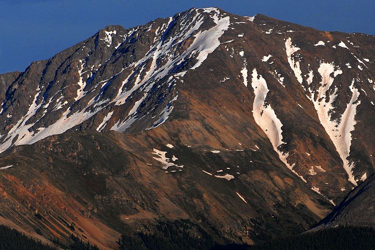
The Southwest Ridge is the shortest route up La Plata Peak. It starts near the old town site of Winfield, climbs through a basin to a notch on the southwest ridge, then goes up a big rocky slope to join the standard route just below the summit. The round trip is about 7.5 miles with around 3,600 feet of gain.
It is rated Class 2. The grade is steep and some sections are loose, and the trail disappears on the main rocky slope. Hikers who want a trail the whole way will do better on the standard Northwest Ridge. This route suits people who are fine with steep, off-trail talus and want a shorter day.
Plan on 6 to 8 hours car to car.
Plan of the day
Start by
By 5:30 a.m. Most of the climbing is above treeline.
Turnaround
If you are not at the flat spot near 14,000 feet by 11 a.m., or storms are building, turn back. The rocky slope is slow to descend.
Crux
The big rocky slope above the notch. It is steep and has no real trail, though the rock is more stable than it looks.
Route-finding
Moderate. Follow cairns on the rocky slope and aim for the middle of it. On the way down, be sure to find the bypass around the false summit and the correct slope back to the notch.
Water
A small stream near the start and water in the basin. Filter it. Carry at least 2 liters for the upper mountain.
County Road 390 leaves U.S. 24 about 20 miles south of Leadville, or about 14.5 miles north of Buena Vista. Take this dirt road west for roughly 11.3 miles to the Winfield town site.
At the junction, leave the main road (which bends left) and take the rougher road to the right, signed for the Continental Divide Trail and La Plata Peak. Follow a fence, then turn left. Pass the Winfield Cemetery at about 0.4 mile and some parking pullouts. At about 1.8 miles, turn right at a signed junction and park about 50 yards up. A high-clearance vehicle is best for this road. Vehicles are not allowed past this point.
Trail in the treesTundraRidgeTalus and screeExposed to lightning
The line is elevation, the band underneath is the ground, and the numbered dots match the steps below. Mileage and elevations are approximate.
1
Parking area 10,720' · 0 mi
Walk up the closed road, which is for administrative use only. After a little over 0.1 mile you reach the real start of the trail.
2
Trail start 10,780' · 0.1 mi
Start up the trail and cross a small stream. Continue to a bend that looks over a gulch at the bottom of the basin.
3
Gulch overlook 11,000' · 0.4 mi
Follow the trail alongside the gulch for less than half a mile.
4
Basin opens up 11,500' · 0.9 mi
The ground opens up and you soon reach treeline where the basin ends to the south. The southwest ridge is visible from here, though the top is hidden.
5
North end of the basin 12,100' · 1.6 mi
Follow the trail through willows to the far end of the basin. It can be muddy after rain. Look for the trail climbing northwest to a notch in the ridge.
6
Old mine 12,400' · 1.9 mi
A little above 12,400 feet, old mine workings sit under a cliff band. Bear right and continue up.
Watch for: The trail is steep and loose here.
7
Notch in the southwest ridge 12,750' · 2.2 mi
The trail gets better as you near the ridge. After about 650 feet of climbing from the basin, reach the notch. Turn right and head northeast.
Watch for: Note this spot for the way down.
8
Base of the rocky slope 12,950' · 2.7 mi
After about half a mile of easy walking, the trail ends below a large rocky slope. Find bits of trail and cairns. If it gets confusing, aim for the middle of the slope.
Watch for: There may be many cairns. Do not drift too far left or right.
9
Flat spot near 14,000 feet 13,980' · 3.2 mi
The slope gets steeper as you climb. The rock is fairly stable, but watch for loose stones and dirt. At the top you reach a flat area.
Watch for: Loose rock can fall on people below.
10
False summit bypass 14,200' · 3.5 mi
Gain the ridge crest, then use cairns to head for a false summit at 14,200 feet. Just before its top, go around it on the left. Drop slightly on the far side.
Watch for: Look back and study this spot so you can find it on the way down.
11
Join the standard route 14,180' · 3.55 mi
You meet the upper part of the Northwest Ridge trail. Follow it higher.
12
Summit of La Plata Peak 14,344' · 3.75 mi
Cross one more false summit; the true summit is a short walk beyond.
Getting down
Reverse the route. Leave the standard trail at the right spot and go around the false summit on its west side, back to the flat area near 14,000 feet. Descend the rocky slope carefully, aiming for the notch. Go down the steep, loose section past the old mine into the basin, then follow the trail back to the car. If you are unsure of the way, you can descend the standard Northwest Ridge, but it ends at a different trailhead far away.
If things go wrong
Back down the way you came is the fastest way out. The notch at 12,750 feet and the basin below it are the first places out of the worst of the wind and weather. If a storm moves in while you are on the rocky slope, go down steadily but carefully. Do not rush on loose rock. In an emergency, call 911 if you have signal.
Other routes
Every way up La Plata Peak we list, with its class.
This describes the route in its usual season. Distances and elevations are close estimates for planning. Snow, ice, rockfall, a washed-out road or an afternoon storm can make it a very different climb. Check recent conditions the week you go and turn around when the day tells you to.