Afternoon storm risk is the line that matters. Everything else is comfort. In summer, plan to be off the ridge before the build-up starts, not as it starts. Forecast for the summit point, adjusted for its elevation · data from Open-Meteo.
Alternate route · Ellingwood Ridge
Overview
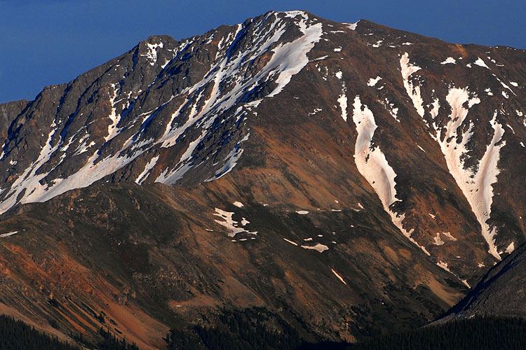
Ellingwood Ridge is a long, rugged Class 3 route on La Plata Peak. From the La Plata Gulch trailhead you climb a steep side ridge to timberline, then follow a jagged ridge with many rock towers for miles before it turns toward the summit. It is one of the harder and more tiring ridge routes on a Colorado 14er.
This is for experienced scramblers only. Route-finding is complex, there is exposure in places, and there is a lot of loose and rotten rock. Staying true to the crest would take technical climbing, so most parties drop to the east side to keep the moves at Class 3, with some possible Class 4. It is far harder than the standard Northwest Ridge. The trip is about 9.5 miles with about 5,900 feet of gain, due to all the ups and downs.
Plan on 12 to 15 hours car to car. The ridge is slow.
Plan of the day
Start by
By 3 or 4 a.m. The ridge is long and slow, and you have little chance to escape once on it.
Turnaround
If you are not at Point 13,138 by about 10 a.m., or storms are building, turn back. The hardest route-finding comes after that point.
Crux
The ledges and gullies past Point 13,138, where the route goes around blind corners and cliffs on loose rock. A second, shorter crux is a big buttress on the final climb, passed on its left (east) side.
Route-finding
Very hard. There are few cairns and many possible lines. Stay on the crest or its east side, and expect to go down a lot to avoid the worst spots.
Water
Only at the creek crossings near the start. Carry 3 to 4 liters for the day.
South of Leadville, leave U.S. 24 and head west on Colorado 82 toward Twin Lakes. After about 14.6 miles, the marked La Plata trailhead and its parking lot are on the left.
This is the same trailhead used for the standard route, and most cars can reach it.
Trail in the treesRidgeTalus and screeScramblingTundraExposed to lightning
The line is elevation, the band underneath is the ground, and the numbered dots match the steps below. Mileage and elevations are approximate.
1
La Plata Gulch trailhead 10,000' · 0 mi
Walk back along the dirt road for about 0.3 mile to the spot where it bends right. From that bend, the La Plata Trail heads due east.
Watch for: Stay on the trail. The land nearby is private.
2
South Fork Lake Creek bridge 9,950' · 0.5 mi
Top a small hill, then use a sturdy wooden bridge to get over the creek.
3
La Plata Gulch Creek bridge 10,050' · 1 mi
Stay on the main trail about half a mile to a second creek. Cross it on a log bridge. Right after, the main trail turns sharply right (south). Leave it here and take the fainter trail straight ahead.
Watch for: Top off water. There is little or none higher up.
4
La Plata Basin Gulch creek 10,150' · 1.2 mi
Follow the faint trail east. Cross the next creek, then turn uphill (south) and follow the gulch.
5
Steep, narrow ridge 10,600' · 1.6 mi
Climb onto a steep, narrow ridge and follow the trail along its crest.
6
Timberline boulder field 11,200' · 2 mi
Near 11,200 feet the trees end at a large boulder field. The trail mostly ends here.
7
First steep slope 11,800' · 2.3 mi
Climb the steep talus slope above. Faint paths are loose. The solid rock on the right is usually better. Expect steep Class 2 with a few easy Class 3 moves.
Watch for: Loose scree and dirt. Watch your footing.
8
Grassy knoll and first tower 12,200' · 2.6 mi
The slope eases onto grass. The first rock tower stands at the top. Rest and look at the ridge ahead.
9
Point 13,206 13,206' · 3.2 mi
Aim for the ridge's highest point. Stay on the crest or on its east side as you pass many rock towers, with lots of ups and downs.
Watch for: Much of the crest is technical. Drop east to keep it at Class 3.
10
Point 13,138 13,138' · 3.6 mi
Pass over Point 13,206, then continue to the grassy top of Point 13,138.
Watch for: Check your time and the weather before the crux.
11
Crux ledges and gullies 13,000' · 4.1 mi
From here the route follows ledges that lead to cliffs, gullies and corners you cannot see around. You will lose height to keep it at Class 3 or 4. Some spots are exposed. Look for a scree path up to a small saddle.
Watch for: Rotten rock. Test every hold.
12
Big buttress 13,700' · 4.5 mi
At the saddle the ridge turns west toward the summit. Climb a long, steep talus slope. Go around a large buttress on its left (east) side.
13
East La Plata (about 14,180 feet) 14,180' · 4.8 mi
Top out on this high point. The true summit is visible across a saddle.
14
Summit of La Plata Peak 14,344' · 5 mi
Drop down, passing more rock towers on the left (south). Scramble up to the saddle and walk west about a hundred yards to the top.
Getting down
Go down the standard Northwest Ridge. It has a trail and leads back to the same La Plata Gulch trailhead. Take care on the steep, loose ground high on the ridge. Do not try to descend Ellingwood Ridge.
If things go wrong
The only easy escape is before you get far onto the ridge. Once past Point 13,138, going forward to the summit and down the Northwest Ridge is usually the best choice. The slopes off the ridge are steep, loose and often cliffy. If a storm hits, move off the crest to the east side and keep low, but do not drop into unknown gullies. Call 911 if someone is hurt, and expect a long wait for help.
Other routes
Every way up La Plata Peak we list, with its class.
This describes the route in its usual season. Distances and elevations are close estimates for planning. Snow, ice, rockfall, a washed-out road or an afternoon storm can make it a very different climb. Check recent conditions the week you go and turn around when the day tells you to.