Afternoon storm risk is the line that matters. Everything else is comfort. In summer, plan to be off the ridge before the build-up starts, not as it starts. Forecast for the summit point, adjusted for its elevation · data from Open-Meteo.
Alternate route · Lincoln Amphitheater
Overview
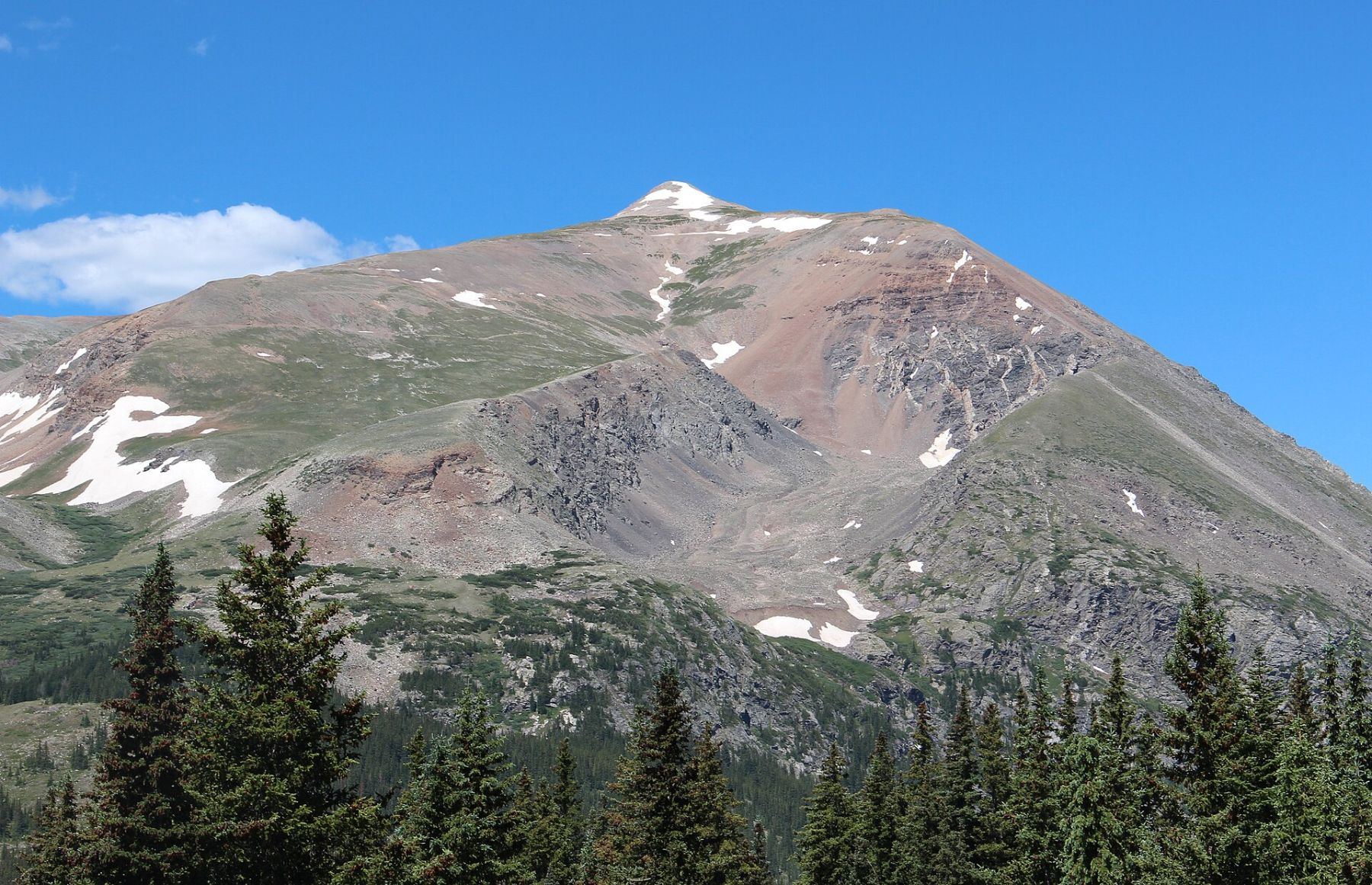
The Lincoln Amphitheater route climbs Mount Lincoln from Montgomery Reservoir on the east side. It goes up a hidden bowl, then the southeast ridge, then around to the northeast ridge for the last push. It is short and steep and sees far fewer people than the standard route from Kite Lake.
It is Class 2, but most of it is off-trail. You will cross talus fields and a rock glacier and pick your own way through the bowl. It suits hikers who are comfortable on rough ground and with basic route-finding. The round trip is about 4.75 miles with about 3,400 feet of gain.
Plan on 5 to 7 hours. The upper ridge crosses old mining roads, so expect some odd junctions near the top.
Plan of the day
Start by
By 5 or 5:30 a.m. You leave the trees early and spend most of the day in the open.
Turnaround
If you have not reached the southeast ridge near 13,400 feet by about 10 a.m., or storms are building, turn around.
Crux
Leaving the amphitheater near 12,500 feet. You need to skirt cliffs and a waterfall, then avoid the loose rock in the middle of the east slope.
Route-finding
Moderate. The trail ends at the mouth of the amphitheater. Above that, stay near the right side of the bowl, then climb to the southeast ridge. Near the top, cut right and traverse north below the summit to reach the northeast ridge.
Water
The stream in the amphitheater runs most of the summer. Treat any water you take. Carry at least 2 liters.
Just under a mile south of Hoosier Pass, turn west off Colorado 9 onto County Road 4. Reset your trip meter. Stay straight at 0.3 and 0.6 miles. At 0.8 miles, take the upper road on the right. The Montgomery Reservoir parking area comes up at 1.4 miles.
To reach the trailhead, cross a small bridge and follow the road around the reservoir. It gets rougher near 1.6 miles. Make a left at 1.7 miles and leave the car by a small water building and a concrete wall. Low cars may prefer to park at the reservoir and walk.
Trail in the treesTalus and screeTundraRidgeExposed to lightning
The line is elevation, the band underneath is the ground, and the numbered dots match the steps below. Mileage and elevations are approximate.
1
Montgomery Reservoir trailhead 10,890' · 0 mi
Walk over the small bridge that spans the South Platte River's Middle Fork. Follow a good trail into the forest.
2
Forest trail 11,100' · 0.4 mi
Climb through the pines. The trail slowly bends left, toward the south.
3
Talus fields 11,400' · 0.7 mi
Hop up through a large talus field, then a second one.
Watch for: Boulders can move. Test your footing.
4
Waterfalls 11,600' · 0.9 mi
Climb a few hundred feet beside the stream to a set of falls. Go around them on the right.
Watch for: Ice may linger near the falls early in the season.
5
Mouth of the amphitheater 11,700' · 1 mi
Climb onto or around the rock glacier at the entrance to the bowl. The trail ends here.
6
Through the amphitheater 12,500' · 1.5 mi
Go west about half a mile, either up the middle of the bowl or along its right side.
7
Exit the amphitheater 12,900' · 1.7 mi
Stay right of a small stream. Go around cliffs and a waterfall, then turn left. Stay out of the loose rock in the middle of the east slope.
Watch for: Loose rock. Watch for anything knocked down by people above.
8
Southeast ridge 13,400' · 1.9 mi
Reach Lincoln's southeast ridge near 13,400 feet and follow it uphill.
Watch for: From here you are fully exposed to wind and lightning.
9
Mining roads 13,800' · 2.1 mi
Near 13,800 feet you meet an old road. Keep climbing the ridge, crossing or following roads as needed.
10
Traverse to the northeast ridge 14,100' · 2.3 mi
Short of the summit, go right and cross north under the top until you reach the northeast ridge.
11
Mount Lincoln summit 14,293' · 2.4 mi
Turn left and climb the ridge to the summit.
Getting down
Most people return the way they came. Go back down the northeast ridge, traverse south below the summit, and descend the southeast ridge to about 13,400 feet. Drop into the amphitheater, again avoiding the loose center of the east slope. Follow the bowl east to its mouth, pass the falls on the left going down, and pick up the trail back to the reservoir.
If things go wrong
The amphitheater is the quickest shelter from wind. From the southeast ridge, head back down into the bowl the way you came. If a storm hits near the summit, do not linger on the ridge. Get down to the bowl and then to the trees. Call 911 if someone is hurt and you have signal.
Other routes
Every way up Mount Lincoln we list, with its class.
This describes the route in its usual season. Distances and elevations are close estimates for planning. Snow, ice, rockfall, a washed-out road or an afternoon storm can make it a very different climb. Check recent conditions the week you go and turn around when the day tells you to.