Afternoon storm risk is the line that matters. Everything else is comfort. In summer, plan to be off the ridge before the build-up starts, not as it starts. Forecast for the summit point, adjusted for its elevation · data from Open-Meteo.
Alternate route · Keplinger Couloir
Overview
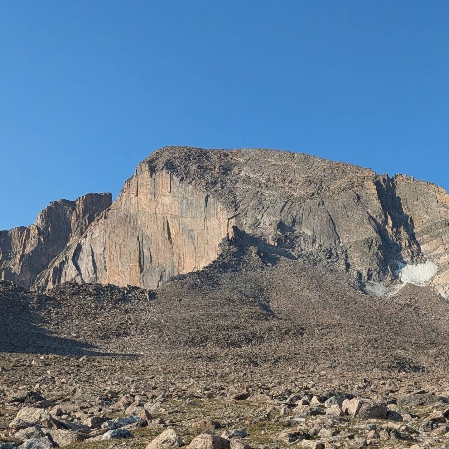
Keplinger's Couloir is a remote route up the south face of Longs Peak from the Wild Basin area of Rocky Mountain National Park. It follows the Sandbeach Lake Trail, then crosses rough, trailless forest to a high basin, climbs the westernmost gully on the south face, and finishes on the Homestretch of the standard Keyhole route. The round trip is about 16 miles with around 5,900 feet of gain.
The route is rated Class 3. The couloir runs from about 12,000 to 13,600 feet and reaches about 45 degrees at its steepest. Early in the season it holds snow and is a snow climb. Later in summer it is loose rock and talus. The ledge at the top can be an easy talus walk in summer or steep snow in colder months.
This is a long, committing day for experienced hikers with strong navigation skills and snow or scrambling experience. It is far quieter than the Keyhole route. Plan on 12 to 15 hours, or camp in Wild Basin with a park permit.
Plan of the day
Start by
By 2 or 3 a.m. The approach alone is over 5 miles, and you want to be in the couloir early, before snow softens or storms build.
Turnaround
Head down if you have not topped out of the couloir by 10:30 a.m., or if the weather is turning. The summit is still a slow scramble away.
Crux
The couloir itself, up to about 45 degrees, and the ledge above it, which can hold steep snow outside of summer.
Route-finding
Hard. The bushwhack from the Sandbeach Lake Trail to timberline is about 1.6 miles through thick forest with no trail. Carry a GPS and know how to use it. In the basin, the couloir is the one farthest left on the south face.
Water
Streams along the Sandbeach Lake Trail, Hunter Creek, and an unnamed lake at timberline. Filter all of it. Carry at least 2 to 3 liters above the lake.
Colorado 7 connects Lyons, Estes Park and Colorado 72. The Wild Basin turnoff is on the west side of Colorado 7, roughly 7 miles north of its junction with Colorado 72.
Follow the access road and bear right toward the national park entrance station about 0.15 mile ahead. Park on the right just past the station. A park entry pass is needed, and you should check the park's current rules for entry and camping.
Off-trail, no set pathTrail in the treesSnow or couloirScramblingExposed to lightning
The line is elevation, the band underneath is the ground, and the numbered dots match the steps below. Mileage and elevations are approximate.
1
Sandbeach Lake trailhead 8,500' · 0 mi
Start up the Sandbeach Lake Trail. The first four miles are easy hiking on a good trail through forest.
2
Leave the trail 10,250' · 3.9 mi
About 0.1 mile before Sandbeach Lake, leave the trail to the right, heading north. From here to timberline there is no trail.
Watch for: Mark this spot on your GPS so you can find the trail on the way back.
3
Bushwhack through the timber 10,700' · 4.6 mi
Head northwest through thick forest. Mount Meeker is in view, and later Pagoda Mountain and Longs Peak appear.
Watch for: Slow going. Deadfall and dense trees make it easy to drift off course.
4
Hunter Creek crossing 11,000' · 5.2 mi
Cross Hunter Creek near 11,000 feet and keep heading northwest.
Watch for: Good place to filter water.
5
Unnamed lake at timberline 11,200' · 5.5 mi
Reach timberline near a small lake at about 11,200 feet. Go straight uphill into the basin above.
6
Base of Keplinger's Couloir 12,000' · 6.3 mi
The couloir is the westernmost, farthest left, of the gullies on the south face. Start climbing near 12,000 feet.
Watch for: Put on your helmet. If there is snow, put on crampons.
7
Middle of the couloir 12,800' · 6.8 mi
The climbing is straightforward. The slope steepens as you go and reaches about 45 degrees at the steepest.
Watch for: Rockfall is common. Stay out of the fall line of others.
8
Top of the couloir 13,600' · 7.3 mi
Near the top, the Palisades and Southeast Longs rise as rock towers just to your right. Exit the couloir near 13,600 feet.
Watch for: Check the weather and your time here.
9
Ledge to the Homestretch 13,900' · 7.7 mi
Turn left (west) onto a ledge. In summer this is a talus walk. With snow it can be steep and serious.
Watch for: Snow on this ledge can exceed 50 degrees in colder months.
10
Summit of Longs Peak 14,259' · 8 mi
The ledge leads to the Homestretch, the final slabs on the standard route. Follow the painted bullseye markers up the smooth rock to the broad, flat summit.
Watch for: The Homestretch slabs are slick when wet or icy.
Getting down
Most people reverse the route. Go back down the Homestretch, east along the ledge, and down the couloir. Face in on steep snow or loose rock. From the lake at timberline, use your GPS to bushwhack back southeast to the Sandbeach Lake Trail, then follow the trail out.
If things go wrong
Before the couloir, simply turn around and retrace your path to the trail. In the couloir, going down is the only practical way out, so turn back early if conditions are poor. From the top of the route there is no short, easy exit. If a storm hits near the summit, get off the high ground as fast as you safely can. Help is far away on this route. In an emergency, call 911 if you have signal and be ready for a long wait.
This describes the route in its usual season. Distances and elevations are close estimates for planning. Snow, ice, rockfall, a washed-out road or an afternoon storm can make it a very different climb. Check recent conditions the week you go and turn around when the day tells you to.