Afternoon storm risk is the line that matters. Everything else is comfort. In summer, plan to be off the ridge before the build-up starts, not as it starts. Forecast for the summit point, adjusted for its elevation · data from Open-Meteo.
This is a snow climb. It is only safe when the snow is firm and stable, usually early in the morning in late spring and early summer. You need an ice axe, crampons, a helmet and the skills to use them. Check avalanche conditions before you go.
Snow route · East Face
Overview
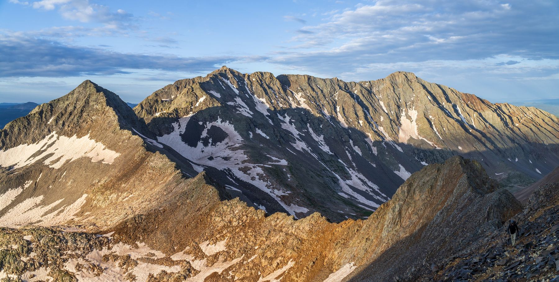
The East Face route climbs Mount Wilson from the Cross Mountain trailhead near Lizard Head Pass. It leaves the trail, contours through forest to upper Slate Creek, climbs a snowy basin toward Gladstone Peak, and finally takes a small south couloir up to the ridge a short way below the top. It is rated Class 3 with moderate snow.
This is for experienced climbers. The couloir is about 40 to 45 degrees, and the final pitch to the summit is loose Class 3. Compared with the standard north-side finish, it avoids the exposed Class 4 moves on the summit block. It is best done as a snow climb.
The round trip is about 12 miles with about 4,900 feet of gain. Plan on 10 to 13 hours.
Plan of the day
Start by
By 3 or 4 a.m. You want firm snow in the basin and couloir.
Turnaround
Turn back if the snow is soft or loaded, or if you are not at the base of the couloir by mid morning.
Crux
The last 150-foot pitch from the south ridge col to the summit. It is loose but no harder than Class 3.
Route-finding
Hard at first. There is no trail from 11,100 feet to Slate Creek. Contour west and northwest through forest, staying above 11,000 feet. In the basin, pick your line based on the snow.
Water
Several small creeks in the forest and Slate Creek. Filter or melt snow. Carry 2 to 3 liters.
Off-trail, no set pathTrail in the treesTundraSnow or couloirRidgeExposed to lightning
The line is elevation, the band underneath is the ground, and the numbered dots match the steps below. Mileage and elevations are approximate.
1
Cross Mountain trailhead 10,070' · 0 mi
Take the Cross Mountain trail northwest across an open area and on into the trees.
2
Leave the trail 11,100' · 1.75 mi
After about 1.75 miles, turn left off the trail and work west through the forest.
Watch for: From here there is no trail. Keep track of your route for the return.
3
Contour above Slate Creek 11,000' · 2.5 mi
Do not drop straight to the creek. Contour northwest and stay above 11,000 feet for over a mile. Cross a few small creeks, which may be under snow.
4
Leave the thick forest 10,900' · 3 mi
After the last creek crossing, exit the thick trees and continue northwest. Near 11,000 feet you see Gladstone Peak and Wilson's east side.
5
Upper Slate Creek 11,100' · 3.5 mi
Leave the trees and meet upper Slate Creek. Turn north up the drainage.
6
Top of the lower headwall 12,000' · 4.2 mi
Climb an easy headwall. Gladstone Peak rises ahead. Keep heading north, choosing your line by snow cover.
Watch for: The basin's sides can hold wind-loaded snow, so be careful.
7
Boxcar Couloir entrance 12,400' · 4.6 mi
The Boxcar Couloir starts off to the left. Keep going north-northwest toward Gladstone.
8
View of the east face 12,900' · 5 mi
Wilson's east face comes into view to the west. Head west-southwest toward it. Find the summit and the small couloir leading to the south ridge.
9
Base of the south couloir 13,800' · 5.6 mi
Climb steepening snow into the couloir. It is 40 to 45 degrees. Climb about 350 feet to a col on the south ridge.
Watch for: A fall here could be serious. Use good axe technique.
10
South ridge col 14,100' · 5.8 mi
On the west side, descend roughly 10 feet into a gully. When you reach a large rock, go right.
11
Summit of Mount Wilson 14,256' · 6 mi
A last 150-foot pitch takes you to the summit. This is the crux. The rock is loose.
Watch for: Test every hold. Watch for rockfall onto partners below.
Getting down
Reverse the route. Climb carefully back down the summit pitch to the col, then descend the couloir facing in if it is steep or firm. Retrace your line across the basin, down upper Slate Creek, and contour back through the forest to the Cross Mountain trail. Take care to find the trail again.
If things go wrong
Below the couloir, retreat back down the basin and Slate Creek. The forest contour is the slowest part, so leave extra time. If someone is hurt, get to safe ground, keep them warm and call 911 if you have signal. This is a remote area and rescue is slow.
Other routes
Every way up Mount Wilson we list, with its class.
This describes the route in its usual season. Distances and elevations are close estimates for planning. Snow, ice, rockfall, a washed-out road or an afternoon storm can make it a very different climb. Check recent conditions the week you go and turn around when the day tells you to.