Afternoon storm risk is the line that matters. Everything else is comfort. In summer, plan to be off the ridge before the build-up starts, not as it starts. Forecast for the summit point, adjusted for its elevation · data from Open-Meteo.
This is a snow climb. It is only safe when the snow is firm and stable, usually early in the morning in late spring and early summer. You need an ice axe, crampons, a helmet and the skills to use them. Check avalanche conditions before you go.
Snow route · Angel of Shavano
Overview
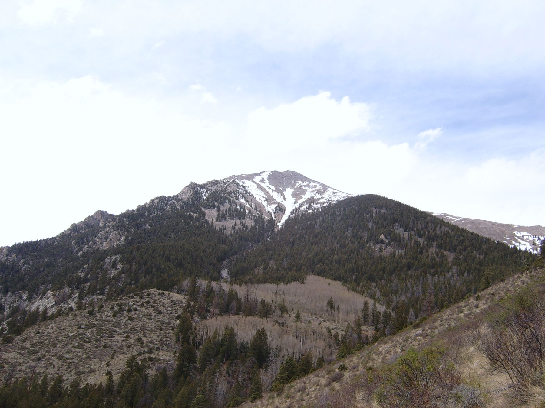
On the southeast side of Mount Shavano lies a snow feature called the Angel of Shavano. From below, it looks like an angel with its arms raised. It is a popular spring snow climb and ski line. In a good year, snow runs from the Angel all the way to the summit.
It is an easy snow climb, Class 2 on rock. The steepest part is between about 12,200 and 12,600 feet. You still need an ice axe and crampons, and you should know how to self-arrest. Compared with the standard East Slopes route, it trades the summer trail for a direct line up snow. It is a good first snow climb for people learning to use an axe.
The round trip is about 8 miles with 4,600 feet of gain. Plan on 7 to 10 hours.
Plan of the day
Start by
By 4 or 5 a.m. You want firm snow on the Angel and to be off it before it gets soft.
Turnaround
If the snow is soft and you sink deep, or by late morning you are still well below the Angel's top, turn back.
Crux
The steepest part of the Angel, between about 12,200 and 12,600 feet.
Route-finding
Moderate. You must find where to leave the trail near 11,100 feet and work through the trees without a trail.
Water
A stream low on the route. Carry 2 to 3 liters and treat any water.
Near Poncha Springs, go one mile north on U.S. 285 past where it meets U.S. 50, and turn west on County Road 140. The Salida airport is on the other side of the highway from this turn.
Drive 1.7 miles and turn right on CR 250. The road turns to dirt and gets rough and rocky on BLM land. At about 5.9 miles there is a junction; keep left onto FR 252. The signed trailhead is at about 9 miles. There is more parking a little farther up if the lot is full.
Blank Cabin (Shavano / Tabeguache). Road conditions near the trailhead change after storms. Check your clearance and have a backup plan for a lower lot.
Trail in the treesTalus and screeOff-trail, no set pathTundraRidgeExposed to lightning
The line is elevation, the band underneath is the ground, and the numbered dots match the steps below. Mileage and elevations are approximate.
1
Blank Cabin trailhead 9,750' · 0 mi
Follow the trail about 0.1 mile to a junction.
2
Colorado Trail junction 9,780' · 0.1 mi
Go right on the Colorado Trail. Hike about a quarter mile.
3
Mount Shavano trail junction 9,850' · 0.35 mi
Turn left onto the Shavano trail. After a short rocky stretch, turn right and follow the trail north, then west.
4
Flat area in the forest 10,700' · 1.3 mi
The trail switchbacks through the forest and passes a couple of boulders to a flat spot.
5
Stream crossing 10,800' · 1.5 mi
Reach a stream and follow it uphill, then cross it.
6
Leave the trail 11,100' · 1.8 mi
Leave the trail to the left and follow the drainage west, under the Angel. If unsure, go on to a bend at 11,200 feet where the trail turns right, and leave the trail there.
Watch for: This turn is easy to miss.
7
Treeline in the basin 11,600' · 2.3 mi
Walk west through the trees; the ground is easy. Pick up the drainage's stream and stay with it west and northwest. Near 11,600 feet you come out of the trees in the middle of the basin.
Watch for: Turn on your avalanche beacon and check the snow.
8
Base of the Angel 12,000' · 2.6 mi
Walk up the middle of the basin to the bottom of the Angel. Put on crampons and helmet.
9
Steepest snow 12,400' · 2.85 mi
Climb the Angel. The steepest part is between about 12,200 and 12,600 feet.
Watch for: Keep your axe ready. Snow that is too soft or too icy makes this harder.
10
Top of the Angel 13,300' · 3.3 mi
Climb through the upper part of the Angel to its head. The ground gets easier here, and you can finally see the summit.
11
Standard trail crossing 13,600' · 3.5 mi
You cross the upper trail of the East Slopes route near here. If the snow runs out, you can follow that trail to the top.
12
East ridge 14,000' · 3.8 mi
If the snow continues, go north up the slope to the east ridge. Turn left.
13
Summit of Mount Shavano 14,230' · 4 mi
Climb rocky ground along the ridge to the summit.
Getting down
You can go back down the Angel if the snow is still firm, facing in on the steep part if needed. If the snow has gone soft, a safer choice is to follow the standard East Slopes trail down, which you can join near 13,600 feet. It returns to the same trailhead. Many people ski or ride the Angel.
If things go wrong
Below the Angel you can turn back at any time and return through the trees to the trail. On the Angel, the standard East Slopes trail crosses near the top, which gives an easier way down. If snow is too soft or the weather turns, go down early. In an emergency, call 911 if you have signal.
Other routes
Every way up Mount Shavano we list, with its class.
This describes the route in its usual season. Distances and elevations are close estimates for planning. Snow, ice, rockfall, a washed-out road or an afternoon storm can make it a very different climb. Check recent conditions the week you go and turn around when the day tells you to.