Afternoon storm risk is the line that matters. Everything else is comfort. In summer, plan to be off the ridge before the build-up starts, not as it starts. Forecast for the summit point, adjusted for its elevation · data from Open-Meteo.
Standard route · Northwest Ridge
Overview
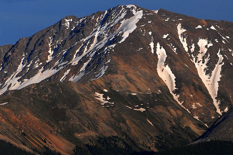
La Plata Peak is a long, steep hike with a trail most of the way. The first half climbs a forested gulch and a series of steep switchbacks. The second half follows the rocky northwest ridge for well over a mile to a small summit. It is a big day: 9.25 miles round trip and about 4,400 feet of climbing. Most people take 7 to 10 hours.
The lower trail is easy to follow. The ridge is where the work starts. The trail fades in the talus, and one section swings off the ridge crest and around a rock buttress on the west side. This is where people lose the path. Above that, the ridge stays steep and rocky almost to the top.
The climbing is Class 2: rough trail and boulder hopping, with no real scrambling if you stay on route. The main dangers are the long time spent above treeline on an exposed ridge, lightning, and loose rock. Fit hikers with some 14er experience will do well here. It is not a good first 14er for someone who has never been on talus.
Plan of the day
Start by
By 5 a.m. You reach the ridge around 12,750 feet and then spend two or more hours above treeline on rock with no fast way off.
Turnaround
If you are not on the northwest ridge (12,750 feet, the rocky crest above the square boulder flat) by 9:30 a.m., or not at the 13,500-foot flat spot by 11 a.m., turn around. Turn around sooner at the first thunder or building clouds.
Crux
The talus section on the upper ridge where the trail leaves the crest, wraps around the west side of a buttress, and climbs back to the ridge. After that, the steep push from 13,500 to 13,800 feet is the hardest physical stretch.
Route-finding
Easy to follow in the trees and on the switchbacks. The buttress bypass on the ridge is the one place people commonly lose the trail. If you feel you have gone too far along the west side, climb left back to the crest.
Water
Lake Creek and La Plata Gulch Creek run beside the lower trail, and the gulch has water up to about 11,000 feet. There is no reliable water above that. Filter or treat all of it. Carry at least 3 liters from the trailhead.
From U.S. 24 south of Leadville, turn west onto Colorado 82 toward Twin Lakes and Independence Pass. Drive about 14.6 miles on the highway. The signed trailhead parking area is on the left (south) side of the road, at the South Fork Lake Creek road.
The drive is all pavement and any car can make it. The lot is at about 10,150 feet. It is a popular peak, so on summer weekends the lot can be full early. Do not block the South Fork road.
RoadTrail in the treesTundraRidgeTalus and screeExposed to lightning
The line is elevation, the band underneath is the ground, and the numbered dots match the steps below. Mileage and elevations are approximate.
1
La Plata Gulch trailhead 10,150' · 0 mi
Start at the parking area off Colorado 82. Walk down the dirt South Fork Lake Creek road. After about 100 yards you cross a vehicle bridge over Lake Creek. Stay on the road.
2
Trail sign off the road 10,150' · 0.3 mi
About a quarter mile past the bridge, look for a trail sign on the left side of the road. Leave the road here and walk east into the forest on the La Plata Gulch Trail.
Watch for: Do not keep walking up the road. It is easy to miss the sign in the dark.
3
South Fork bridge 10,200' · 0.6 mi
The trail winds through pine and aspen and reaches the South Fork of Lake Creek. Cross it on a solid bridge. The trail stays level and easy here.
4
La Plata Gulch Creek log bridge 10,250' · 1 mi
About a third of a mile later, cross La Plata Gulch Creek on a log bridge. Turn right and head south, keeping the creek on your right. You pass through a small clearing.
Watch for: The log bridge can be icy or wet early in the morning.
5
Steep climb begins 10,400' · 1.3 mi
Near 10,400 feet the trail gets much steeper. It climbs close to the east side of the creek on roots and rock steps. This steep pitch gains about 500 feet before it eases.
6
Upper gulch 11,000' · 1.9 mi
Above 11,000 feet the slope relaxes and the trail runs along the open gulch. You can see the steep north face of La Plata ahead. Watch for the point where the trail bends left, away from the creek, and heads back into the trees.
Watch for: In winter and spring this gulch is avalanche terrain.
7
Narrow gully switchbacks 11,800' · 2.5 mi
The trail traverses through trees to the base of a steep, narrow gully on the east side of the gulch. Tight switchbacks climb the gully. At the top, around 11,800 feet, turn right and traverse south across the open hillside.
Watch for: Loose dirt and small rocks on the switchbacks. Go slowly on the way down.
8
Second set of switchbacks 12,100' · 2.8 mi
The traverse ends at another series of switchbacks at about 12,100 feet. You are above treeline now and can see the ridge above you to the east and south.
9
Square boulder flat 12,300' · 3.05 mi
Near 12,300 feet the trail reaches a flat, open bench with a large square boulder. Cross the open area, then turn left and climb a rocky section toward the ridge.
Watch for: This is a good place to check the sky. The ridge ahead has no quick exit.
10
Northwest ridge 12,750' · 3.35 mi
Top out on the northwest ridge. The summit is still about 1.25 miles away and the terrain gets harder. From here the trail weaves through boulders near the crest. Look back and note this spot so you can find the turn off the ridge on the way down.
Watch for: Note where you came onto the ridge. Missing this turn on descent is a common mistake.
11
Buttress bypass 13,100' · 3.7 mi
Follow the ridge to the base of a rock buttress. The trail goes right, onto the west side of the ridge, and crosses talus below the buttress. The path is faint here. It curves around the buttress and then turns left and climbs back to the crest.
Watch for: Most confusing part of the route. If you have gone too far along the west side, turn left and climb back to the ridge crest.
12
13,500-foot flat spot 13,500' · 4 mi
Back on the crest, climb to a flat area at about 13,500 feet. The summit comes into view, but there is still steep work ahead. The next 300 feet are the steepest on the ridge. In early summer, firm snow here may be easier than the rock if you have microspikes.
13
Trail improves 13,800' · 4.2 mi
Around 13,800 feet the trail becomes clearer and the grade eases a little. Stay near the ridge crest on the beaten path.
14
High point near 14,200 feet 14,200' · 4.45 mi
Above 14,000 feet the route heads south to a high point near 14,200 feet. From here the summit is a short walk away to the left.
15
Summit 14,344' · 4.6 mi
Turn left and follow a faint path over rocks to the small summit. You can see the Sawatch peaks all around, including Elbert and Massive to the north and the deep Ellingwood Ridge dropping to the east.
Turn left to stay on La Plata Peak Northwest Ridge (Standard)
Here Laplata Peak-Blackbear Trail goes off to the right. Turn left to follow La Plata Peak Northwest Ridge (Standard).
Coming down: Turn right to stay on La Plata Peak Northwest Ridge (Standard). Don’t take Laplata Peak-Blackbear Trail.
Landmarks to know
Vehicle bridge over Lake Creek just past the parking lot.
Trail sign on the left side of the South Fork road after about a quarter mile.
Log bridge over La Plata Gulch Creek, then a turn right (south).
Narrow gully with tight switchbacks on the east side of the upper gulch.
Flat bench with a large square boulder at about 12,300 feet.
Rock buttress on the ridge that the trail bypasses on the west (right) side.
Flat spot at 13,500 feet with the summit in view.
Getting down
Go down the same way. On the upper ridge, take care in the talus around the buttress. Coming down, the trail goes onto the west side of the ridge below the buttress and then climbs back to the crest. It is easy to drift too far west or to follow a false path down the wrong side.
The most important turn is where you leave the ridge at about 12,750 feet and drop northwest toward the square boulder flat. If you miss it and keep going down the ridge, you will end up on steep, rough ground above the trees. Below the flat, the switchbacks in the narrow gully are steep and loose. Tired legs slip here, so take your time.
If things go wrong
Once you are on the ridge, the only good way off is the way you came. There is no safe shortcut down the sides. If weather turns, head back down the ridge right away and get off it at the 12,750-foot turn, then down to the square boulder flat and into the gulch. The trees below 11,800 feet are the nearest shelter. If someone is hurt, keep the group together, add layers, and move toward lower ground if it is safe to do so. Call 911 if you have a signal; cell coverage on this route is not reliable, so be ready to send someone down to the trailhead for help.
3D flyover
Press play to fly the Northwest Ridge. The graph shows elevation along the way and how much you gain each mile. Open full screen.
For planning only. The line is traced from open map data, not walked in the field, and off-trail parts are drawn straight. Load it in your GPS app to see the route, but navigate with your eyes, a map and the route description.
See the trail on video
A climb of this route filmed by The Dreamologist. The video belongs to them and only plays when you press play.
Jump to
Other routes
All 4 routes up La Plata Peak, with the class and round-trip distance for each.
Ellingwood RidgeA legendary, massive test of route-finding skills and endurance. Instead of the standard path, you lock onto a jagged, multi-mile granite ridge serrated with massive towers and deep rock notches. You spend hours scrambling up and over or bypassing blocky rock steps, maintaining a razor-focus on navigation to avoid getting trapped in dangerous, loose couloirs.
Expect talus, scree and stretches where the trail disappears. Ankles and weather cause most of the trouble here. Start early, keep an eye on the sky, and set a turnaround time before you leave the car.