Afternoon storm risk is the line that matters. Everything else is comfort. In summer, plan to be off the ridge before the build-up starts, not as it starts. Forecast for the summit point, adjusted for its elevation · data from Open-Meteo.
Alternate route · East Slopes
Overview
This is an eastern approach to Mount Bross that begins high above Alma at the Mineral Park mine, up in Dolly Varden Gulch. It follows old mining roads the whole way. The grade is steady and there is no scrambling. It is Class 1, one of the easiest ways up any high peak in the state.
It suits new hikers who want a long day at altitude without rough terrain. The walk is about 9 miles round trip with roughly 2,900 feet of gain. That is longer than the standard route from Kite Lake, but the footing is easier. You are above treeline for most of the day, on wide open slopes with no shelter.
The summit of Bross sits on private mining land and has been officially closed to the public since 2007. Check the current access status before you go. If it is still closed, respect it. Plan on 5 to 7 hours car to car.
Plan of the day
Start by
By 6 a.m. You are above treeline soon after the bristlecone area and stay exposed for hours.
Turnaround
If you are not near the Dolly Varden mine by 10:30 a.m., or storms are forming, turn around. There is no cover on the road.
Crux
There is no hard spot. The challenge is the long, open walk at high altitude, and the summit's closed status.
Route-finding
Easy. Turn right at the road junction just past the Mineral Park mine, then stay on the main road. Many side roads branch off to old mines. Ignore them.
Water
There is no dependable water on this route. Carry all you need, about 2 to 3 liters.
Head for Alma on Colorado 9. In the middle of town, turn at the small sign for the Kite Lake road. Drive through a neighborhood and continue 2.8 miles. Go right on the Windy Ridge road, which may be signed as road 787 or 415. After roughly 2.75 miles you reach parking by the Mineral Park mine, up in Dolly Varden Gulch.
These are dirt mining roads. Check current conditions before relying on a low car. Much of the land around here is private. Park only in the signed area and stay on the roads.
RoadRidgeTundraExposed to lightning
The line is elevation, the band underneath is the ground, and the numbered dots match the steps below. Mileage and elevations are approximate.
1
Mineral Park mine parking 11,280' · 0 mi
Hike a few hundred feet up the road beyond the Mineral Park mine workings.
Watch for: Private mining land. Stay on the road.
2
Road junction 11,350' · 0.15 mi
A few hundred feet past the mine, the road splits. Go right, heading for the bristlecone pine area on Windy Ridge.
3
Windy Ridge bristlecone area 11,700' · 0.8 mi
Walk up the road through the bristlecone pines. These old trees are protected, so stay on the road.
4
Above treeline 12,100' · 1.3 mi
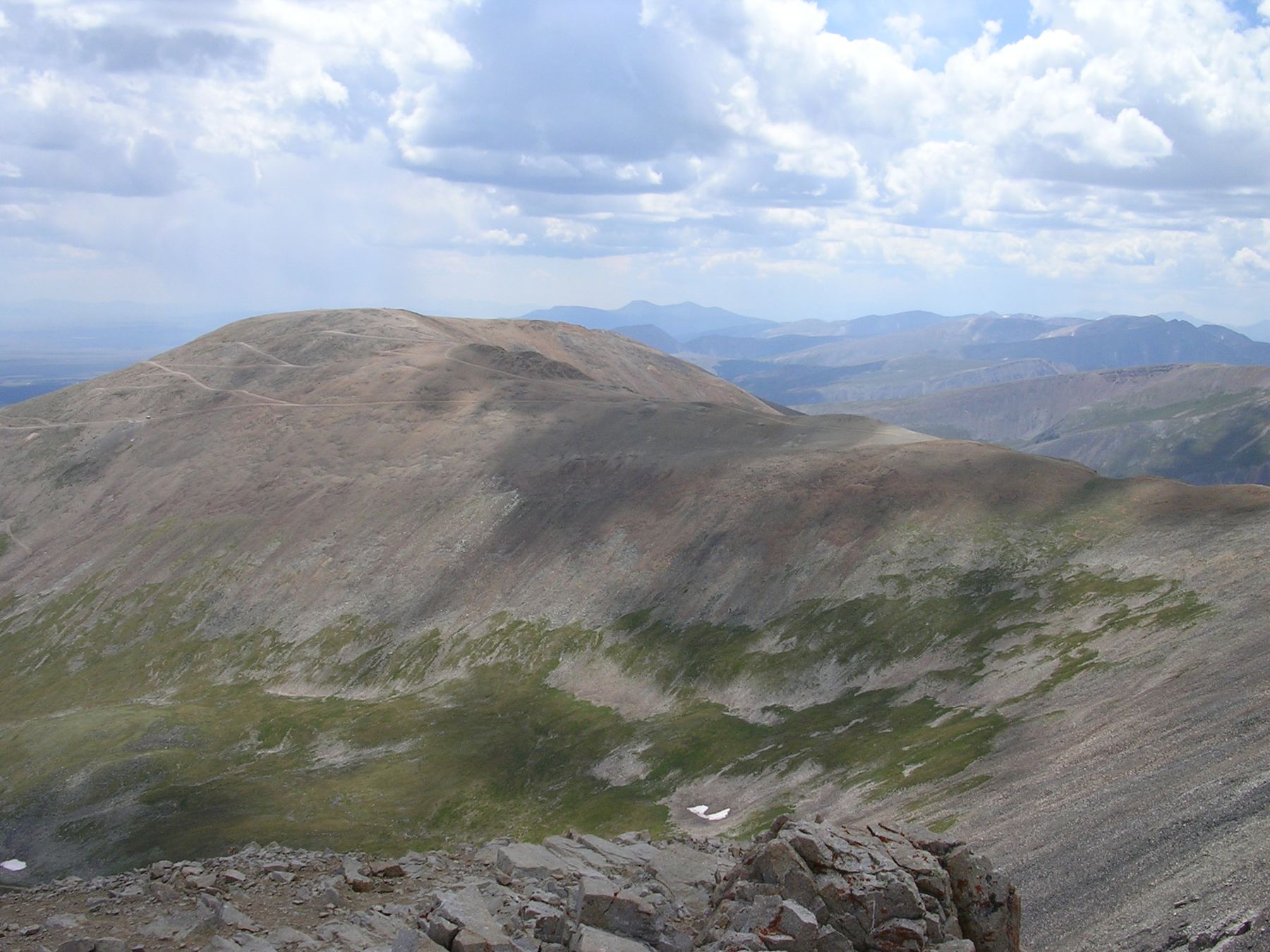
The trees end and you can see the road winding up toward the summit area. Much of the rest of the route is in view.
Watch for: From here on there is no shelter. Watch the sky.
5
Traverse south of the summit 13,200' · 3 mi
The road zigzags uphill for roughly 2 miles; stay on it. Near 13,200 feet it cuts left across steeper ground on the south side of the peak.
6
Dolly Varden mine 13,400' · 3.3 mi
Next, the road bends right and rises above the Dolly Varden mine. Pass the mine and stay on the main road.
Watch for: Stay away from old mine openings and buildings.
7
East side of Bross 13,700' · 3.7 mi
The main road brings you around to the east side of the mountain. Keep walking north and then west on it.
8
Saddle with Mount Cameron 14,000' · 4.3 mi
Once on the north side, the road bends northwest and leads to the wide saddle that joins Bross and Mount Cameron. At the saddle, turn left (south) onto a smaller road.
9
Summit of Mount Bross 14,178' · 4.5 mi
The smaller road leads up a short, easy slope to the broad summit. Only go up if access is open or you have permission from the landowners.
Watch for: The summit has been closed to the public since 2007. Check current status.
Getting down
Go back the way you came. From the summit, follow the small road north to the saddle with Cameron, then turn right onto the main road and walk it back around the east side and down past the Dolly Varden mine. The road is easy to follow, but side roads branch off in many places. Stay on the main one and turn left at the junction just above the Mineral Park mine to reach your car.
If things go wrong
You can turn around at any point and walk back down the road. It is the fastest way off. If a storm catches you, head down right away. The whole upper route is open ground, so do not wait it out up high. Other people and vehicles may be on the road. In an emergency, call 911 if you have signal.
This describes the route in its usual season. Distances and elevations are close estimates for planning. Snow, ice, rockfall, a washed-out road or an afternoon storm can make it a very different climb. Check recent conditions the week you go and turn around when the day tells you to.