Afternoon storm risk is the line that matters. Everything else is comfort. In summer, plan to be off the ridge before the build-up starts, not as it starts. Forecast for the summit point, adjusted for its elevation · data from Open-Meteo.
Standard route · West Slopes
Overview
Mount Bross is the shortest climb from Kite Lake: 3.25 miles round trip with about 2,250 feet of gain. The route climbs a steep gully system on Bross's west side, then follows a rocky ridge to a broad, rounded summit area. Most people take 3 to 4 hours.
Before you go, know this: the summit of Bross sits on private mining claims owned by several landowners, and it has been officially closed to the public for years. Access has changed more than once. Check the current status before your trip. If it is still closed, do not go to the true summit without permission, and respect any signs you see.
The route is Class 2. It is steep, loose, and gravelly, and it is known for being slippery on the way down. The entire climb is above treeline, starting at 12,000 feet, with no shelter anywhere. It suits hikers who are steady on loose ground and who will turn around for weather.
Plan of the day
Start by
By 6 a.m. The climb is short, but you are above treeline the whole time and storms in this range often start before noon.
Turnaround
If you are not on the ridge crest at 13,300 feet by 10 a.m., or if clouds are building, turn around. Be off the upper ridge by 11 a.m.
Crux
Slippery gravel on the upper ridge near 13,600 feet, which is worse on the descent. The gully crossing at 13,100 feet is also steep and loose.
Route-finding
Moderate. The route crosses the gully twice and makes a sharp left turn at 13,100 feet that people miss. Above that, trail segments come and go in the rocks until about 13,600 feet.
Water
Only near the start, from the Kite Lake drainage. There is none on the mountain. Carry 2 liters. Filter any water here; the basin has a long mining history.
Take Colorado 9 to the town of Alma. In the middle of town, turn west onto the small road signed for Kite Lake. It passes through a residential area, then becomes a dirt road up Buckskin Gulch. Follow it about 6 miles to Kite Lake.
When dry, most cars can handle the road until the last mile, which is rougher. A good-clearance two-wheel-drive car can usually get within a couple hundred yards of the lot. The lot is at 12,000 feet and has restrooms and some campsites. A day-use fee is charged. The lot fills early on summer weekends.
TundraRidgeExposed to lightning
The line is elevation, the band underneath is the ground, and the numbered dots match the steps below. Mileage and elevations are approximate.
1
Kite Lake trailhead 12,000' · 0 mi
The trail leaves from the parking area's east edge, right before the road crosses the stream flowing out of Kite Lake. This is not the main Democrat trail, which heads north. You are going east toward Bross.
Watch for: Do not follow the crowd north toward Democrat. The Bross trail starts on the east side of the lot.
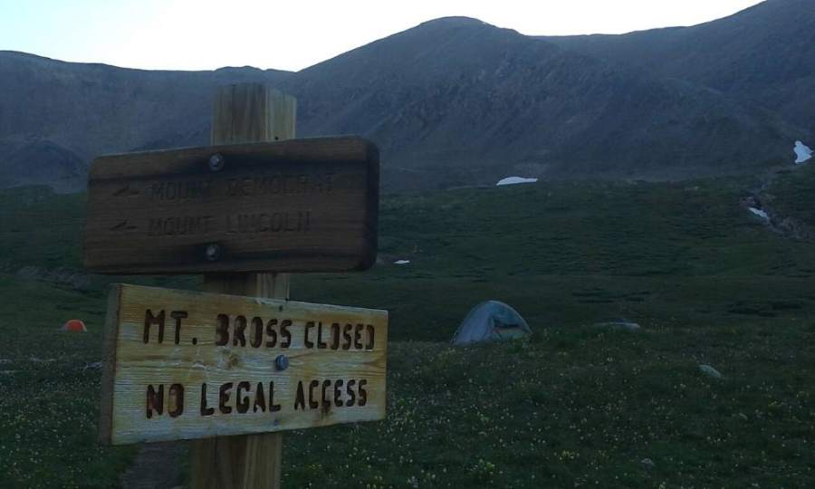
The closure sign for Bross at Kite Lake · Photo: Xnatedawgx
2
Across the basin 12,150' · 0.2 mi
Walk east across the open basin. Ahead you can see a gully that drains down between Bross and the lower bump to its south, called South Bross. Aim for its base.
3
Base of the gully 12,300' · 0.35 mi
Reach the bottom of the gully near 12,300 feet. Cross it to the south side. The crossing is short and easy.
4
Steep rocks south of the gully 12,400' · 0.45 mi
Climb up through a band of steep rocks, then turn right (southeast). The trail climbs the slope south of the gully.
5
Trail bends back north 12,500' · 0.55 mi
Near 12,500 feet the trail swings back to the left, closer to the gully. Follow it up the south side of the gully.
6
South side of the gully 12,800' · 0.75 mi
Keep climbing along the south edge of the gully. The ground is steep dirt and rock with a worn trail.
Watch for: Loose rock. Keep space between you and anyone above you.
7
Traverse into the gully 13,100' · 0.95 mi
At about 13,100 feet the trail cuts left into the gully itself.
8
Sharp left turn 13,150' · 1 mi
Cross the gully and make a sharp left, heading northwest toward the ridge on the north side of the gully. This turn is easy to miss.
Watch for: Key turn. If you keep going straight up the gully, you are off route.
9
Ridge crest 13,300' · 1.1 mi
Climb about 200 feet to the ridge crest at 13,300 feet. Look back and note where you came up so you can find this spot on the way down.
10
Rocky ridge 13,450' · 1.2 mi
Follow broken trail segments up the rocky ridge. The path is faint in places. Stay near the crest.
11
Gravel trail 13,600' · 1.3 mi
Near 13,600 feet the rocks thin out and the trail becomes clearer. It is covered in fine gravel.
Watch for: This gravel is very slippery on the way down. Go slow here.
12
Left side of the ridge 13,850' · 1.45 mi
The trail moves to the left side of the ridge and the broad summit area comes into view.
13
Top of the west gully 14,000' · 1.5 mi
At about 14,000 feet you reach the top of a gully that climbs from the west. This is the edge of the summit area.
Watch for: The summit is on private land. If it is closed, this is where you stop.
14
Summit area 14,178' · 1.6 mi
If access is open or you have permission, an unmaintained path leads to the broad, flat summit area. Respect any closure signs.
Watch for: Do not enter old mine openings or structures.
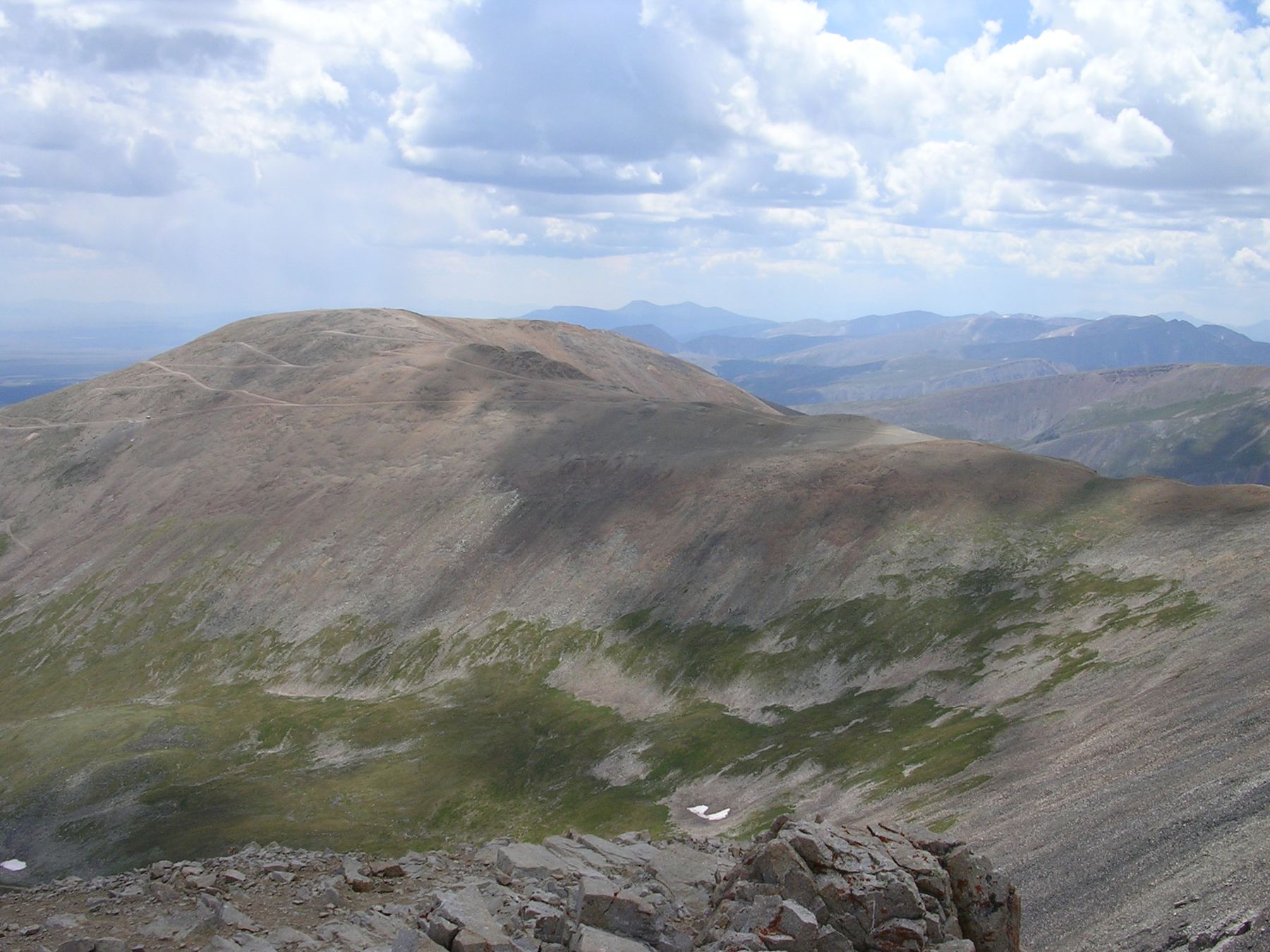
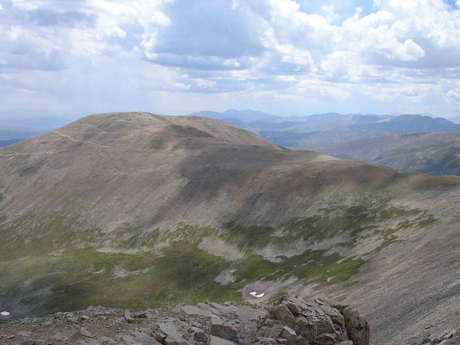
Mount Bross's broad summit area · Photo: Matt Vincent
Along the route
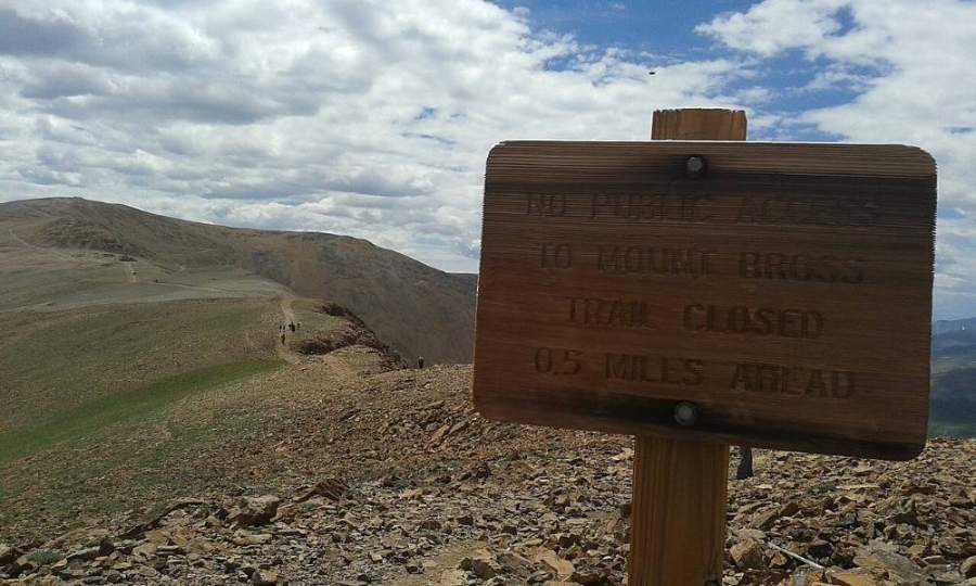
A no-public-access sign on Bross's northwest ridge · Photo: Xnatedawgx
Landmarks to know
Trail leaving the east side of the Kite Lake lot, not the main trail north.
The gully between Bross and South Bross straight ahead to the east.
Crossing to the south side of the gully at 12,300 feet.
The traverse back into the gully and the sharp left turn at about 13,100 feet.
The ridge crest at 13,300 feet on the north side of the gully.
The gravel-covered trail near 13,600 feet where the rocks thin out.
The top of the west gully at 14,000 feet, at the edge of the summit area.
Getting down
Go down the same way. The gravel trail from about 13,600 feet down to the ridge crest is the most slippery part of the route. Take small steps and use poles.
The key place to go wrong is the turn off the ridge at 13,300 feet. You must leave the ridge, drop into the gully, cross it, and then follow the trail down its south side. Do not keep heading down the ridge or straight down the gully. Lower down, cross the gully again at 12,300 feet and walk west back to the lot. Many people also descend Bross as the last peak of the Decalibron loop; that trail is steep and loose too.
If things go wrong
The fastest way off is the route you came up. Do not try to shortcut down the steep slopes; they are loose and there may be old mine openings. If weather turns, head down right away. There is no shelter anywhere on the route, so keep moving to lower ground and your car. If someone is hurt, keep them warm, stay in one place on the trail, and call 911. Cell coverage here is spotty, so be ready to send someone down to the trailhead.
3D flyover
Press play to fly the West Slopes. The graph shows elevation along the way and how much you gain each mile. Open full screen.
For planning only. The line is traced from open map data, not walked in the field, and off-trail parts are drawn straight. Load it in your GPS app to see the route, but navigate with your eyes, a map and the route description.
See the trail on video
A climb of this route filmed by BackCountry Overland. The video belongs to them and only plays when you press play.
Other routes
All 5 routes up Mount Bross, with the class and round-trip distance for each.
Mount Democrat → Mount Cameron → Mount Lincoln → Mount Bross
Class 2 still means loose rock and route-finding
Expect talus, scree and stretches where the trail disappears. Ankles and weather cause most of the trouble here. Start early, keep an eye on the sky, and set a turnaround time before you leave the car.