Afternoon storm risk is the line that matters. Everything else is comfort. In summer, plan to be off the ridge before the build-up starts, not as it starts. Forecast for the summit point, adjusted for its elevation · data from Open-Meteo.
This is a technical climb. Falls here can be fatal. It is for experienced climbers who are comfortable on steep, exposed rock and can decide when to turn back.
Technical route · North Buttress
Overview
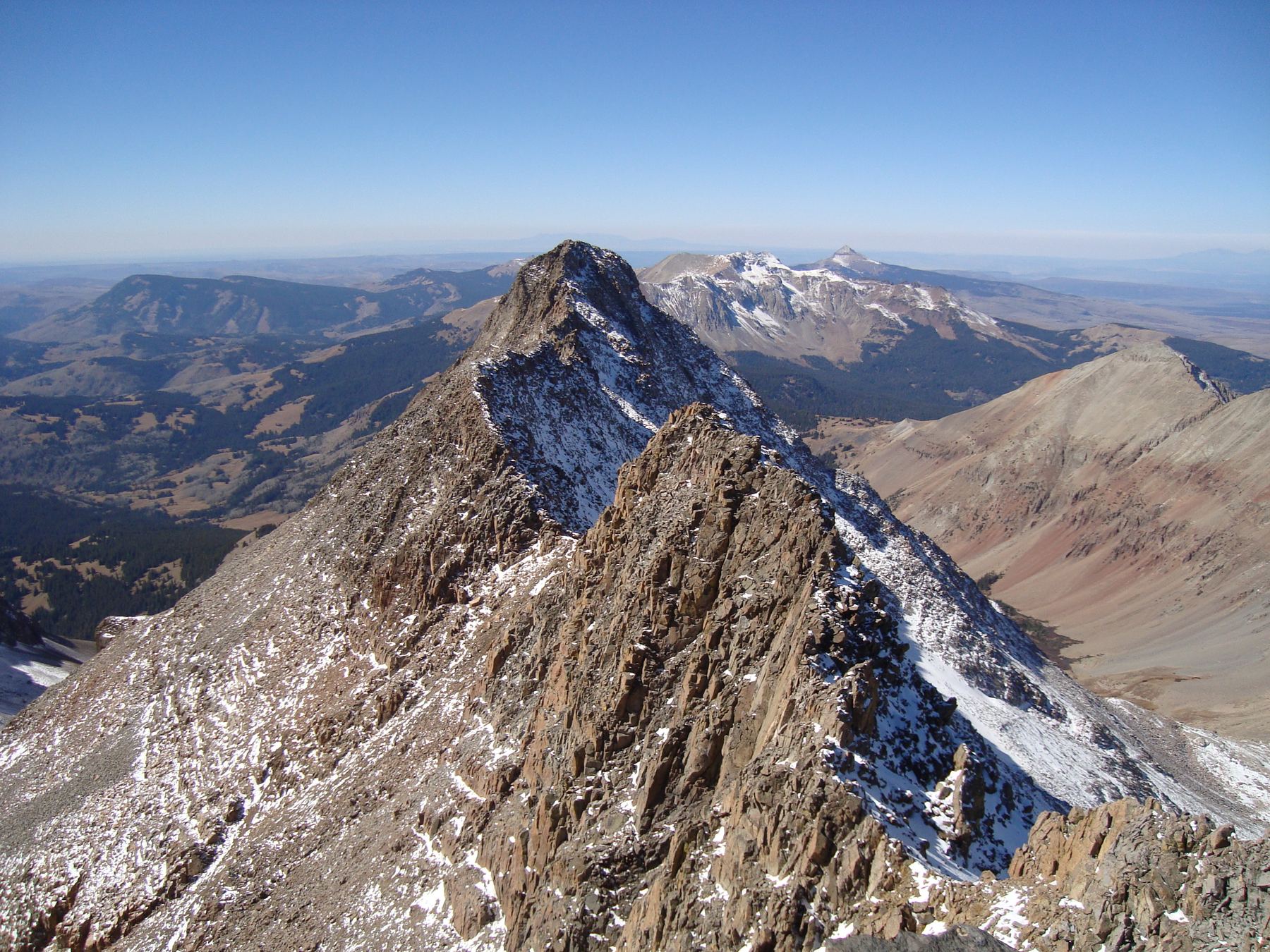
The North Buttress is a steep rock scramble up El Diente from the Navajo Lake basin. It is a good choice once the snow is gone, because the rock on the buttress is more solid than on the standard North Slopes route. It starts as easy boulder hopping and gets harder and more exposed as you go up.
Most of the climb is Class 2 and 3. There is one Class 4 move near the summit. The route is for experienced scramblers who are at ease on exposed rock and can find their own way. The buttress breaks naturally into six sections, separated by flat benches.
The route record lists about 5 miles round trip and 3,200 feet of gain. That covers the climb above Navajo Lake. The approach hike from the trailhead to the lake adds several miles each way. Many people camp at the lake.
Plan of the day
Start by
Very early from the trailhead, or before 6 a.m. from a camp at Navajo Lake.
Turnaround
If you have not reached the V-shaped snowfield by about 10 a.m., turn around. The hardest and most exposed climbing is still above you.
Crux
The summit pitch. Short, steep chimneys with a Class 4 move, and a loose section above. Solid rock right of the gray slabs gives a cleaner option.
Route-finding
Moderate to hard. Leave the trail at a grassy shoulder near 11,800 feet. On the buttress, use the benches as checkpoints. In the boulder jumble, the easier way is usually to the right.
Water
Navajo Lake and the creek above it. There is none on the buttress. Fill up and treat water before you leave the trail.
Leave Telluride heading south on Colorado 145 and cross Lizard Head Pass. After another 5.2 miles, make a right onto Forest Road 535. Drive 4.1 miles on this dirt road to a big meadow and junction. Stay straight on 535.
Pass the Kilpacker trailhead at about 5 miles and keep going another 2 miles. The Navajo Lake trailhead is on the right, about 7 miles from Colorado 145. Most cars can reach it in dry conditions.
Talus and screeTundraScramblingExposed to lightning
The line is elevation, the band underneath is the ground, and the numbered dots match the steps below. Mileage and elevations are approximate.
1
Navajo Lake trailhead 9,340' · 0 mi
Take the Navajo Lake trail up the valley to the lake. This is the standard approach used by other El Diente and Wilson routes.
Watch for: The approach is long. Pace yourself.
2
Navajo Lake 11,150' · 4.5 mi
Continue past the lake. The trail traverses high above the creek, crossing talus slopes.
Watch for: Distance to the lake is an estimate. Check your map.
3
Grassy shoulder 11,800' · 5.3 mi
The trail bends back toward the creek at a grassy shoulder near 11,800 feet. Leave the trail and head right (south) toward the buttress. Old mining debris sits to its left.
4
The Boulder Field 12,100' · 5.5 mi
Make your way across the boulders to the buttress's base (Class 2). Get up on the ridge at a point higher than the steep gray rock at its bottom.
5
The Slabs 12,500' · 5.7 mi
Go over the crest, then climb the solid gray slabs that lie right of the ridge top. When a large boulder blocks the way, go left and scramble up to the first wide bench.
6
The Jumble 12,900' · 5.9 mi
Climb a large, tilted field of boulders. You will need to find your way in places and make a few Class 3 moves. When unsure, the easier path is usually to the right (west). This ends at the second bench.
Watch for: Test big blocks before you trust them.
7
The Hump 13,200' · 6.05 mi
The next section looks steep but goes easily on Class 2 ledges. Stay on or just left of the high point of the buttress. At the third bench, a V-shaped snowfield is right ahead.
8
The V 13,550' · 6.25 mi
Follow a ledge ahead and then right. Look left for a short Class 3 passage of two or three moves on solid rock. Then hike left over talus to regain the crest. Climb the narrowing spine, which gets close to a knife edge.
Watch for: Exposure grows quickly on this spine.
9
Fourth bench 13,800' · 6.4 mi
Before reaching the top of the tower at the end of the spine, look left for a ledge that goes around it. Follow it to a saddle.
10
Summit pitch 14,050' · 6.55 mi
For the best line, keep the gray slabs on your left and go up solid rock directly to the summit ridge. The other option is steep, 10-foot chimneys with a Class 4 move, then a short loose slope up and right.
Watch for: Cliffs drop off to the right, and a steep couloir falls away to the left. Climb carefully.
11
El Diente summit 14,159' · 6.65 mi
You come out onto the West Ridge with under 100 yards left to the top. Scramble along solid blocks to the high point.
Getting down
Downclimbing the buttress is possible but slow and exposed. Many climbers descend the standard North Slopes route instead, which returns to the same basin above Navajo Lake. Know that route well before you choose it, because it has loose rock and snow early in the season. Either way, return to the Navajo Lake trail and hike out.
If things go wrong
Below the V-shaped snowfield, you can retreat down the buttress by reversing the easy sections and using the benches as rest points. Above it, retreat means downclimbing exposed Class 3 terrain, so decide early. Lower down, the grassy shoulder and trail are close. If someone is hurt, keep them warm and still and call 911 if you have signal. Rescue here is slow.
Other routes
Every way up El Diente Peak we list, with its class.
This describes the route in its usual season. Distances and elevations are close estimates for planning. Snow, ice, rockfall, a washed-out road or an afternoon storm can make it a very different climb. Check recent conditions the week you go and turn around when the day tells you to.