Afternoon storm risk is the line that matters. Everything else is comfort. In summer, plan to be off the ridge before the build-up starts, not as it starts. Forecast for the summit point, adjusted for its elevation · data from Open-Meteo.
This is a snow climb. It is only safe when the snow is firm and stable, usually early in the morning in late spring and early summer. You need an ice axe, crampons, a helmet and the skills to use them. Check avalanche conditions before you go.
Snow route · Lost Rat Couloir
Overview
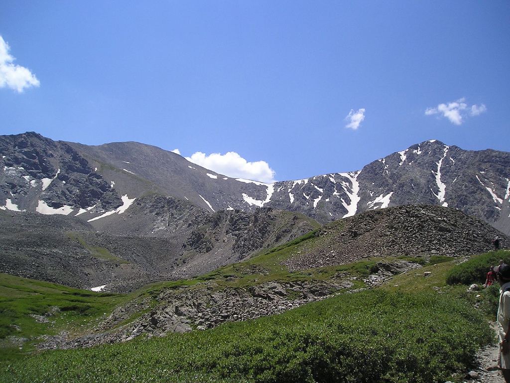
Lost Rat Couloir is a steep snow climb on the east side of Grays Peak. It rises from the head of Stevens Gulch to the east ridge, then follows the ridge to the summit. It is a popular spring line close to Denver, with far fewer people than the standard trail.
It is rated Class 3 with steep snow. The couloir reaches about 45 degrees near the top and narrows in its upper part. It is for climbers who are solid with an ice axe and crampons and know how to judge avalanche conditions. It is much harder than the standard Grays trail, which has no snow climbing in summer.
The round trip is about 6.5 miles with about 3,000 feet of gain from the summer trailhead. Plan on 6 to 8 hours.
Plan of the day
Start by
Before dawn, often 4 a.m. The couloir faces east and gets early sun, which softens the snow and raises the risk of slides and falling ice.
Turnaround
Be off the steep part of the couloir before the sun has warmed it. If the snow is soft or you are not near the fork at 13,100 feet by about 8 a.m., turn back.
Crux
The upper couloir from 13,100 to 13,500 feet, where the slope reaches about 45 degrees and the walls close in.
Route-finding
Easy in the basin. Leave the main trail just before the sign near 12,100 feet on an old road. At the fork above 13,100 feet, stay left in the main couloir.
Water
The stream in Stevens Gulch near the trailhead. It may be frozen in spring. Carry what you need, about 2 to 3 liters.
Drive I-70 and get off at exit 221, Bakerville. Cross to the south side and find the dirt lot where Forest Road 189 begins, which serves as the winter trailhead. Low-clearance cars should park here even when the road above is open.
The summer trailhead, at 11,280 feet, is about 3 miles up this road. Stay straight at a junction after 1 mile. The upper lot has restrooms, and a few campsites are close by. In spring, snow may keep the road closed, which adds about 3 miles each way.
TundraTalus and screeSnow or couloirRidgeExposed to lightning
The line is elevation, the band underneath is the ground, and the numbered dots match the steps below. Mileage and elevations are approximate.
1
Grays Peak summer trailhead 11,280' · 0 mi
Cross the bridge over the stream and start up the Grays trail into Stevens Gulch.
Watch for: If you park at the winter trailhead, add about 3 miles each way.
2
Upper Stevens Gulch 11,700' · 0.6 mi
Keep climbing on the trail. Grays Peak and the couloir come into view ahead.
3
Leave the Grays trail 12,100' · 1.5 mi
Just before a trail sign near 12,100 feet, turn left onto a small old road. Follow it down a little, then south toward the middle of the basin.
Watch for: In deep snow the road may be hidden. Head south across the basin.
4
Southwest end of the basin 12,300' · 2 mi
Keep to the road, or close to it, while it runs to the far end of the basin and up onto the talus under the couloir.
5
Base of Lost Rat 12,500' · 2.3 mi
Put on your helmet, crampons and avalanche gear. Take out your axe and begin climbing.
Watch for: Check the snow. Stop if it is wet, slabby or has recent wind loading.
6
Couloir steepens 12,800' · 2.45 mi
Above 12,800 feet the slope gets steeper as the walls close in.
7
Fork in the couloir 13,100' · 2.6 mi
Near 13,100 feet the couloir splits. Stay left in the main couloir. The next 300 feet are simple but reach about 45 degrees.
Watch for: A fall here would be hard to stop. Keep your axe ready.
8
Narrowest section 13,500' · 2.8 mi
Near 13,500 feet the couloir bends slightly left and is at its narrowest. Climb about 100 more feet to the top.
Watch for: Rock and ice can fall through this narrow spot.
9
Top of the couloir 13,580' · 2.9 mi
You reach the east ridge. Turn right (west). About 700 feet of ridge climbing remain.
10
Grays Peak summit 14,275' · 3.25 mi
Follow the ridge to the top. Torreys Peak is close by to the north.
Getting down
Most people do not downclimb the couloir. The usual way down is the standard Grays trail, which leaves the summit to the north and east and winds back down into Stevens Gulch to the trailhead. In spring it may still be snow-covered, so bring your axe and crampons and watch for soft snow. You can also downclimb Lost Rat if the snow is firm and you are confident.
If things go wrong
Below the fork, you can reverse the couloir. Face in and move carefully. Above the fork, it is often safer to finish the climb and descend the standard trail than to downclimb steep, narrow snow. In a storm, get off the ridge quickly and head down into Stevens Gulch. Call 911 if someone is hurt and you have signal.
This describes the route in its usual season. Distances and elevations are close estimates for planning. Snow, ice, rockfall, a washed-out road or an afternoon storm can make it a very different climb. Check recent conditions the week you go and turn around when the day tells you to.