Afternoon storm risk is the line that matters. Everything else is comfort. In summer, plan to be off the ridge before the build-up starts, not as it starts. Forecast for the summit point, adjusted for its elevation · data from Open-Meteo.
This is a technical climb. Falls here can be fatal. It is for experienced climbers who are comfortable on steep, exposed rock and can decide when to turn back.
Technical route · North Ridge
Overview
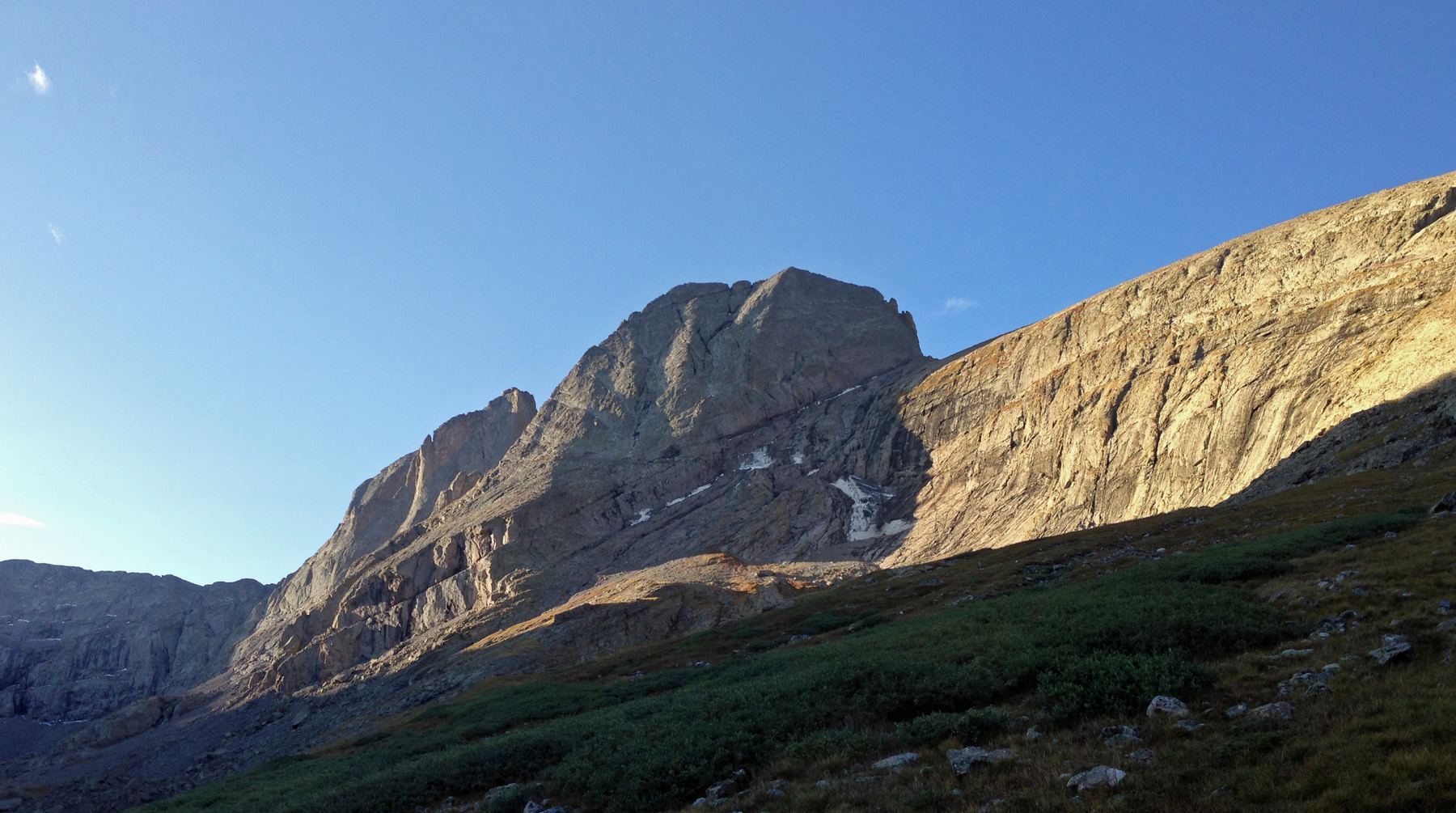
This technical rock route climbs Kit Carson Peak by its north ridge, in the Sangre de Cristo Range. You hike to Willow Lake, walk up the valley beyond it, and then scramble and climb onto the north ridge, which you follow all the way to the summit.
It is rated Class 4, with long stretches of steep, exposed climbing on knobby conglomerate rock. A fall in many places would be serious or fatal. This route is only for experienced climbers who are solid on exposed Class 4 terrain. It is far harder than the standard route over Challenger Point.
The round trip is about 11.4 miles with about 5,300 feet of gain. As a single day it is very long, often 12 hours or more. Many parties camp at Willow Lake.
Plan of the day
Start by
Very early. By 3 a.m. for a single-day trip, or by 5 a.m. from a camp at Willow Lake.
Turnaround
Be on the north ridge by about 9:30 a.m. If you are not, or storms are building, turn back. Retreating from the ridge is not simple.
Crux
Two spots: getting onto the ridge from the northeast face, where the Class 4 climbing starts, and the steep, exposed pitch to reach the summit plateau near the top.
Route-finding
Moderate. From Willow Lake the ridge is in plain view. The key is getting past the cliff bands in the valley before gaining height, then finding the easiest way up the northeast face to the ridge.
Water
Willow Creek and Willow Lake. None on the climb. Filter and carry 3 liters from the lake.
Take Colorado 17 to Moffat. On the south side of town, turn east at the sign for Crestone onto Road T. Drive about 11.5 miles to Crestone.
Keep going straight into town, then make a left at Alder Street. Go a short way and turn right onto Galena. Galena becomes a dirt Forest Service road, number 949, as it leaves town. The Willow Creek trailhead is about 2 miles up this road.
Trail in the treesTundraTalus and screeSnow or couloirScramblingExposed to lightning
The line is elevation, the band underneath is the ground, and the numbered dots match the steps below. Mileage and elevations are approximate.
1
Willow Creek trailhead 8,850' · 0 mi
Start early. Follow the well-used trail east toward Willow Lake.
2
Switchbacks up the valley 10,000' · 2 mi
The trail climbs many switchbacks as it winds up the valley and crosses the creek.
3
Willow Lake 11,560' · 4 mi
The trail reaches the lake. This is a good place to camp and fill water.
Watch for: Fill water here. There is none higher up.
4
North side of the lake 11,700' · 4.3 mi
Walk around the lake along its left (north) side. Keep high, over the top of the cliffs and waterfalls. From this spot you can see the whole north ridge.
Watch for: Do not drop toward the cliffs and waterfalls.
5
Past the cliff bands 12,100' · 4.8 mi
Continue southeast up the valley. Get past the boulders and cliffs by going under them, either low in the valley or through the gap separating the boulders from the cliff bands. Get past the cliffs before you climb much higher.
Watch for: Climbing too early puts you into cliffy ground.
6
Base of the Outward Bound Couloir 12,600' · 5.2 mi
Walk all the way to the base of the couloir. Turn right and climb the rocks on its west side. The northeast face comes into view, with the north ridge on its skyline.
Watch for: Put on your helmet here.
7
Grassy ledges 13,000' · 5.4 mi
Scramble easy Class 3 grassy ledges toward the northeast face, picking the easiest line toward the ridge.
8
Onto the north ridge 13,300' · 5.5 mi
Here the face steepens, and you start the Class 4 climbing. Keep angling right until you reach the clear spine of the north ridge.
Watch for: First crux. The exposure is big. Test every hold on the knobby rock.
9
The north ridge 13,700' · 5.6 mi
Follow the ridge upward. It is steep and exposed, with many Class 4 sections on conglomerate rock.
Watch for: Knobs can break off. Do not trust a single hold.
10
Pitch to the summit plateau 14,000' · 5.65 mi
Climb the final steep pitch to reach the plateau. There is a big drop on the left.
Watch for: Final crux. Go slow and consider a rope if anyone in your group is unsure.
11
Summit of Kit Carson Peak 14,167' · 5.7 mi
Above the pitch the angle eases. A last short scramble and walk leads to the top.
Getting down
Do not plan to downclimb the north ridge. It would likely need at least one rappel. The usual way down is to follow Kit Carson Avenue across to Challenger Point, then descend the standard Challenger route back to Willow Lake. If you have the right gear and the snow is good, you can also use the Outward Bound Couloir. From the lake, follow the trail back down to the trailhead.
If things go wrong
Before you commit to the Class 4 climbing on the face, turning around is simple. Once on the ridge, going up and off via Kit Carson Avenue is often safer than retreating down. If you must go down the ridge, be prepared to rappel. Carry a rope if there is any doubt in your group.
Other routes
Every way up Kit Carson Peak we list, with its class.
This describes the route in its usual season. Distances and elevations are close estimates for planning. Snow, ice, rockfall, a washed-out road or an afternoon storm can make it a very different climb. Check recent conditions the week you go and turn around when the day tells you to.