Afternoon storm risk is the line that matters. Everything else is comfort. In summer, plan to be off the ridge before the build-up starts, not as it starts. Forecast for the summit point, adjusted for its elevation · data from Open-Meteo.
Alternate route · Loft Route
Overview
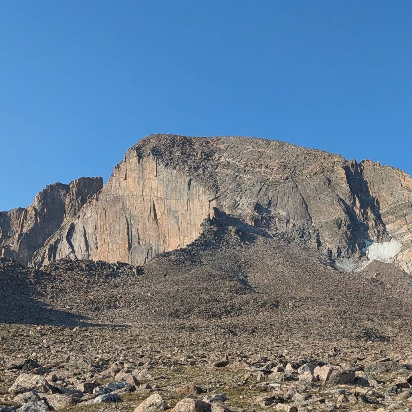
The Loft Route climbs Longs Peak from the east by way of the Chasm Lake area, the Loft Couloir, a broad, flat area called the Loft, and Keplinger's Couloir. It joins the Keyhole Route for the final Homestretch. It is rated Class 3, with a short downclimb that has a few Class 4 moves.
It is for experienced scramblers who are good at route finding. There is no set trail from below Chasm Lake to the top, and cairns can be misleading. Compared with the Keyhole Route, it is a bit shorter and avoids the crowded Ledges and Trough, but it has harder route finding and a tricky downclimb.
The round trip is about 13 miles with about 5,300 feet of gain. Plan on 12 to 15 hours.
Plan of the day
Start by
By 2 or 3 a.m. This is a very long day and storms are common by early afternoon.
Turnaround
If you are not on the Loft by about 9 a.m., or clouds are building, turn around. There is still a lot of committing ground above.
Crux
Getting down from the Loft's northwest corner to Clark's Arrow, which takes a few Class 4 moves.
Route-finding
Hard. Use the Chasm Lake trail, then pick your own line to where the Loft Couloir begins. Exit the couloir left before its steepest part, cross the Loft to its northwest corner, and look for the cairn at the top of the downclimb.
Water
Alpine Brook low down and near Mills Moraine below Chasm Lake. Filter it. That is the last water.
You will find the trailhead on the west side of Colorado 7. Coming from the north, start at the junction of U.S. 36 and Colorado 7 and go about 9.2 miles south; the Ranger Station turnoff is there. From the south, drive about 10 miles north from the junction of Colorado 7 and Colorado 72.
Turn west and drive about 1 mile to the trailhead. You may not camp in your car in this lot. A tent campground is close by, and Meeker Park has other campgrounds. The lot fills very early in summer.
Trail in the treesTundraTalus and screeScramblingExposed to lightning
The line is elevation, the band underneath is the ground, and the numbered dots match the steps below. Mileage and elevations are approximate.
1
Longs Peak Ranger Station trailhead 9,400' · 0 mi
Look for the trail to the left of the ranger station. In half a mile, at the Estes Cone junction, go left or straight.
2
Goblins Forest 10,100' · 1.2 mi
Go by the camping area. The trail then zigzags up through the forest, and Alpine Brook stays on your left.
3
Log bridge near treeline 10,900' · 2.3 mi
Cross the brook on a log bridge and pass a warning sign about the dangers above treeline. Soon the Diamond comes into view.
4
Chasm Lake junction 11,550' · 3.5 mi
On the ridge running east from Mount Lady Washington, turn onto the Chasm Lake trail. Here the Loft Route splits off from the Keyhole Route.
Watch for: There is a toilet just east of this junction.
5
Mills Moraine 11,700' · 4 mi
Continue to level ground beneath Chasm Lake. This is the last place for water. From here there is no set trail.
Watch for: Fill up and filter here.
6
Base of the Loft Couloir 12,000' · 4.5 mi
Head over to the Ship's Prow and pass along its south side. A worn path of loose dirt and gravel zigzags up the couloir.
Watch for: Loose rock. Watch for rockfall from people above.
7
Exit ramp 12,900' · 5 mi
Higher up there is some Class 3 scrambling. Before the wet rock near the top, leave the gully on the left onto a ramp. Scramble a block and more ramps, heading up and west.
Watch for: Stay south of the steep upper part of the couloir.
8
The Loft 13,450' · 5.4 mi
You come out at the southeast corner of a broad, level field of boulders. Cross it heading northwest, going around the Beaver on its west side.
9
Downclimb to Clark's Arrow 13,300' · 5.7 mi
Look in the northwest corner for a cairn; it shows where the downclimb begins. Descend a gully with a few Class 4 moves, then use a ledge to escape it. Clark's Arrow is over your right shoulder.
Watch for: This is the crux. Take your time.
10
Keplinger's Couloir 13,600' · 5.9 mi
Climb the couloir, keeping to its east side near the rock walls.
11
Ramp to the Homestretch 13,900' · 6.2 mi
Near the top, the Notch is on your right. Turn left and follow a ramp west. You will meet Keyhole Route climbers here.
12
Base of the Homestretch 14,000' · 6.3 mi
Climb the smooth slabs to the top. To avoid lines, there is a good scramble in a cleft to the left of the Homestretch.
Watch for: The slabs are slick when wet or icy.
13
Summit of Longs Peak 14,259' · 6.5 mi
The summit is a large, flat boulder field. Take a short break and head down before weather builds.
Getting down
Many climbers descend the Keyhole Route, and then take the main trail back past the Chasm Lake junction to the trailhead. You can also reverse the Loft Route, but the upclimb out of Clark's Arrow and the loose Loft Couloir make that slower. Know your descent plan before you start.
If things go wrong
Below the Loft, go back down the Loft Couloir to Mills Moraine and the trail. Once past Clark's Arrow, it is often best to continue to the summit and take the Keyhole Route down. If a storm hits on the Loft, get off the open boulder field quickly. For injuries, call 911 if you have signal. Rescues here take many hours.
This describes the route in its usual season. Distances and elevations are close estimates for planning. Snow, ice, rockfall, a washed-out road or an afternoon storm can make it a very different climb. Check recent conditions the week you go and turn around when the day tells you to.