Afternoon storm risk is the line that matters. Everything else is comfort. In summer, plan to be off the ridge before the build-up starts, not as it starts. Forecast for the summit point, adjusted for its elevation · data from Open-Meteo.
This is a technical climb. Falls here can be fatal. It is for experienced climbers who are comfortable on steep, exposed rock and can decide when to turn back.
Technical route · North Slopes
Overview
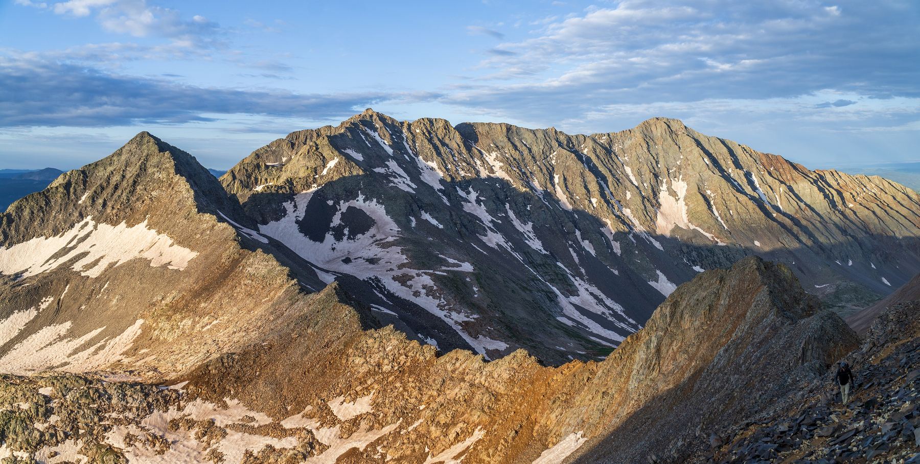
The North Slopes route on Mount Wilson climbs out of Navajo Basin in the San Juans. It goes up a shoulder, over a green lichen-covered rock wall, across a series of rock ribs and gullies, and then up a narrow summit ridge with a Class 4 crux.
This used to be the standard route on Wilson. Today most people use the Southwest Slopes as the standard route, since it is easier and less loose. The North Slopes is a technical route with Class 3 scrambling and a few Class 4 moves near the top. It is only for experienced climbers who are comfortable on exposed rock.
From the Navajo Lake trailhead the round trip is about 16 miles with 5,100 feet of gain. Most people camp in the basin. As a day climb, plan on 12 to 14 hours.
Plan of the day
Start by
By 4 a.m. from the trailhead, or first light from a camp in the basin.
Turnaround
If you are not at the notch on the northeast ridge by 10:30 a.m., or clouds are building, turn back.
Crux
The last few rocks before the summit. The easiest way is to climb around on the left. The right side needs an exposed Class 4 move.
Route-finding
Hard. Cairns help, but crossing the ribs and gullies needs care. If you go too high, the crossings get harder and looser.
Water
Streams in Navajo Basin. None above the shoulder. Carry 3 liters from the basin and treat all water.
Take Colorado 145 south out of Telluride and over Lizard Head Pass. About 5.2 miles farther, go right on Forest Road 535.
After 4.1 miles of dirt road you come to a big meadow and a junction. Keep straight on 535. The Kilpacker trailhead is at about 5 miles; go about 2 more miles to the Navajo Lake trailhead on the right. The road is fine for most cars when dry.
Trail in the treesTundraScramblingRidgeExposed to lightning
The line is elevation, the band underneath is the ground, and the numbered dots match the steps below. Mileage and elevations are approximate.
1
Navajo Lake trailhead 9,350' · 0 mi
Follow the Navajo Basin approach trail up the valley.
2
Navajo Lake 11,150' · 5 mi
The trail passes Navajo Lake and keeps climbing into the upper basin. Many people camp in the basin.
3
Upper Navajo Basin 12,200' · 6.3 mi
Near 12,200 feet the basin ends, and the way to Mount Wilson comes into view. Leave the trail.
4
Shoulder below the northeast ridge 12,600' · 6.6 mi
A shoulder rises toward Wilson's northeast ridge; walk to its base. Then get across the stream and hike south up the shoulder. There are bits of trail and cairns.
5
Green wall 13,100' · 6.9 mi
At about 13,100 feet you reach a wall of green, lichen-covered rock. Find the cairns and climb up the middle of the wall. Near the top you need two or so easy Class 3 moves.
Watch for: Wear a helmet from here up.
6
Top of the green wall 13,400' · 7.05 mi
Above 13,400 feet the ground eases. The northeast ridge is above you, but do not climb to it yet.
7
Start of the traverse 13,600' · 7.2 mi
Keep climbing to about 13,600 feet to avoid the bad, loose ground to your right. Where it flattens, look for cairns and start an upward traverse southwest across rock ribs and gullies.
Watch for: If you go too high, the ribs get harder and looser, with Class 3+ moves.
8
Final gully 14,100' · 7.6 mi
Keep crossing ribs and gullies and gaining height slowly. Near 14,100 feet, the last gully leads up to a notch on the northeast ridge.
Watch for: A little snow in the gullies can help if you have crampons.
9
Summit ridge 14,180' · 7.75 mi
Go right to a smaller notch, then turn left onto the narrow summit ridge. Expect Class 3 scrambling and a few Class 4 moves.
10
Summit crux 14,230' · 7.9 mi
Just before the summit, a set of rocks blocks the ridge. The easiest way is around on the left. Going right needs an exposed Class 4 move.
Watch for: This is the crux. Take your time and test each hold.
11
Summit of Mount Wilson 14,256' · 8 mi
After the crux, scramble a short way to the top.
Getting down
Go back the way you came. Downclimb the crux and the summit ridge with care, then go down the gully from the notch and reverse the traverse across the ribs. Look for the cairns and stay at the right height. Downclimb the green wall and hike down the shoulder to the basin, then follow the trail out.
If things go wrong
Before the green wall you can turn around and walk back to the basin at any time. Above it, the only good way off is the way you came. Do not drop into unknown gullies; the ground is loose and steep. In an emergency, call 911 if you have signal. Rescue here can take many hours.
Other routes
Every way up Mount Wilson we list, with its class.
This describes the route in its usual season. Distances and elevations are close estimates for planning. Snow, ice, rockfall, a washed-out road or an afternoon storm can make it a very different climb. Check recent conditions the week you go and turn around when the day tells you to.