Afternoon storm risk is the line that matters. Everything else is comfort. In summer, plan to be off the ridge before the build-up starts, not as it starts. Forecast for the summit point, adjusted for its elevation · data from Open-Meteo.
Standard route · West Ridge from Summit Lake
Overview
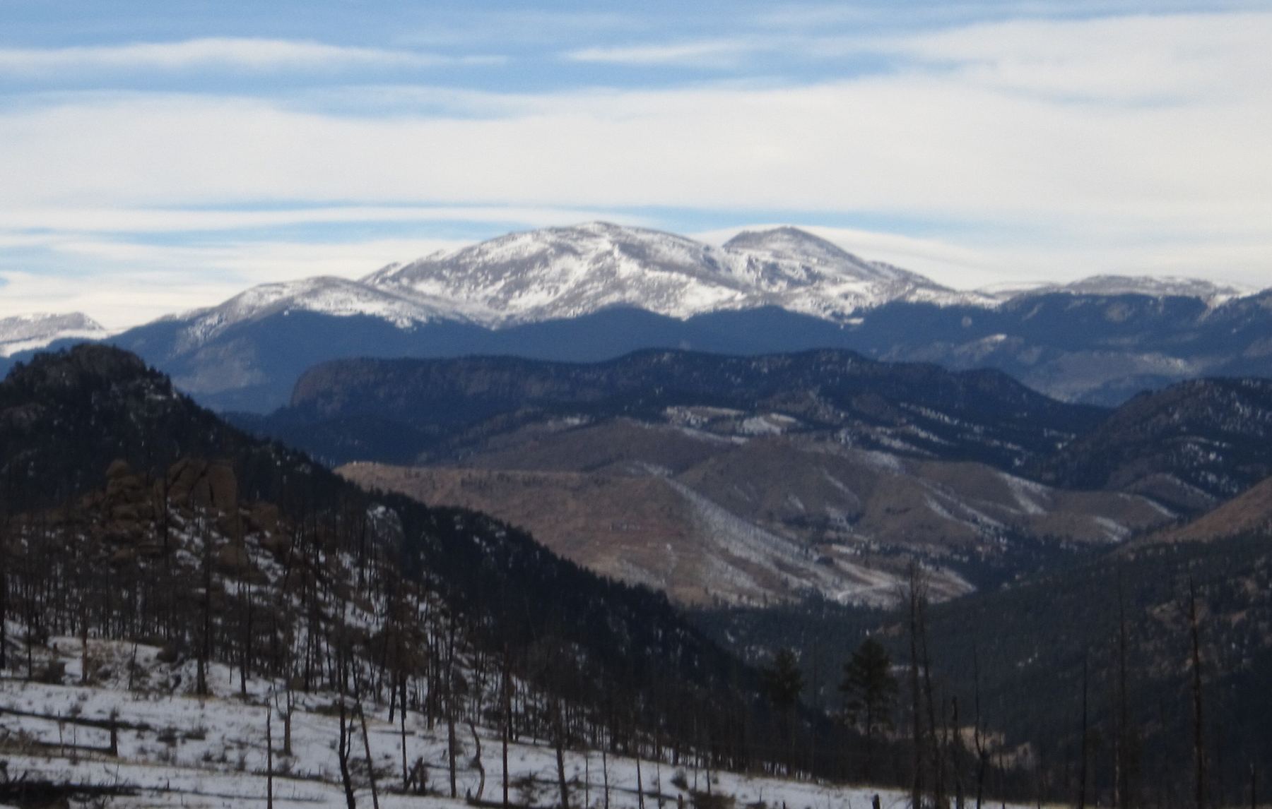
Mount Blue Sky, formerly Mount Evans, has a paved road to the top, but the hike from Summit Lake is a real mountain route. It climbs the rocky east ridge of Mount Spalding, a 13er, then drops to a saddle and follows Blue Sky's long west ridge to the summit. It is Class 2, about 5.5 miles round trip with 2,000 feet of gain, and most of it is on rock rather than smooth trail.
The whole route is above treeline, starting at 12,850 feet. That makes it short but not easy. The air is thin from the first step, the footing is broken rock for long stretches, and there is nowhere to hide from a storm. Much of the ridge to Blue Sky is marked only by cairns and short bits of trail, so good visibility matters.
Most hikers take 4 to 6 hours. It suits people who can handle a few hours of rocky walking and some light hand use. Do not let the road fool you: people get hurt and lost on this ridge, and a storm can hit fast. You also have to get off before the weather turns, not count on a ride from the top.
Plan of the day
Start by
As early as the road and your reservation allow. The earliest reservation window is usually 7 to 9 a.m., but the gate is often open earlier if the weather is good. An early start matters because the whole route is exposed.
Turnaround
If you have not reached the end of Blue Sky's west ridge at 13,800 feet by 11 a.m., or clouds are building, turn back there. From that point the summit is still about a mile away.
Crux
The rocky section on Spalding's east ridge between about 13,200 and 13,400 feet, where you bypass rough ground just left of the crest. The long traverse below Blue Sky's west ridge is not hard, but it is slow, cairned talus.
Route-finding
Moderate. At the north end of Summit Lake, take the signed trail up the ridge, not the lower trail that bends left near the water. On Blue Sky's west ridge, follow the cairns closely; in fog it is easy to wander off onto steep ground.
Water
Summit Lake is the only water, and it is at the start. There is none on the route. Carry at least 2 liters, and treat any lake water.
Leave Interstate 70 at Idaho Springs, Exit 240. Colorado 103 heads south from there; stay on it 13.5 miles until you reach Echo Lake. Turn onto the Mount Blue Sky road (Colorado 5), show your reservation at the entrance station, and continue 9 miles to the parking area at Summit Lake, which is signed.
The road is paved but narrow, with steep drop-offs and no guardrails in places. It is open only in summer and early fall and can close for bad weather. You need a timed reservation to park at Summit Lake, and you have to buy it before the day of your hike. The route enters the Mount Evans Wilderness, so wilderness rules apply.
RidgeScramblingTundraExposed to lightning
The line is elevation, the band underneath is the ground, and the numbered dots match the steps below. Mileage and elevations are approximate.
1
Summit Lake parking area 12,850' · 0 mi
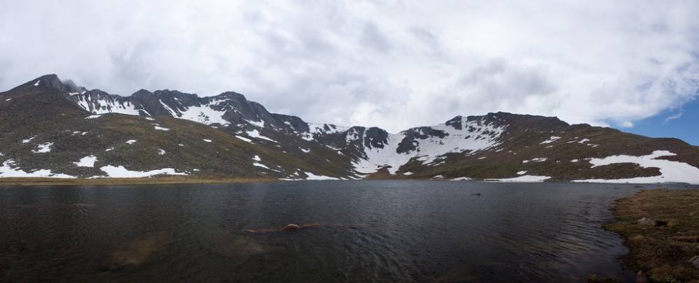
From the lot, walk north past a stone building. Summit Lake sits in a bowl below the cliffs of Blue Sky's north face. Find the trail that leads toward the north end of the lake.
Summit Lake, where the route begins · Photo: squeaks2569
2
North end of Summit Lake 12,850' · 0.2 mi
Walk along the lake to its north end. The ridge of Mount Spalding rises to the west.
3
Spalding ridge trail 12,900' · 0.35 mi
Look for a signed trail that heads up the east ridge of Spalding. Take this upper trail.
Watch for: Do not take the lower trail that veers left along the lake.
4
Rocky ridge climb 13,100' · 0.6 mi
The trail climbs steeply through rocky ground, then eases for a bit. Use your hands for balance where the rock is broken.
5
Bypass left of the crest 13,200' · 0.75 mi
Around 13,200 feet, rough rocky knobs block the crest to the right. Stay left, just under the crest, to get around them.
Watch for: Loose rock on this bypass. Test holds before you weight them.
6
Back on the crest 13,400' · 0.95 mi
Near 13,300 feet you return to the ridge, and by about 13,400 feet the ground gets easier. Cross a small trough and keep following the rocky ridge.
7
Mount Spalding 13,842' · 1.3 mi
Reach the top of Spalding. From here you get a good look at Blue Sky's west ridge to the south. The summit buildings of Blue Sky are visible on the far end.
Watch for: Check the weather here. It is still more than a mile to Blue Sky.
8
Blue Sky-Spalding saddle 13,600' · 1.6 mi
Leave Spalding heading south, following cairns and short bits of trail down to the saddle at about 13,600 feet.
9
End of the west ridge 13,800' · 1.9 mi
Keep following cairns south to the west end of Blue Sky's ridge at about 13,800 feet. Head for a hump on the ridge and aim for a notch just before it.
10
Traverse below the crest 13,900' · 2.1 mi
From the notch, drop a little to the right and pick up the cairned path heading east. The route stays below the crest on the south side for most of the rest of the way. The summit is almost a mile away from here.
Watch for: Slow, uneven talus. Follow the cairns; the ground below is steep.
11
West Evans 14,100' · 2.4 mi
Pass a prominent bump on the ridge known as West Evans. The summit comes into clear view ahead, with the road and buildings close by.
12
Summit tourist trail 14,200' · 2.65 mi
As you near the summit area, you meet the short paved and gravel trail that tourists use from the upper parking lot. Follow it up.
Watch for: Mountain goats and bighorn sheep are common here. Give them plenty of space.
13
Summit 14,268' · 2.75 mi
Follow the tourist trail to the summit rocks. The ruins of an old observatory sit near the top. Expect crowds who drove up.
Here an unmarked path goes off to the right; Chicago Lakes Trail goes off to the right. Turn left to follow Summit Lake Trail.
Coming down: Turn right to stay on Summit Lake Trail. Don’t take the unmarked path or Chicago Lakes Trail.
2Mile 1.9 · 13,800'
Stay on Mount Blue Sky Ridge Trail
Here Sawtooth Ridge Traverse goes off to the right. Keep going straight on Mount Blue Sky Ridge Trail.
Coming down: Keep going straight on Mount Blue Sky Ridge Trail. Don’t take Sawtooth Ridge Traverse.
Landmarks to know
The stone building next to the Summit Lake lot
The signed upper trail at the north end of the lake (not the lower lakeside trail)
Mount Spalding's rocky summit, the first high point
The Blue Sky-Spalding saddle at about 13,600 feet
A hump and notch at the west end of Blue Sky's ridge
Cairns along the south side of the ridge, below the crest
The West Evans bump, then the road, parking lot, and observatory ruins at the summit
Getting down
Return the same way. On the ridge back to Spalding, follow the cairns carefully; people who drop too far south or north below the crest end up on steep, loose slopes. From the notch at the west end of the ridge, head north to the saddle and climb back over Spalding. You have to regain about 250 feet to get back over Spalding, which feels hard at this point.
On Spalding's east ridge, stay on route past the rocky knobs near 13,200 feet, then follow the trail down to the north end of Summit Lake. Do not try to shortcut down to the lake from the ridge; the slopes above the lake are steep and cliffy. Some people walk down the road instead, but it is a long way and you need to be sure of a ride.
If things go wrong
If weather turns while you are on Blue Sky's west ridge, the road near the summit may be the quickest place to reach shelter, but only if the road is still open and you can get a ride down. Otherwise, go back to the saddle and over Spalding, or turn back before leaving Spalding if the sky looks bad. Never try to drop straight down to Summit Lake from the ridges; there are cliffs. Stay off the crest in lightning. If someone is hurt, get them out of the wind, keep them warm, and call 911 if you have a signal. Rangers and road traffic are nearby in summer, which can help in an emergency.
3D flyover
Press play to fly the West Ridge from Summit Lake. The graph shows elevation along the way and how much you gain each mile. Open full screen.
For planning only. The line is traced from open map data, not walked in the field, and off-trail parts are drawn straight. Load it in your GPS app to see the route, but navigate with your eyes, a map and the route description.
See the trail on video
No video yet
We haven’t found a good video of this route that matches the way we describe it. The route strip, junctions and 3D flyover show the way in the meantime.
Other routes
All 8 routes up Mount Blue Sky, with the class and round-trip distance for each.
TypeRouteClassTrailheadRound trip
Standard
West Ridge from Summit Lake
Class 2
Summit Lake (Mount Blue Sky)5.5 mi · 2,000'Full route →
Expect talus, scree and stretches where the trail disappears. Ankles and weather cause most of the trouble here. Start early, keep an eye on the sky, and set a turnaround time before you leave the car.