Afternoon storm risk is the line that matters. Everything else is comfort. In summer, plan to be off the ridge before the build-up starts, not as it starts. Forecast for the summit point, adjusted for its elevation · data from Open-Meteo.
Standard route · Northwest Gully
Overview
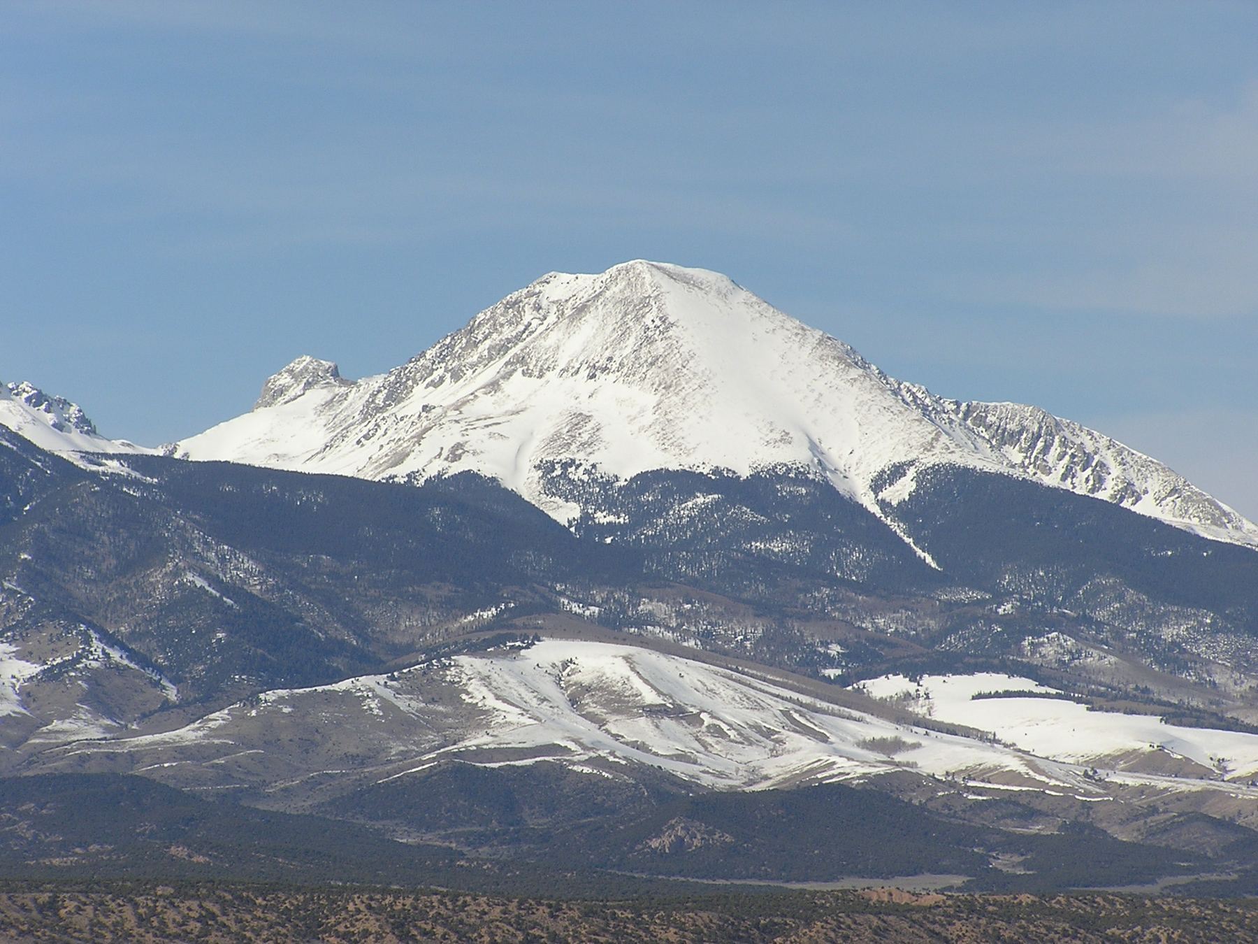
Mount Lindsey is a remote peak at the south end of the Sangre de Cristo range, reached from the head of the Huerfano River valley. The standard route crosses the river, climbs a steep, trail-less-feeling stretch of forest to a high basin, and then follows a ridge to a saddle below the peak. From there you climb a steep gully on the north side of the mountain and finish with some easy Class 3 moves near the top.
The route is short in miles but has a lot going on. The gully is steep and loose once the snow is gone, and it is easy to knock rocks onto people below. This route suits hikers with solid Class 2 experience who are ready for their first easy Class 3 peak and are careful on loose rock. Plan on 6 to 9 hours round trip.
The upper part of the route crosses private land, and the landowner requires every climber to sign a liability waiver before the climb. Do that before you go. If the gully has melted out, many people prefer the steeper but more solid northwest ridge from the same saddle.
Plan of the day
Start by
By 5 a.m. You are above tree line from about 12,000 feet, and the gully is no place to be in a storm.
Turnaround
If you are not at the 13,150-foot saddle by 10 a.m., or clouds are building, turn around. Once in the gully, you are committed to a slow climb and a slower descent.
Crux
The upper part of the northwest gully near 13,600 feet: steep, loose rock with a few narrow spots that need easy Class 3 moves when there is no snow.
Route-finding
Moderate. The trail across the river is unmarked, and in the forest above the boulder field the path is steep and can be faint. In the gully and on the traverse above the notch, pick the most solid rock and keep a sharp eye on where you came up.
Water
The Huerfano River and the stream near 11,400 to 11,600 feet are the water sources. Filter or treat it. There is no water in the basin above tree line or on the upper mountain.
Start in Gardner, northwest of Walsenburg. Go roughly half a mile west on Highway 69, then turn west onto County Road 550 and zero your trip meter; the trailhead is a little more than 22 miles ahead. Pavement gives out at 7 miles. Keep left at 11.8 miles, which puts you on Forest Road 580. Keep left again at 15.7 miles where a private ranch entrance splits off; from here the road narrows but good clearance usually gets through. Near 20 miles you come to the west edge of a big landslide, where the road has been rerouted.
Past the landslide there is a steep section that needs a 4WD vehicle. Drive 2 more miles on a rough, narrow road to the Lily Lake trailhead at 10,700 feet. There are dispersed camping spots along this last stretch. Low-clearance cars should park before the landslide section and walk. The route enters the Sangre de Cristo Wilderness, and the upper mountain is private land where a signed waiver is required.
Trail in the treesTalus and screeTundraRidgeScramblingExposed to lightning
The line is elevation, the band underneath is the ground, and the numbered dots match the steps below. Mileage and elevations are approximate.
1
Lily Lake trailhead 10,700' · 0 mi
Follow the Lily Lake trail south through the trees and into a large, open meadow along the Huerfano River. Lindsey and its neighbor, the Iron Nipple, rise at the head of the valley.
2
Lily Lake trail junction 10,550' · 1 mi
After about a mile, the Lily Lake trail bends right. Go straight on an unmarked trail for about 100 yards to the river.
Watch for: Do not follow the Lily Lake trail right.
3
Huerfano River crossing 10,550' · 1.05 mi
Cross the Huerfano River and head south. About 0.1 mile past the crossing, the trail turns left and climbs away from the river.
Watch for: The crossing can be high and cold in early summer.
4
Boulder field in the forest 10,800' · 1.4 mi
The trail zig-zags up through thick forest to the edge of a boulder field.
5
Stream gully 11,400' · 1.8 mi
Climb about 600 feet steeply through the trees on the right side of the boulder field until you reach a stream in a small gully. Follow the stream's left side.
Watch for: Steep, rooty trail. Slow going.
6
Stream crossing 11,600' · 1.95 mi
Cross the stream and keep climbing south up the hillside.
Watch for: Last water.
7
Tree line and basin 12,000' · 2.3 mi
Come out of the trees at about 12,000 feet. You look into a high basin with Lindsey's summit beyond it.
8
East side of the basin 12,200' · 2.5 mi
Drop a little, walk across toward the east side of the basin, and climb to about 12,200 feet.
9
Small ridge to 13,000 feet 13,000' · 3 mi
Follow a small ridge up to a crest near 13,000 feet. You are now on private land.
Watch for: Have your waiver done before this point.
10
Iron Nipple–Lindsey saddle 13,150' · 3.2 mi
Cross a boulder field to the saddle between the Iron Nipple and Lindsey. Lindsey's rugged north face and the northwest gully are in front of you. The northwest ridge, the more solid option, rises to the right.
Watch for: Decide here: gully or ridge.
11
Base of the gully 13,250' · 3.4 mi
Follow the ridge southeast to about 13,200 feet, where the trail cuts left (east) across the slope to the bottom of the gully.
12
Northwest gully 13,600' · 3.65 mi
Climb the gully slowly. It is steep and loose. Stay on the more solid rock along its right (upper) edge where you can. Near the top, a few narrow spots need easy Class 3 moves if there is no snow.
Watch for: Rockfall. Wear a helmet and do not climb under other parties.
13
Notch at top of the gully 13,750' · 3.75 mi
Pass through a small notch at the top of the gully. From here, traverse east across a few shallow gullies while slowly gaining height. Or turn right and climb angled Class 3 slabs straight toward the summit ridge.
14
Summit ridge 14,000' · 3.95 mi
The slope stays steep above 13,800 feet until you reach Lindsey's summit ridge near 14,000 feet. Turn right (southeast).
15
Summit 14,055' · 4.1 mi
Walk about 0.2 mile southeast along the ridge to the summit. You can see Blanca Peak and the rest of the Blanca group to the southwest.
Landmarks to know
Large meadow along the Huerfano River below the trailhead.
Junction at 1 mile where the Lily Lake trail goes right: go straight to the river.
Boulder field in the forest near 10,800 feet.
Tree line at about 12,000 feet with a view into the basin and Lindsey's summit.
The Iron Nipple, a pointed bump on the ridge, next to the 13,150-foot saddle.
The steep northwest gully on Lindsey's north face.
Small notch at the top of the gully, then the summit ridge.
Getting down
Go back the way you came, and take the gully slowly. It is steepest and loosest near the top. Go down one at a time, or stay close together so any rock knocked loose cannot pick up speed. From the summit ridge, make sure you head back down to the same notch you came through; other gullies on this face lead to cliffs.
At the saddle, cross the boulder field back to the small ridge and down into the basin. In the forest, the trail is steep and easy to lose. Keep the stream on your right as you go down to the boulder field, then follow the zig-zags back to the river crossing and the meadow.
If things go wrong
The saddle at 13,150 feet is the key decision point. If weather looks bad or anyone is struggling, turn back there. Once in the gully, the fastest way off is back down it; the northwest ridge is steeper and more exposed and is not a quicker escape. If a storm hits, get out of the gully, down to the saddle and into the basin, then into the trees below 12,000 feet. If someone is hurt, keep them still and warm and away from the fall line of the gully, and send someone down for help. The trailhead is very remote and help will take a long time. Call 911 if you have a signal.
3D flyover
Press play to fly the Northwest Gully. The graph shows elevation along the way and how much you gain each mile. Open full screen.
For planning only. The line is traced from open map data, not walked in the field, and off-trail parts are drawn straight. Load it in your GPS app to see the route, but navigate with your eyes, a map and the route description.
See the trail on video
A climb of this route filmed by The Virtual sherpa. The video belongs to them and only plays when you press play.
Jump to
Other routes
All 3 routes up Mount Lindsey, with the class and round-trip distance for each.
Class 3 means sustained scrambling with your hands, on terrain where a fall has real consequence. Build up on easier scrambles first, wear a helmet, go with someone who has led this kind of ground, and remember that downclimbing is harder than going up.