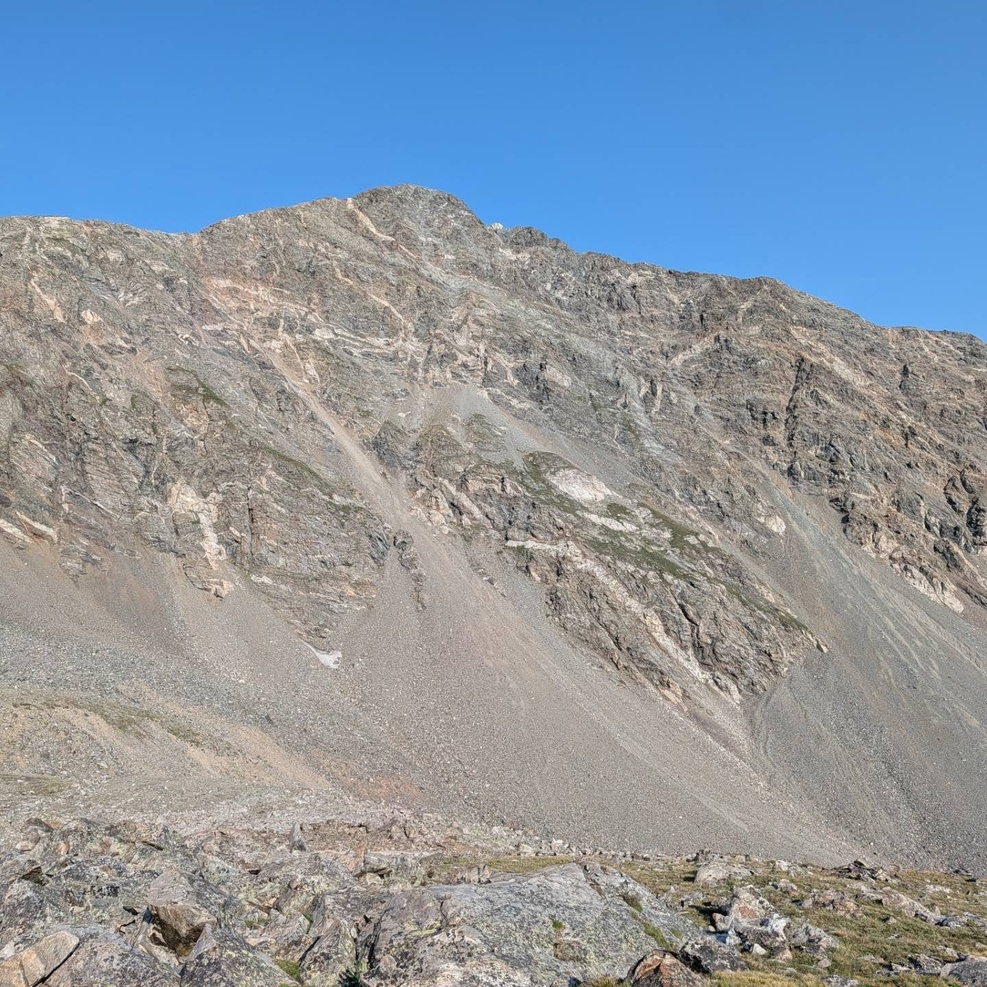
Afternoon storm risk is the line that matters. Everything else is comfort. In summer, plan to be off the ridge before the build-up starts, not as it starts. Forecast for the summit point, adjusted for its elevation · data from Open-Meteo.
Standard route · South Slopes
Overview
Torreys is one of the most climbed fourteeners in Colorado and one of the easiest to reach from Denver. It sits right next to Grays Peak, and the two share a trailhead and most of a trail. The route walks up the long, open valley of Stevens Gulch, climbs to the saddle between the two peaks, and then heads north up a steeper final half mile to Torreys' pointed summit.
It is a Class 1 hike on a clear trail the whole way, so it is a common first fourteener. That does not make it safe in bad weather. You are above treeline for most of the day with nowhere to hide from lightning, and the wind on the saddle can be fierce. The last stretch above the saddle is steep with loose gravel on top of hard ground, which is easy to slip on coming down.
The round trip is 7.75 miles with about 3,000 feet of gain. Most people take 5 to 7 hours. Many hikers add Grays by going from the saddle to one summit, back to the saddle, and up the other, which adds roughly a mile and a few hundred feet. The trail is very busy on summer weekends, and parking fills well before sunrise.
Plan of the day
Start by
By 5 a.m. The lot fills very early on weekends, and storms often build over the Front Range by late morning. You are above treeline almost from the start.
Turnaround
Be at the Grays-Torreys saddle (about 13,700 feet) by 11 a.m. If you are not, or if clouds are growing tall, turn around there. Do not start adding Grays after noon.
Crux
The final half mile from the saddle to the summit is steep, with loose gravel on a hard trail. It is not technical, but it is tiring going up and slippery going down.
Route-finding
Very easy in clear weather. The one place to pay attention is the junction near 13,300 feet, where you leave the Grays trail and traverse right toward the saddle. In fog, keep to the trail on the way down so you do not drift into the wrong drainage.
Water
The stream in Stevens Gulch is at the trailhead and near the trail low in the valley. There is no reliable water higher up. Filter or treat it; many people carry all they need from the car.
Bumpy, rutted 4WD dirt road requiring high clearance; the tight dirt lot fills completely before sunrise.
Terrain
A wide, beautifully manicured dirt highway cutting through a vibrant, emerald-green alpine basin.
You cross a wooden footbridge over a rushing creek and enjoy a smooth, gentle march up the valley floor. As the basin closes in, the dirt path seamlessly transitions into long, sweeping gravel switchbacks up Grays' wide north ridge. To loop over to Torreys, you descend a broad, rocky saddle before grinding up a steeper, looser, chunkier Class 2 dirt-and-rock trail to the second summit.
Take I-70 to the Bakerville exit (exit 221). Cross to the south side of the highway to a dirt parking area at the start of the Grays Peak road (Forest Road 189). This is the winter trailhead. If you are in a low-clearance car, park here and walk up the road; it is almost 3 miles to the summer trailhead.
With a higher-clearance vehicle, drive up the rough dirt road. Go straight at a junction after about 1 mile and continue about 2 more miles to the summer trailhead at 11,280 feet. There are restrooms and a few dispersed campsites near the lot. The county does not allow parking along the road below the trailhead and will ticket cars there. If the upper lot is full, drive back down to the bottom and walk up.
TundraRidgeScramblingTalus and screeExposed to lightning
The line is elevation, the band underneath is the ground, and the numbered dots match the steps below. Mileage and elevations are approximate.
1
Grays Peak trailhead 11,280' · 0 mi
Start at the south end of the lot. Cross the large footbridge over the stream in Stevens Gulch. The trail heads south up the valley.
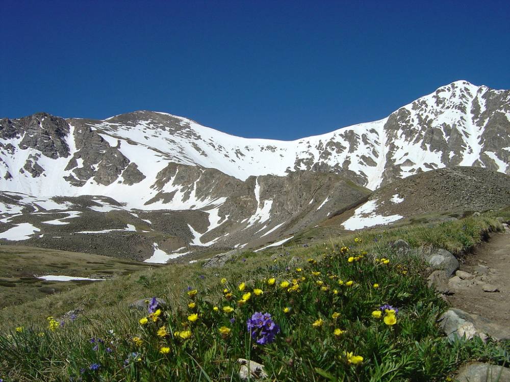
Grays and Torreys from the lower valley · Photo: emerson12
2
Lower Stevens Gulch 11,600' · 0.7 mi
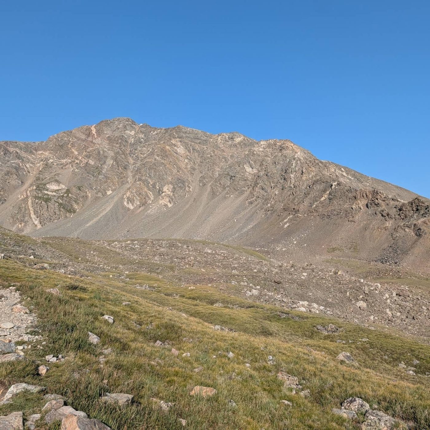
The trail runs up the valley floor through willows and tundra. Kelso Mountain rises on your right. Torreys and Grays come into view at the head of the valley; Torreys is the pointed one on the right.
Watch for: Early season, snow and old avalanche debris can cover the trail below Kelso Mountain.
3
Information sign 12,000' · 1.5 mi
An information sign stands beside the trail, about halfway to the summit. It is a good place to check the weather and your time.
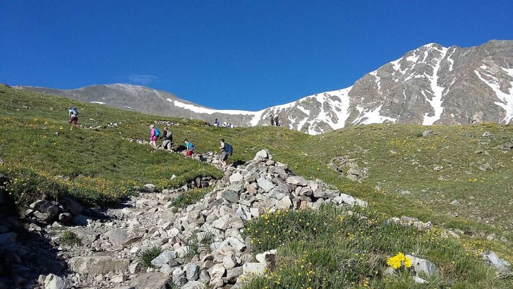
Hikers on the valley trail with both peaks ahead · Photo: Xnatedawgx
4
Rocky section 12,300' · 1.9 mi
The trail climbs up and crosses a rocky area. The footing gets rougher but the path is still easy to see.
5
Around a small ridge 12,450' · 2.2 mi
The trail bends around a little ridge. That ridge heads south to Grays and meets its east side.
6
Trail swings left 12,600' · 2.4 mi
Above about 12,600 feet the trail turns left and traverses along the west side of that rocky ridge, climbing steadily.
7
Climbing toward the junction 12,950' · 2.7 mi
Steady switchbacks lead up the slope. The saddle between Grays and Torreys is now clearly visible above and to your right.
8
Grays-Torreys junction 13,300' · 3 mi
A trail junction. The main trail goes left and up to Grays. For Torreys, leave the Grays trail and take the path that traverses right, heading southwest toward the saddle.
Watch for: Easy to miss if you are following the crowd up Grays.
9
Traverse to the saddle 13,500' · 3.2 mi
The trail crosses the slope on a steady grade. Stay on the path here; the tundra is fragile.
10
Grays-Torreys saddle 13,700' · 3.4 mi
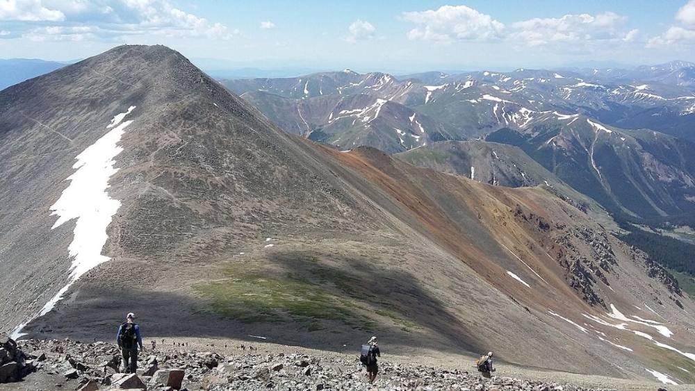
A broad, often windy saddle between the two peaks. Turn right (north) onto the Torreys trail. Kelso Ridge, a harder scramble, comes up the far side of Torreys to your right.
Watch for: Check the time and weather here. This is your turnaround point.
The saddle between Torreys and Grays · Photo: Xnatedawgx
11
Upper south slopes 14,000' · 3.65 mi
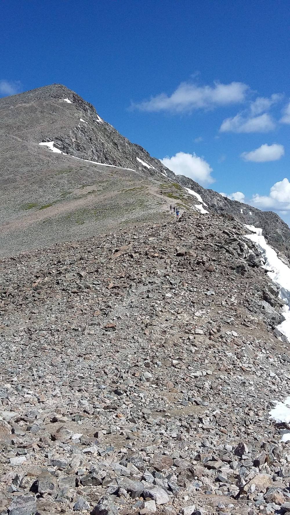
The trail steepens and climbs in short switchbacks on loose gravel and small rock. Take short steps and rest when you need to.
Watch for: Loose gravel on hard ground. Very slippery on the way down.
12
Summit 14,272' · 3.9 mi
A small, rocky summit with a steep drop on the north side. Grays is across the saddle to the south, and Kelso Ridge drops off to the northeast.
Watch for: Early season cornices can hang over the north and east sides. Stay off them.
The last climb from the saddle up Torreys · Photo: Xnatedawgx
Here Kelso Ridge goes off to the right. Keep going straight on Grays Peak Trail.
Coming down: Keep going straight on Grays Peak Trail. Don’t take Kelso Ridge.
2Mile 3.4 · 13,700'
Stay on Grays/Torreys Connector Trail
Here Grays Torreys Saddle Trail goes off to the left. Keep going straight on Grays/Torreys Connector Trail.
Coming down: Keep left to stay on Grays/Torreys Connector Trail. Don’t take Grays Torreys Saddle Trail.
Landmarks to know
The large footbridge over the stream right at the trailhead.
Kelso Mountain on your right as you walk up the valley.
The information sign about halfway in.
A rocky crossing near 12,300 feet.
The Grays-Torreys trail junction near 13,300 feet, where you traverse right.
The broad saddle between the two peaks at about 13,700 feet.
Tight switchbacks on loose gravel up to a small, pointed summit.
Getting down
Go back down the same trail to the saddle. The gravel on the upper slope is the most likely place to fall on this route. Go slowly, keep your weight over your feet, and use poles if you have them. From the saddle, follow the traverse back southeast to the junction and join the main Grays trail down the valley.
Do not try to shortcut off the saddle straight down toward the valley. The slopes are loose and fragile, and you can end up on steep ground. In fog, stick to the trail; the valley is wide and the route down it is the one you came up.
If things go wrong
The trail is the bail route. From anywhere on the route, turn around and head back down Stevens Gulch; the valley gets you lower quickly and the trail is easy to follow. If a storm hits near the summit, get off the top and down to the saddle and then keep going toward the valley rather than waiting it out. If someone is hurt, keep them warm and out of the wind. The trail is busy, so ask other hikers for help, and call 911 if needed.
3D flyover
Press play to fly the South Slopes. The graph shows elevation along the way and how much you gain each mile. Open full screen.
For planning only. The line is traced from open map data, not walked in the field, and off-trail parts are drawn straight. Load it in your GPS app to see the route, but navigate with your eyes, a map and the route description.
See the trail on video
No video yet
We haven’t found a good video of this route that matches the way we describe it. The route strip, junctions and 3D flyover show the way in the meantime.
Other routes
All 7 routes up Torreys Peak, with the class and round-trip distance for each.
TypeRouteClassTrailheadRound trip
Standard
South Slopes
Class 1
Grays Peak (Stevens Gulch)7.75 mi · 3,000'Full route →
Kelso RidgeA classic, thrilling scramble that follows the razor-sharp white granite spine dividing the two main basins. You stow your poles at the Kelso saddle and immediately engage in hands-on climbing over steep blocks and exposed notches. The definitive crux is a narrow, white knife-edge rock spine where you must walk or shuffle with immense vertical air dropping away on both sides, finishing directly on the summit of Torreys.
Class 3
Grays Peak (Stevens Gulch)6.75 mi · 3,100'Full route →
Dead Dog CouloirA premier spring mountaineering line cutting straight up the massive north face. Climbers must stand at the base at dawn to avoid solar warming hazards. You kick steps straight up a steep, narrow snow funnel that stays consistently locked at 40° to 45° before toping out through a tight, rocky slot onto the upper summit ridge.
Class 3steep snow
Grays Peak (Stevens Gulch)6 mi · 3,000'Full route →
A Class 1 rating means a trail, not a stroll. Altitude, distance and weather still decide how this goes. Afternoon thunderstorms build fast above treeline in summer, so plan to be heading down by noon, and carry more water than you think you need.